HomeDiagramsDatabaseMapsForum About
     

Go Back   SkyscraperPage Forum > Discussion Forums > City Discussions


Reply

 
Thread Tools Display Modes
     
     
  #1  
Old Posted May 11, 2026, 9:11 PM
Docere Docere is offline
Registered User
 
Join Date: Jul 2014
Posts: 8,636
How does your city define its neighborhoods/districts?

Toronto has 158 officially defined neighborhoods, so an average of roughly 20,000 on average. There were 140 that were set in the 90s but recently 18 new ones were created.

https://www.toronto.ca/city-government/d...neighbourhood/#location=&lat=&lng=&zoom=

In terms of reflecting the reality of how things are, they're a bit contrived and a lot of people don't identify with the "official" ones. These are based on census tracts and an official neighborhood for statistical purposes, so very small neighborhoods are included with larger ones.

In terms of neighborhood identity, there are several core neighborhoods that have had long, enduring identities and are pretty well-defined areas such as the Annex, the Beaches, the Junction, Parkdale, Riverdale and Rosedale. But there's a lot of BIA or realtor creations that ended up becoming "accepted" as well, such as Bloor West Village and Roncesvalles. Still a lot of others are just administrative names as there's no "obvious" names or consistent use, like "East End-Danforth", "Greenwood-Coxwell", "Palmerston-Little Italy", "Dovercourt-Wallace Emerson-Junction" etc.

Some cities I'm aware use something quite a bit bigger for planning purposes, such as the famed Community Areas created by the University of Chicago. I believe NYC uses the 59 community districts as the local statistical unit.
Reply With Quote
     
     
  #2  
Old Posted May 11, 2026, 9:42 PM
mhays mhays is online now
Never Dell
 
Join Date: Jul 2001
Posts: 21,049
Many ways, depending on department or purpose.
__________________
"Alot" has never been a word.
Reply With Quote
     
     
  #3  
Old Posted May 11, 2026, 10:01 PM
Steely Dan's Avatar
Steely Dan Steely Dan is online now
devout Pizzatarian
 
Join Date: Jul 2001
Location: Lincoln Square, Chicago
Posts: 30,214
Quote:
Originally Posted by Docere View Post

Some cities I'm aware use something quite a bit bigger for planning purposes, such as the famed Community Areas created by the University of Chicago.


Source: wikipedia


The best aspect of Chicago's Community Area system is the fact that the borders have been consistent since the 1920s (with two exceptions*), making it very easy to track changes over time at the neighborhood level because of that consistency.

The two main knocks against it are:

1. the highly variable sizes. The largest (Near North Side) has 105,000 people, and the smallest (Burnside) has only 2,100 people. However, tha vast majority of CA's fall somewhere between 15K and 60K.

2. The fact that the map was devised long before the city's expressways were even envisioned, there are some community areas that are now bisected by the expressway that don't feel as whole as they once did. Places like avondale, Irving park and the near west side come to mind.


(*)the two changes to Chicago's CA system over the past 100+ years:

In the mid 50s the city annexed about 14 square miles of land for the big ORD "bubble" that necessitated the creation of community area #76.

In the 1980s, the Edgewater Chamber of Commerce, along with other community groups, successfully lobbied the city to allow the area of the Uptown CA north of Foster Ave to splinter off and become the 77th official CA, aptly named Edgewater. It's why community area 77 on the map above is out of numerical sequence.
__________________
"Missing middle" housing can be a marvelous middle ground for many middle class families.

Last edited by Steely Dan; May 11, 2026 at 10:43 PM.
Reply With Quote
     
     
  #4  
Old Posted May 11, 2026, 10:12 PM
Docere Docere is offline
Registered User
 
Join Date: Jul 2014
Posts: 8,636
Looking at the Encyclopedia of Chicago, each of the 77 community areas has an article, and includes population figures from 1930 and 1960 (and more "recent" figures from 1990 and 2000). It's nice to be able to have this data over time in the same area.

A few other neighborhoods have short separate articles as well, such as Streeterville, Gold Coast and Old Town.
Reply With Quote
     
     
  #5  
Old Posted May 11, 2026, 11:15 PM
Steely Dan's Avatar
Steely Dan Steely Dan is online now
devout Pizzatarian
 
Join Date: Jul 2001
Location: Lincoln Square, Chicago
Posts: 30,214
Quote:
Originally Posted by Docere View Post
Looking at the Encyclopedia of Chicago, each of the 77 community areas has an article, and includes population figures from 1930 and 1960 (and more "recent" figures from 1990 and 2000). It's nice to be able to have this data over time in the same area.
Yes. The temporal aspect of the boundary consistency makes them extremely useful to track all manner of demographic data over time.

And because they're used by the local metropolitan planning agency (CMAP), they make it extremely easy to find neighborhood level data within the city without the tediousness of adding up census tracts.

For example, here's all kinds of demographic data about my CA of Lincoln Square that took me 5 seconds to find:

Population: 41,673

Macro-demos:
- white: 60.9%
- latino: 19.8%
- asian: 9.2%
- black: 4.4%
- other: 5.6%

Origin:
- native-born: 77.9%
- foreign-born: 22.1%

Age Cohorts:
- <20: 18.8%
- 20 to 34: 28.0%
- 35 to 49: 26.6%
- 50 to 64: 15.5%
- 65+: 11.2%

Median Household Income: $93,606

Median home value (ZHVI): $493,000

Housing:
- renter-occupied: 59.1%
- owner-occupied: 40.9%

Housing Unit Typology:
- detached SFH: 14.8%
- attached SFH: 2.0%
- 2 - 9 units: 56.3% ("missing middle" housing FTW!)
- 10 - 19 units: 11.1%
- 20+ units: 15.7%

Automobiles Per Household:
- 0: 23.2%
- 1: 53.1%
- 2: 20.7%
- 3+: 3.1%


Quote:
Originally Posted by Docere View Post
A few other neighborhoods have short separate articles as well, such as Streeterville, Gold Coast and Old Town.
Yes, most CA's are broken down further into more informal "neighborhoods". My own Lincoln Square has nabes like Ravenswood, Bowmanville, Rockwell Gardens, and Budlong Woods within it. But these are way more informal designations, without the hard-edged, unchanging boundaries that make the CA's so useful. And because these sub-neighborhoods are not officially sanctioned by the city, they are far more open to fungible abuse by real estate agents. I've seen real estate listings quoting "and just steps away from vibrant and lively Andersonville" that are a solid one mile away from anything that most people would consider "Andersonville", and they can get away with it because Andersonville isn't defined in any legal sense.
__________________
"Missing middle" housing can be a marvelous middle ground for many middle class families.

Last edited by Steely Dan; May 12, 2026 at 1:11 AM.
Reply With Quote
     
     
  #6  
Old Posted May 12, 2026, 1:25 AM
Docere Docere is offline
Registered User
 
Join Date: Jul 2014
Posts: 8,636
Canada's other big three:

Montreal is organized into 19 boroughs, which range in size from about 20,000-170,000. List of neighborhoods by borough:

https://en.wikipedia.org/wiki/List_of_neighbourhoods_in_Montreal

Vancouver is the only major Canadian city that didn't expand its boundaries in the postwar period, so it's quite small. The city is organized into 22 "official" neighborhoods (planning areas) which were established in the 1960s.

https://en.wikipedia.org/wiki/List_of_neighbourhoods_in_Vancouver
Reply With Quote
     
     
  #7  
Old Posted May 12, 2026, 9:40 AM
muppet's Avatar
muppet muppet is offline
if I sang out of tune
 
Join Date: Sep 2004
Location: London
Posts: 6,470
London has 32 boroughs, split into about 700 wards, loosely corresponding with the 600 'High Streets' where local shops, eateries, bars and businesses dominate. This of course echoes the hundreds of former town and village centres that got swallowed up by the Victorian/ Edwardian monster.

In reality people don't much know their ward name, more likely a loose term of their district, which numbers around 500 different ones. If you're asked where you live in the city you'd probably start off with that district name.

If they don't know it, you add in the nearest big High Street/ transport interchange eg: 'I'm from Yiewsley, near Uxbridge'. Many of these lines have been drawn by class, and continues to this day despite the mixing. You could live in gritty old Woolwich, but now the new Elizabeth Line has made it highly desirable and all the luxury towers are being built, the area around the station has increasingly been delineated as 'Woolwich Riverside'.

I adversely live in a district with two names. I'm in Clapham Junction, named after the major station there. However this is in Battersea, a good mile away from where Clapham starts.

The reason for the name confusion is they didn't want to brand the new station Battersea Junction, as at the time it was the worst area in the city, so they appropriated the district down the road instead. I endlessly have to correct people, no not Clapham (which is posh) but Clapham Junction. There are of course several other Claphams -Clapham North, Common, Village and High St.

Last edited by muppet; May 12, 2026 at 2:31 PM.
Reply With Quote
     
     
  #8  
Old Posted May 12, 2026, 10:40 AM
muppet's Avatar
muppet muppet is offline
if I sang out of tune
 
Join Date: Sep 2004
Location: London
Posts: 6,470
UK is absolutely defined by class, though it pretends not to be. Which district you live in the city can subtly point to which strata you belong to, if they can work it out - everywhere's gentrified or gentrifying, and even historically poor streets lived next door with rich, but there are clues.

Some people might say 'Acton', 'Wembley'. 'Wimbledon' or 'Croydon' but it would have big differences if it was north, east, south, west or central, as defined by their respective 4 or 5 stations of that name. Or instead of saying Hackney, they'd say Victoria Park. Instead of an ex council estate in Victoria they'd say Belgravia. Instead of North Kensington, they'd just say Kensington -or even better to throw the scent off, Chelsea. Others take pains to mention they live in Brixton Hill not just Brixton, or Wandsworth 'near the park', 'by the station' or 'by the river' to delineate they're in the second highest earning district of the capital, rather than the working class one that is the centre.


Crazily enough, rich people will do the opposite. Hiding their wealth and pretending they rubbed shoulders with gangs (of ladies who lunch) and people who have to wake up at 6 to commute (to yoga classes). Popstar du jour, Olivia Dean may allude to a background from the mean streets of Walthamstow, but her mum was a barrister and she went to a private school.


At the end of the day class divide has become impossible to ignore in the UK, dictating your prospects in life entirely. It's the biggest marker of change in the city at the mo, and a subtle signposting of social upheaval. I would imagine many other cities are going through similar, as new areas become 'reinvented' and others priced out.

Last edited by muppet; May 21, 2026 at 5:42 AM.
Reply With Quote
     
     
  #9  
Old Posted May 12, 2026, 3:06 PM
Docere Docere is offline
Registered User
 
Join Date: Jul 2014
Posts: 8,636
London is such a complex and enormous entity.

How many council positions were contested in London last week?
Reply With Quote
     
     
  #10  
Old Posted May 12, 2026, 3:35 PM
wwmiv wwmiv is offline
Registered User
 
Join Date: Sep 2009
Location: Austin -> San Antonio -> Columbia -> San Antonio -> Chicago -> Austin -> Denver -> Austin
Posts: 5,781
Quote:
Originally Posted by Docere View Post
London is such a complex and enormous entity.

How many council positions were contested in London last week?
All of them.

• Labour went from 1035 (2022 regularly scheduled wins) to 696
• Conservatives gained from 384 to 407
• Liberals gained from 182 to 243
• Reform gained from 14 to 79 (London is NOT Reform territory)
• Green gained from 18 to 297
__________________
Houston: 2.4m (+3.9%) + MSA suburbs: 5.4m (+12%) + CSA exurbs: 200k (+5%)
Dallas: 1.3m (+2%) / FtW: 1.0m (+10%) + suburbs: 6.4m (9%) + exurbs: 566k (+9%)
San Antonio: 1.5m (+6%) + MSA suburbs: 1.2m (+10%) + CSA exurbs: 82k (+3%)
Austin: 994k (+3%) + MSA suburbs: 1.6m (+18%)
Texas (whole): 31.29m (+7%) / Texas (balance): 8.6m (+3%)
Reply With Quote
     
     
  #11  
Old Posted May 12, 2026, 3:52 PM
Docere Docere is offline
Registered User
 
Join Date: Jul 2014
Posts: 8,636
So there are more than 1700 elected members of the local authorities.
Reply With Quote
     
     
  #12  
Old Posted May 12, 2026, 4:23 PM
eschaton eschaton is offline
Registered User
 
Join Date: Dec 2013
Posts: 5,570
Pittsburgh has 90 official neighborhoods. The map of them is below:


Historically, every one of Pittsburgh's neighborhoods was based upon one or more census tracts, which made them easy to track for statistical/demographic reasons. However, due to the Census's habits of merging together tracts when the population gets too low, some of them are now comprised of Census block groups instead.

Some of these neighborhoods are quite, quite small in terms of population. Chateau, for example, had a population of only 11 people in 2020. It's largely an industrial area that was cleaved off of Manchester during mid-century urban renewal, and has two remaining houses (this one seems vacant, and 
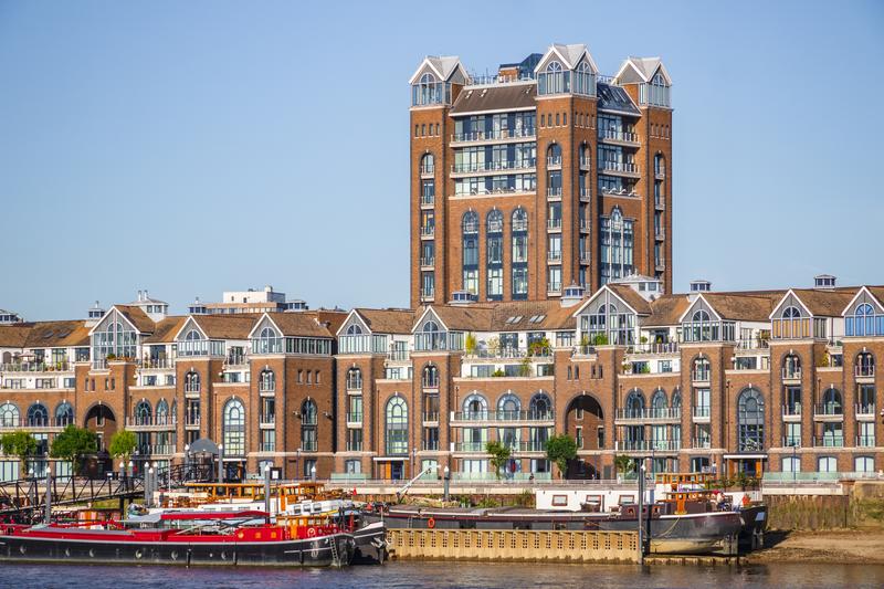
this one is quite nice) plus a smattering of people living on houseboats at a small marina. South Shore (just across the river from Downtown) had only 19 people in 2020, though there's now a 319-unit apartment complex there. Past this, there are another 18 neighborhoods which have less than 1,000 people.

I think the city is overdue for redefining the neighborhoods, but not so much due to this. The city arbitrarily splits a bunch of neighborhoods (Oakland, Squirrel Hill, Lawrenceville, Homewood) into multiple parts. There's also a number of "project neighborhoods" like Arlington Heights and St. Clair, where the original project closed, meaning the reason it was tracked demographically separately is irrelevant. The funniest one is St. Clair, which was the name of the old neighborhood, and was a majority black housing project. The "neighborhood" side of St. Clair asked to be calved off into its own distinct neighborhood, which was named Mt. Oliver (after the adjacent independent borough). Then St. Clair village was closed, with the old St. Clair now just having 183 residents (and Mt. Oliver the city neighborhood having 443).

Last edited by eschaton; May 12, 2026 at 5:34 PM.
Reply With Quote
     
     
  #13  
Old Posted May 12, 2026, 4:44 PM
Docere Docere is offline
Registered User
 
Join Date: Jul 2014
Posts: 8,636
That's an average population of 3,500 per neighborhood (though obviously with variation).
Reply With Quote
     
     
  #14  
Old Posted May 12, 2026, 5:17 PM
Steely Dan's Avatar
Steely Dan Steely Dan is online now
devout Pizzatarian
 
Join Date: Jul 2001
Location: Lincoln Square, Chicago
Posts: 30,214
Quote:
Originally Posted by Docere View Post
That's an average population of 3,500 per neighborhood (though obviously with variation).
And for comparison, Chicago's 77 official Community Areas have an average of ~35,000 people.

I wonder if there's some kind of proportional maximum going on, like regardless of the size of the city, they have a tendency to divide themselves up into roughly 50 to 100 neighborhoods, perhaps because anything more simply becomes far too unwieldy from a knowledge/memory perspective?

Like, I know all 77 of Chicago's CA's and where they are because it's a manageable number of things to have knowledge about. But for the hundreds of sub-neighborhoods that the CA's are informally divided up into, those become a big blind spot for me as you move further away from my general region of the city.

I know where the Ashburn CA is (far SW side), but I couldn't tell you a single one of the sub-neighborhoods that it's divided into without looking it up.

I have to imagine the inverse for someone in Ashburn is also true regarding their knowledge of the sub-neigborhoods of my Community Area on the far N side.
__________________
"Missing middle" housing can be a marvelous middle ground for many middle class families.

Last edited by Steely Dan; May 12, 2026 at 5:52 PM.
Reply With Quote
     
     
  #15  
Old Posted May 12, 2026, 5:29 PM
Docere Docere is offline
Registered User
 
Join Date: Jul 2014
Posts: 8,636
Imagine NYC with 1,700 neighborhoods or even half that.
Reply With Quote
     
     
  #16  
Old Posted May 12, 2026, 5:47 PM
eschaton eschaton is offline
Registered User
 
Join Date: Dec 2013
Posts: 5,570
Quote:
Originally Posted by Docere View Post
That's an average population of 3,500 per neighborhood (though obviously with variation).
Yeah, it's an excessive number of neighborhoods. As I said, we have too many as officially defined, with many of them not having any sort of real identity. But I think, at most, we need to eliminate like 20 of them.

Due to topography, a lot of even the small neighborhoods both exist as a coherent geography and a cultural thing. Somewhere like Allegheny West (population 540) and Polish Hill (Population 1,201) are absolutely real places.

Quote:
Originally Posted by Steely Dan View Post
I wonder if there's some kind of proportional maximum going on, like regardless of the size of the city, they have a tendency to divide themselves up into roughly 50 to 100 neighborhoods, perhaps because anything more simply becomes far too unwieldy from a knowledge/memory perspective?
Doesn't explain why Boston has only 23 neighborhoods.

IIRC, Baltimore has 250 as well.
Reply With Quote
     
     
  #17  
Old Posted May 12, 2026, 5:54 PM
Steely Dan's Avatar
Steely Dan Steely Dan is online now
devout Pizzatarian
 
Join Date: Jul 2001
Location: Lincoln Square, Chicago
Posts: 30,214
^ Tendency.

Not an absolute.


But more data is surely needed.

Just thinking out loud.
__________________
"Missing middle" housing can be a marvelous middle ground for many middle class families.
Reply With Quote
     
     
  #18  
Old Posted May 12, 2026, 6:03 PM
Yuri's Avatar
Yuri Yuri is offline
Registered User
 
Join Date: Sep 2008
Posts: 6,148
São Paulo has very strict and well defined districts, dating back since 1950 at least without any changes. Map: https://upload.wikimedia.org/wikipedia/commons/5/56/Mapa_sp.svg and they're grouped into sub-prefectures, which have some administrative powers. They have sub-mayors who are appointed by the mayor. More: https://pt.wikipedia.org/wiki/Divis%C3%A...tiva_do_munic%C3%ADpio_de_S%C3%A3o_Paulo

However, population and even the mail ignore them completely. They have informal and smaller neighbourhoods that are loosely and informally defined, with lots of overlapping. For example, the famous Higienópolis, the Jewish hood, full of masterpiece modernist highrises and tree lined exists doesn't exist officially. It's part of Consolação District. Virtually 100% of population is completely unaware of it.
__________________
London - São Paulo - Rio de Janeiro - Londrina - Frankfurt
Reply With Quote
     
     
  #19  
Old Posted May 12, 2026, 11:39 PM
ColDayMan's Avatar
ColDayMan ColDayMan is offline
B!tchslapping Since 1998
 
Join Date: Jul 2001
Location: Columbus
Posts: 20,461
Cincinnati has 52 neighborhoods. Like Pittsburgh, they are basically carved up due to hills or being former streetcar suburbs on the edges of the city.


https://wikimedia.org/


Columbus officially has 189 neighborhoods. Some tiny, some huge. Some from the 1700's, some from 1995.


https://live.staticflickr.com/


Dayton has 94 neighborhoods.


https://mistythomastrout.wordpress.com


Cleveland, Toledo, Akron, and Youngstown also have distinctive neighborhood boundaries. I'd imagine every state as old or older than Ohio (1803) has already defined neighborhoods for their city.
__________________
Click the x: _ _ X _ _!
Reply With Quote
     
     
  #20  
Old Posted May 13, 2026, 12:01 AM
Comrade's Avatar
Comrade Comrade is online now
They all float down here
 
Join Date: Jan 2002
Location: Hair City, Utah
Posts: 9,607
Salt Lake is all over the place with its neighborhood designation. I think the only two neighborhoods the city agrees on universally is SugarHouse and the Avenues. Every other neighborhood is either listed sometimes on its own or listed as part of a larger neighborhood section (like Westside Salt Lake City - which includes Rose Park, Glendale and Poplar Grove).

What I mean:

The City's General Plan lists each neighborhood includes a much broader 'neighborhood definition' (again, with the Avenues and SugarHouse the only two neighborhoods that are widely universal). These include:

Avenues
Capitol Hill
Central
City Creek
Downtown
East Bench
Northwest
Northwest Quadrant
SugarHouse
Westside

But there's definitely more well-known neighborhoods, specifically those western ones I mentioned (Rose Park, Glendale and Poplar Grove) that also have their own community council so I guess it's probably best to just go off those. And even then, those neighborhoods have sub-neighborhoods within.

This is probably the best breakdown. But even this doesn't include specific neighborhoods like Marmalade, which is part of the Capitol Hill neighborhood.

This map seems to be the most thorough of Salt Lake's neighborhoods and their sub-neighborhoods:


But again, it's inconsistent as it misses some of the neighborhoods that have their own community council (like the East-Central Community Council).

So, yeah, I'm not gonna figure it out.
Reply With Quote
     
     
This discussion thread continues

Use the page links to the lower-right to go to the next page for additional posts
 
 
Reply

Go Back   SkyscraperPage Forum > Discussion Forums > City Discussions
Forum Jump


Forum Jump


All times are GMT. The time now is 11:06 PM.

     
SkyscraperPage.com - Privacy Statement - Top

Powered by vBulletin® Version 3.8.7
Copyright ©2000 - 2026, vBulletin Solutions, Inc.