HomeDiagramsDatabaseMapsForum About
     

Go Back   SkyscraperPage Forum > Regional Sections > Canada > Atlantic Provinces > Halifax > Urban, Urban Design & Heritage Issues


Thread Tools Display Modes
     
     
Prev Previous Post   Next Post Next
     
     
  #1  
Old Posted Apr 3, 2011, 4:41 AM
someone123's Avatar
someone123 someone123 is offline
hähnchenbrüstfiletstüc
 
Join Date: Nov 2001
Location: Vancouver
Posts: 35,643
The Evolution of Gottingen Street

Google Earth has a very interesting feature: historical satellite photography. You can pick an old date and see what things looked like back then. For Halifax, the imagery goes back to 2003.

I noticed that the differences around Gottingen from 2003-2010 were particularly pronounced so I generated a few images to show the new buildings that were constructed:
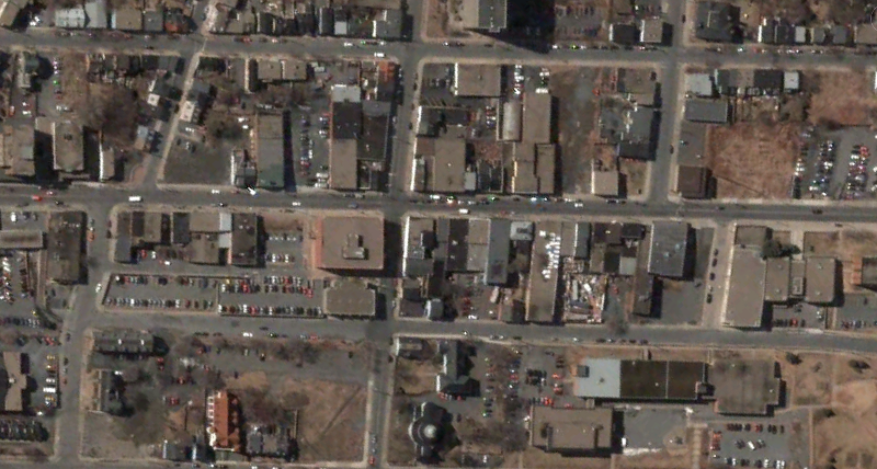
2003:


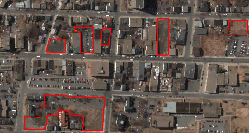
Development sites, 2003-2010:
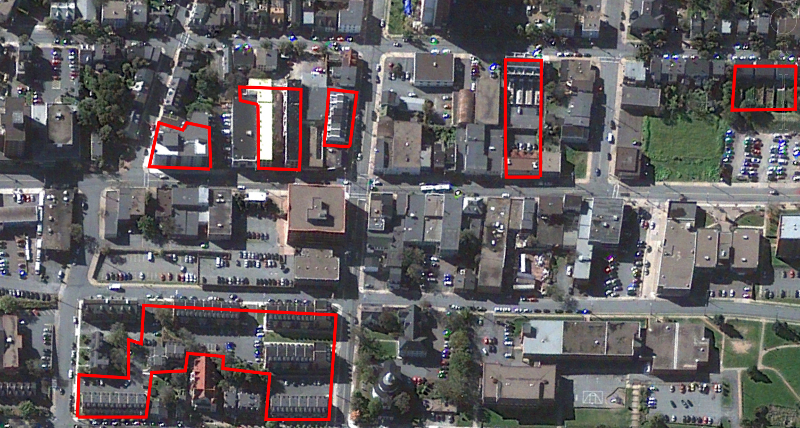


2010:


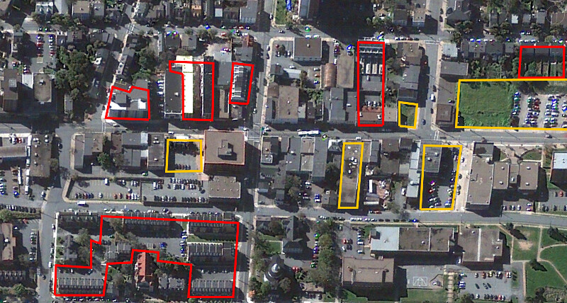
Potential new development sites as discussed in the development section:


Looking around central areas of Halifax, there's been a pretty significant amount of residential construction over the past 8 years. I think most people underestimate how much has changed.
Reply With Quote
     
     
End


Go Back   SkyscraperPage Forum > Regional Sections > Canada > Atlantic Provinces > Halifax > Urban, Urban Design & Heritage Issues
Forum Jump


Forum Jump


All times are GMT. The time now is 12:21 PM.

     
SkyscraperPage.com - Privacy Statement - Top

Powered by vBulletin® Version 3.8.7
Copyright ©2000 - 2026, vBulletin Solutions, Inc.