Quote:
Originally Posted by Yuri

But the thing is this growth dates 1950 (post #78). It's by far the fastest growth county on the western half of PA for the past 70 years. If it's not Pittsburgh sprawl, something else must be driven their growth. Maybe they're some kind of farming boomtown contrasting with shrinking coal cities, a bit like Grand Rapids, I don't know.
|
I'm not really sure what answers you're looking for here.
Butler County grew in population until the 1960s/70s just like all the counties in the region grew. Postwar manufacturing jobs were plentiful throughout western PA. And yes, it did continue to grow while other counties in the southwestern PA region started to decline in population with the decline in the steel industry.
But you have to remember, in the 1950s, Butler County only had around 100k in population. It was approximately 2x to 3.5x smaller than Beaver, Fayette, Washington, and Westmoreland counties back then, and 16x times smaller than Allegheny County. So even though Butler grew by significant percentages (12%, 16%, 14%) in the 60s, 70s, and 90s, we're not talking about all that many people.
It has only gained around 100k (or less) people over the past 70 years, so let's not act like it's some booming sunbelt suburban county.
As I said previously, in the 70s, the southwestern corner of the county became a crossroads for the new I-79 and I-76 highways, and development ensued. So yes, the growth in that area of Butler County could be considered "Pittsburgh sprawl"... but we're only talking about
1/10 of Butler County's land area. Roughly 80 square miles in the southwestern corner of an 800 square mile county -- so saying that Butler County is "suburban Pittsburgh" is really pretty silly, when we're basically talking about that red township and the one to its right in the map below only.


 Prev
Prev


 ... it's definitely not a commonly-used name at all) and some of adjacent Adams Township up along US-19 and I-79 to just south of Zelienople.
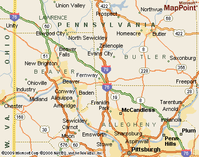


 Linear Mode
