Quote:
Originally Posted by ethereal_reality

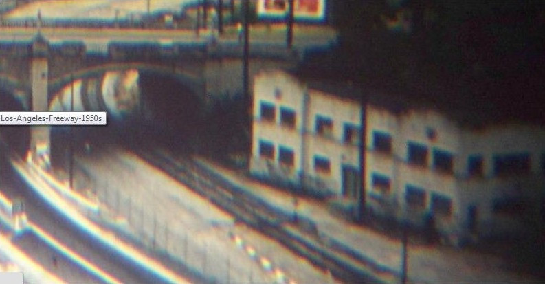
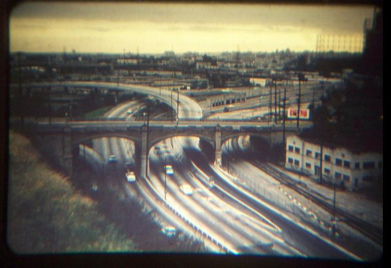
I'm curious about the white building on the right. Does anyone know what building that is?
Notice how the railroad tracks come within a few feet of it's front door.
 |
Quote:
Originally Posted by HenryHuntington
That building was the trainmens' off-duty quarters at PE's Macy Street Yard, ER. It lasted at least until the early 1960s, possibly longer.
|
I originally thought that the building might have had a Gallardo Street address, and since Gallardo Street is very short, it would be easy to track down. As I checked various old maps it became clear that for most of its life, the building served the railroad in some capacity, so
HenryHuntington's identification makes perfect sense.
What the old maps also show is how this once residential neighborhood got divided, first by the railroad, then the addition of Ramona Boulevard, and finally the change to the San Bernardino Freeway and El Monte Busway.
Los Angeles Past made some very good posts about the construction of Ramona Boulevard back in 2010 - you can see them
here,
here and
here.
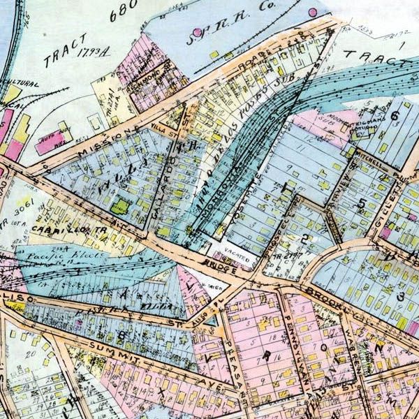
This is the Baist map from 1910. The Pacific Electric Railroad only appears to have a single track down the center of Monrovia Street. Neighboring Yosemite Street has also been divided into plots, and there seem to be houses along Gallardo Street and Prospect Place.
 www.historicmapworks.com
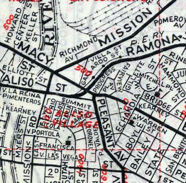
Skipping ahead to the 1921 Baist map, and the railroad is taking over. The old single track has become at least four, with many more at the northern end of Monrovia Street. Both Yosemite Street and the short perpendicular street at its southern end have the word "Vacated" on them. Could that be our trainmens' off-duty quarters on the lower corner of Monrovia Street?
 www.historicmapworks.com
The 1943 Renie Atlas isn't as detailed, but does show Ramona Boulevard where Monrovia and Yosemite Streets used to stand.
 www.historicmapworks.com
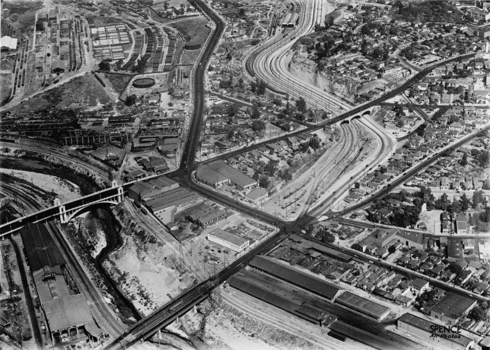
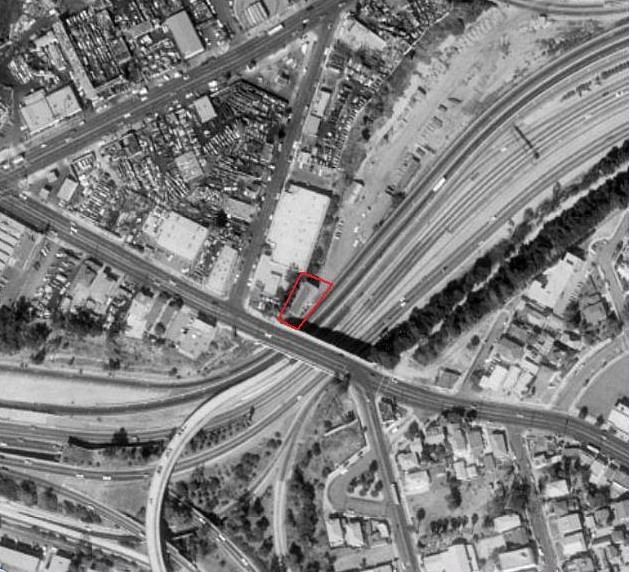
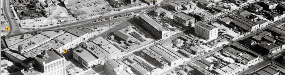
This aerial view is from 1948, and appears to show
e_r's building just above the Macy Street Bridge. I think there are only two rail lines going under the bridge at this point, although there are still plenty more as they go north. Check out
post #2161 by
sopas ej for a couple of pictures looking south from the Macy Street Bridge in the 1950s.
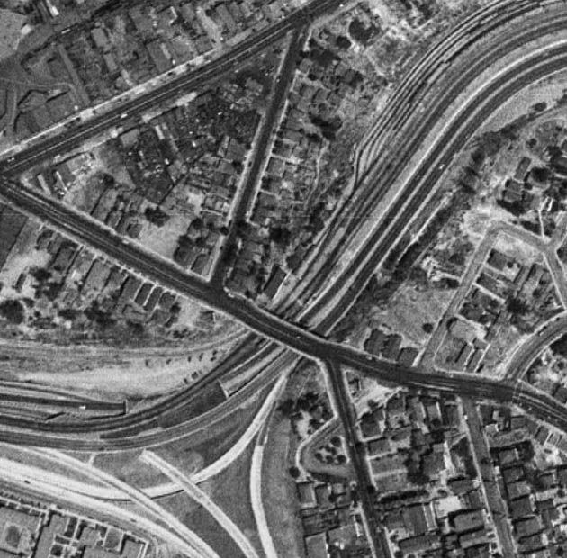
Historic Aerials
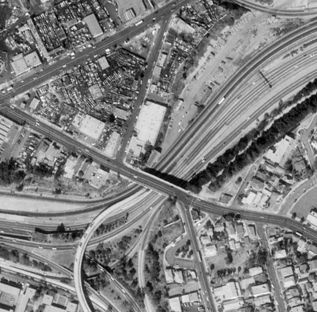
The curved overpass that once linked the San Bernardino and Santa Ana Freeways (as mentioned in
sopas ej's post) is still present in this 1980 aerial. The old railroad tracks were removed a couple of years after the image above was taken, and replaced (a couple of decades later) by the El Monte Busway. This is the last date at which I can see the trainmens' building by the Macy Street Bridge. Google Earth shows that it had gone by 1994. You may also notice that Gallardo Street was still residential in the image above, but by 1980 it had become home to several auto wrecking yards. The 1980s must have been the heyday for these yards because there were several more in the surrounding area (I recall a scene from 'The Fall Guy' being filmed in a yard just across N Mission Road). Many of the yards survive to this day, but they don't dominate the area as they once did.
Historic Aerials
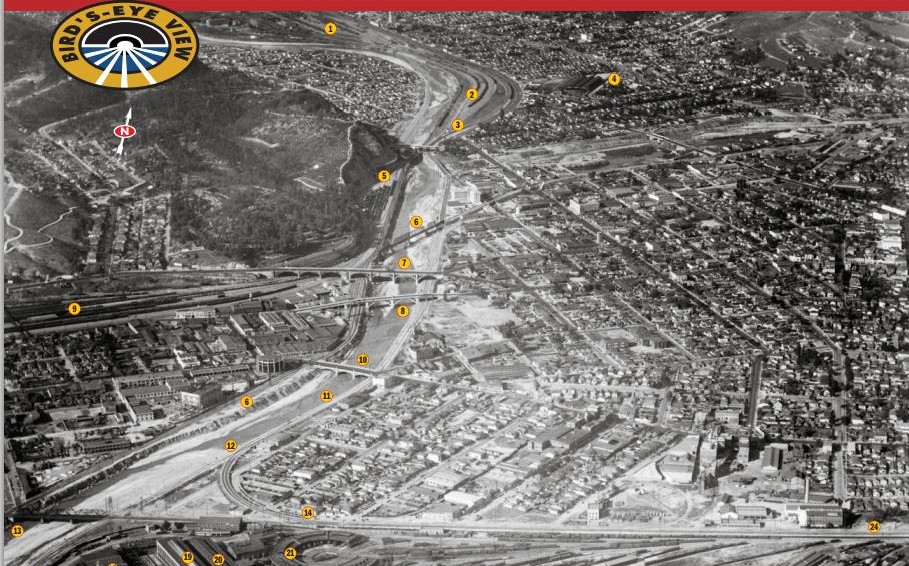
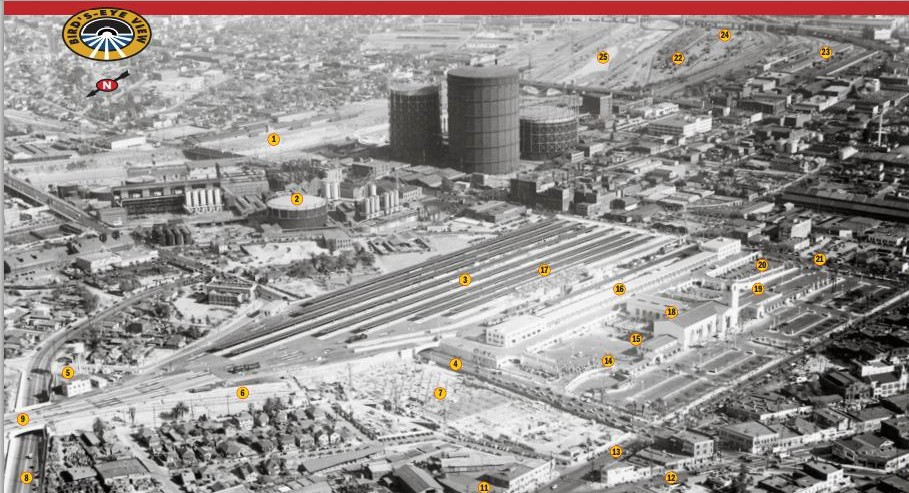
Before I leave this area, I'll finish with this great aerial that I found on USC. It's undated, but shows Ramona Boulevard completed while
the Aliso Street Viaduct had yet to be built, so my guess is late 1930s. It really shows how the railroad once dominated the area. I think it also helps to show where the pictures in
Los Angeles Past's posts (see top of this post) were taken.
 USC Digital Library


 Prev
Prev


 -my damn computer again.


 )
)


 GSV
GSV


 Linear Mode
