Quote:
Originally Posted by brickell

Where are you getting your numbers from memph? Are you manually picking out the urban area tracts?
|
Maybe.

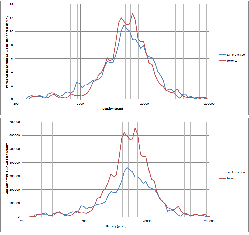
Chicago
2000: 10,270 ppsm (8,307,904)
2010: 9,125 ppsm (8,814,602)
2010 including Kenosha: 9,047 ppsm (8,944,424)
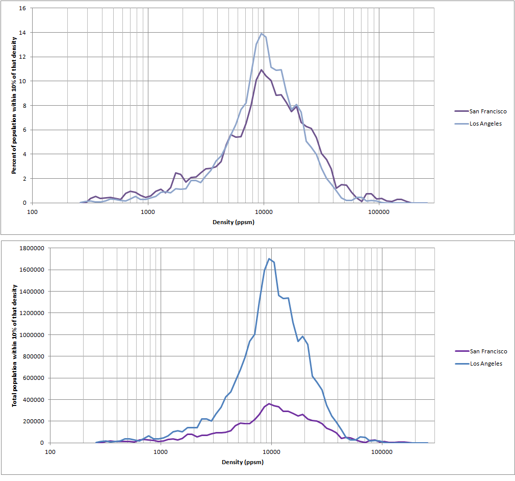
Houston
2000: 4,514 ppsm (3,822,509)
2010: 4,589 ppsm (5,153,230)
2010 including Conroe: 4,554 ppsm (5,212,160)
Houston's urban area merged with Conroe, TX and Chicago's merged with Kenosha, WI so I have the numbers before and after. There were probably some smaller mergers as well that are included in the first 2010 values.


 Prev
Prev


 Nowhere in New York City can you be as close to a supertall skyscraper and have that low residential density as you do when you go west or south of the Sears Tower, I mean less than a mile south there is a huge empty field and stores with huge parking lots and almost no residents. I admit to being a bit envious and sorry for the rant but I am trying to make this be strictly for comparative purposes as it has fascinated me as of late.


 Linear Mode
