Quote:
Originally Posted by odinthor

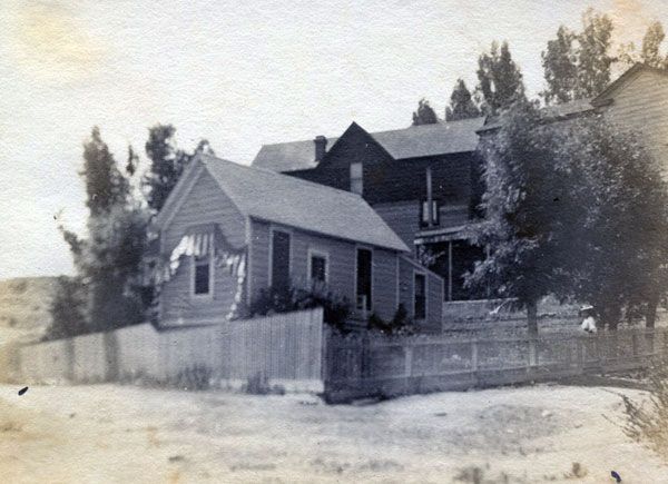
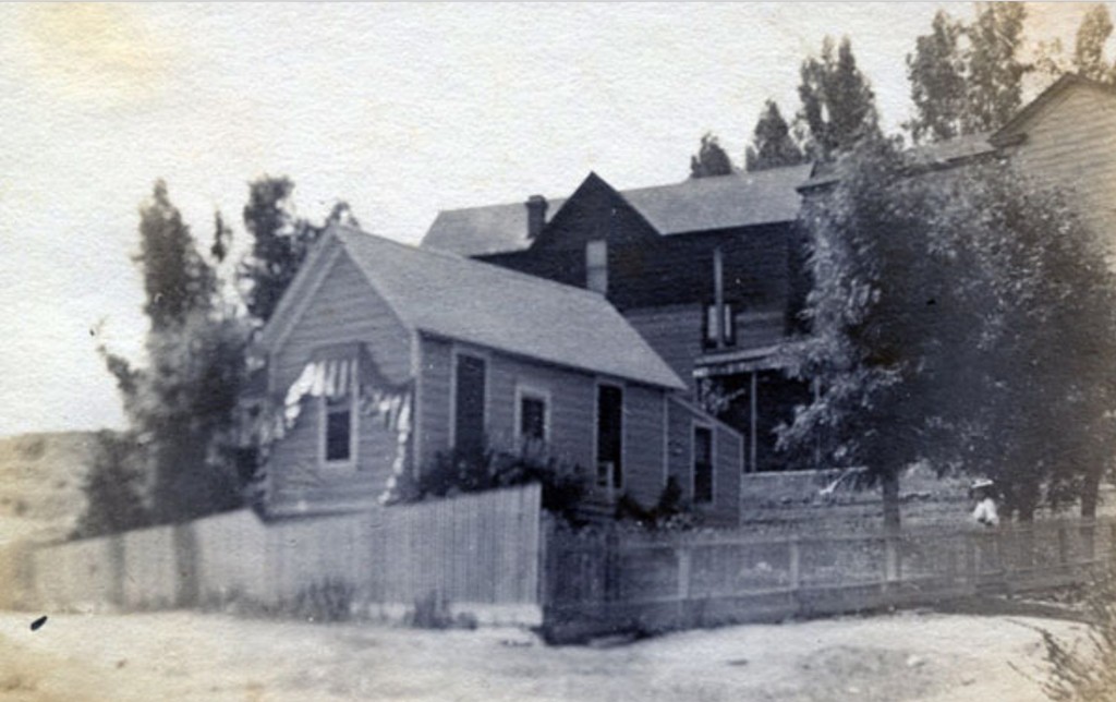
Fulfilling a promise, or threat, I made back in April, here's the pic that is on the back of the photo album page the front of which has that photo of the Main St. face of the Bullard Block. It's tightly glued to the album page, so I don't think it wise to pry it up to see if there's any data on the back of the photo.
 odinthor collection
It's labeled "Residence of Fred Robinson Los A.", with no further indication of location. Any thoughts?
You will detect a person in the photo who, I suspect, is not Fred Robinson. |
I took it as a promise, not a threat.

1894 LACD:
 LAPL
LAPL
1903 LACD:

fold3.com
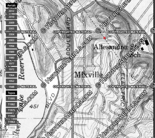
Brook Street is now S. Toluca Street, as you'll see on the maps that follow.
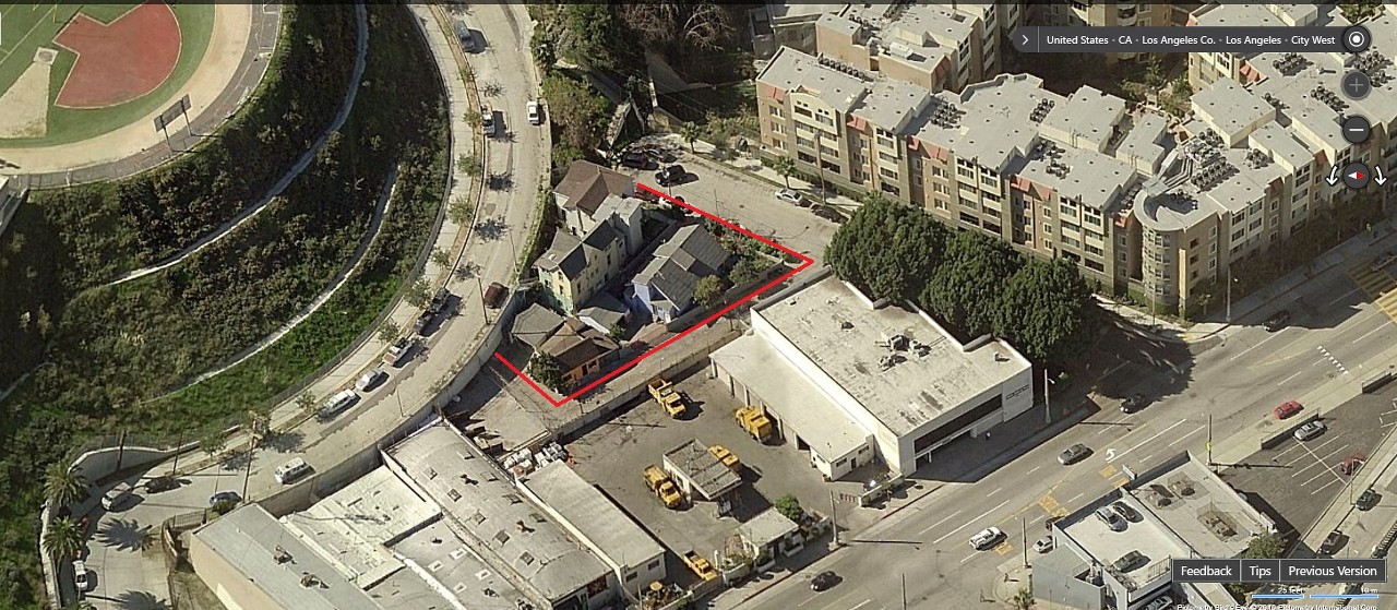
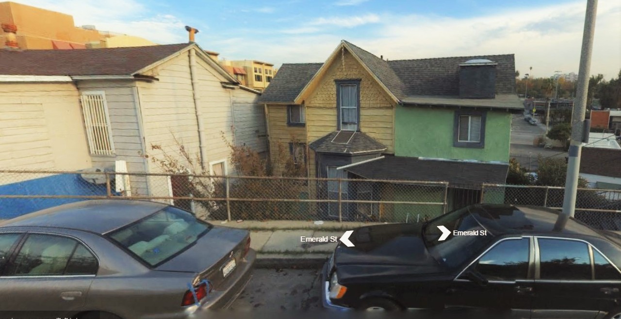
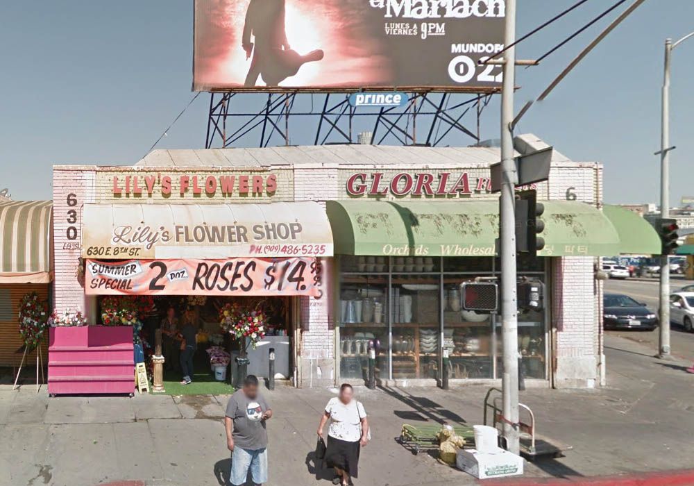
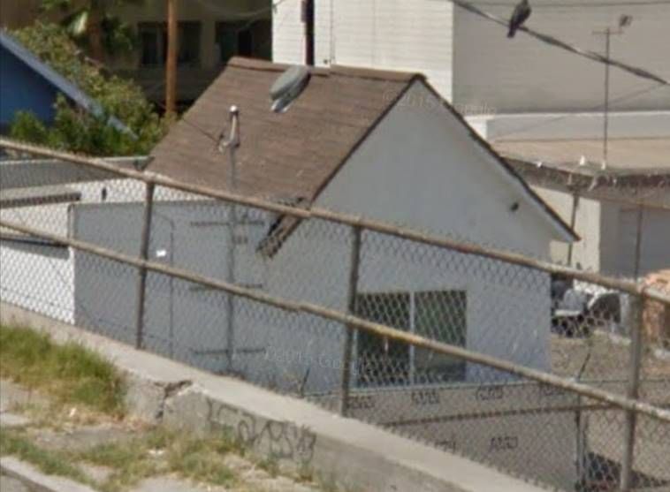
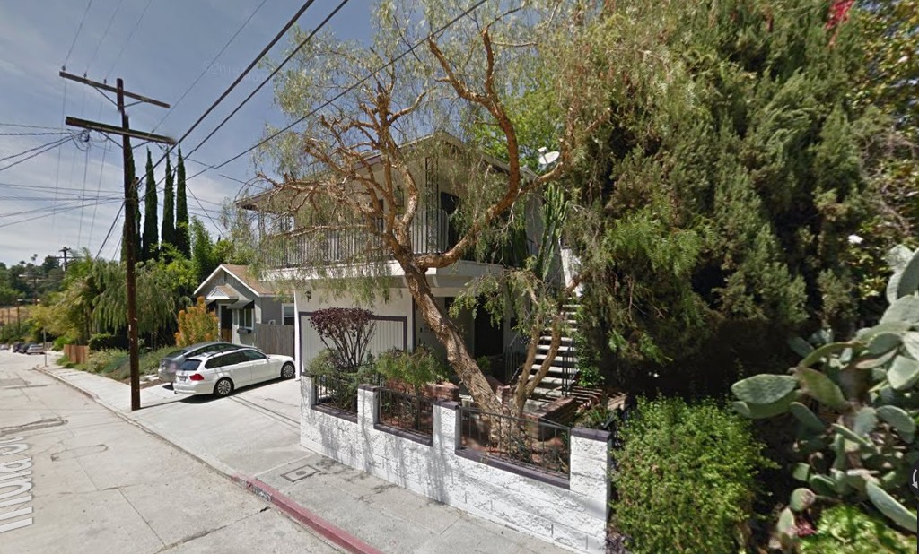
Below, the blue house is 222 S. Toluca, at right is 242 S. Toluca, and the yellow house in the rear is 251 Emerald.
The roof lines of 242 Toluca and 251 Emerald plus the hill in the background are all consistent with the vintage photo
(though the windows of 251 Emerald are not). The blue house is too big to be the one-story home in the vintage photo,
but the little white building down at the end of the lot at left might be the same structure:
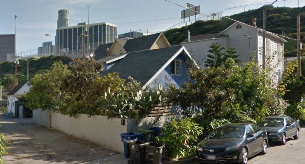
March 2015 GSV
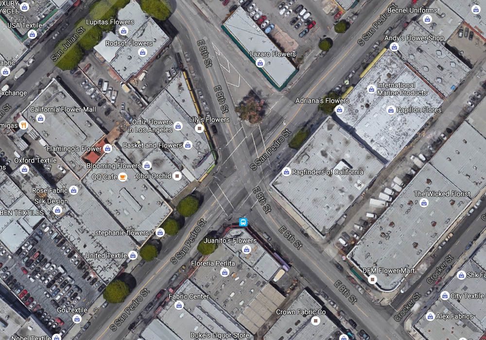
Here's a map of the area as it is today. The buildings on the east side of S. Toluca, just north of Emerald, are those
shown in the GSV view above:
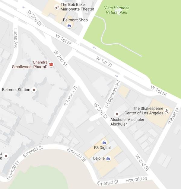
Googlemap
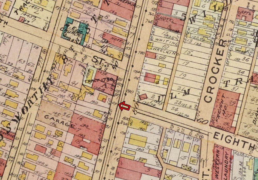
At far left on the 1906 Sanborn Map below, we see S. Toluca was then called Brook Street. One-story 222 Brook sits in
the same orientation to the houses next door as it does in the vintage photo. We also see Fred Robinson's grocery store
at 1266 W. 2nd Street, marked S for Store, next to the compass rose:
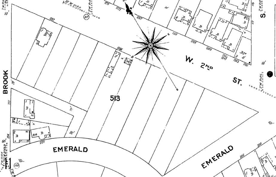
Proquest via LAPL


 Prev
Prev


 Thanks for the correction Blaster.
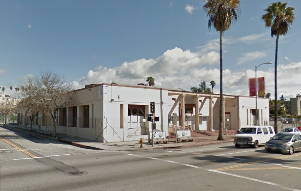


 Linear Mode
