HomeDiagramsDatabaseMapsForum About
     

Go Back   SkyscraperPage Forum > Discussion Forums > Transportation


Reply

 
Thread Tools Display Modes
     
     
  #521  
Old Posted Aug 4, 2012, 5:04 PM
ardecila's Avatar
ardecila ardecila is offline
TL;DR
 
Join Date: Jun 2006
Location: the city o'wind
Posts: 16,383
Yeah, a Dulles-Pentagon link could be pretty useful. Unfortunately retrofitting new connections into existing subway tunnels is very complex if they weren't designed with future-provisions. It's hard to see how they could do it while maintaining train service. I guess if the land above the junction is not intensely developed and the tracks are not too deep, they could just do the work in a huge pit and backfill later (I believe this is how they built the junction south of King Street)

As always, a "flat junction" is much easier to build than a "flying junction", but the flat junction would place constraints on train frequency that are probably unacceptable given WMATA's peak headways.
__________________
la forme d'une ville change plus vite, hélas! que le coeur d'un mortel...
Reply With Quote
     
     
  #522  
Old Posted Aug 5, 2012, 12:10 AM
cambron J's Avatar
cambron J cambron J is offline
Registered User
 
Join Date: Jul 2012
Posts: 150
Connecting the C route (Blue line) north of the Pentagon to the L route (Yellow line) east of the Pentagon would be an all cut and cover affair as the existing tunnels east and west of the Pentagon are cut and cover. The outbound L route (Yellow line) to inbound C route (Blue line) would be the easiest as the tunnel would not have to pass over or under any of the existing tunnels. Outbound C route (Blue line) would have to duck under both C route (Blue line) tunnels and both L route (Yellow line) tunnels to connect to the inbound L route (Yellow line). NATM might be employed in this area to reduce the need to demolish the new Pentagon River Terrace Entrance.

The K route (Orange line) tunnels west of Rosslyn and C route (Blue line) tunnels south of Rosslyn are tunnels bore through bed rock. Portions of the K route (Orange line) tunnels west of Rosslyn run through easements under private property. Again the inbound K route (Orange line) to outbound C route (Blue line) would be the easiest as the tunnel would not have to pass over or under any of the existing tunnels. The inbound C route (Blue line) to outbound K route (Orange line) might end up being a little bit more tricky. The inbound C route (Blue line) to to outbound K route (Orange line) would likely have its junction south of the existing portal north of Arlington Cemetery station so it can pass over the existing C route (Blue line) tunnels and K route (Orange line) tunnels because the K route (Orange line) between Rosslyn and Court House ascend / descend on a 4 percent grade, ducking them under would require grades greater then the maximum allowed 6 percent.

There also is the issue as to where the junction turnout would be located. There is sufficient lengths of tangent on the routes east and north of the Pentagon and west of Rosslyn to insert junction turnouts, South of Rosslyn the junction turnouts would likely have to be on the surface just north of the Arlington Cemetery station.
__________________
John in the sand box of Maryland's eastern shore.
Reply With Quote
     
     
  #523  
Old Posted Aug 5, 2012, 5:14 PM
afiggatt afiggatt is offline
Registered User
 
Join Date: May 2009
Location: Virginia
Posts: 333
Quote:
Originally Posted by cambron J View Post
The K route (Orange line) tunnels west of Rosslyn and C route (Blue line) tunnels south of Rosslyn are tunnels bore through bed rock. Portions of the K route (Orange line) tunnels west of Rosslyn run through easements under private property. Again the inbound K route (Orange line) to outbound C route (Blue line) would be the easiest as the tunnel would not have to pass over or under any of the existing tunnels. The inbound C route (Blue line) to outbound K route (Orange line) might end up being a little bit more tricky. The inbound C route (Blue line) to to outbound K route (Orange line) would likely have its junction south of the existing portal north of Arlington Cemetery station so it can pass over the existing C route (Blue line) tunnels and K route (Orange line) tunnels because the K route (Orange line) between Rosslyn and Court House ascend / descend on a 4 percent grade, ducking them under would require grades greater then the maximum allowed 6 percent.
Thanks for the technical details on the issues with the possible interline connectors. I would have simply noted that Rosslyn is a deep station cut of of solid rock and that an interline connector there would be expensive to build. A shortcoming of the interline connector south of Rosslyn is that it would skip the Rosslyn station, one of the busier stations on the Orange line.

I see from the insert map on pg 9 that the concept for the Blue-Yellow interline connector north of the Pentagon shows a second Pentagon station connected to the existing Pentagon station via a tunnel. That would make it a fairly expensive interline connector.

The 3rd interline connector south of L'Enfant Plaza would bypass (crowded) L'Enfant which I gather is one of the points to it. Looking at the map, it appears the interline connector could be long enough to support inserting a station on it. But the area does not look dense enough or far enough away from the Waterfront Metro station to justify a new inserted station.

They did not include in the alternate routes reviewed, but the Rosslyn interline connector would allow for an all Virginia line. Once the Silver Line opens, someone starting from Huntington or Eisenhower stations going to Tysons, Reston, Dulles will have to either:
1) Take the long route via 1 connection at L'Enfant Plaza and through downtown DC.
2) Make 2 connections by switching to a Blue line train from King St to the Pentagon and then connect to a Silver Line train at Rosslyn. Thiis could take even longer during Rush Plus.

An interline connection south of Rosslyn would allow for a new line to run from the end of the Silver Line at Ashburn to Dulles to Tysons to Court House and then to the Pentagon to King St to Huntington. We'll see when the complete Silver Line opens, but I suspect there will be a fair amount of King Street, Potomac Yards, National Airport to Tysons Corner and further out the Silver Line traffic.

The cost - benefit analysis of the interline connectors will probably result in the ideas being dropped. On the other hand, if they do move forward with the Blue Line re-route to Georgetown and M Street concept. they should look at building the interline connector at the same time to soon to be little used Blue Line tunnels leading to the existing Rosslyn station. If the idea is even feasible. Then there could be a re-routed Blue Line and a new TBD color line running from Ashburn to Huntington.
Reply With Quote
     
     
  #524  
Old Posted Aug 6, 2012, 1:11 AM
cambron J's Avatar
cambron J cambron J is offline
Registered User
 
Join Date: Jul 2012
Posts: 150
afiggatt
I see from the insert map on pg 9 that the concept for the Blue-Yellow interline connector north of the Pentagon shows a second Pentagon station connected to the existing Pentagon station via a tunnel. That would make it a fairly expensive interline connector.


If WMATA wants the platforms on the C route to L route connector to be close to the existing Pentagon station they are going to have to dig those tunnel real close to the river entrance side of the Pentagon. An alternative would be to put the connector alignment along Washington Boulevard side Pentagon then build the C route to L route connector station parallel to the existing station. This would be similar to the Rosslyn station for the M Street subway. See PDF page 12 Future Metrorail Capacity Needs (424 KB PDF file).

The 3rd interline connector south of L'Enfant Plaza would bypass (crowded) L'Enfant which I gather is one of the points to it. Looking at the map, it appears the interline connector could be long enough to support inserting a station on it. But the area does not look dense enough or far enough away from the Waterfront Metro station to justify a new inserted station.

Inserting a station between the sunken tube tunnel under the Washington Channel and the Waterfront station would not be an easy trick. As it stand now the tunnels between L'Enfant Plaza and Waterfront and between L'Enfant Plaza and the Washington Channel tunnel will require significant modification west of the Waterfront station and east of the Washington Channel tunnel as there is not sufficient tangent track to accommodate junction turnouts.

They did not include in the alternate routes reviewed, but the Rosslyn interline connector would allow for an all Virginia line. Once the Silver Line opens, someone starting from Huntington or Eisenhower stations going to Tysons, Reston, Dulles will have to either:
1) Take the long route via 1 connection at L'Enfant Plaza and through downtown DC.
2) Make 2 connections by switching to a Blue line train from King St to the Pentagon and then connect to a Silver Line train at Rosslyn. Thiis could take even longer during Rush Plus.


WMATA presently advertizes 3 minute headway on the trunk segments of the system during peak, reality is they are actually running something closer to 2 minute headway on the Rush Plus schedule. The train control and signaling system is designed to accommodate 90 second headways. WMATA can not operate the the railroad on 90 second headways because they don't have enough rolling stock.
__________________
John in the sand box of Maryland's eastern shore.
Reply With Quote
     
     
  #525  
Old Posted Aug 6, 2012, 2:21 AM
paytonc's Avatar
paytonc paytonc is offline
pragmatist
 
Join Date: May 2005
Location: beautiful as well as sanitary DC
Posts: 227
Quote:
Originally Posted by afiggatt View Post
The 3rd interline connector south of L'Enfant Plaza... it appears the interline connector could be long enough to support inserting a station on it. But the area does not look dense enough or far enough away from the Waterfront Metro station to justify a new inserted station.
I wouldn't assume that new connector tracks serving only one line would automatically lead to new stations, but an infill station there would be located directly at the Wharf redevelopment, and at the southern edge of the Southwest EcoDistrict. Although the area is currently under-used, it will be very intensively developed over the near and mid-term.
__________________
draft SUV drivers first
http://westnorth.com
Reply With Quote
     
     
  #526  
Old Posted Aug 6, 2012, 4:45 AM
Nexis4Jersey's Avatar
Nexis4Jersey Nexis4Jersey is offline
Greetings from New Jersey
 
Join Date: Mar 2009
Location: North Jersey
Posts: 3,283
Some Tysons Corner pix...


Untitled by VaDOT, on Flickr


Untitled by VaDOT, on Flickr


Untitled by VaDOT, on Flickr


Untitled by VaDOT, on Flickr
Reply With Quote
     
     
  #527  
Old Posted Aug 23, 2012, 1:54 PM
dgreen dgreen is offline
Registered User
 
Join Date: May 2011
Posts: 89
Quote:
Originally Posted by dgreen View Post
Reston has great potential.
Speaking of Reston's potential, the owners of the Reston National Golf Course are interested in redeveloping the land.

Whether it's likely to happen, a good idea or a bad idea, or would be done in a way that urbanists support is all irrelevant to the fact that it seems people see the value of the land on the north and south side of the toll road. The eastern end of the golf course is less than 1/2 mile from the Weihle Ave Station and the western end is about a 1/2 mile from the Reston Station.
Reply With Quote
     
     
  #528  
Old Posted Sep 15, 2012, 3:57 AM
cambron J's Avatar
cambron J cambron J is offline
Registered User
 
Join Date: Jul 2012
Posts: 150
Visited the project area 09 08 2012, Here are my observations, link to pictures at end of post.

The last span of the elevated in the median of the Dulles Access Road was set on 07 17 2012 completing all of the bridge and elevated construction.

Back to the east, all of the sound barrier parapets on the flyover bridges have been installed. Virtually all of the parapets on the elevated between the east abutment in the median of the Dulles Connector Road and the Tysons Corner station have been installed. More then half have been installed between the Greensboro and Spring Hill Road stations. Most of the ones that remain to be installed are on the north side along outbound track N2. West of the Spring Hill Road stations the parapets have been installed roughly 200' west of the straddle bent over eastbound VA-7 Leesburg Pike on inbound track N1 and just south of the eastbound lanes of the VA-267 Dulles Toll Road on outbound track N2.

Rail has been pulled west to the west abutment in the median of the Dulles Access Road on track N1, and to a point near the straddle bent over the eastbound VA-267 Dulles Toll Road. From the west track has been laid to the bottom of the grade of the west abutment retained fill.

Train control has been installed in the junction and testing is being done on the Orange line main line tracks. I do not know if the third rail has been energized on the N route Silver line tracks in the junction. I also do not know if feeler car has been run through the area.

The Falls Church Yard lead cut and cover tunnel has been completed and the surface restored, however the track between the yard and the yard lead junction has not been laid.

The platform canopy at the Tysons McLean station is nearly complete. The mezzanine to platform escalators and elevators along with the escalators in the entrance pavilion on the south side of VA-123 Dolley Madison Boulevard have been installed. The emergency exit structure at both ends of the station are in place along with the stairs in side. The columns for the pedestrian bridge connecting the entrance pavilion to the station mezzanine are in place. The contractor tasked with the construction bridge is do so on property the south south of the entrance pavilion that will eventually become the station off street bus terminal. After they are assembled they will be transported to the columns and lifted into place.

Most of the heavy construction taking place at the Tysons Corner station is happening in the area of the entrance pavilion on the south side of VA-123 Chain Bridge Road in front of Tysons Corner Center. The mezzanine to platform escalators and elevators have been installed. The emergency exit structure at the east of the platform is in place.

At the Greensboro station construction has begun on the assembly of the station canopy. The construction of both entrance pavilions are well under way. The mezzanine to platform escalators and elevators have been installed.

At the Spring Hill road station construction of both entrance pavilions are well under way. The mezzanine to platform escalators and elevators have been installed.

At Wiehle Avenue the south entrance pavilion is well under way the north entrance pavilion will be integrated into the Reston Station development that is presently under construction on the former park and ride property.

The station with fare collection mezzanine above the platform (Tysons Corner, Greensboro and Wiehle Avenue) will have the arched combination mezzanine platform canopy. The station with fare collection mezzanine under the platform (Tysons McLean and Spring Hill) will have the gabled platform canopy.

Couple of oddities I have noticed:

The south entrance pavilions at the Greensboro and Spring Hill stations are being built partly in the right lanes of VA-7 Leesburg Pike.

At several location the train control contractor is unable to install of the interlockings signals because the surface mounted cable trays next to the barrier walls is located where the basses for signal poles need to be.

There are various items that look as if they were considered as after thoughts. Such as drainage from bridge decks, traction power cables locations. On the existing railroad bridge deck drainage pipes are inside the columns as are the conduits for traction power cables. On this project the bridge deck drainage pipes are surface mounted on the columns as are the cable trays that carry the traction power cables. I am going to guess that before all is said and done I will also notice other things that were changed or added as after thoughts.

The pictures I took can be seen at 09 08 2012.
__________________
John in the sand box of Maryland's eastern shore.
Reply With Quote
     
     
  #529  
Old Posted Oct 4, 2012, 3:34 AM
cambron J's Avatar
cambron J cambron J is offline
Registered User
 
Join Date: Jul 2012
Posts: 150
From VDoT flicker photo stream Aerials in NOVA August-22-2012
Pictures taken couple of weeks after the pictures I took in the post above
All pictures by Trevor Wrayton


VA-7 Leesburg Pike VA-267 Dulles Access / Toll Roads.


VA-7 Leesburg Pike VA-267 Dulles Access / Toll Roads.


VA-7 Leesburg Pike Spring Hill station.


VA-7 Leesburg Pike, Greensboro and Spring Hill stations.


VA-7 Leesburg Pike, Greensboro and Spring Hill stations.


VA-123 Dolley Madison Boulevard VA I-495 Capitol Beltway.


VA-123 Dolley Madison Boulevard VA I-495 Capitol Beltway, Tysons Corner station.


VA-123 Dolley Madison Boulevard VA I-495 Capitol Beltway, Tysons Corner station.


VA-123 Dolley Madison Boulevard VA-267, Tysons McLean station.


VA-123 Dolley Madison Boulevard VA-267, Tysons McLean station.


VA I-66 VA-267 Dulles Connector Road flyover.


VA I-66 VA-267 Dulles Connector Road flyover.

Previous VDoT Aerials can be seen at my DCMP blog.
__________________
John in the sand box of Maryland's eastern shore.

Last edited by cambron J; Oct 4, 2012 at 3:47 AM.
Reply With Quote
     
     
  #530  
Old Posted Oct 10, 2012, 2:10 AM
202_Cyclist's Avatar
202_Cyclist 202_Cyclist is offline
Registered User
 
Join Date: Feb 2009
Posts: 5,945
Another delay for H Street/Benning Road streetcar line

Another delay for H Street/Benning Road streetcar line


Posted by Mike DeBonis
October 9, 2012
Washington Post

"At this rate, it’s hard to see a streetcar rolling down any D.C. street before 2014.

That’s the only conclusion to draw after city transportation director Terry Bellamy told a D.C. Council panel Tuesday that a Northeast neighborhood’s move to block plans for a car barn could add up to 90 days — or a lot more — to the current official estimated opening date of “late 2013.”

The proximate reason for the latest delay is an application to city historic preservation authorities seeking landmark status for Spingarn Senior High School and its grounds, which is where city officials are planning to locate the car barn that is a prerequisite for the line’s opening. Should the Historic Preservation Review Board grant the Kingman Park Civic Association’s request later this year, the process of reworking the plans could add many months to the opening date. Should it decline the application, the delay would be less dramatic..."

http://www.washingtonpost.com/blogs/...-line/?hpid=z6

David Alpert also has a post about this at Greater Greater Washington.
Landmark nomination, or DDOT snafus, may delay streetcar
http://greatergreaterwashington.org/...lay-streetcar/
Reply With Quote
     
     
  #531  
Old Posted Oct 11, 2012, 2:56 PM
dgreen dgreen is offline
Registered User
 
Join Date: May 2011
Posts: 89
Not sure what thread this fits in. I thought someone posted about the Wilson Bridge pedestrian/bike path when it opened, but I can't find that post.

Anyway, I noticed something somewhat strange yesterday. I commute across the Wilson Bridge. On my way home last night, I noticed more people than usual using the path. Most days, I'd say there might be one or two people (not that I'm usually counting) in the evening around 6 PM. Yesterday, I noticed a couple walkers, a couple bikers, and a couple joggers right at the beginning of the bridge. So I decided to count. I counted 25 people using the path in the one minute it takes me to cross the bridge in a car.

Now, that's certainly nothing amazing. We're not talking Brooklyn Bridge traffic here. But, it was definitely a noticeable change. I'm pretty much never in that area on the weekends, so I'm not sure what the weekend traffic is like. The one time I walked the bridge a couple years ago, it was my family and about 5 other people over about a 30 minute time frame.
Reply With Quote
     
     
  #532  
Old Posted Nov 21, 2012, 1:49 PM
OhioGuy OhioGuy is offline
Registered User
 
Join Date: Jul 2004
Location: DC
Posts: 7,653
A great update with 93 photos of the silver line construction from the Orange line to Wiehle Avenue in Reston.

http://cambronj.blogspot.com/2012/11...1-17-2012.html
Reply With Quote
     
     
  #533  
Old Posted Nov 21, 2012, 1:53 PM
cambron J's Avatar
cambron J cambron J is offline
Registered User
 
Join Date: Jul 2012
Posts: 150
Visited the project area 11 17 2012, Here are my observations, link to pictures at end of post.

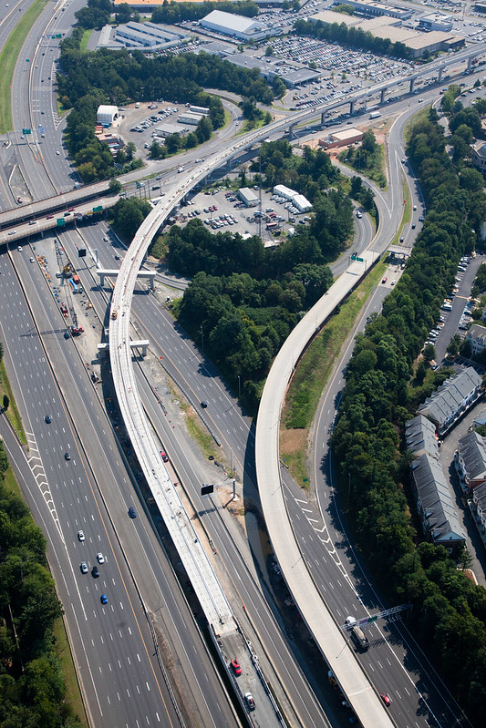
The signal installation problem at some of the interlockings has been solved. The contractor attached an L bracket to the inside of the barrier wall above the cable trench and mounted the signal mast base on top of the L brackets. A flexible conduit extends down from the under side of the bracket into the cable trench.

The feeler car is now located in the Falls Church Yard. This could mean that WMATA is close to making the first run on the route under third rail power. Word has it this move should happen before the middle of December.

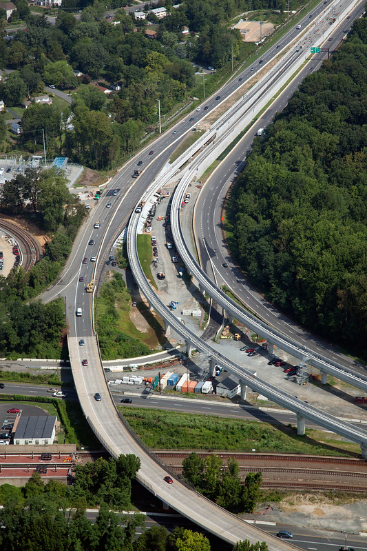
This would make sense because all of the traction power substations from the junction and along the Dulles Connector Road VA-267 are in place and have been connected to the third rail. All of the cables connecting the tiebreaker and substation along Dolley Madison Boulevard and Chain Bridge Road VA-267 including the inside to outside third rail jumper cables are in place. All of the traction power substations and jumper cables are in place along Leesburg Pike VA-7 and the Dulles Access Road all the way to the Wiehle-Reston East station. The only location where third rail cables have not been installed is between the substation and the interlocking west of the Spring Hill station.

It is not uncommon to test the traction power distribution system using trains prior to having the train control and signaling system up and running.

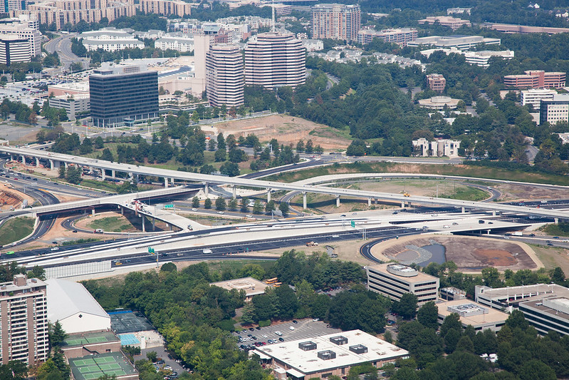
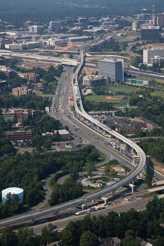
All of the signals have been installed between the junction and the McLean station and along the Dulles Access Road west of Leesburg Pike. The signals protecting the interlocking west of the Spring Hill station did not appear to be installed yet, I am unable to see the interlocking west of the Tysons Corner station so I can not tell what the progress is there.

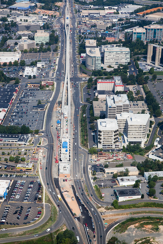
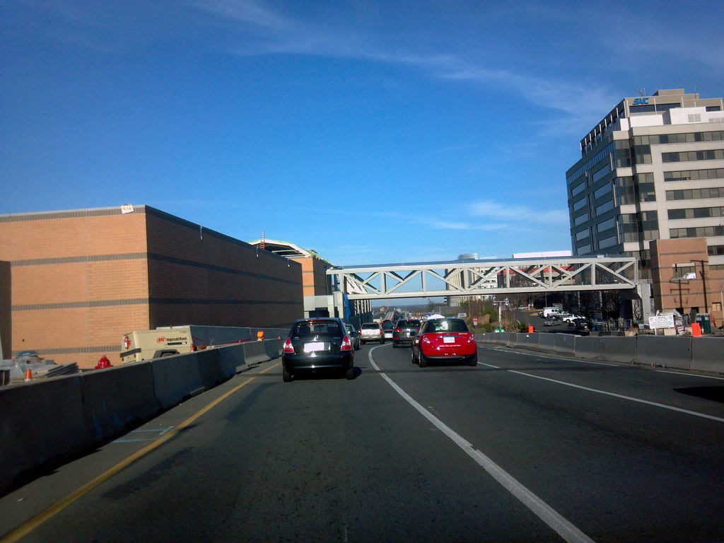
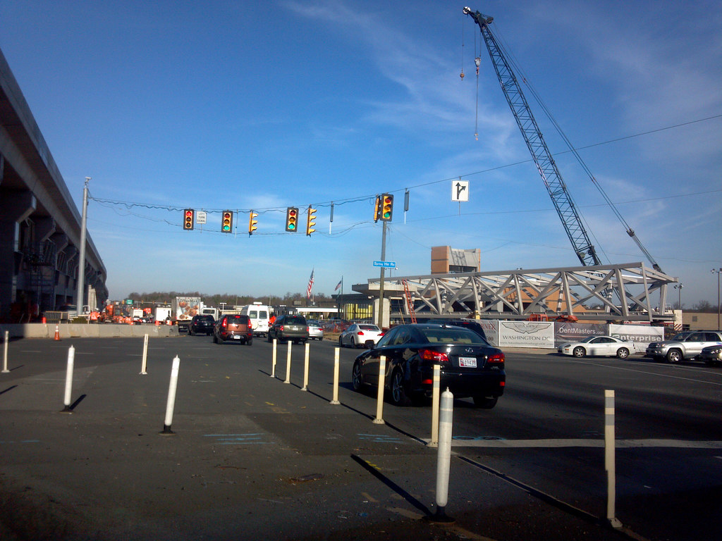
The 5 pedestrian bridges at the McLean, Greensboro and Wiehle-Reston East stations have been installed. One span at Wiehle-Reston East, north side, is awaiting the contractor building the Reston Station development. The pedestrian bridge for the north side at Spring Hill was being assembled on the ground. The entrance pavilions at Spring Hill are not totally done and are still awaiting their architectural precast concrete. The contractor was starting the assembly of the canopy over the entrance pavilion at the McLean station.

Escalators have been installed in the entrance pavilions at McLean, Greensboro north entrance and Wiehle-Reston East south entrance. The only entrance pavilions where work is being done on the elevators is at the McLean station.

So far I have noticed two incorrectly fabricated architectural precast concrete panel. At first I thought it one of them was installed upside down, on closer inspection it has the darker bands one course lower then the others on the first one I noticed and two courses higher on the other.

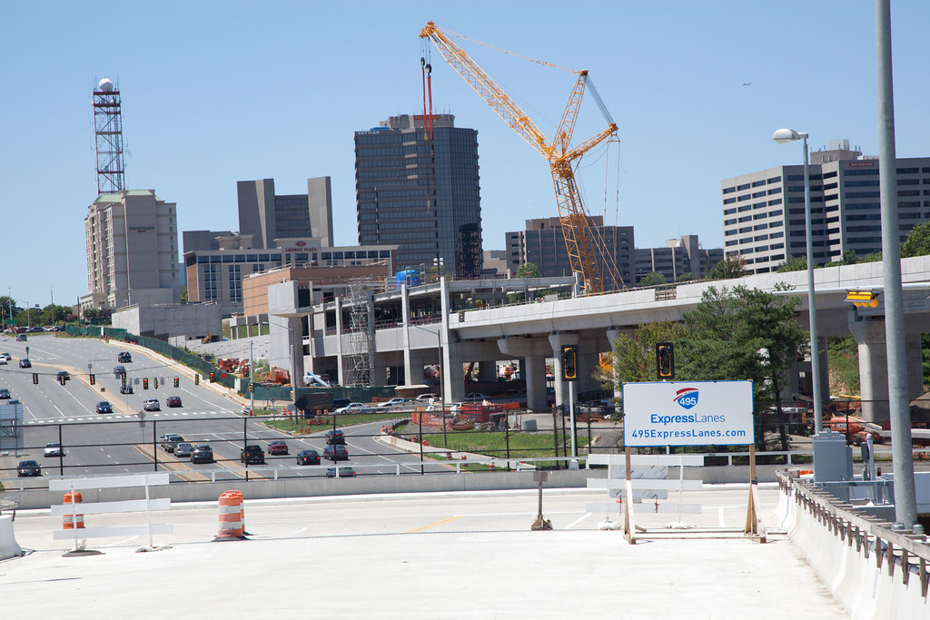
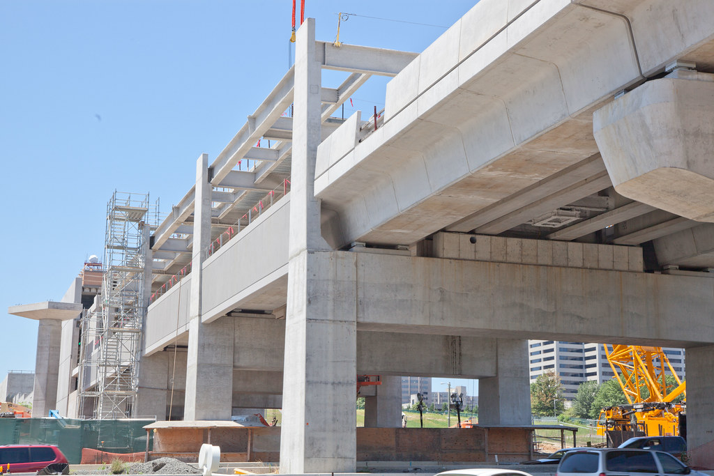
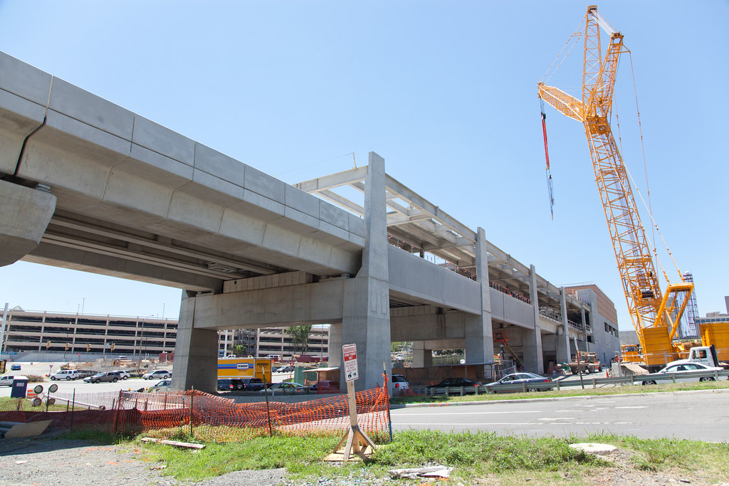
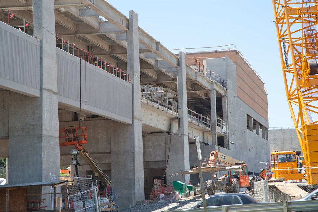
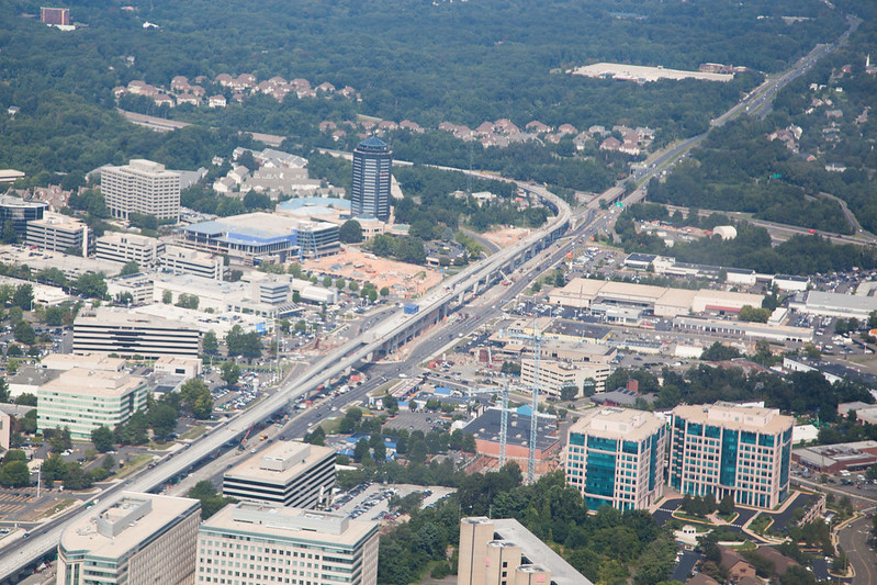
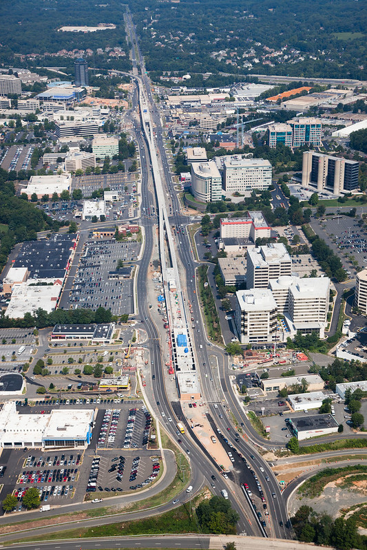
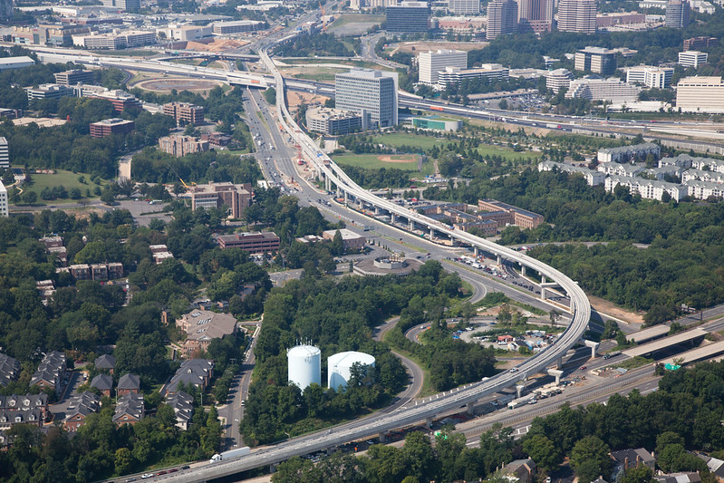
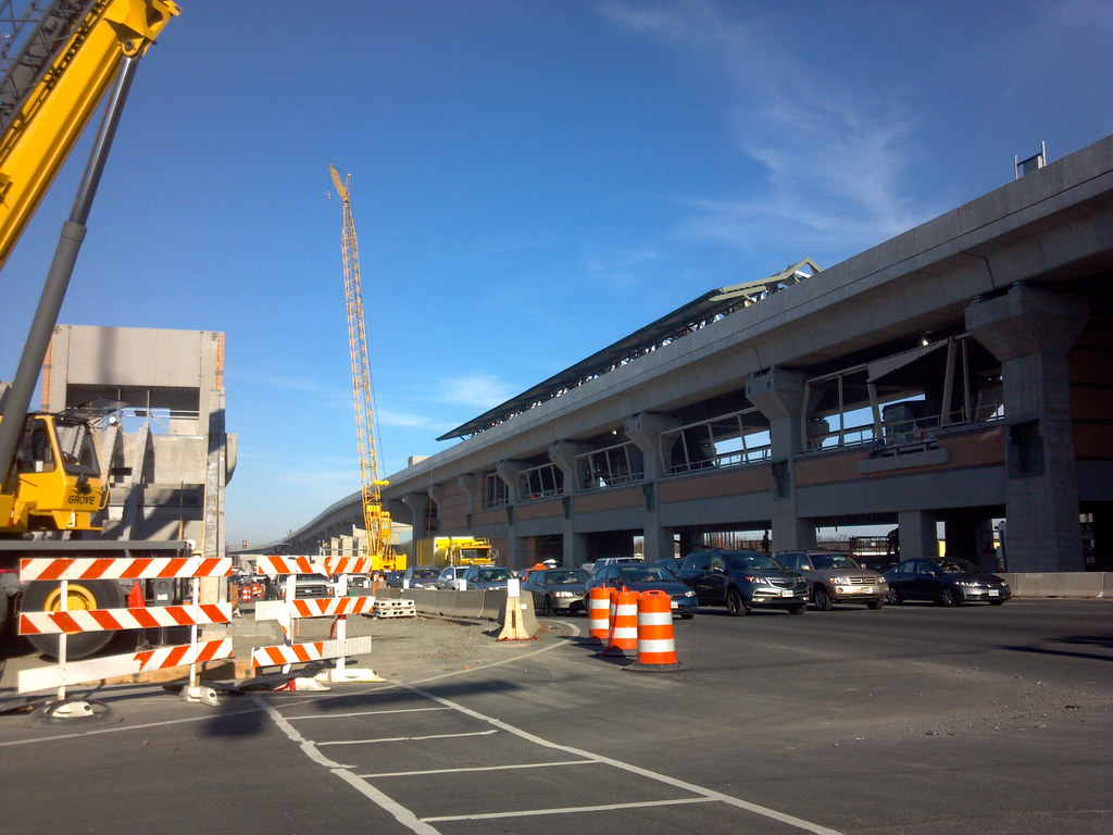
The platform canopies have been installed at the McLean station. Progress is well under way at the Spring Hill station. The mezzanine and platform canopies at Greensboro and Tysons Corner are nearly done.

Most of the architectural steelwork at the McLean station has been installed

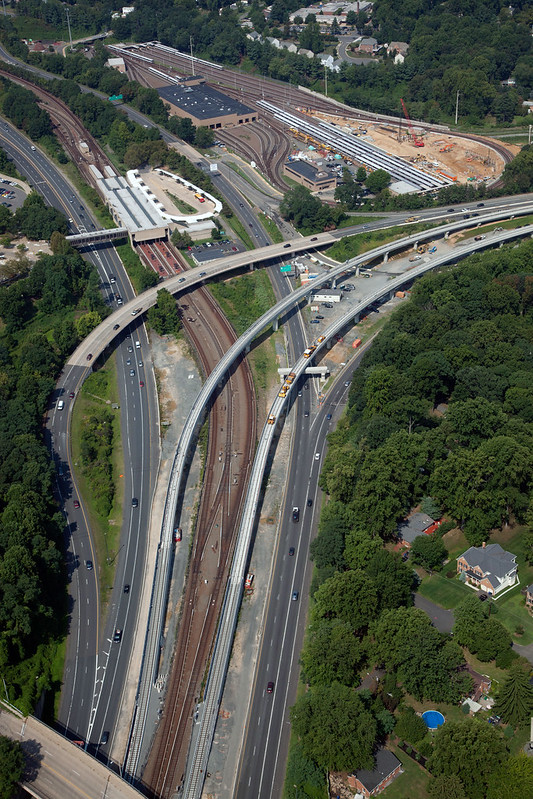
The right of way intrusion detection system cables on the fences from the junction to the east abutment at Old Chain Road have been installed. Form the west abutment west of Leesburg Pike to the tail tracks west of the Wiehle-Reston East station the installation is about 95 percent done.

Chaining signs have been installed along the right of way as far west as Hunter Mill Road a T/B (Turn Back) sign has been installed west of the yard lead junction. Various signs that identify the location of train control boundaries have been installed.

Based on my latest observations the RTUs (Remote Terminal Unit) are as follows:
  • K98 K&N Junction
  • N91 Plainfield Street (Fall Church Yard Lead)
  • N92 Baldwin Drive (Dulles Connector Road)
  • N01 McLean (Tysons East)
  • N02 Tysons Corner (Tysons Central 123)
  • N03 Greensboro (Tysons Central 7)
  • N04 Spring Hill (Tysons West)
  • N05 Wolf Trap
  • N93 Chatham Ford Drive
  • N94 Hunter Mill
  • N95 Sunset Hill Road
  • N06 Wiehle-Reston East (Wiehle Avenue)
In the curve east of the Hunter Mill Road overpass and in the curve west of the Beulah Road overpass the elevation of inbound track N1 is lower then the elevation of outbound track N2.

The structure built to house post-tension segment casting plant at Dulles International Airport is still standing, however all of the equipment used to do the casting and handling of the segments has been removed.

Captioned thumb nails along with the above and past essays can be view at cambronj.blogspot.com DCMP 11 17 2012.
Pictures with captions can be viewed at picasaweb.google.com/cambronjr DCMP 11 17 2012.
__________________
John in the sand box of Maryland's eastern shore.
Reply With Quote
     
     
  #534  
Old Posted Dec 7, 2012, 3:56 AM
Cirrus's Avatar
Cirrus Cirrus is offline
cities|transit|croissants
 
Join Date: Jul 2001
Location: Washington, DC
Posts: 18,384
A few quick construction pictures I snapped today with my cell phone while stopped amidst traffic.

Greensboro station:


Spring Hill station:


Viaduct near Spring Hill:


Spring Hill's pedestrian bridge, waiting to be installed:
__________________
writing | twitter | flickr | instagram | ssp photo threads
Reply With Quote
     
     
  #535  
Old Posted Dec 9, 2012, 6:02 PM
cambron J's Avatar
cambron J cambron J is offline
Registered User
 
Join Date: Jul 2012
Posts: 150
I see the finished assembling the first pedestrian bridge for the Spring Hill station. Traffic advisories don't say when it will be set.

Several people posting in an other forum reported seeing WMATA's "feeler car" (clearance checking car) on 12 06 and 12 07 2012 at various location along the route. Running the feeler car over the route is the first step taken before test trains start running.
__________________
John in the sand box of Maryland's eastern shore.
Reply With Quote
     
     
  #536  
Old Posted Dec 17, 2012, 7:47 PM
202_Cyclist's Avatar
202_Cyclist 202_Cyclist is offline
Registered User
 
Join Date: Feb 2009
Posts: 5,945
Capital Bikeshare

The District Department of Transportation published the locations for 54 new Capital Bikeshare stations expected to be installed this winter.

DDOT Releases New Capital Bikeshare Locations
Reply With Quote
     
     
  #537  
Old Posted Dec 18, 2012, 12:03 AM
Busy Bee's Avatar
Busy Bee Busy Bee is offline
Show me the blueprints
 
Join Date: Feb 2006
Location: on the artistic spectrum
Posts: 10,374
Hey, does anyone in DC know where I can find some pics online of the completed O and P street reconstruction in Georgetown? Thanks.
__________________
Everything new is old again

There is no goodness in him, and his power to convince people otherwise is beyond understanding
Reply With Quote
     
     
  #538  
Old Posted Dec 31, 2012, 3:32 PM
202_Cyclist's Avatar
202_Cyclist 202_Cyclist is offline
Registered User
 
Join Date: Feb 2009
Posts: 5,945
Crystal City streetcar plans underway (Washington Post)

Crystal City streetcar plans underway

By Patricia Sullivan
Dec 30, 2012
Washington Post

"The District’s H Street streetcar gets a lot of buzz, much of it owing to the neighborhood’s ongoing redevelopment and proximity to downtown. The Purple Line, more than a decade in the making, is much scrutinized as plans move forward to build a 16-mile transit way between Bethesda and New Carrollton. And the Arlington-Fairfax Columbia Pike streetcar has generated noisy opposition from activists who prefer less-costly buses.

But there’s another streetcar project in the area that so far has quietly moved forward.

In what is now a high-rise, car-centric area, Arlington County is planning a 2.5-mile-long streetcar line along the Route 1 corridor between Crystal City and the Alexandria city limits. Planners hope the streetcar will help to create a walkable neighborhood with street-level retail, dense housing and offices..."

http://www.washingtonpost.com/local/...939_story.html
Reply With Quote
     
     
  #539  
Old Posted Jan 22, 2013, 8:03 PM
eleven=11 eleven=11 is offline
Registered User
 
Join Date: Aug 2012
Posts: 1,053
google maps & wiki maps has new pics/maps
Reply With Quote
     
     
  #540  
Old Posted Jan 23, 2013, 4:34 PM
paytonc's Avatar
paytonc paytonc is offline
pragmatist
 
Join Date: May 2005
Location: beautiful as well as sanitary DC
Posts: 227
Quote:
Originally Posted by Busy Bee View Post
Hey, does anyone in DC know where I can find some pics online of the completed O and P street reconstruction in Georgetown? Thanks.
http://fixingoandpstreets.com/
http://www.flickr.com/photos/ddotpho...7631568787719/

I keep forgetting to snap photos of these when I'm around there. They did remove the "no bikes" signs, but cobblestones (with tracks, for added spite) are more effective for keeping us two-wheelers away than any sign could be.
__________________
draft SUV drivers first
http://westnorth.com
Reply With Quote
     
     
This discussion thread continues

Use the page links to the lower-right to go to the next page for additional posts
 
 
Reply

Go Back   SkyscraperPage Forum > Discussion Forums > Transportation
Forum Jump


Forum Jump


All times are GMT. The time now is 9:56 PM.

     
SkyscraperPage.com - Archive - Privacy Statement - Top

Powered by vBulletin® Version 3.8.7
Copyright ©2000 - 2024, vBulletin Solutions, Inc.