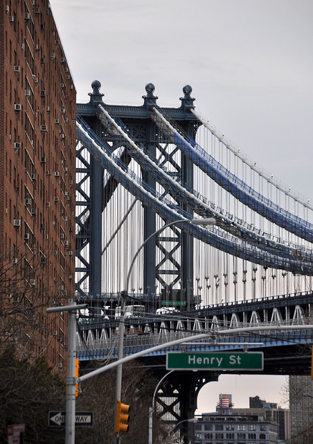
Road Trip to Southern Kentucky
Planning for a trip to the mountains of southeastern Kentucky always involves careful routing to maximize daylight photography opportunities and to maximize the number of bridges and tunnels seen. Deep valleys, winding one-lane roads and detours are almost always a certainty, and traveling from one point to another is never a straight line. My goal for this journey was to photograph four bridges that will be replaced in the near future with new spans, and to explore more of my home state.
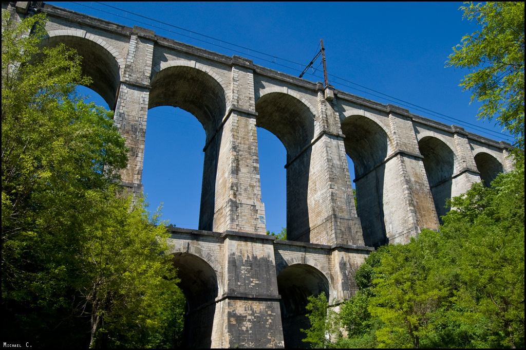
My first visit along my 600 mile travel was the
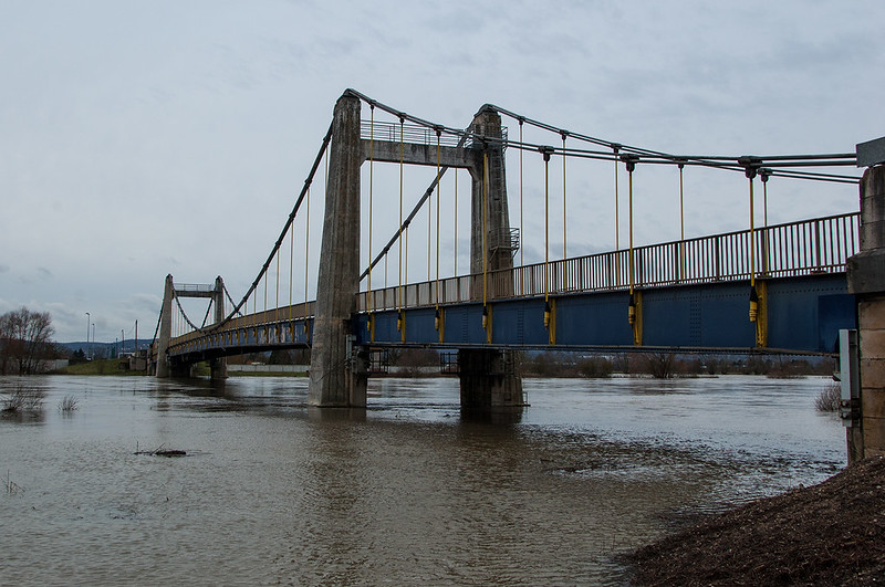
Heidelberg Bridge in Heidelberg, which carries Kentucky Route 399 over the Kentucky River. The polygonal Warren through truss was constructed in 1968 and replaced an earlier span at that location.


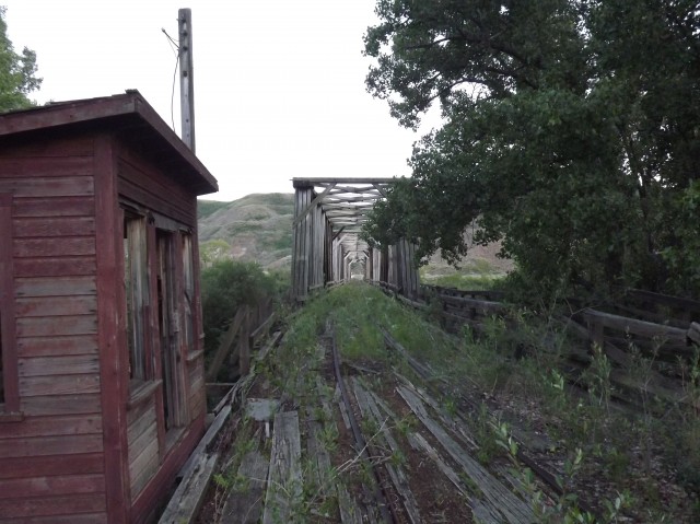
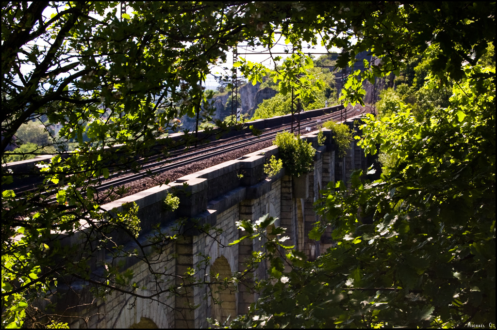
The
Heidelberg Bridge (Riney-B) was located adjacent to the Heidelberg highway span and carried the Richmond, Nicholasville, Irvine & Beattyville Railroad (Riney-B) Sturgeon Creek branch.
The 2.98-mile line was constructed by the Kentucky Coal Development Company from Heidelberg to Ida May via Sturgeon Creek from March 1907 to January 1908. The Riney-B was acquired by the Louisville & Atlantic Railroad on November 1, 1909, only to fall into the hands of the Louisville & Nashville Railroad a year later. The Sturgeon Creek branch provided a connection to the Kentucky, Rockcastle &*Cumberland*Railroad, but a lack of traffic on the branch caused it to be discontinued on April 13, 1935.
Only the piers remain today.

I had to pass eastward towards Jackson, and Kentucky Route 30 was the most logical route. It was a slow and tortious two-lane road, but it offered some great photographic opportunities of classic Appalachia. The
Kentucky Route 30 through truss bridge over the Middle Fork Kentucky River in Breathitt County was constructed in 1935 and is one of the more generic highway spans in the state with little ornamentation. It's still better than an even more generic reinforced concrete span.

After visiting a closed school and photographing the county seats of Booneville and Jackson, I waited for the sun to fall. I came across the
Kentucky Route 1812 pony truss bridge over Quicksand Creek near Jackson that was constructed in 1929 and snapped away, hoping for car trails on this full-moon night.
 Below
Below:*I revisited it the next day for an*additional*photograph.

Located adjacent to the Quicksand Creek Bridge is the
Robinson Road/County Route 1387 through truss over the North Fork Kentucky River. Constructed in the early 1900s, the bridge is scheduled to be replaced with a new 350-foot, two-lane span. Even fewer vehicles used Robinson Road than Kentucky Route 1812, and I waited for over one hour for the perfect shot: car trails that exhibited a car traversing a pothole ridden driving surface.
 Below
Below:*And in daylight.

I drove further south towards Hazard to complete some additional night photography before finding a hotel. The*
Combs Bridge carries Kentucky Route 80 over the Kentucky River in Combs and the three-span Parker truss was constructed in 1929. It is slated for replacement.
 Below
Below:*I revisited it the next day for an*additional*photograph.

South of Hazard is the
Glomawr Bridge carries Kentucky Route 451 over the North Fork Kentucky River in Glomawr. The Parker through truss was constructed in 1927 and is slated for replacement in 2013.
The Transportation Cabinet and Federal Highway Administration is currently*soliciting*a new owner for the bridge. The program allows government agencies, historic preservation organizations or individuals to reconstruct the bridge if its original characteristics are retained at the new site. Historic organizations and individuals must be approved by the state historic preservation officer to be eligible. The Transportation Cabinet and the Federal Highway Administration will pay the costs of marking parts of the bridge, disassembling it,*transporting*it to the new site and off-loading it. The recipient is responsible for all other costs, including site preparation, reassembly, replacement of parts suitable for the proposed use, and approaches.
 Below
Below: The span looks much better in daylight.


I spent much of the next day traversing the ridges and valleys of Perry and Breathitt counties.*I began my morning in Hazard and came across*
Town Mountain Road Bridge*that carries Kentucky Route 451 over the North Fork Kentucky River.*The span was completed in 2009 and is named after Mayor William D. Gorman, who led the city from 1978 until his death on October 9, 2010. The structurally massive bridge is aesthetically pleasing, although it has little to no vegetation worth noting around it. A little landscaping would go a long way.


Further south is the
North Fork Kentucky River Bridge for old Kentucky Route 15 in Jeff that was constructed in 1926 by the Atlantic Bridge Company of Greensboro, North Carolina. It was bypassed in 1969 with a new alignment.

The Louisville & Nashville Railroad (L&N) surveyed a route from Jackson south to the headwaters of the Kentucky River's North Fork to access rich coal veins of the eastern part of the state. A report on the survey was submitted on May 19, 1903 by Major R.H. Elliott of Birmingham, Alabama. No action was taken on the report until 1909 when the L&N acquired the Lexington & Eastern Railroad, which extended from Lexington to Jackson. An engineer, J.E. Willoughby, was sent out to locate a line from Jackson south into the coal fields, an attorney followed soon after acquiring right-of-way.
By October 1910, 80% of the right-of-way was secure and by January 1, 1911, construction had commenced on much of the alignment. The L&N spent $5.7 million to construct 101 miles of track from Dumont near Jackson to McRoberts along the North Fork Kentucky River, requiring 16 bridges.
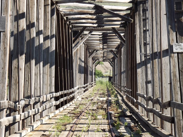
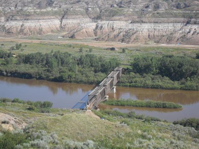
The
Jeff Railroad Bridge was constructed in Jeff by the Virginia Bridge and Iron Company in c. 1910 - c. 1911.


Further north along the same railroad is the*
Lothair Railroad Bridge*that was constructed by the same company in the same timeframe just south of Hazard. A pedestrian suspension bridge paralleled the railroad but it has long since collapsed.


Immediately north of the bridge is the
Lothair Tunnel.

The
Campbell Tunnels are located near near Napfor north of Hazard,*and were constructed circa 1911.

Even more remote is the*
Line Tunnel*located near Barwick between Breathitt and Perry counties,*and was constructed circa 1911.

The
Kentucky Union Railway*(KU) was a railroad that extended for 95 miles from Lexington to Jackson. The company was incorporated in 1872 to reach coal and timber resources in the southeastern reaches of the state. Construction did not begin on a rail line until 1886 when 14.7 miles of railroad was completed from Kentucky Union (later the L&N) Junction east of Winchester and Clay City. The line was extended west to Lexington in 1890 and southeast to Jackson in 1891 for a total of 92 miles. The route included six tunnels and 20 bridges.
The O&K Tunnel is located 1.37 miles north of Jackson at O&K Junction and was constructed in*1891. The*
Ohio & Kentucky Railway*(O&K) diverged from the tunnel and traveled northward.

The
North Fork Kentucky River Bridge is located north of Jackson, and carries Kentucky Route 3193 over the North Fork Kentucky River.*The bridge was constructed in 1910 as part of the*O&K, which once extended from O&K Junction 1.37 miles northwest of Jackson to the Licking River in Morgan County. The railroad was abandoned in 1933 and parts of the*rail bed*were converted into a roadway.


I hope you enjoyed this trip down into the hills of southeast Kentucky!


 Prev
Prev


 Linear Mode
