HomeDiagramsDatabaseMapsForum About
     

Go Back   SkyscraperPage Forum > Regional Sections > Canada


Reply

 
Thread Tools Display Modes
     
     
  #1061  
Old Posted Aug 26, 2015, 1:27 AM
Metro-One's Avatar
Metro-One Metro-One is offline
Registered User
 
Join Date: Sep 2008
Location: Japan
Posts: 16,837
Okay, here is a big southern Interior of BC update from my trip back to Canada a couple weeks ago.

First is my parents place up in the Cariboo (a plateau area north of Kamloops, the elevation is around 1200 meters and there are hundreds of lakes, lots of summer homes and cabins. This is BC's answer to Ontario's Cottage Country. The lake water up there is amazingly clear and makes for some of the best swims I have ever had. The sky is also amazingly clear. I feel this area of BC has the most "typical Canadian" feel to it.

First off, my parent's private waterfront:

Sulphours Lake Afternoon by Ian, on Flickr

And the surrounding Cariboo country side

Aspen Sky by Ian, on Flickr

Cariboo Fields by Ian, on Flickr

Cariboo Farms by Ian, on Flickr

Cariboo Roads by Ian, on Flickr

Cariboo Lake Country by Ian, on Flickr

Cariboo Country by Ian, on Flickr

Pics are my own, next stop will be Kamloops
__________________
Bridging the Gap
Check out my Flickr: https://www.flickr.com/photos/306346...h/29495547810/ and Youtube channel https://www.youtube.com/channel/UCV0...lhxXFxuAey_q6Q
Reply With Quote
     
     
  #1062  
Old Posted Aug 26, 2015, 1:41 AM
Klazu's Avatar
Klazu Klazu is offline
Registered User
 
Join Date: Apr 2012
Location: Above Metro Vancouver clouds
Posts: 10,187
Nice job, Metro-One!

Here is some more beautiful British Columbia from Joffre Lakes up in Pemberton. I was blown away by the beauty of this place which is on par with Lake Louise in Banff! No wonder so many people make it up there to see the scenery as this is only 2 hours from Vancouver!


Parking lot is full already at 10am.


Lower Joffre Lake is just a short walk from the parking lot. What a beautiful spot to sit down and relax!


Trail up has recently been groomed (and some are mad about it). It is now easy to walk, although still a steep hike.


Made it to the Middle Joffre Lake.


Veeeery nice!


Upper Joffre Lake with Matier Glacier in the bakcground. Note the tiny tents in the right corner. Yep, scale of this place is gigantic with the lake 1565 meters above the sea level and the peaks reaching 2700 meters.


Stream from the glacier. They are melting fast.


Camping ground in the rocks.


It's a tough terrain to navigate.


Ice cold stream from the glaciers.


What a place to have a lunch!


Some daredevils dipping in the cold lake.


Matier Glacier upclose. The glacier extends far beyond what can be seen here. There is a way to climb to it, but it is another 300 meter ascent from the lake and we didn't have the energy anymore. If you stay overnight at the camping ground, you should give it a try. The glacier can be a bit scary though with occasinal loud cracking noises from it. One never knows if a huge piece would be to fall off.


Finally a short video from the area. I am not very avid in shooting video, so please be gentle.

Video Link


BEAUTIFUL BRITISH COLUMBIA!
Reply With Quote
     
     
  #1063  
Old Posted Aug 26, 2015, 4:56 AM
Metro-One's Avatar
Metro-One Metro-One is offline
Registered User
 
Join Date: Sep 2008
Location: Japan
Posts: 16,837
Nice pics, never walked around there before but I hope to do so next time in Canada.

So, here are the next batch of photos, from my favorite provincial park, Lac Du Bois Grasslands.

Lots of interesting rock formations and the smell of sage in the air is wonderful. It was a nice and hot day while hiking the short Mara trail. (around 35). A nice 3km loops of the dry landscape.

Kamloops Hills by Ian, on Flickr

Riding the Rails by Ian, on Flickr

Desert Train, Kamloops by Ian, on Flickr

Hot Folded Rocks by Ian, on Flickr

Mara Trail, Lac Du Bois Provincial Park by Ian, on Flickr

Dry Sage Hills by Ian, on Flickr

Lac Du Bois Park, Kamloops by Ian, on Flickr

Tranquille lake by Ian, on Flickr

Grassland View, Kamloops Lake by Ian, on Flickr

The Sage Brush can become very large in select locations where the ground is just a little more moist.

Tall Sagebrush! by Ian, on Flickr

Dry Kamloops grasslands by Ian, on Flickr

Bunchgrass by Ian, on Flickr

Later I will do some more pictures of the Nicola Valley and Douglas Ranch area.

All pics are my own, Cheers!
__________________
Bridging the Gap
Check out my Flickr: https://www.flickr.com/photos/306346...h/29495547810/ and Youtube channel https://www.youtube.com/channel/UCV0...lhxXFxuAey_q6Q
Reply With Quote
     
     
  #1064  
Old Posted Aug 26, 2015, 9:38 PM
LeftCoaster's Avatar
LeftCoaster LeftCoaster is offline
Moderator
 
Join Date: Nov 2005
Location: Toroncouver
Posts: 12,634
Wow, varied indeed. Hard to believe those two places are only 3 hours apart (thanks google maps!).
Reply With Quote
     
     
  #1065  
Old Posted Aug 26, 2015, 10:41 PM
SignalHillHiker's Avatar
SignalHillHiker SignalHillHiker is online now
I ♣ Baby Seals
 
Join Date: Jul 2012
Location: Sin Jaaawnz, Newf'nland
Posts: 34,728
So beautiful. Reminds me ever so slightly of the tablelands here but you can see the heat in the B.C. ones - ours look cold.

That has to be one of the few places like that in Canada? With the Badlands too I think?
__________________
Note to self: "The plural of anecdote is not evidence."
Reply With Quote
     
     
  #1066  
Old Posted Aug 26, 2015, 10:49 PM
Boris2k7's Avatar
Boris2k7 Boris2k7 is offline
Majestic
 
Join Date: Sep 2005
Location: Calgary
Posts: 12,010
Quote:
Originally Posted by SignalHillHiker View Post
So beautiful. Reminds me ever so slightly of the tablelands here but you can see the heat in the B.C. ones - ours look cold.

That has to be one of the few places like that in Canada? With the Badlands too I think?
Yeah, the Alberta Badlands can be pretty similar. See my photos of Dinosaur Provincial Park near Brooks, AB.

(Note: I've posted these photos before. They are from a couple years ago)


Dinosaur Provincial Park 5 by RemotelyBoris, on Flickr


DPP Hoodoos by RemotelyBoris, on Flickr


Dinosaur Provincial Park 8 by RemotelyBoris, on Flickr
__________________
"The only thing that gets me through our winters is the knowledge that they're the only thing keeping us free of giant ass spiders." -MonkeyRonin

Flickr
Reply With Quote
     
     
  #1067  
Old Posted Aug 28, 2015, 12:31 AM
Klazu's Avatar
Klazu Klazu is offline
Registered User
 
Join Date: Apr 2012
Location: Above Metro Vancouver clouds
Posts: 10,187
Here is my first photoset from a trip to Tofino on Vancouver Island back in 2012. We had a rainy Victoria Day long weekend to spend in there, but rain only adds to the Tofino experience!


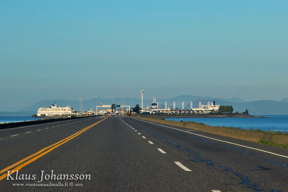
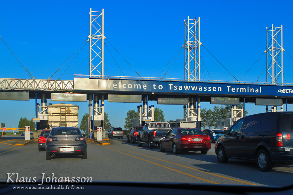
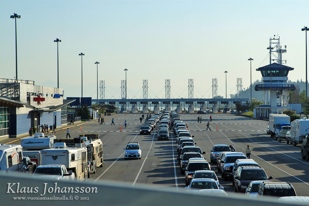
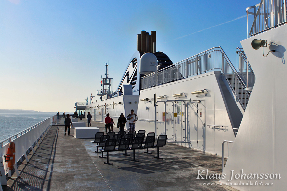
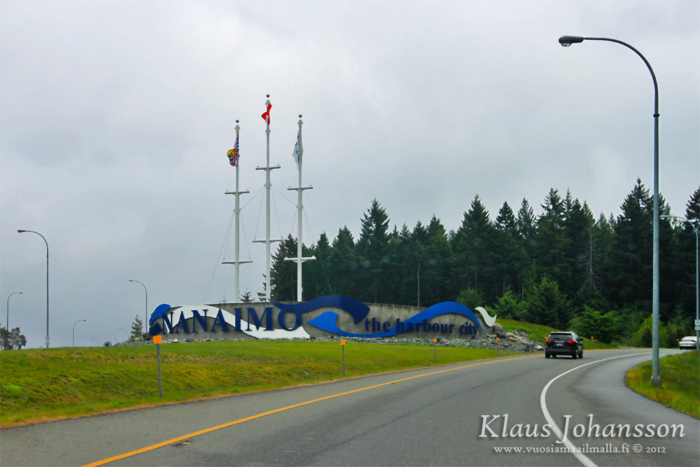
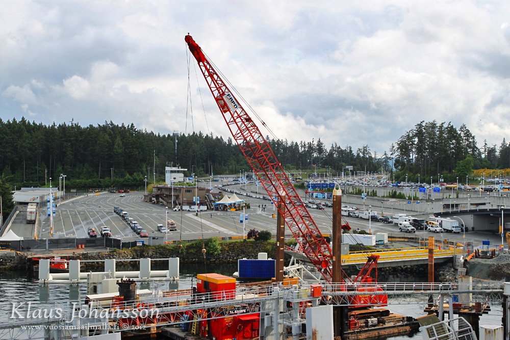
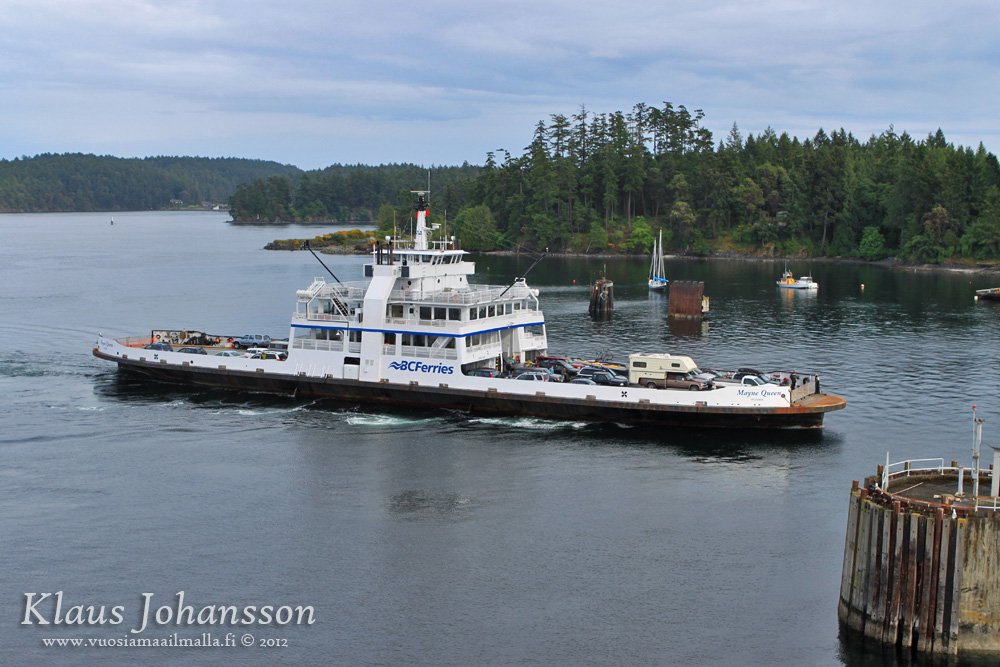
We took the ferry from Tsawwassen terminal to Nanaimo, which is a 1.5 hour sailing.


There was no time to see Nanaimo this time around and we just passed by.


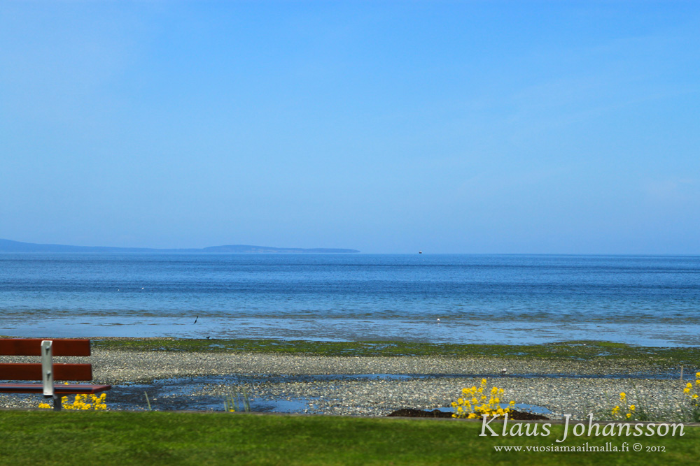
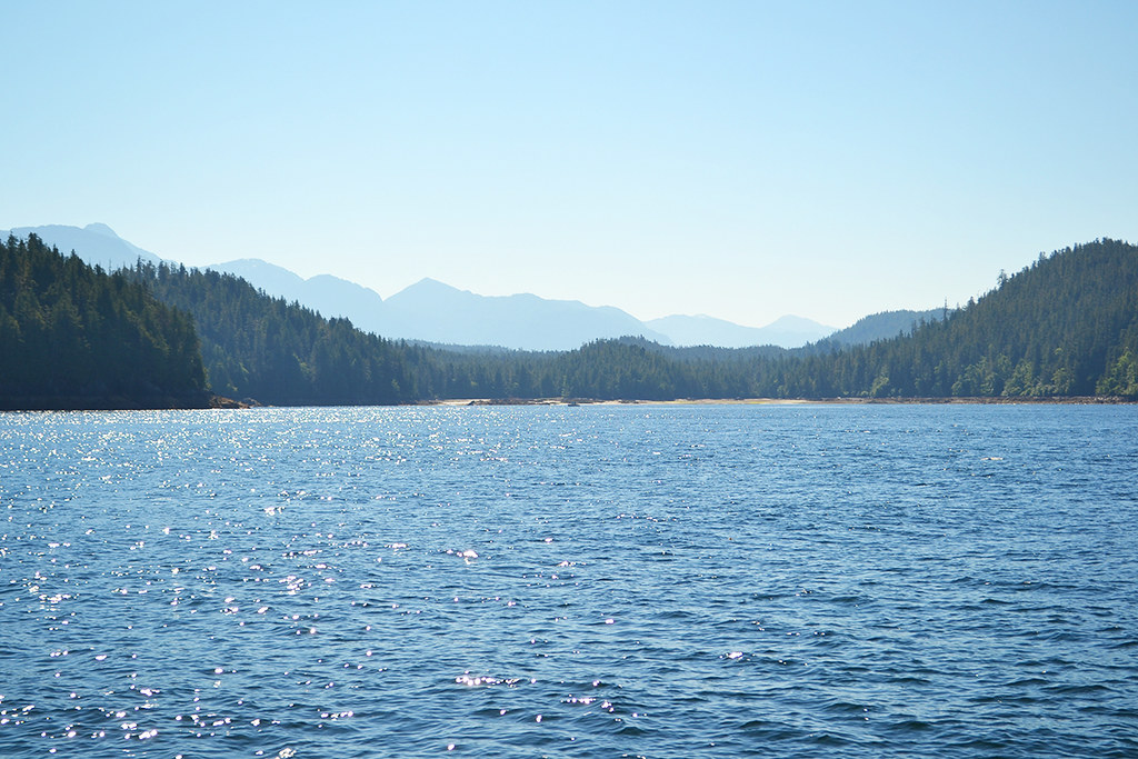
As the weather improved, we opted to drive a smaller road to Parksville. This view is towards Vancouver over the Strait of Georgia. It's a big body of water!


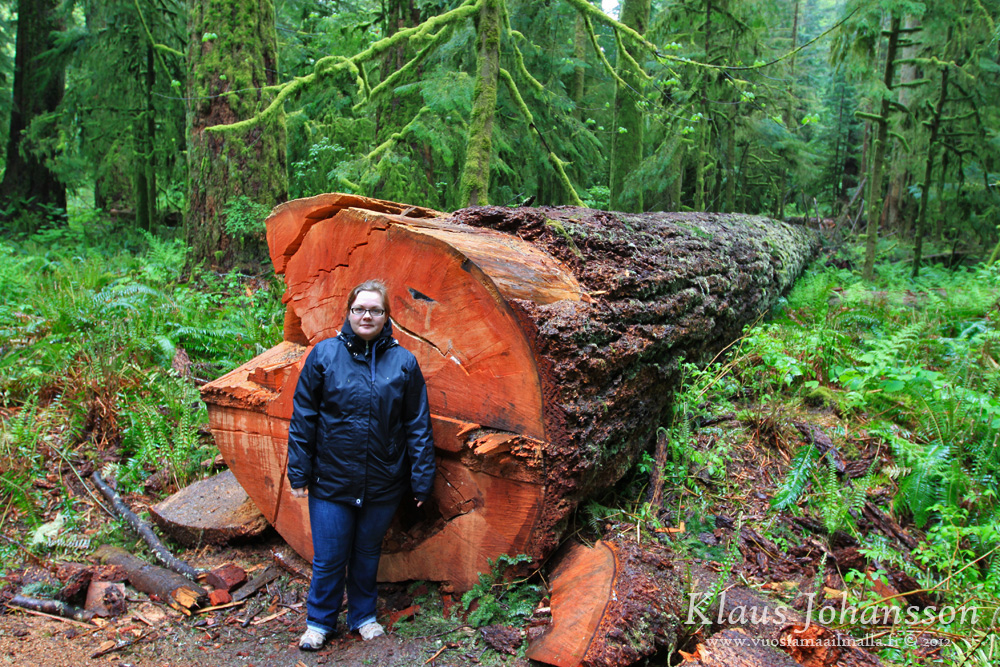
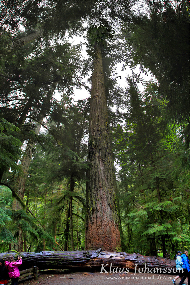
First stop on the road to Tofino is of course Cathedral Grove. The highway takes you through a small patch of ancient forest where few giants still stand tall.


Trees taller than the Leaning Tower of Pisa!


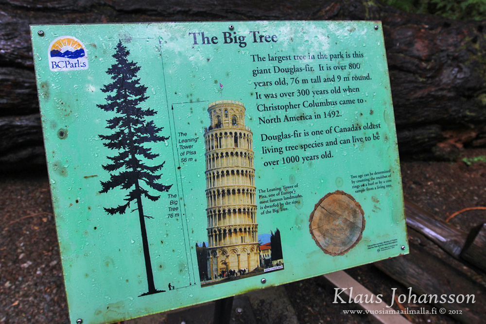
And here is the douglas-fir in question.


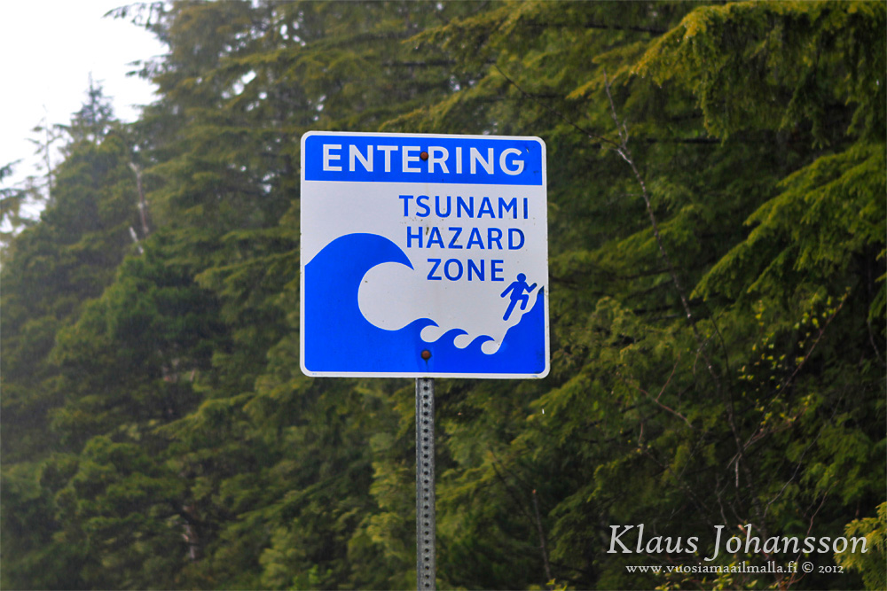
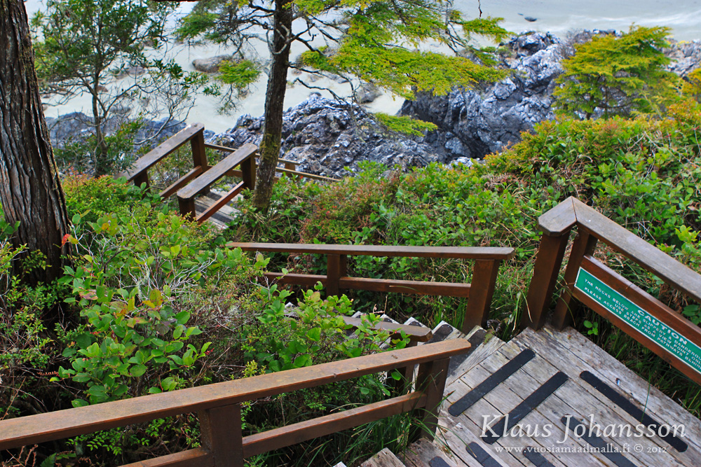
Tofino area is a tsunami hazard zone. There are signs for an escape route everywhere.


A nice place to have a break.


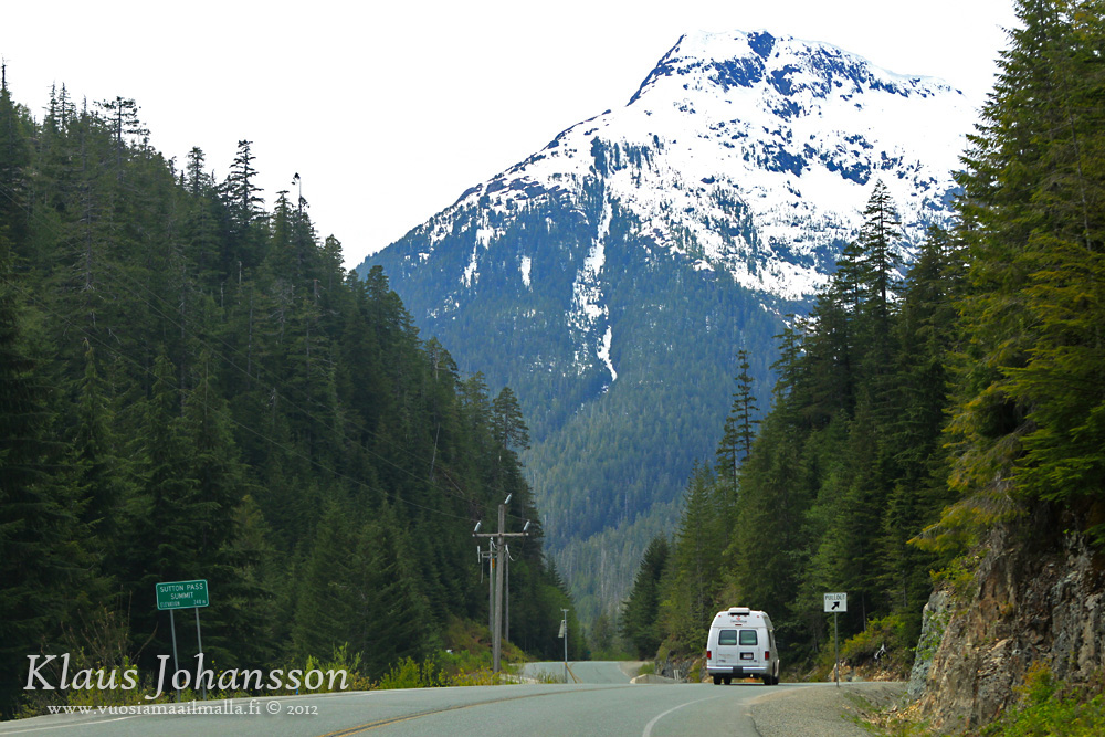
At the end of the road there are only two small villages: Tofino and Ucluelet. They are the only major settlements on the west coast of Vancouver Island.


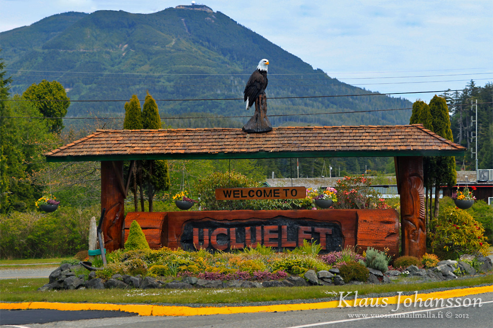
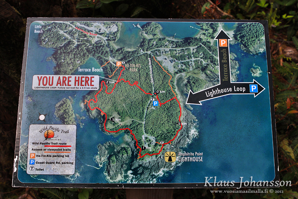
In Ucluelet the most famous activity is the 
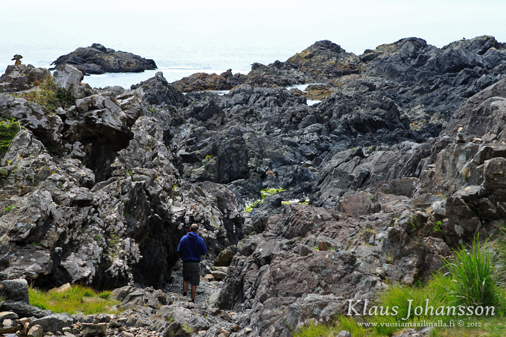
Wild Pacific Trail which is perfect for storm watching (a major activity during winter time and something we have yet to do!).


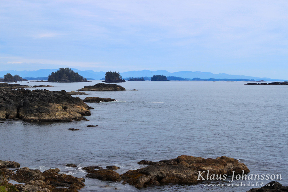
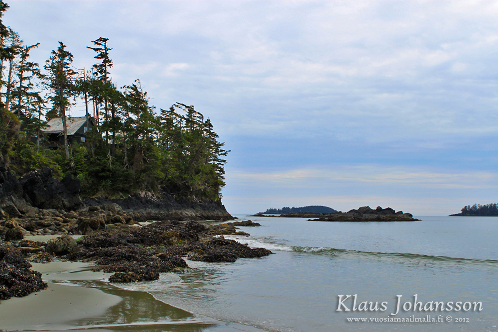
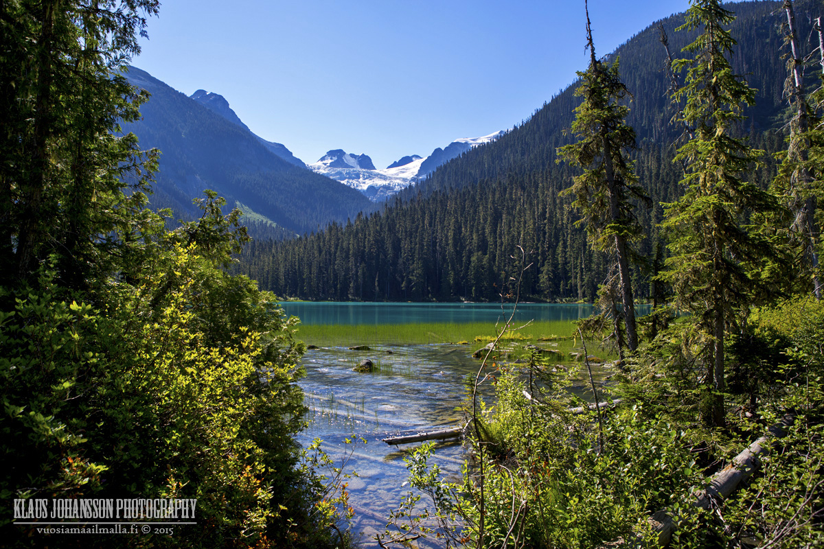
The pacific coast is rugged.


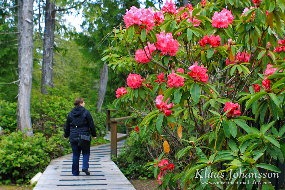
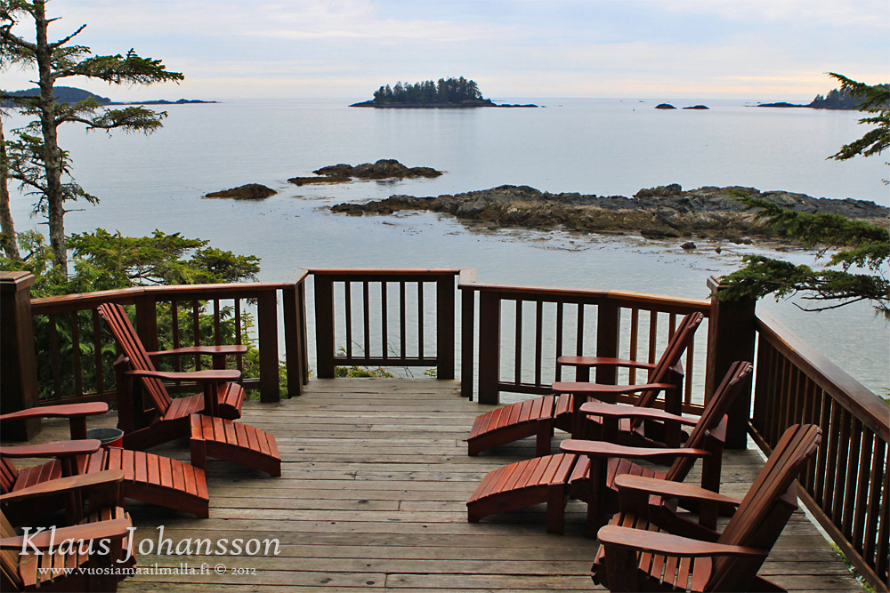
We stayed at Middle Beach Lodge which was a quiet paradise tucked deep in the rainforest. Just an amazing place sit by a fireplace, watching the rain outside.


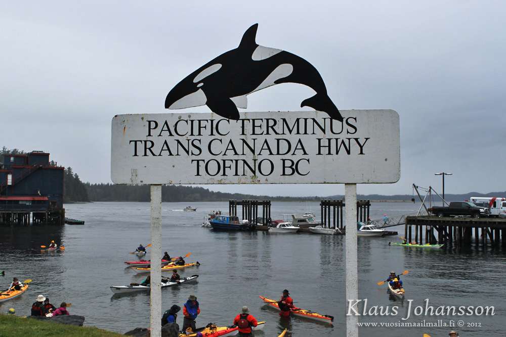
Tofino is the western end of the Trans-Canada Highway. St John's is the eastern end, I believe.


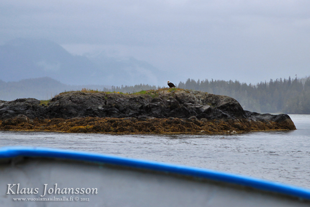
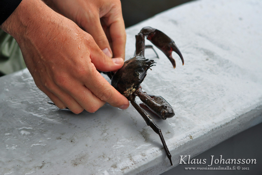
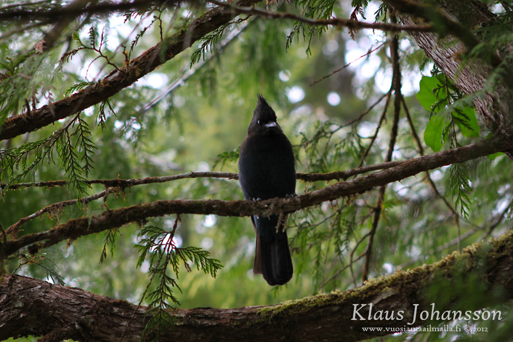
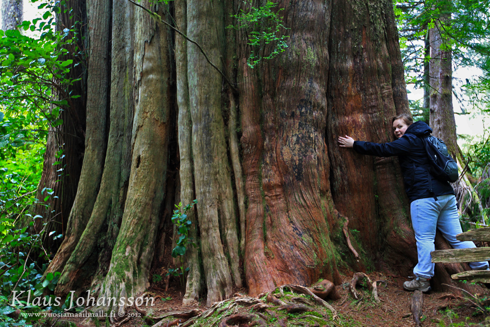
From Tofino we took a boat trip to nearby Meares Island. On the way there you see eagles, crabs, birds, seals, ...


Meares Island is an uninhabited island which has been speared from human touch. There is only a small plank trail called The Big Tree Trail and boy, it is exactly that! Boats only bring a few people to the island at once, so you have all the serenity almost to yourself!


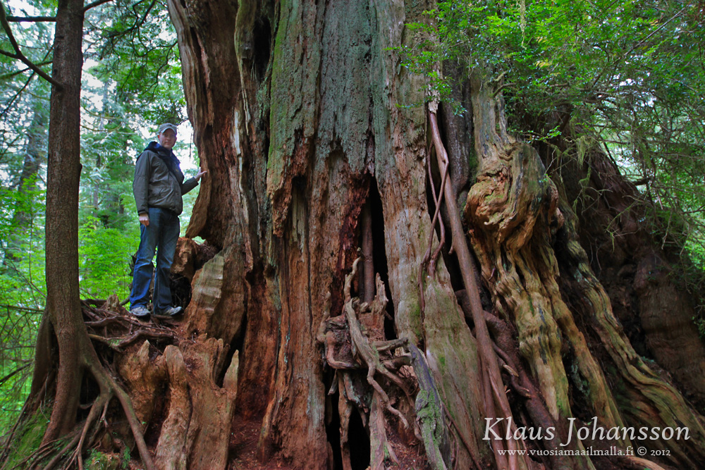
The trees on this trail are massive. MASSIVE. There are three especially distinguished red cedars along the trail that are each between 1000 and 1500 years old! These trees are among the oldest in Canada.


These ancient red cedars are huge. HUGE!


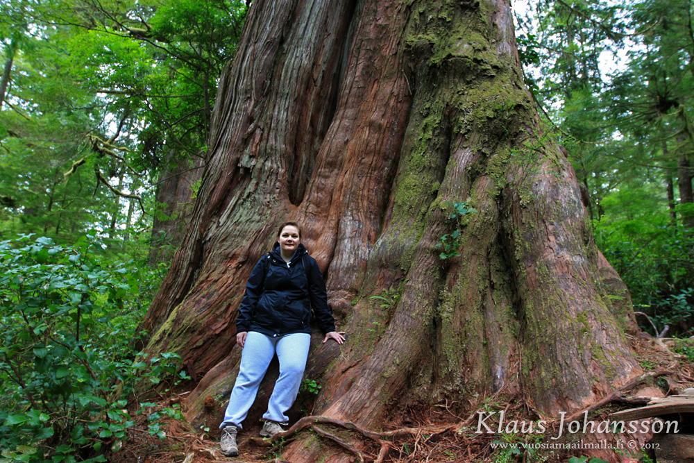
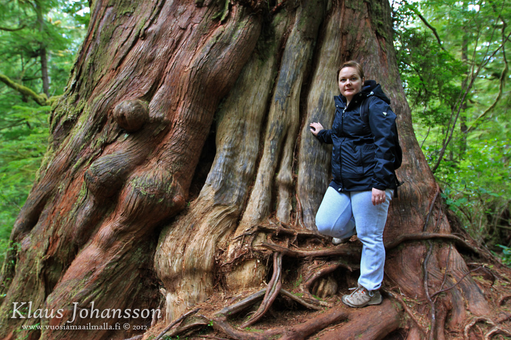
Hugging a living giant.


The Hanging Garden is where the trail ends and it is the largest of them all with circumference of 18.3 metres (60 feet)!


Meares Island is a must-see when in Tofino, although hopefully it will stay relatively unknown and is speared from the crowds. I have never seen trees this big and only some individual red cedars down in California should be bigger than them. They are impressive to say the least and make you really humble.


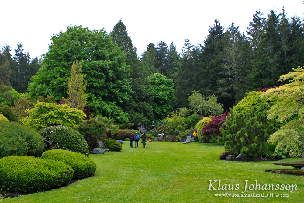
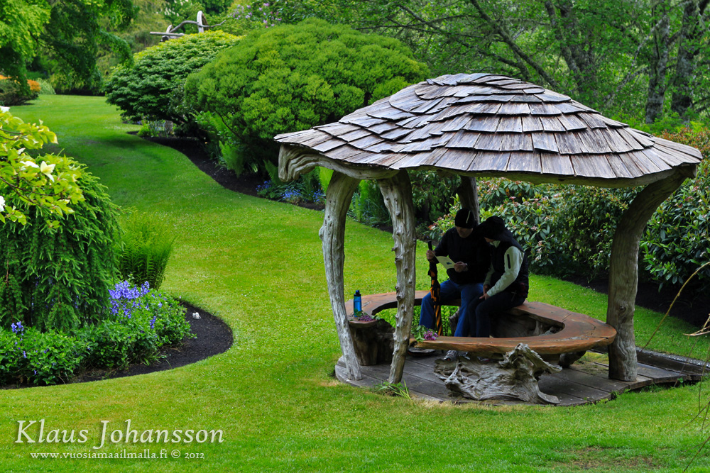
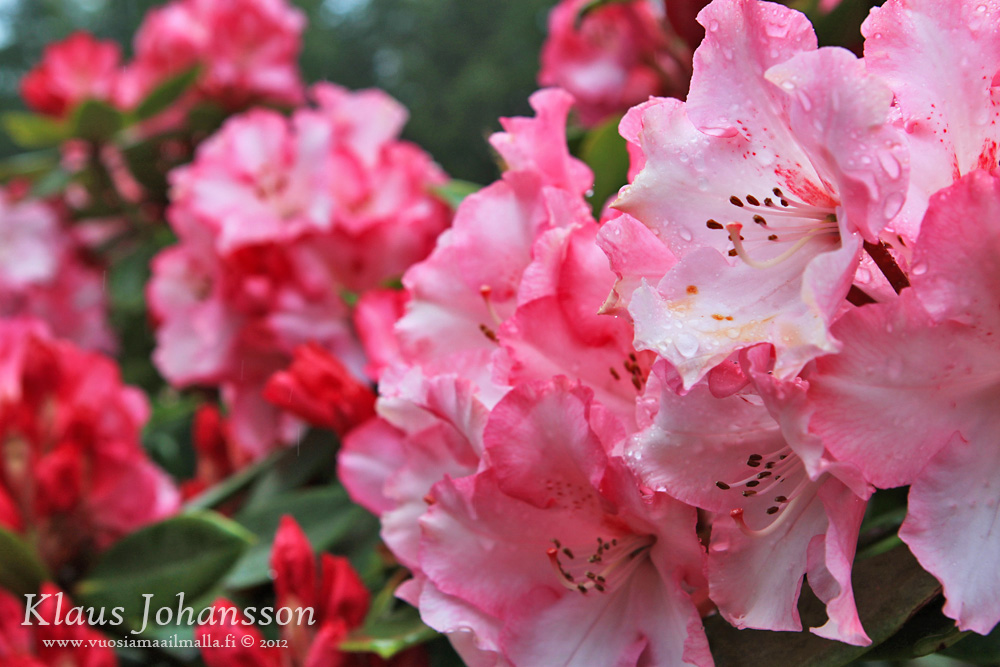
Only on Victoria Day there is an annual free entry to the nearby Stubbs Island which has an impressive private garden. It is very well-maintained!


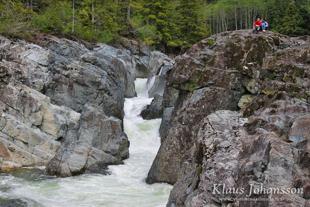
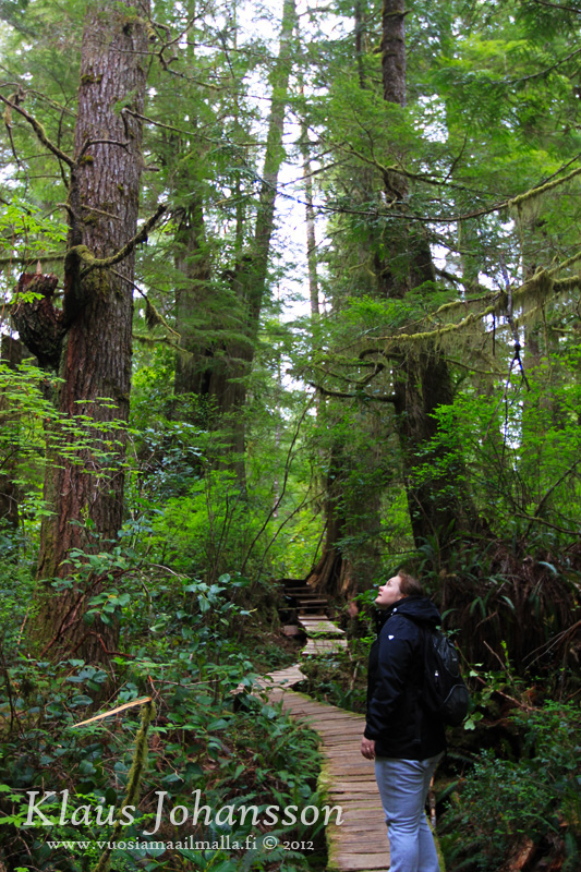
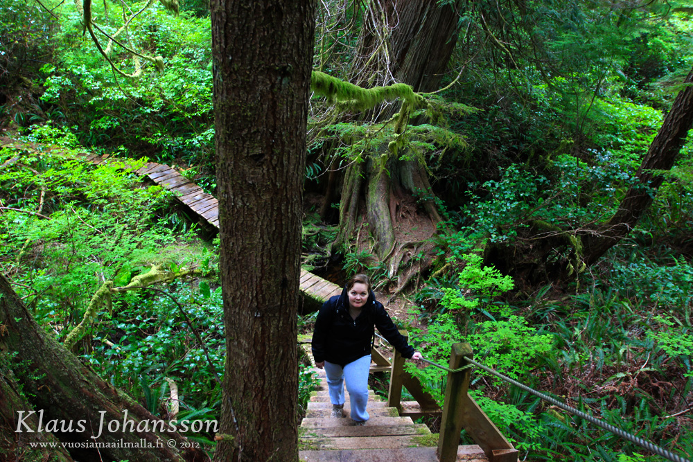
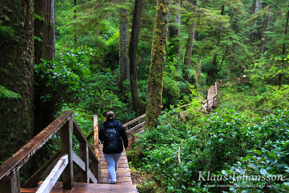
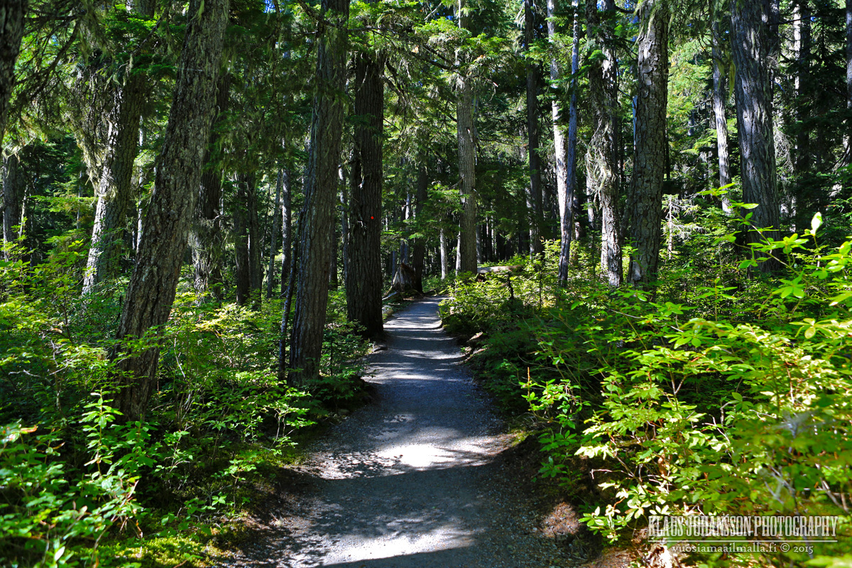
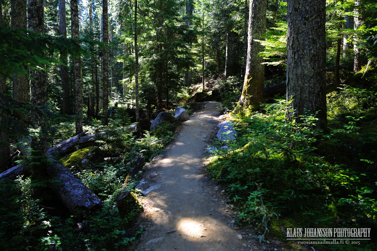
Another great rainy day trail is the 
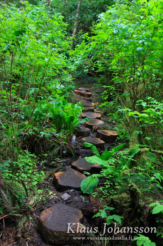
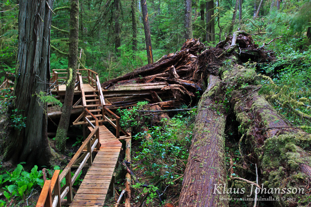
Rainforest Trail inside the Pacific Rim National Park (the road to Tofino cuts right through it). Great way to experience the temperate rainforests that are native to the pacific northwest. It is highly recommended during a rainy day, as the sound of rain in such a forest is just so soothing and relaxing.


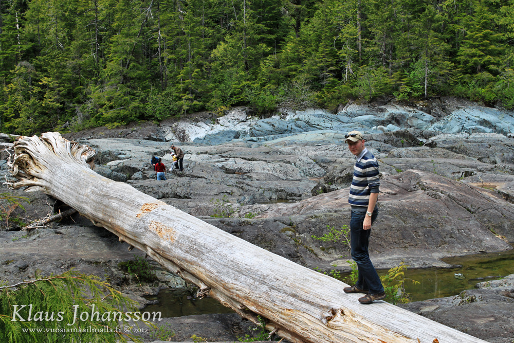
Nothing that falls in a National Park is ever moved. Just built around.


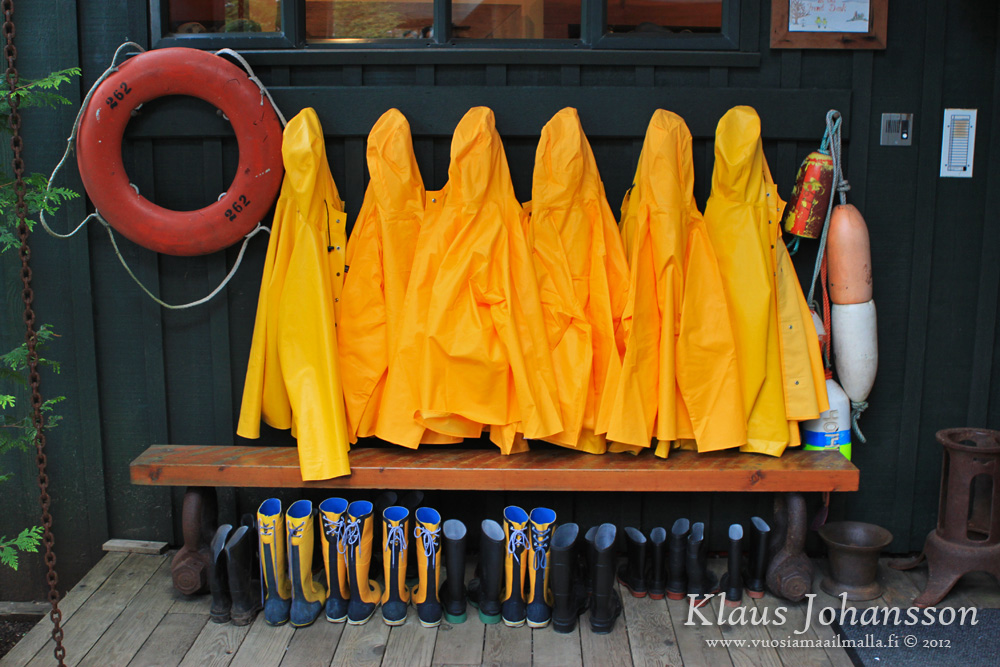
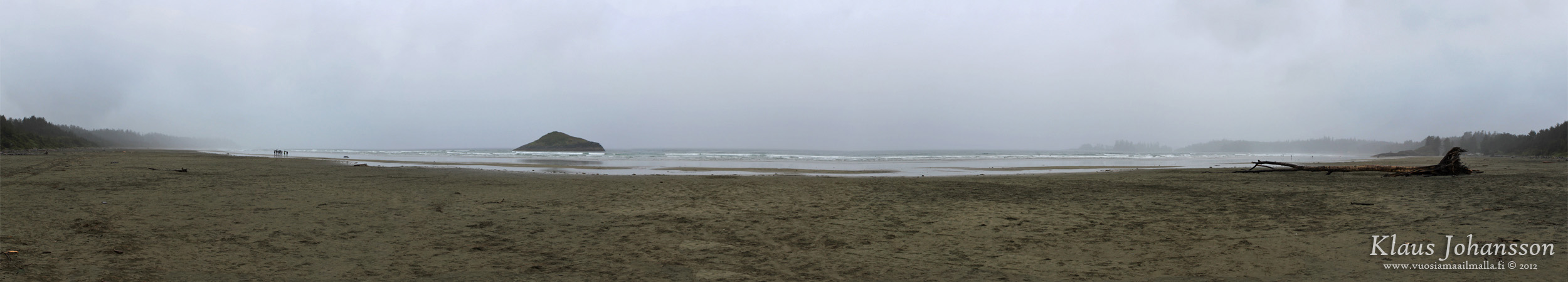
Tofino is of course also known as the laid-back surfing capital of Canada and the surf's up especially every time there is an approaching storm.


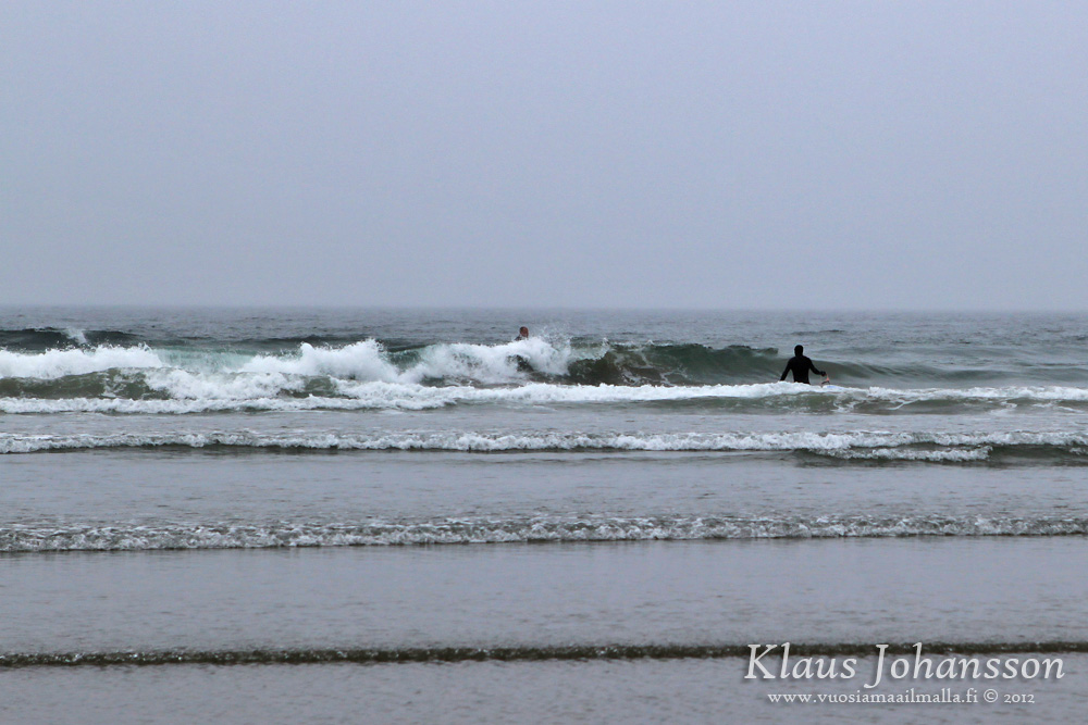
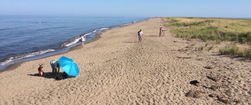
Most people surf on the 16 kilometers long and aptly named Long Beach. On a nice day it makes for an amazing place to swim, however the water of the northern pacific ocean is cold even during summer.


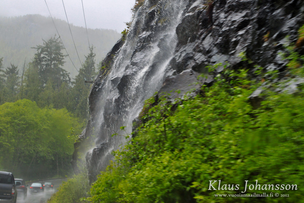
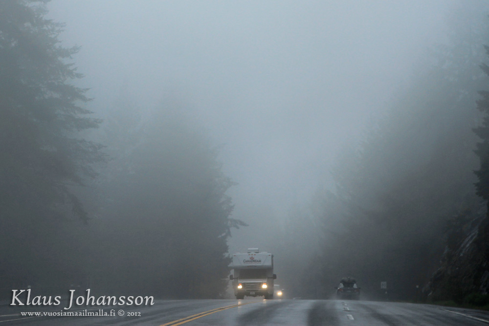
On the way back we had some poor weather.


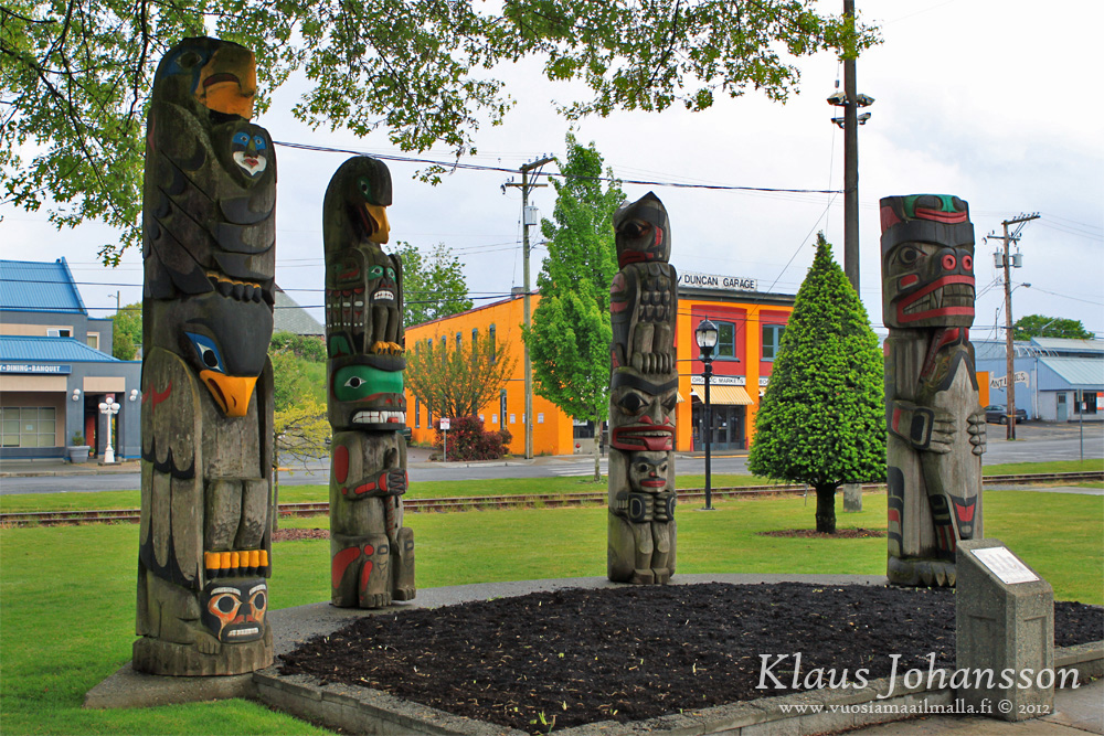
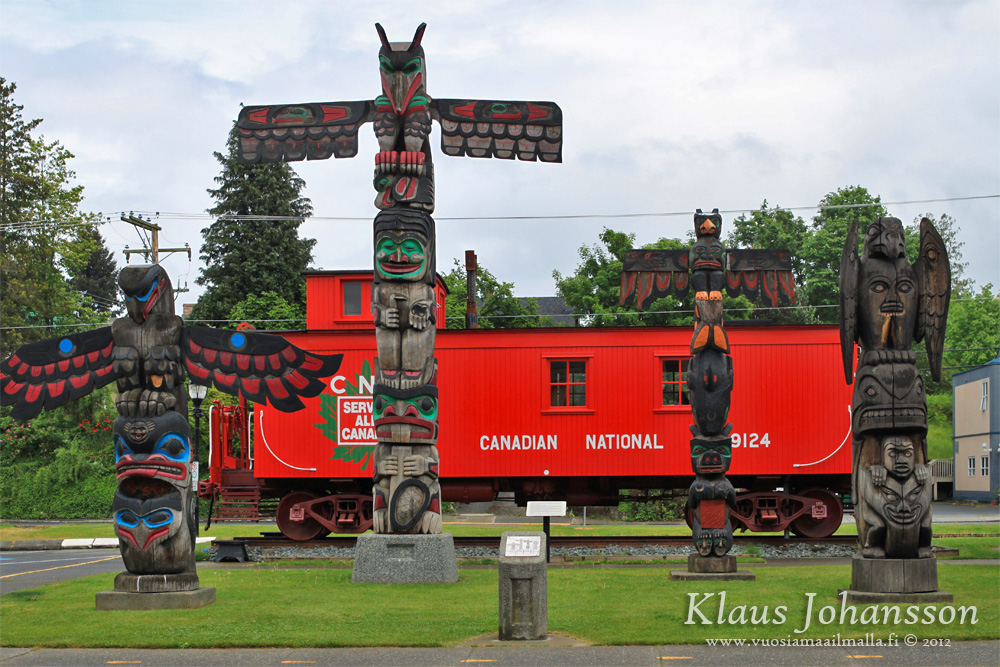
We made a brief stop in Duncan to see the totem poles in the city center.


Our ferry back left from Swartz Bay near Victoria, which is a 340 kilometer and 6 hour drive from Tofino. We didn't have any time to spend in Victoria on this trip.


So there you have it. Like mentioned, Tofino was amazing and the secluded atmosphere there is just great. It is getting more touristy year-by-year and accommodation can be quite expensive around high season, but it is a great trip for any outdoors lover and we really loved our trip there.
Reply With Quote
     
     
  #1068  
Old Posted Aug 28, 2015, 12:41 AM
SignalHillHiker's Avatar
SignalHillHiker SignalHillHiker is online now
I ♣ Baby Seals
 
Join Date: Jul 2012
Location: Sin Jaaawnz, Newf'nland
Posts: 34,728
Great pics, Klazu.

Also...

Quote:
Originally Posted by Klazu View Post
Mile Zero, Trans-Canada Highway, St. John's, NF (1984) by Duncan_and_Gladys, on Flickr
__________________
Note to self: "The plural of anecdote is not evidence."
Reply With Quote
     
     
  #1069  
Old Posted Aug 28, 2015, 12:44 AM
Klazu's Avatar
Klazu Klazu is offline
Registered User
 
Join Date: Apr 2012
Location: Above Metro Vancouver clouds
Posts: 10,187
Yeah, that's what I remembered. What a country do we have between those two signs!
Reply With Quote
     
     
  #1070  
Old Posted Aug 28, 2015, 2:40 AM
Calgarian's Avatar
Calgarian Calgarian is offline
Registered User
 
Join Date: Jun 2006
Location: Calgary, AB
Posts: 24,072
Quote:
Originally Posted by Klazu View Post
Yeah, that's what I remembered. What a country do we have between those two signs!
Yes we do, every province and territory has unique and beautiful places that can amaze you!
__________________
Git'er done!
Reply With Quote
     
     
  #1071  
Old Posted Aug 28, 2015, 5:15 PM
Airboy Airboy is offline
Registered User
 
Join Date: Sep 2008
Location: Edmonton/St Albert
Posts: 9,183
Really good restaurant at the south end of Long Beach.

Did you get a chance to stop at Cathedral Grove on your way back.
__________________
Why complain about the weather? Its always going to be here. You on the other hand will not.
Reply With Quote
     
     
  #1072  
Old Posted Aug 28, 2015, 5:41 PM
Klazu's Avatar
Klazu Klazu is offline
Registered User
 
Join Date: Apr 2012
Location: Above Metro Vancouver clouds
Posts: 10,187
Quote:
Originally Posted by Airboy View Post
Really good restaurant at the south end of Long Beach.
Yeah, made it there during our third trip to Tofino (photos in the future).

Quote:
Originally Posted by Airboy View Post
Did you get a chance to stop at Cathedral Grove on your way back.
Yup, see three photos above.
Reply With Quote
     
     
  #1073  
Old Posted Aug 28, 2015, 5:47 PM
Airboy Airboy is offline
Registered User
 
Join Date: Sep 2008
Location: Edmonton/St Albert
Posts: 9,183
Quote:
Originally Posted by Klazu View Post
Yeah, made it there during our third trip to Tofino (photos in the future).

Yup, see three photos above.
For some reason I missed those.

Here are some of my Archived beach photos.
North Baffin Island (Pond Inlet)
[IMG][/IMG]
Ellesmere Island Gris Fjiord
[IMG][/IMG]
Baffin Tundra
[IMG][/IMG]
kugluktuk Nunavut (Coppermine River)
[IMG][/IMG]
__________________
Why complain about the weather? Its always going to be here. You on the other hand will not.
Reply With Quote
     
     
  #1074  
Old Posted Aug 28, 2015, 10:22 PM
edm_guy's Avatar
edm_guy edm_guy is offline
Registered User
 
Join Date: Mar 2009
Location: Edmonton
Posts: 174
Great photos by all!

Here are some photos from my summer around BC and in Alberta...

I had the opportunity to do a day tour through the Khutzeymateen Grizzly Bear Sanctuary just north of Prince Rupert. Spectacular scenery and was one of the highlights of my summer

GT3 by Jay, on Flickr

GT6 by Jay, on Flickr

GT7 by Jay, on Flickr

GT8 by Jay, on Flickr

GT9 by Jay, on Flickr

GT10 by Jay, on Flickr

GT5 by Jay, on Flickr

GT2 by Jay, on Flickr

Alberta Beach
AB1 by Jay, on Flickr

AB4 by Jay, on Flickr

AB8 by Jay, on Flickr

AB14 by Jay, on Flickr
Reply With Quote
     
     
  #1075  
Old Posted Aug 30, 2015, 12:18 PM
SignalHillHiker's Avatar
SignalHillHiker SignalHillHiker is online now
I ♣ Baby Seals
 
Join Date: Jul 2012
Location: Sin Jaaawnz, Newf'nland
Posts: 34,728
I've never done the climb, but I've been above the Beamer many times:

Torbay by R C, on Flickr

And there are usually people climbing in the area:

Torbay by R C, on Flickr

Just a reminder to be careful. We lose a few tourists every year, but locals are generally more aware and careful.

Two dead so far in just a few days.


Be careful hiking, everybody.

On a happier note, a new section of the East Coast trail is now available:

East Coast Trail gets challenging new expansion

Quote:
The president of the East Coast Trail Association says the popular pathway is in the process of getting bigger, and even more challenging.

The current trail, which runs 265 kilometres from Cappahayden to Cape St. Francis, has been expanded by 32.5 kilometres.

"The landscape is hilly, it's rolly," said Randy Murphy in an interview on CBC Radio's CrossTalk on Friday.

"There's lots of up and downs."

The association is expanding a section of trail between Cape St. Francis and Portugal Cove-St. Philip's.

Murphy said the new portion of trail is signed, but not hardened, meaning no trail structure has been added. While tree stumps and brush have been cut back, the association has not yet laid down a boardwalk or stairs.

This, Murphy said, adds to the challenge. The president said hikers familiar with the Spout and Cape Broyle paths will appreciate the difficult new trek.

"They're strenuous because of their length, and the changes in elevation above 150 metres," he said of the Spout and Cape Broyle.

"Well, this one is equally strenuous as those and the added challenge is that there are no trail structures to make it easier for the hiker to pass."

By next year, the association hopes to have secured funding to harden the wet areas of the trail, as well as address potentially dangerous portions of the path.

Plan ahead

In the meantime, Murphy warns potential hikers to plan ahead by picking up a map at the association headquarters on Pippy Place in St. John's.

"The hiker's responsible for their own safety and they need to be careful, be smart and be prepared," Murphy said.

The 18-kilometre stretch between Cape St. Francis and Bauline, Murphy said, brings hikers over marsh land, through mature forests and past waterfalls.

"The landscape is phenomenal and the view of Conception Bay is second to none."

Murphy said the toughest part of the trail is in the Black Head area, where temporary ropes have been put in place for hikers' safety.

"They've got to make sure that they look ahead and pick their footing carefully because it can be slippery at times," he warned.

"We're adding great value to the province in terms of creating fantastic recreational and tourism space for residents and for people who come here to visit."

For more information, visit the East Coast Trail website.
http://www.cbc.ca/news/canada/newfou...sion-1.3208711
__________________
Note to self: "The plural of anecdote is not evidence."
Reply With Quote
     
     
  #1076  
Old Posted Aug 31, 2015, 12:03 AM
uzi's Avatar
uzi uzi is offline
Registered User
 
Join Date: Sep 2013
Location: Ontario
Posts: 1,644
^ that is sad.

I'm not sure whether these pics belong here or in the"post ur city pics" forum. this is Beasley park in Kelowna under Norhtern lights.

[IMG]DSC_0135 by Uzair Shahid97, on Flickr[/IMG]

[IMG]DSC_0131 by Uzair Shahid97, on Flickr[/IMG]

[IMG]DSC_0127 by Uzair Shahid97, on Flickr[/IMG]

[IMG]DSC_0126 by Uzair Shahid97, on Flickr[/IMG]
__________________
RESPECT FOR EVERYONE
Reply With Quote
     
     
  #1077  
Old Posted Aug 31, 2015, 12:04 AM
uzi's Avatar
uzi uzi is offline
Registered User
 
Join Date: Sep 2013
Location: Ontario
Posts: 1,644
here is a panor....

[IMG]Beasley park Panorama by Uzair Shahid97, on Flickr[/IMG]
__________________
RESPECT FOR EVERYONE
Reply With Quote
     
     
  #1078  
Old Posted Sep 2, 2015, 3:00 PM
PhilippeMtl's Avatar
PhilippeMtl PhilippeMtl is offline
Registered User
 
Join Date: Sep 2005
Location: Rosemont-la-petite-patrie, Montreal
Posts: 2,179
Reply With Quote
     
     
  #1079  
Old Posted Sep 5, 2015, 9:52 PM
SignalHillHiker's Avatar
SignalHillHiker SignalHillHiker is online now
I ♣ Baby Seals
 
Join Date: Jul 2012
Location: Sin Jaaawnz, Newf'nland
Posts: 34,728
S. and I went for a hike in Petty Harbour (just outside St. John's, basically a suburb these days) because she loves it there. It reminds her of the Oregon coast. Not sure why, but there it is.

People here really have to stop treating the Confederate flag as just another anti-status quo NL/Che/Acadia/etc. symbol.


Petty Harbour on the left, Maddox Cove on the right. St. John's is about 15 minutes drive behind and directly between then. Though, the suburbs of Goulds and Kilbride (both part of the city) are right behind that hill.


__________________
Note to self: "The plural of anecdote is not evidence."
Reply With Quote
     
     
  #1080  
Old Posted Sep 7, 2015, 12:20 AM
MonctonRad's Avatar
MonctonRad MonctonRad is online now
Wildcats Rule!!
 
Join Date: Jun 2008
Location: Moncton NB
Posts: 34,629
La Dune de Bouctouche Irving Eco-Centre, Bouctouche NB

The Bouctouche Dune is a 10 km long barrier dune at the entrance to Bouctouche Bay, located in Kent County, along the Northumberland shore of eastern NB, about 40 minutes north of Moncton.


The Irving Eco-Centre is a private facility (open free to the public) located at the base of the barrier dune where it joins the mainland. As the name implies, it is owned by the Irving family, and operates as an interpretive centre for the local ecology and has a mandate to preserve the dune both for public use, and to preserve the wetland and shorefront habitat for endangered species like the piping plover.

In addition to the interpretive centre, there is about a kilometre of boardwalk leading out into the dune system, with several beach access points for sunbathers and swimmers to reach the beach itself. The rest of the dune is maintained as a protected zone, with no access allowed to the marram grass covered dunes or to the wetlands in behind. Selected areas of beachfront are also off limits if they contain nesting areas for the piping plover.


All photos were taken today. It was a hot and hazy 28C on September 6th. In the distance through the haze, you could make out dozens of wind turbines in West Point PEI. PEI is about 20 km away at this point, and is just barely visible on the horizon. The turbines in fact seemed to be poking directly out of the ocean. It looked pretty exotic. I was going to try and take a picture of them, but my phone died. I might try again later this fall when the skies are less hazy.
__________________
Go 'Cats Go
Reply With Quote
     
     
This discussion thread continues

Use the page links to the lower-right to go to the next page for additional posts
 
 
Reply

Go Back   SkyscraperPage Forum > Regional Sections > Canada
Forum Jump


Forum Jump


All times are GMT. The time now is 3:26 PM.

     
SkyscraperPage.com - Archive - Privacy Statement - Top

Powered by vBulletin® Version 3.8.7
Copyright ©2000 - 2024, vBulletin Solutions, Inc.