HomeDiagramsDatabaseMapsForum About
     

Go Back   SkyscraperPage Forum > Global Projects & Construction > General Development


Reply

 
Thread Tools Display Modes
     
     
  #561  
Old Posted Sep 19, 2009, 12:59 AM
Rail>Auto's Avatar
Rail>Auto Rail>Auto is offline
Registered User
 
Join Date: Aug 2009
Posts: 500
Quote:
Originally Posted by fflint View Post
Just curious, what was on the land that is now AT&T Park before it was built?
Reply With Quote
     
     
  #562  
Old Posted Sep 19, 2009, 3:16 AM
WildCowboy WildCowboy is offline
Registered User
 
Join Date: Aug 2007
Posts: 527
Quote:
Originally Posted by Rail>Auto View Post
Just curious, what was on the land that is now AT&T Park before it was built?
Warehouses, primarily. I believe there was a long pier shed for ships that could dock along the channel there.
Reply With Quote
     
     
  #563  
Old Posted Sep 22, 2009, 5:04 AM
timbad timbad is offline
heavy user of walkability
 
Join Date: May 2008
Location: Mission Bay, San Francisco
Posts: 3,150
former ballpark

Quote:
Originally Posted by WildCowboy View Post
Warehouses, primarily. I believe there was a long pier shed for ships that could dock along the channel there.
this apparently is from 1964, but I think what you can make out at the ballpark site is still what was torn down in 1997 or so (and shows that WildCowboy is right on):

http://webbie1.sfpl.org/multimedia/s...s/AAC-2424.jpg

you also get a glimpse here, on the right side partially obstructed by the 3rd St Bridge:

http://webbie1.sfpl.org/multimedia/s...s/AAD-1692.jpg

and here is a better shot (the ballpark site is on the left):

http://webbie1.sfpl.org/multimedia/s...s/AAD-1703.jpg

(all of these, btw, are part of the SF Library historical photo collection. lots of cool stuff there:

http://sfpl.lib.ca.us/librarylocatio...ry/sfphoto.htm )

it's funny - I worked on 3rd St between Brannan and Townsend through the mid-90's, and - annoyingly to me now - I only have the vaguest sense of what was in the ballpark spot then. it was that unremarkable, at least to me. of course, in those days, there was not much reason to go any farther south than Townsend. I'm not sure I even knew the names of King or Berry Streets then!

Last edited by timbad; Sep 22, 2009 at 5:33 AM. Reason: added photo link
Reply With Quote
     
     
  #564  
Old Posted Sep 22, 2009, 6:49 AM
timbad timbad is offline
heavy user of walkability
 
Join Date: May 2008
Location: Mission Bay, San Francisco
Posts: 3,150
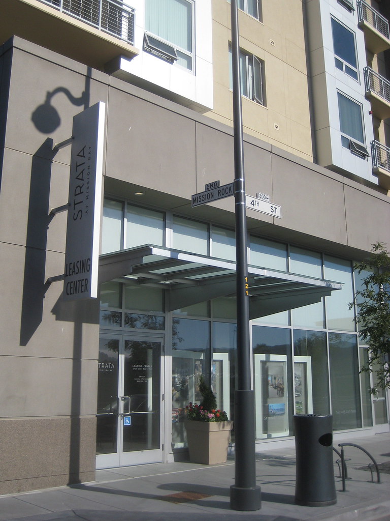
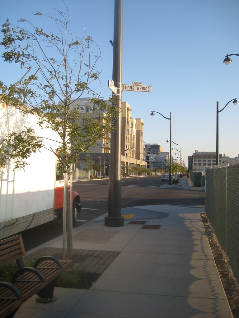
a while back I had promised Busy Bee a shot of the new streetsigns... took a little longer than expected due to yucky weather, but here's an example:


(there might be more incidental ones in the photos further along too...)

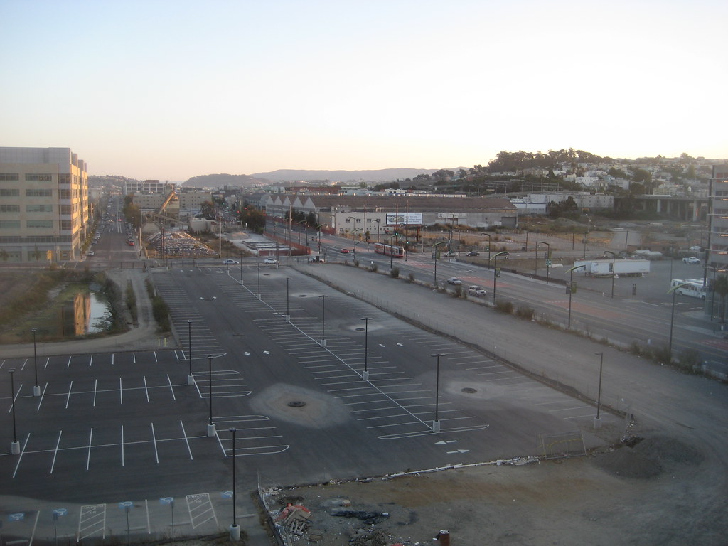
so, a less gloomy update...:

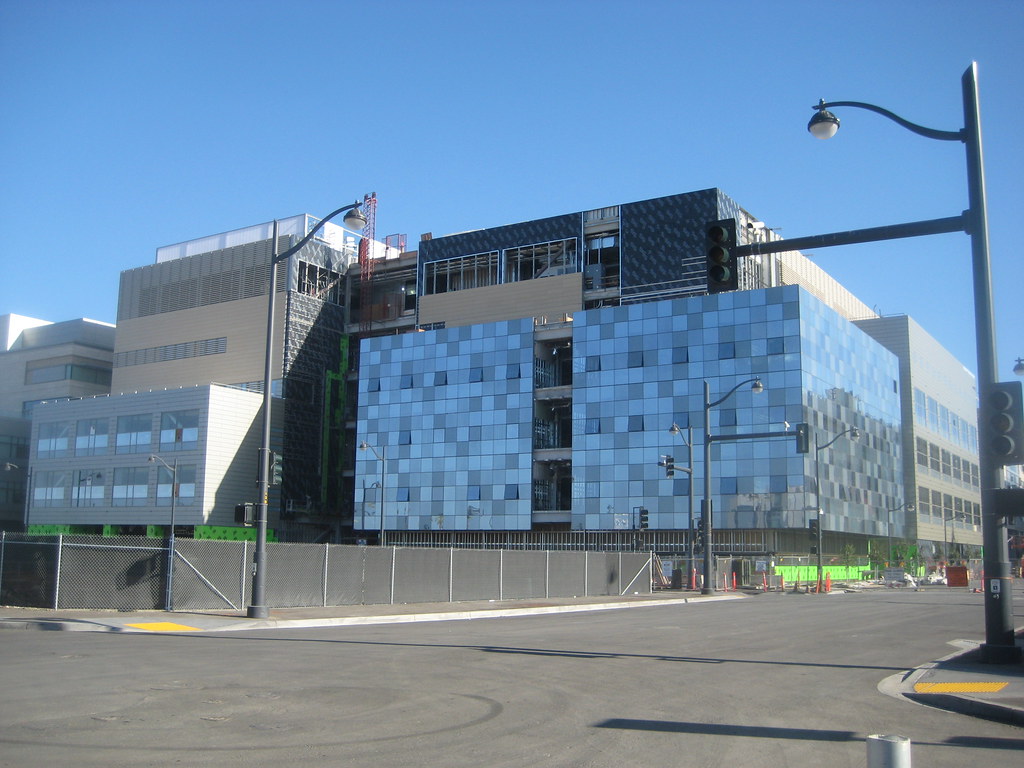
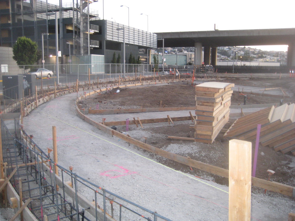
first, our friend the CVRB, standard shot from the front (northwest):


... and from the 'back' (southwest corner), since that is where most of the surface work is going on now.


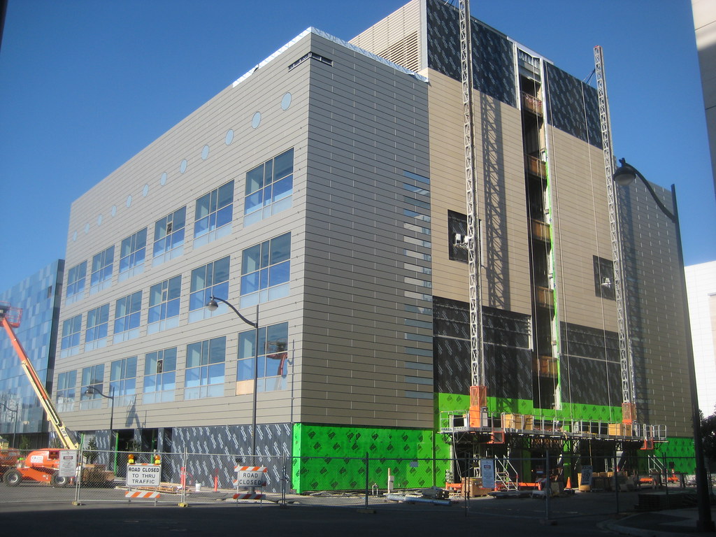
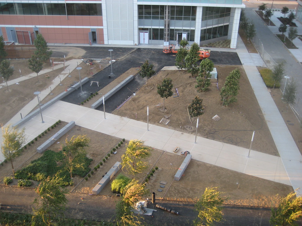
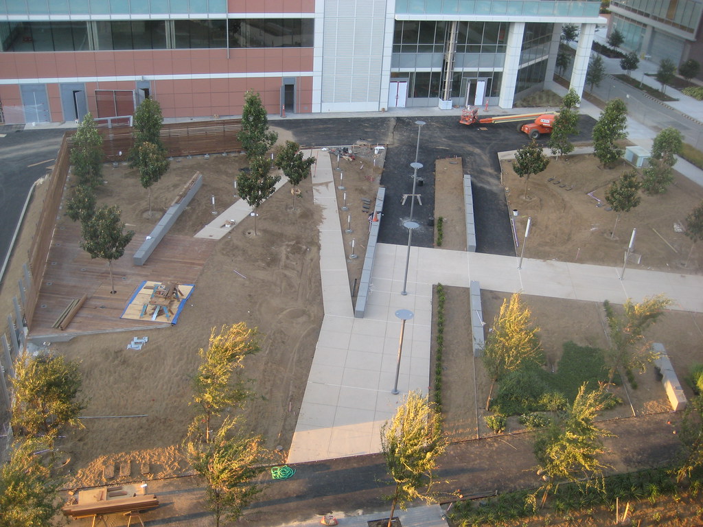
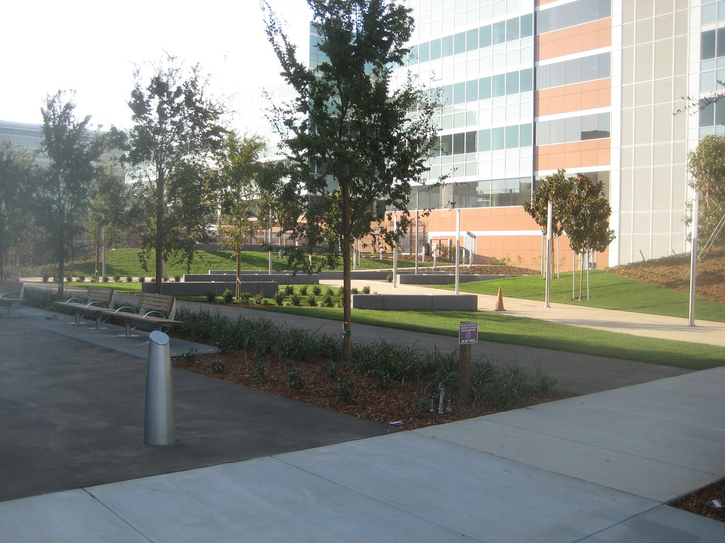
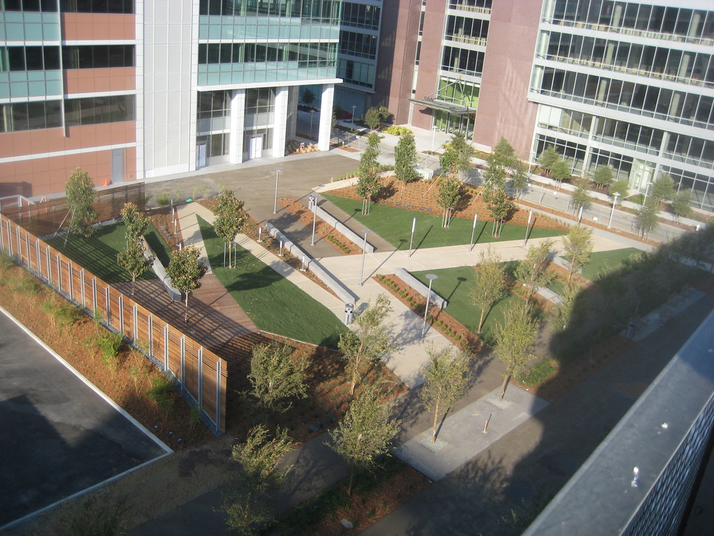
the building is L-shaped, with what appears to be open space for a plaza behind it:


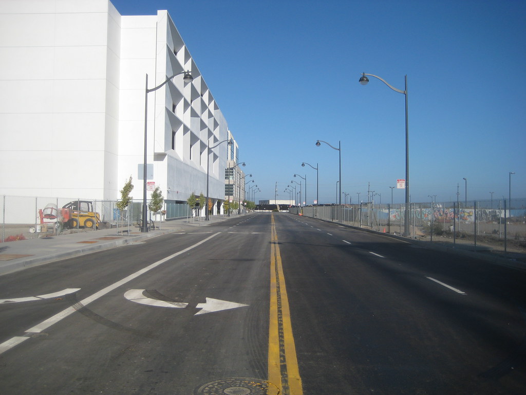
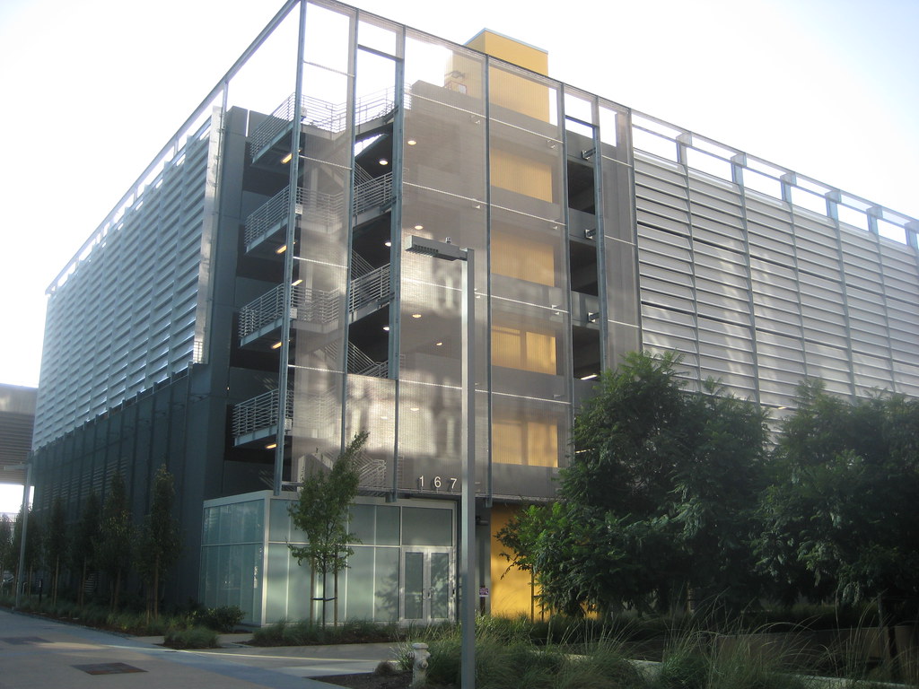
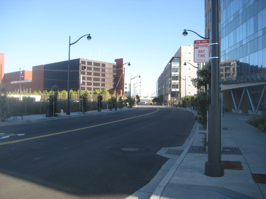
South Street and its garage are both open (looking west from 3rd):


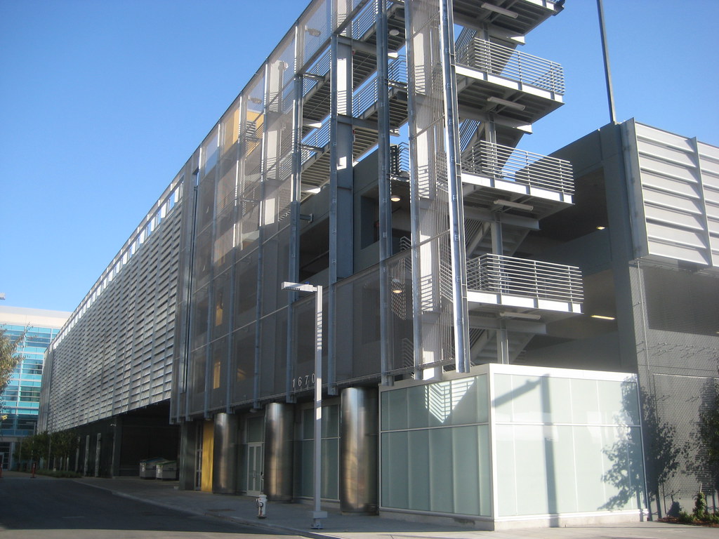
this is looking south along the east side of the garage (sunlight reflections off the Old Navy building across the way):


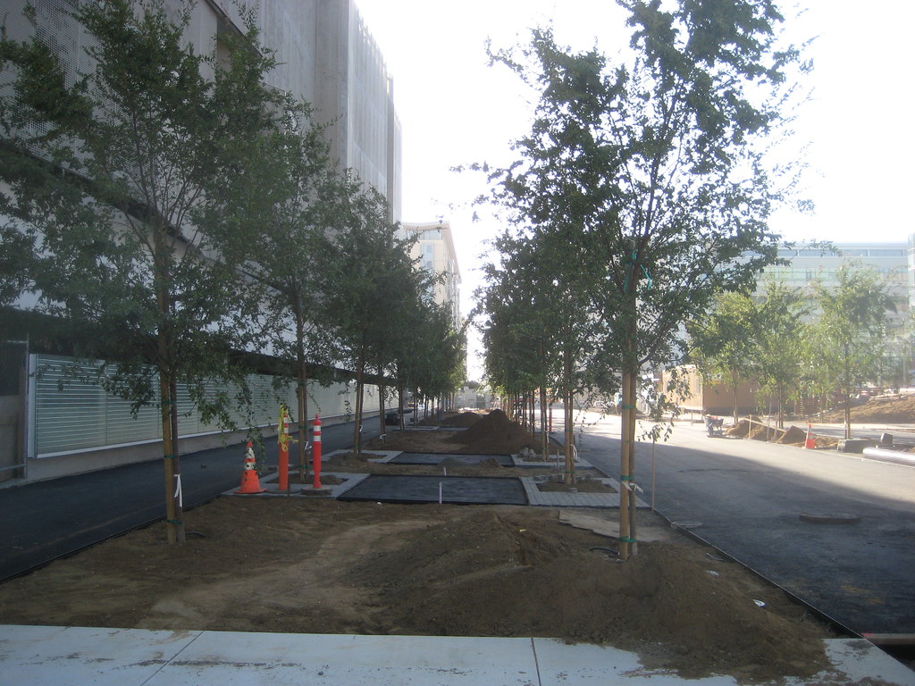
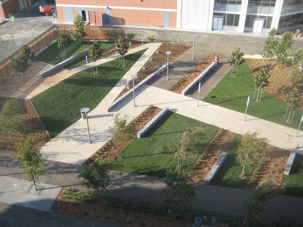
north of the garage, they've started paving the walkways between the trees (and just as Wild Cowboy said, one wide enough for a fire lane):


the Gladstone garage is also open, though they are still putting the finishing touches on it. this is the southeast corner:


looking south along the east side:


Owens St is now also open past 1500 Owens, (here looking south; 1500 Owens is on the right mostly out of the shot) ...


... and there was a banner hung in a window welcoming I think the UCSF Orthopedic Unit as upcoming tenants.

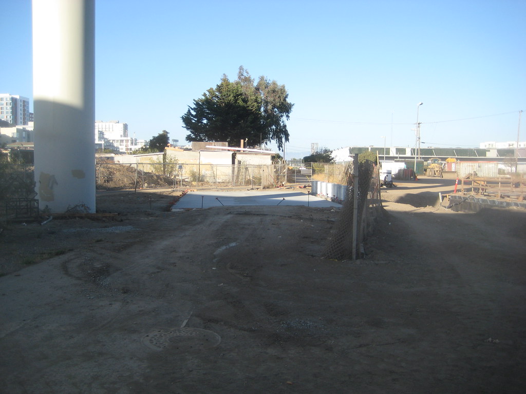
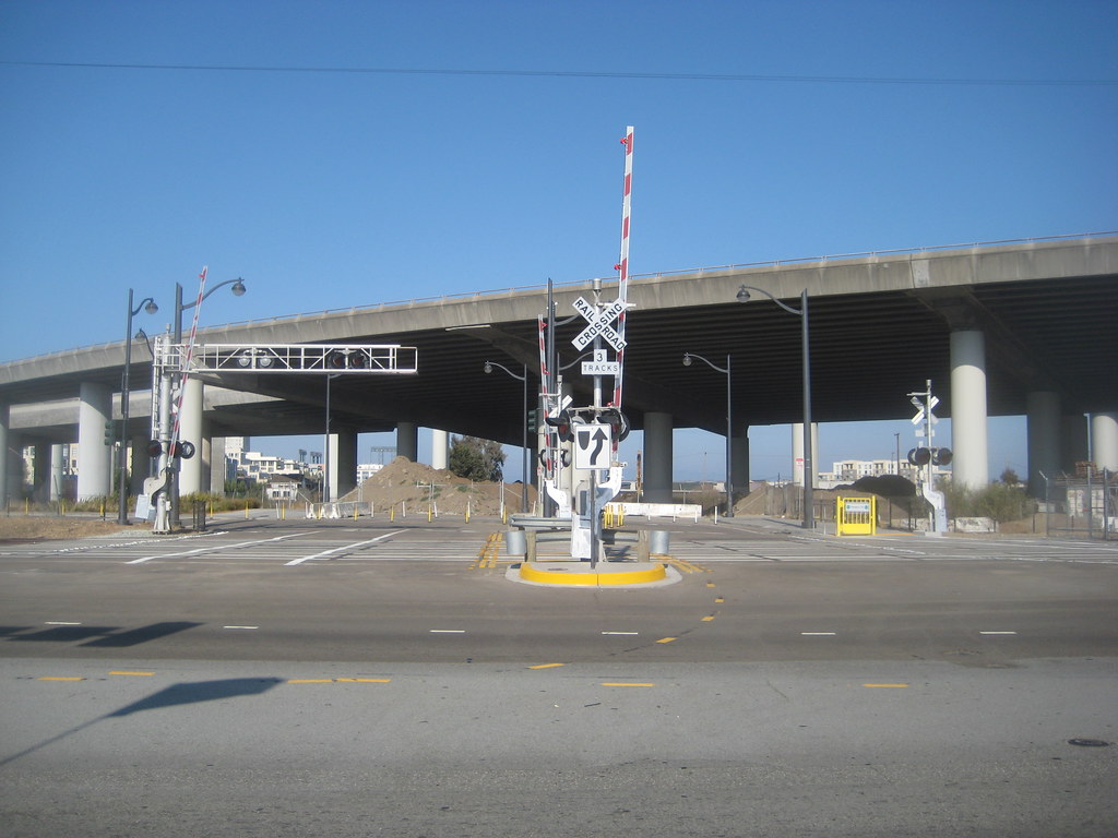
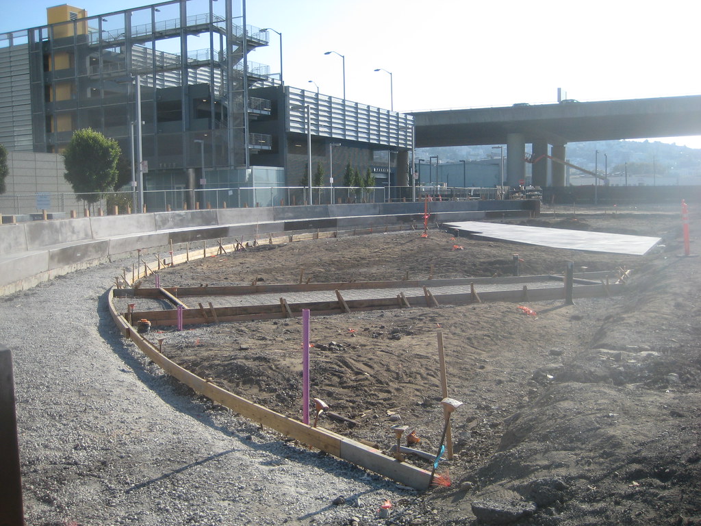
they're still moving dirt around over by the new outlet to Mission Creek (under the freeway on the south side), but they may have placed the first section of new pavement for the walkway that will go through there eventually (I'm curious if they will be doing any landscaping as they wrap up, or whether that will be separate, and later). this is looking east, creek is to the left, houseboats straight ahead but obscured:


other than that,

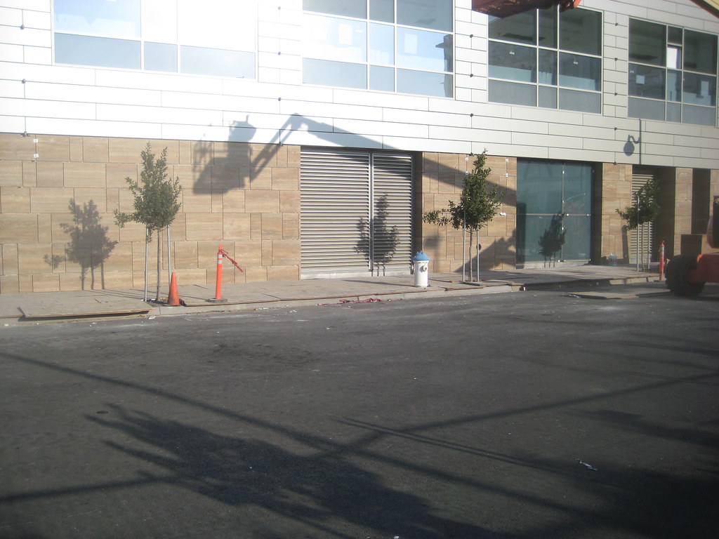
- ex-Pfizer is about done, externally. I'll post a shot in the next update.

- 16th is no longer partially blocked by the sewer line, tho they're still going strong on the digging over there. looks like they've recently dug up an old concrete line. massive sections of it are lying around on the surface off to one side. I didn't go over as far as Mariposa to get the good view down into the site.

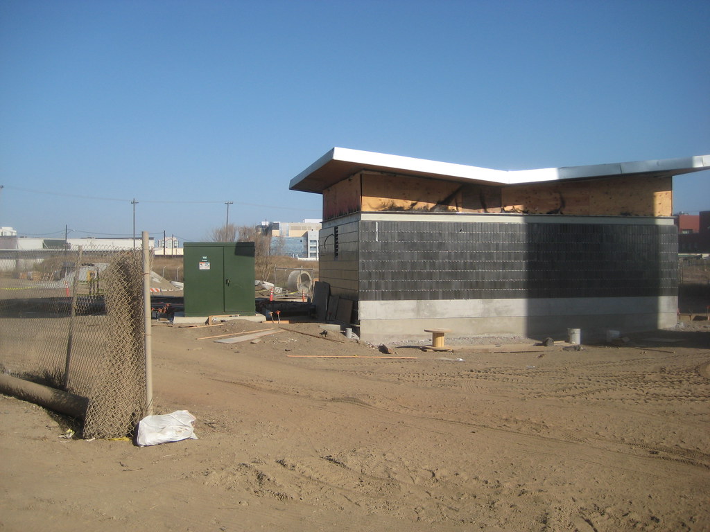
- they are still doing something in one corner of the lot between 1500 Owens and Gladstone, but I can't tell what. moving dirt, but not digging deep at all, at least that I can see. maybe just electric or cabling or something.

and unfortunately, I think that's it!

Last edited by timbad; Sep 22, 2009 at 7:03 AM.
Reply With Quote
     
     
  #565  
Old Posted Sep 22, 2009, 5:43 PM
KVNBKLYN KVNBKLYN is online now
Registered User
 
Join Date: Aug 2007
Location: Brooklyn
Posts: 345
Cool photos!

I worked on Townsend in the mid-nineties, just before all the demolition in that area. I worked with an architect who also had an office in one of the warehouses that was later torn down and I had to help her move her stuff out. Even though I've been in those warehouses, I still have only a slight memory of what they looked like. The ones closer to King were pretty standard one and two story concrete warehouses, but along China Basin there was a pretty cool water-oriented warehouse, as was mentioned by Wild Cowboy. I think the design of the ballpark took some inspiration from that waterside facade of that building. Too bad I never took pictures! I really wish I had some of the old elevated section of 280 along Berry Street as they were tearing it down or of the always incongruous RV park that was on the block between Third and Fourth.

I think I can hear the song Memories playing in the corner of my mind - good, god, am I really that old now?

Quote:
Originally Posted by timbad View Post
this apparently is from 1964, but I think what you can make out at the ballpark site is still what was torn down in 1997 or so (and shows that WildCowboy is right on):

http://webbie1.sfpl.org/multimedia/s...s/AAC-2424.jpg

you also get a glimpse here, on the right side partially obstructed by the 3rd St Bridge:

http://webbie1.sfpl.org/multimedia/s...s/AAD-1692.jpg

and here is a better shot (the ballpark site is on the left):

http://webbie1.sfpl.org/multimedia/s...s/AAD-1703.jpg

(all of these, btw, are part of the SF Library historical photo collection. lots of cool stuff there:

http://sfpl.lib.ca.us/librarylocatio...ry/sfphoto.htm )

it's funny - I worked on 3rd St between Brannan and Townsend through the mid-90's, and - annoyingly to me now - I only have the vaguest sense of what was in the ballpark spot then. it was that unremarkable, at least to me. of course, in those days, there was not much reason to go any farther south than Townsend. I'm not sure I even knew the names of King or Berry Streets then!
Reply With Quote
     
     
  #566  
Old Posted Sep 24, 2009, 12:15 AM
Severitito Severitito is offline
Severitito
 
Join Date: Sep 2009
Location: Cordoba
Posts: 1
Thumbs up

Hello, cool pictures. Miss the city. Regards
Reply With Quote
     
     
  #567  
Old Posted Sep 27, 2009, 10:00 PM
timbad timbad is offline
heavy user of walkability
 
Join Date: May 2008
Location: Mission Bay, San Francisco
Posts: 3,150
a few shots from yesterday's wandering...

for the streetsign fans out there, it looks like they have even installed them for streets that don't really exist yet. Long Bridge, in case it isn't obvious from the pic, will be the one that runs 'diagonally' between 4th and the Commons, south of and parallel to the street that borders Mission Creek Park (which I think is still called Owens even north of the traffic circle).


I walked up to the roof of the South Street Garage to get a better angle on the plaza construction on its north side. ex-Pfizer at the top. it might be hard to tell, but the trapezoid-shaped patch of dirt on the right side (with the bluish mechanical box on top) is actually a little hill:


another angle. here too, the area where they are putting down the planking on the left side is also up a little rise (which is why the whitish path switches back like that), and fenced off at the top, because it drops off to the access road that you can barely see running behind it to the left. imagine that will lead to loading/delivery areas of ex-Pfizer's taller companion building which will go up on that lot to the west.


and I guess we can file this under 'before picture', although more accurately it's a 'during picture', since this shot would have looked pretty different in, say, 2001. looking southwest across the intersection of 3rd and 16th Streets toward the site of the future UCSF medical center:


and this is what's going on on the parcel between Gladstone and 1500 Owens. almost looks like a curved pathway they're constructing, but that seems strange *before* putting up the building intended for the site. looking roughly southwest. the new Gladstone garage in the background.

Reply With Quote
     
     
  #568  
Old Posted Sep 27, 2009, 10:13 PM
timbad timbad is offline
heavy user of walkability
 
Join Date: May 2008
Location: Mission Bay, San Francisco
Posts: 3,150
Long Bridge

'Long Bridge' of course refers to the bridge laid across Mission Bay in the 1860s, before it was filled, almost exactly where 3rd St is now.

http://webbie1.sfpl.org/multimedia/s...s/AAD-1531.jpg

you can see it in the background of this photo, which is looking south across Mission Bay from approximately the current site of the ballpark, as far as I can tell:

http://webbie1.sfpl.org/multimedia/s...s/AAC-1829.jpg
Reply With Quote
     
     
  #569  
Old Posted Sep 28, 2009, 2:59 PM
WildCowboy WildCowboy is offline
Registered User
 
Join Date: Aug 2007
Posts: 527
timbad, thanks as always for the shots.

At 1600 Owens, it looks like there are "spokes" on the inside of that curved path. How far back from Owens does all of that go? It seems like they'll be wanting to connect 1500 to the rest of the "campus" and the parking garage, so that may be what this is.

But I'm wondering if 1600 will be set back a bit and this is part of the final landscape plan going in early in order to serve 1500 Owens, or if maybe they've just decided that construction on 1600 is so far off that they're going to create a temporary public plaza there to tie what's already there together.


That parking lot at the northeast corner of 3rd and 16th vexes me. They put that in a year ago, and as far as I can tell, it's never been used. Old Navy's lot was always bulging, so I thought maybe it was overflow for them, but I've never seen any cars in there. And now there's the South Street garage there for them. And Fibrogen on Illinois has their own garage under their building, so it doesn't appear to be for them. Weird.
Reply With Quote
     
     
  #570  
Old Posted Sep 30, 2009, 6:52 AM
timbad timbad is offline
heavy user of walkability
 
Join Date: May 2008
Location: Mission Bay, San Francisco
Posts: 3,150
Quote:
Originally Posted by WildCowboy View Post
At 1600 Owens, it looks like there are "spokes" on the inside of that curved path. How far back from Owens does all of that go? It seems like they'll be wanting to connect 1500 to the rest of the "campus" and the parking garage, so that may be what this is.

But I'm wondering if 1600 will be set back a bit and this is part of the final landscape plan going in early in order to serve 1500 Owens, or if maybe they've just decided that construction on 1600 is so far off that they're going to create a temporary public plaza there to tie what's already there together.
the interesting thing is that, to the best of my memory, the construction is confined to the southeast third or so of the lot. don't think the other three corners are touched, and I'm not even sure the 'spokes' make it all the way to converge at the supposed hub.

entirely possible that this is for the benefit of 1500 Owens tenants, but it still seems like a strange way to do it at this point. it mostly seems to connect them to the Gladstone garage, which I guess maybe some of them will have to use, once their own surface parking lot in back fills up?
Reply With Quote
     
     
  #571  
Old Posted Sep 30, 2009, 2:25 PM
WildCowboy WildCowboy is offline
Registered User
 
Join Date: Aug 2007
Posts: 527
Quote:
Originally Posted by timbad View Post
entirely possible that this is for the benefit of 1500 Owens tenants, but it still seems like a strange way to do it at this point. it mostly seems to connect them to the Gladstone garage, which I guess maybe some of them will have to use, once their own surface parking lot in back fills up?
Not only may that surface lot fill up, but it may go away. A parking garage has been designed for that spot, but I don't know what the timetable is for its construction.

And they have to be able to get to Starbucks!
Reply With Quote
     
     
  #572  
Old Posted Oct 2, 2009, 7:14 AM
timbad timbad is offline
heavy user of walkability
 
Join Date: May 2008
Location: Mission Bay, San Francisco
Posts: 3,150
Quote:
Originally Posted by WildCowboy View Post

And they have to be able to get to Starbucks!
ah, that's gotta be it: it's Latte Lane!
Reply With Quote
     
     
  #573  
Old Posted Oct 2, 2009, 1:48 PM
WildCowboy WildCowboy is offline
Registered User
 
Join Date: Aug 2007
Posts: 527
Great news...Pfizer's 100,000 square feet in the west half of the 455 MB Blvd S complex is going to be taken by Nektar! And it sounds like deals are in the works with other companies for most, if not all, of the east half.

http://sanfrancisco.bizjournals.com/...05/story1.html
Reply With Quote
     
     
  #574  
Old Posted Oct 7, 2009, 3:27 AM
WildCowboy WildCowboy is offline
Registered User
 
Join Date: Aug 2007
Posts: 527
With the cancer research building opening earlier this year and the cardiovascular research building well underway, eyes now turn to the third building in UCSF's trifecta of focused research facilities, the neurosciences building slated for Block 19A, directly west of the existing Rock Hall.

This building has been on the table for what seems like forever. It was originally slated to be the third research building on the Mission Bay campus, but got bumped back to make room for QB3/Byers Hall when the state came forward with significant money for that initiative. Fundraising then directed priorities toward cancer and cardiovascular buildings, while the campus has struggled to raise money for the neuroscience building.

In an effort to kickstart the building's construction, UCSF scrapped the existing architectural plans and decided to pursue a partnership with developers who would lease the land from UCSF, build the facility on their own dime, and then lease the building back to UCSF. After 30 years, the building would transfer to UCSF.

The Regents have approved the plan and a consortium of developers led by McCarthy Cook (the developer behind China Basin) has been working with UCSF on a plan for the facility. The idea had been that construction could be started by late this year and have the facility ready to open in about mid-2011 on an accelerated timetable, around the same time as the opening of the CVRB.

A brief update today from the Business Times indicates that Chancellor Desmond-Hellmann is still reviewing the plans and finances before giving the final go-ahead. Hopefully it happens soon. I believe we noted a few months ago in this thread that the piles of dirt for surcharging the area around where this building is going to be have been removed, so it should be shovel-ready and things should move pretty quickly once the OK is given.

Quote:
UCSF Ponders Neuroscience Building
Tuesday, October 6, 2009, 7:20pm PDT

One of the go/no-go decisions early in Susan Desmond-Hellmann’s UCSF chancellorship is about a structure — physically and financially.

Building a five-story, 237,000-square-foot neuroscience building on UCSF’s Mission Bay campus means committing to a unique plan that involves a private developer, a nonprofit entity that would float public bonds and signing a 30-year lease.

It could be one of the first — if not the first — buildings in the University of California system to cut costs by turning to a private developer, in this case a consortium that includes McCarthy Cook, to design, build and own a building on campus. After the lease expires, ownership would transfer to UCSF.

The last word we got at the end of September was from the associate vice chancellor of university relations, Barbara French, who said the business plan for the building is “being reviewed by the new chancellor prior to final approval.”

UCSF leaders in the spring had hoped to start construction on the project, next to Rock Hall, by the end of this year. It would house Nobel Prize winner Stan Prusiner and some 600 other researchers, staff, students and patients.

Prusiner would join UCSF’s latest Nobel Prize winner, Elizabeth Blackburn, on the Mission Bay campus.
Reply With Quote
     
     
  #575  
Old Posted Oct 7, 2009, 6:43 AM
timbad timbad is offline
heavy user of walkability
 
Join Date: May 2008
Location: Mission Bay, San Francisco
Posts: 3,150


sure would be nice to see another major building start construction, have another chunk of the MB prairie filled in. things are gradually falling silent around here...

a couple notes from this weekend...

- indeed, the spokes in the construction on the lot next to 1500 Owens do not meet up, and whatever they are doing there is confined to one corner of the parcel. curious, from the rebar and wooden framing I saw, it appears a meter-high wall will run alongside the curved path... stay tuned...

- digging has started again in the parcel of what will be the Commons in front of the HD Cancer building. remember that a deep shaft had been dug a few months ago, and filled with concrete framing, probably as part of sewer infrastructure, but had been left flush with the surface at that point. hard to tell yet what they're doing now, but they're at it again.

- planting/landscaping continues behind the Nektar building

- work continues on the drainage outlet/pumping station on the south side of the creek, and they were even there late - after 8:00p - tonight doing something

- they've cleaned up some of the detritus that had built up around the Mission Creek-7th St train-tracks crossing that has been blocked off and unused since it was basically finished over two years ago. and they may have been working on the lights the other day. signs that this may finally open soon? I'm curious/wary what this will do to traffic on Berry once it does open.

- they are installing Mission-Bay-style streetlights on the south side of 16th St, at least between 3rd and 4th, and it looks like putting in a traffic signal at the 4th St intersection. there already is a functioning one at Owens, and at 3rd of course.
Reply With Quote
     
     
  #576  
Old Posted Oct 7, 2009, 6:56 AM
utgf utgf is offline
Registered User
 
Join Date: Sep 2008
Posts: 16
Quote:
Originally Posted by timbad View Post
- they've cleaned up some of the detritus that had built up around the Mission Creek-7th St train-tracks crossing that has been blocked off and unused since it was basically finished over two years ago. and they may have been working on the lights the other day. signs that this may finally open soon? I'm curious/wary what this will do to traffic on Berry once it does open.
Got a flier in my complex on Berry St indicating the rail crossing opens up tomorrow.
Reply With Quote
     
     
  #577  
Old Posted Oct 11, 2009, 8:01 AM
timbad timbad is offline
heavy user of walkability
 
Join Date: May 2008
Location: Mission Bay, San Francisco
Posts: 3,150
thanks utgf, and here is the photo evidence! (looking east from 7th Street)


eventually, the road will continue, winding back through the freeway columns where all that dirt is now, to a traffic circle that is the link to Owens coming up from the south, Channel from the north, and Mission Bay Blvd coming off the axis of the Commons. The only option for now: turning left before the dirt, the road jogs over to Berry St.

I didn't notice any cars actually use the crossing in the 10 minutes or so I was there, but I imagine that will change as time goes by.

also back there behind the dirt is the work they are doing on the outlet to the creek. the small building which ?may be a pumping station? has gotten a layer of handsome black tiles:


I was surprised at what I found at the lot next to 1500 Owens:


what I thought was going to be a wall along the curving path of Latte Lane, turns out to be concrete benches?! I tried to get enough into the shot that you can see where construction ends on the right side of the pic. it's just dirt from there on out of the pic. anyway, this still seems strange.

1500 Owens itself now sports logos of Celgene and the UCSF Orthopedic Unit on its glass outside.

the stone being installed at ground level on the CVRB looks to be the same as that on the HD Cancer Building (this is on 4th Street):


... and a few more shots of the plaza behind Nektar, which is just about finished. from the ground:


and a couple angles from the roof of the South St garage:


in other news...

- it looks like they are getting ready to (re)pour the sidewalk in front of Nektar

- I think the streetlights on the south side of 16th were *only* related to the intersection with 4th - that is, they have been set up because they also hold the (not yet functioning) traffic lights. there are no other poles besides the two up now. (and to be honest, I'm not sure how new they are; it's possible I just didn't notice them before)

Last edited by timbad; Oct 11, 2009 at 8:18 AM.
Reply With Quote
     
     
  #578  
Old Posted Oct 12, 2009, 3:06 PM
WildCowboy WildCowboy is offline
Registered User
 
Join Date: Aug 2007
Posts: 527
Thanks for another set of great shots, timbad! That plaza behind the Nektar building is looking sharp!

Interesting about Celgene being listed on 1500 Owens. My recollection is that Alexandria has been saying for some time that they had a big biotech signed on for the balance of the space not taken by UCSF, but the name of the company was never announced. Celgene announced earlier this summer that they were hiring someone to oversee translational research in Mission Bay, but I thought maybe that was through their existing ownership of Pharmion in 1700 Owens. Looks like it may be much bigger than that.

That's also curious about the 1600 Owens "park". It's certainly looking to be a rather permanent installation, or if not, they're investing quite a bit in it. I guess they'll just build 1600 Owens around it eventually? But it's weird the way the seating seems to really close things off.
Reply With Quote
     
     
  #579  
Old Posted Oct 15, 2009, 5:50 PM
WildCowboy WildCowboy is offline
Registered User
 
Join Date: Aug 2007
Posts: 527
Just saw this update from the EPA noting several stimulus funding projects in the general Mission Bay area. Within Mission Bay proper, there is a $200,000 grant for turning brownfields into parks. The grant is for Block P16, which is the section of Mission Bay Commons adjacent to the Nektar building, between Third Street and the one already-complete section of the Commons.
Reply With Quote
     
     
  #580  
Old Posted Oct 24, 2009, 8:13 PM
timbad timbad is offline
heavy user of walkability
 
Join Date: May 2008
Location: Mission Bay, San Francisco
Posts: 3,150
1900 Third St warehouse demolition

just got an email notice about the upcoming demolition of the large warehouse (and adjacent 2-story office building) at the corner of Third and Mariposa, on the site of the future UCSF Medical Center. (see 'before picture' from my 9-27 post)

highlights:

abatement (asbestos removal) to start early November, and last about 2 months. demolition itself takes about two weeks, and could be done by the end of the year if all goes well. (but since it may rain between now and then, January is more likely)

the concrete foundation will be left and fenced off until May-June 2010, at which point it will be broken up for re-use. this takes about a month.

then site prep for the medical center begins! this involves "remove and replace" of 2-8 feet of the fill material (dirt etc) below the site, which will be re-compacted after getting rid of boulders and debris. all plants and asphalt also removed, and site graded. this takes about two months.

so by the end of next summer we ought to have nice flat smooth dirt over there, waiting for a medical center to be plopped on top of it.

also mentioned in the email: in spring/summer 2010 they will be working on the sewer/storm drains on the south side of 16th and the portion of 4th that will run "through" the site. (this may have been mentioned already, but I'd forgotten: one of the goals of all this sewer work is to separate what is now a combined sewer and storm drain system. I think this means less chance that heavy rains flush untreated sewage into the Bay?)

Last edited by timbad; Oct 24, 2009 at 8:25 PM.
Reply With Quote
     
     
This discussion thread continues

Use the page links to the lower-right to go to the next page for additional posts
 
 
Reply

Go Back   SkyscraperPage Forum > Global Projects & Construction > General Development
Forum Jump


Forum Jump


All times are GMT. The time now is 3:24 AM.

     
SkyscraperPage.com - Archive - Privacy Statement - Top

Powered by vBulletin® Version 3.8.7
Copyright ©2000 - 2024, vBulletin Solutions, Inc.