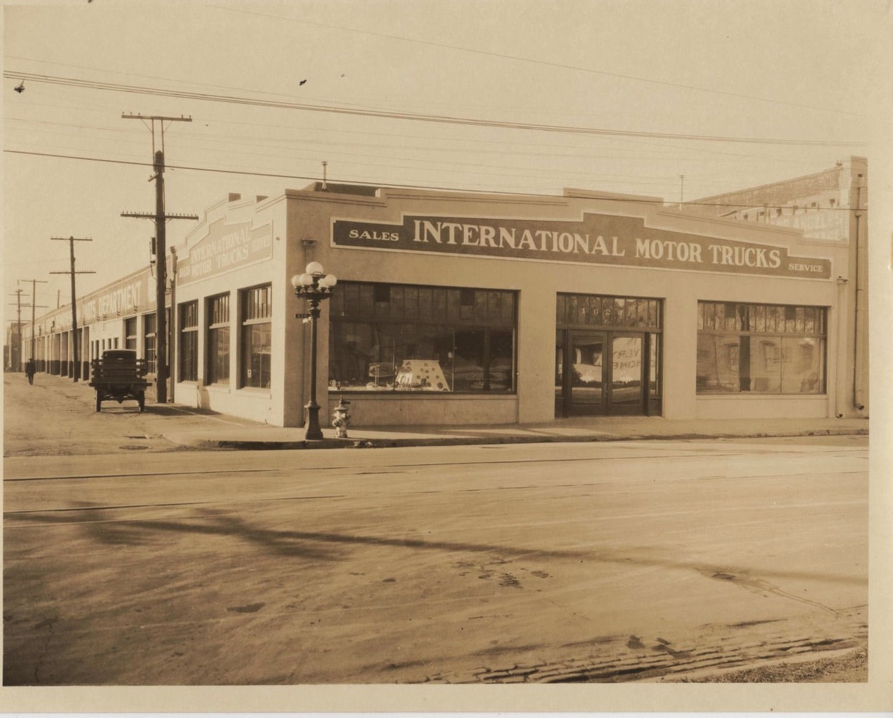
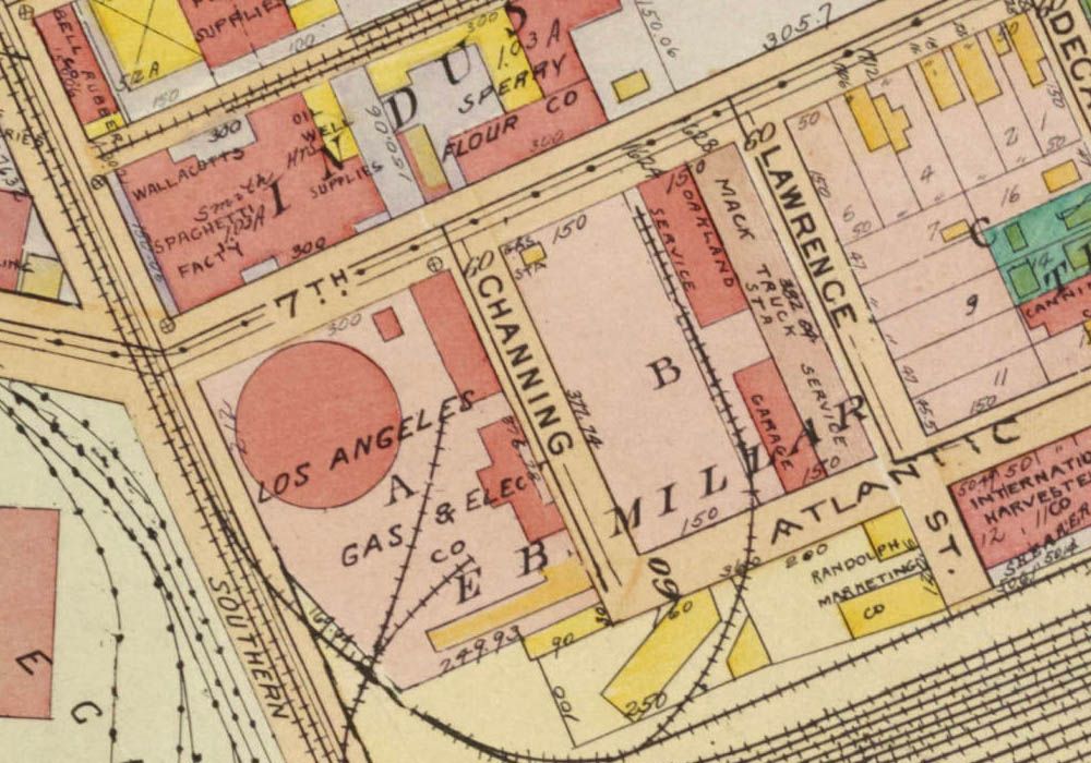
re: International Motor Trucks
+ Sperry Flour Company (Angelus Mills)
Originally posted by
HossC
usc
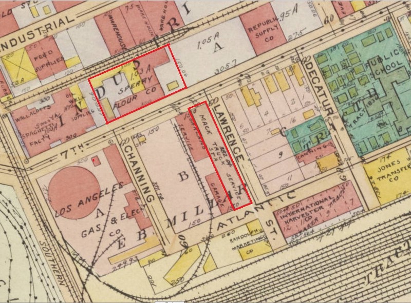
I was surprised to see the Sperry Flour Company across the street from the International Motor Truck Co. ('Mack Truck Service' on the map)
Could this be the flour mill reflected in the front windows of the I.M.T. building?

eBay
enlarged
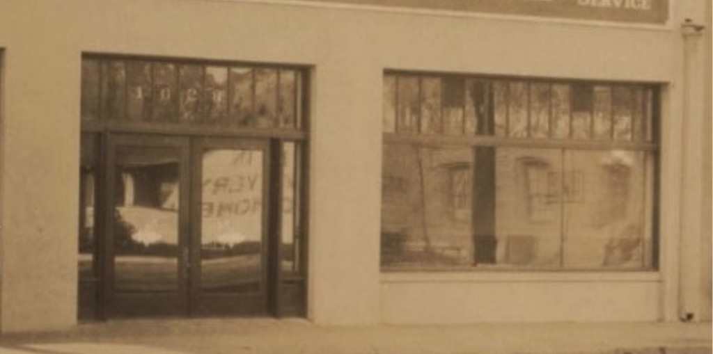
detail
OK, let's flip it horizontally.
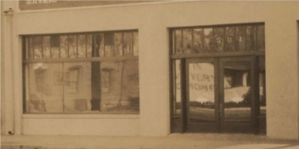
detail
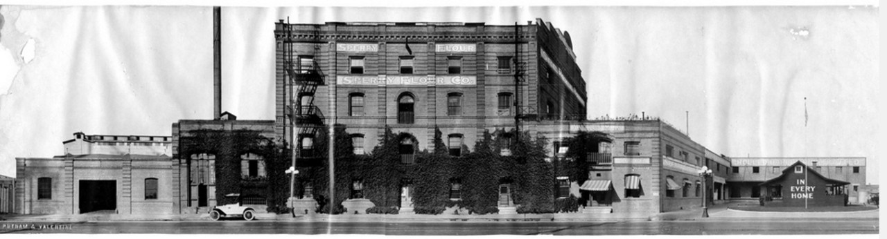
Well, what we're seeing reflected in the windows is a small wooden bungalow with "In Every Home" painted on the side,
and next to it is the larger brick building of the Sperry Flour Company.
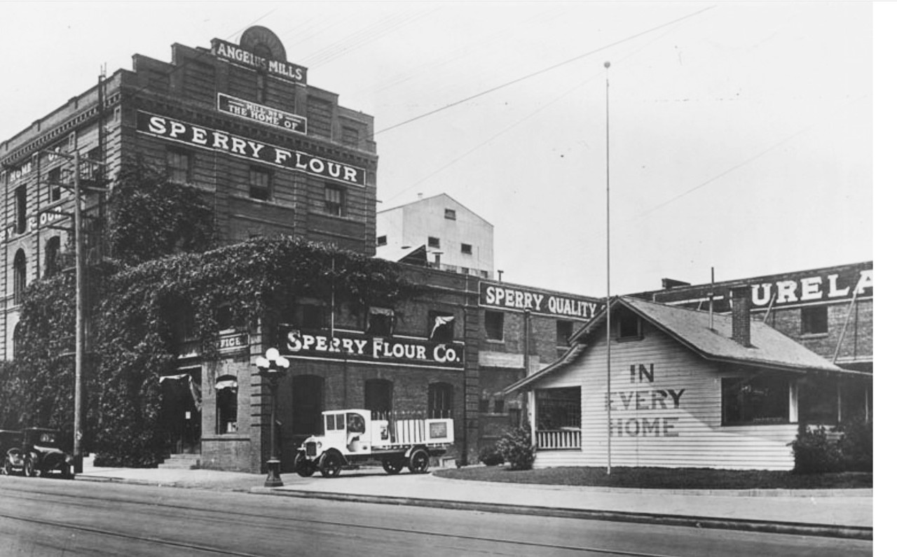
Sperry Flour Company, 1617 E. 7th Street, Los Angeles
 http://photos.lapl.org/carlweb/jsp/F...olNumber=53466
note: At the very top it says 'Angelus Mills'.
In the panorama below, the small bungalow (at far right) has been painted a darker color.
 https://www.flickr.com/photos/crackdog/3307467013
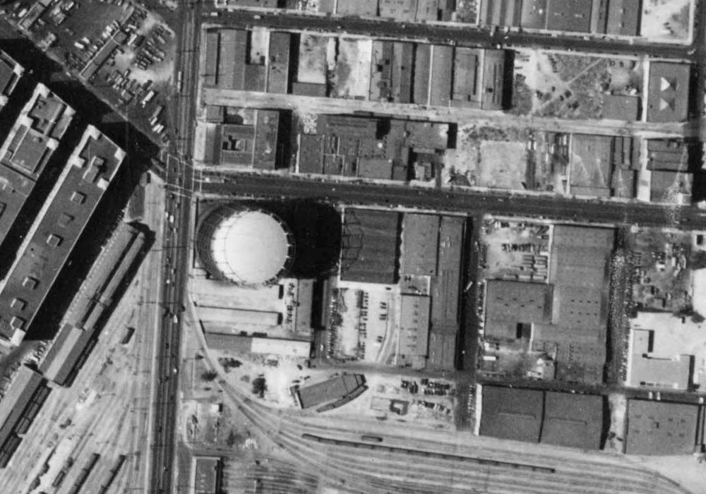
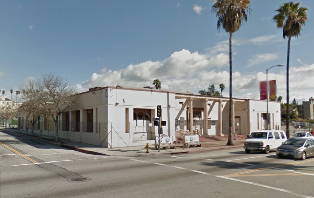
And get this, the old Sperry Flour Company building still stands! - albeit missing the top two floors.
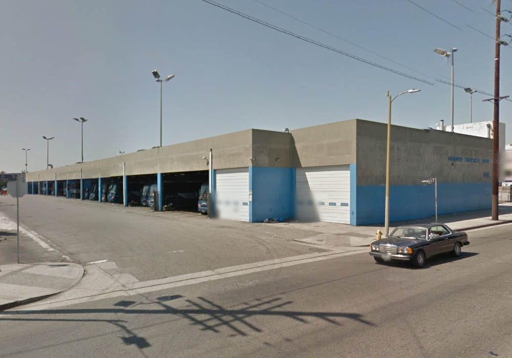
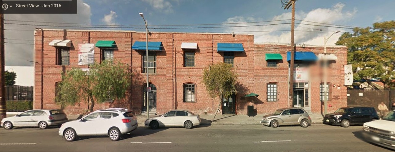 gsv
gsv
Today it's a Los Ninos Learning Complex & Charter School.

google_aerial
Here's a wider view showing the trees on the right, where the little bungalow used to stand.
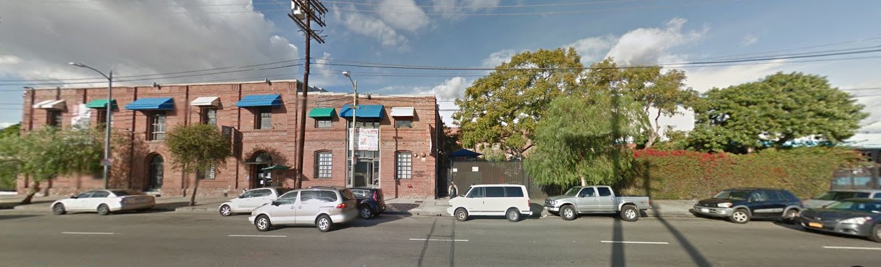
Google
_
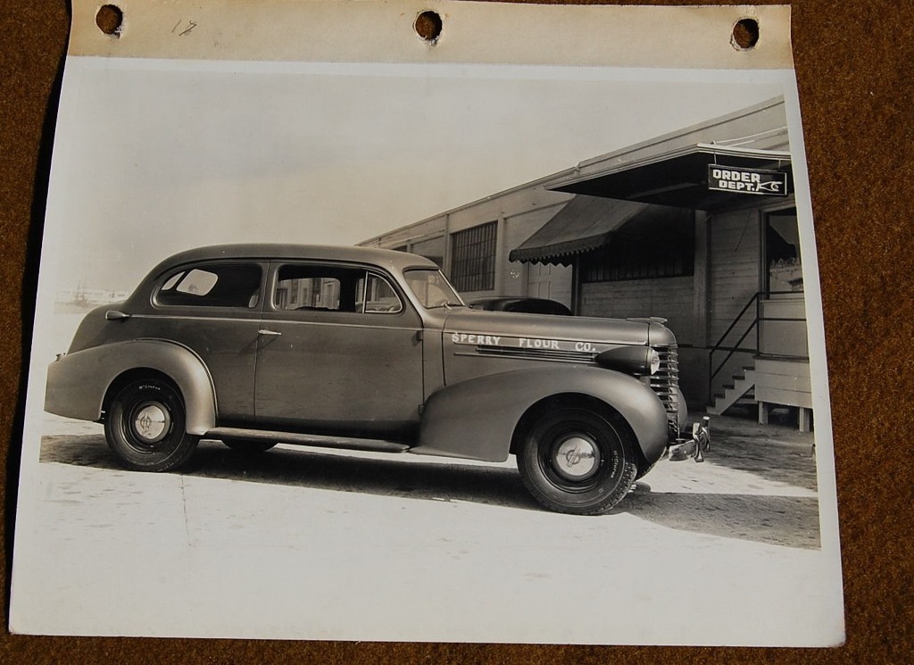
Obviously this is a different site than the Fruitland Avenue address that
Hoss located.
I'm guessing the 7th street site is earlier....or perhaps Sperry moved to Fruitland when General Mills became involved.
Here's a comment I found on flickr that mentions the Fruitland Avenue location.
"I recently came across a wooden recipe box that belonged to my grandparents. The advertisement on the lid of the inside of the box is: Sperry Bakers Service
a unit of General Mills Bakers Service. It says for all information contact Sperry Flour Co. at 4309 Fruitland Ave., Los Angeles, Ca. Does anyone know about this?
I also have a name and address of most likely the sales person that sold flour to my grandparents."
Bev
One last time.........here's the Fruitland Avenue photo.
eBay


 Prev
Prev


 Excellent sleuthing Hoss!


 .
.


 Linear Mode
