Quote:
Originally Posted by Zassk

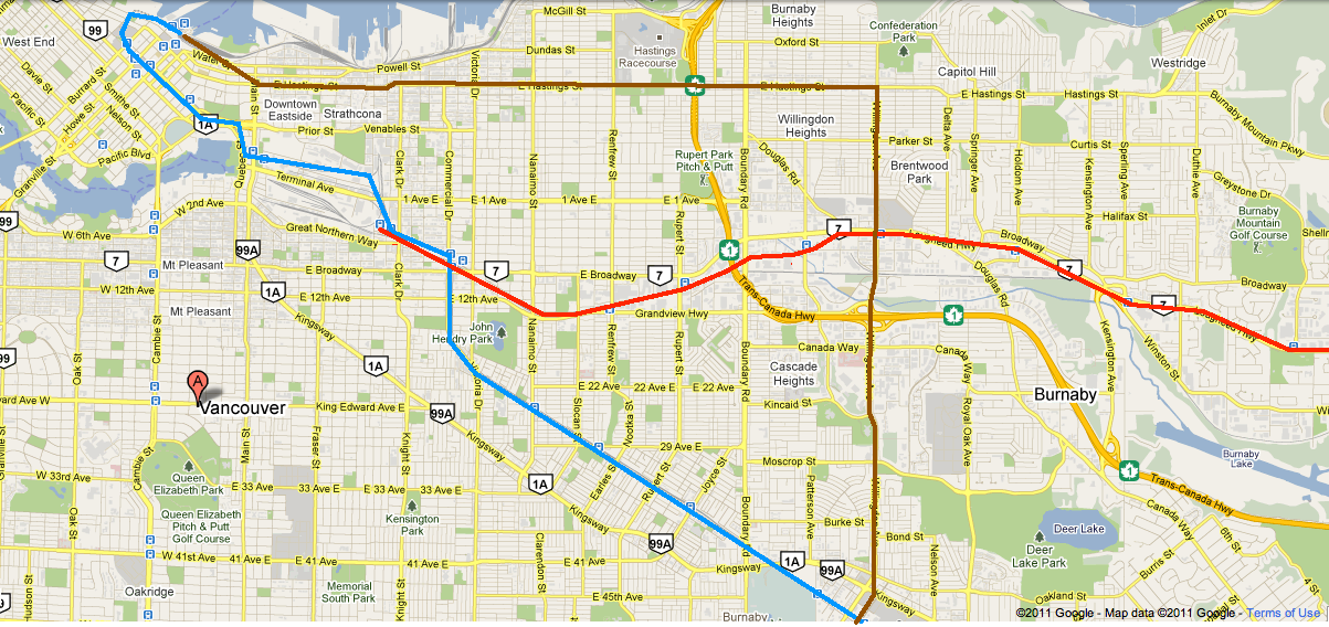
Not a branch line. I'm proposing a new north-south line, with track connections to Millennium only for managing the rolling stock. Initially the line would only go from BCIT to PNE, but with future extensions at both ends to complete the line substantially similar to what you suggested.
If you are referring to the notion of a dangling line ending at BCIT: I'm not the one who said BCIT needed to be reached by a line, but I acknowledge that it would have an immediate "payoff", and doesn't necessarily need to wait for funding for an expensive line underneath the Willingdon and Burnaby Heights hills. Tunnels are always best, but they are damn expensive, and they aren't necessary to serve the PNE or BCIT.
I agree with your statement that a Hastings SkyTrain line could be elevated east of Strathcona. I only proposed going along the waterfront for the following reason:
I foresee some government, in the near future, announcing a 1 or 2 station extension of Expo Line into Gastown and/or Strathcona. It would be dirt cheap to implement, and can be sold to the public as rehabilitating the DTES.
If this occurs, then a continuation eastward to PNE is really just a question of when, not if.... and the cheapest route will be the railyard rather than Hastings Street.
|
There is more existing density and future redevelopment potential right on the Hastings Corridor compared to the waterfront. Hastings is a lot like Broadway, just a decade or so behind. Most of it's length from downtown to Willingdon is commercial or multi family, and it is the logical, and cheaper, direction for downtown to spread. A lot to the east of Hwy 1 has been built in recent years, and there are quite a few plans in the works, and a lot of underused land right on the street, prime for Transit oriented development. Houses along most of the route are on CPR style narrow lots, meaning SFH are tightly packed in. In Burnaby, there is a lot of tightly packed houses north and south of Hastings, meaning a lot of close riders.
I also believe that the land along the east side of Willingdon, between Hastings and Brentwood mall is owned by the city, for when they need to widen Willingdon, but could be used for transit needs. And at Willingdon at Lougheed, all that land is going to become towers. The mall is going to put up towers on its parking lots, and where the Nissan dealership was is going to become condos, and the Carter GM lot is HUGE and will probably go eventually (especially if there was a Willingdon line).
The hill on Willingdon to Metrotown is a bit overrated. Skytrain could easily handle the grade without a tunnel. I've been on many buses that have made it up that hill at over 50km/h, while on Clarke in PoMo, I've never been on a bus that went up that hill over 15km/h. They are different monsters. I bet that even LRT could handle the hill at grade, if not then some above ground guideways could be used to level the grade a bit. So I don't think it would be quite as expensive as you fear. Willingdon is an approved truck route, and I don't think there are any grade warning signs at the top of the hill, so it can't be that bad.
The side benefit of using Skytrain between Metrotown and Waterfront along Hastings is that it could provide a relief line to downtown along the busiest segment of Expo line. The travel time would only be a few minutes longer, and if you were starting your Skytrain journey at Metrotown to Downtown, taking the "back way", while longer, could mean you are not crammed in like sardines.
If LRT was used, the Hastings segment could be a major backbone of future light rail lines down other corridors, like Main, Commercial or Renfrew, or all the way down Hastings to SFU. I also don't think using LRT would be as bad as using LRT on Broadway because Hastings doesn't cross any major North/South corridors like Broadway does (and Hastings is already the worst road into downtown, so you can't really make it worse).


 Prev
Prev


 I wish there were some way to get around that, because otherwise it's a great, and simple, concept.

 Linear Mode
