HomeDiagramsDatabaseMapsForum About
     

Go Back   SkyscraperPage Forum > Regional Sections > Canada > Alberta & British Columbia > Calgary > Calgary Area Photos & Videos


Thread Tools Display Modes
     
     
Prev Previous Post   Next Post Next
     
     
  #10  
Old Posted Sep 6, 2012, 5:48 PM
5seconds 5seconds is offline
Closed account
 
Join Date: Mar 2011
Posts: 935
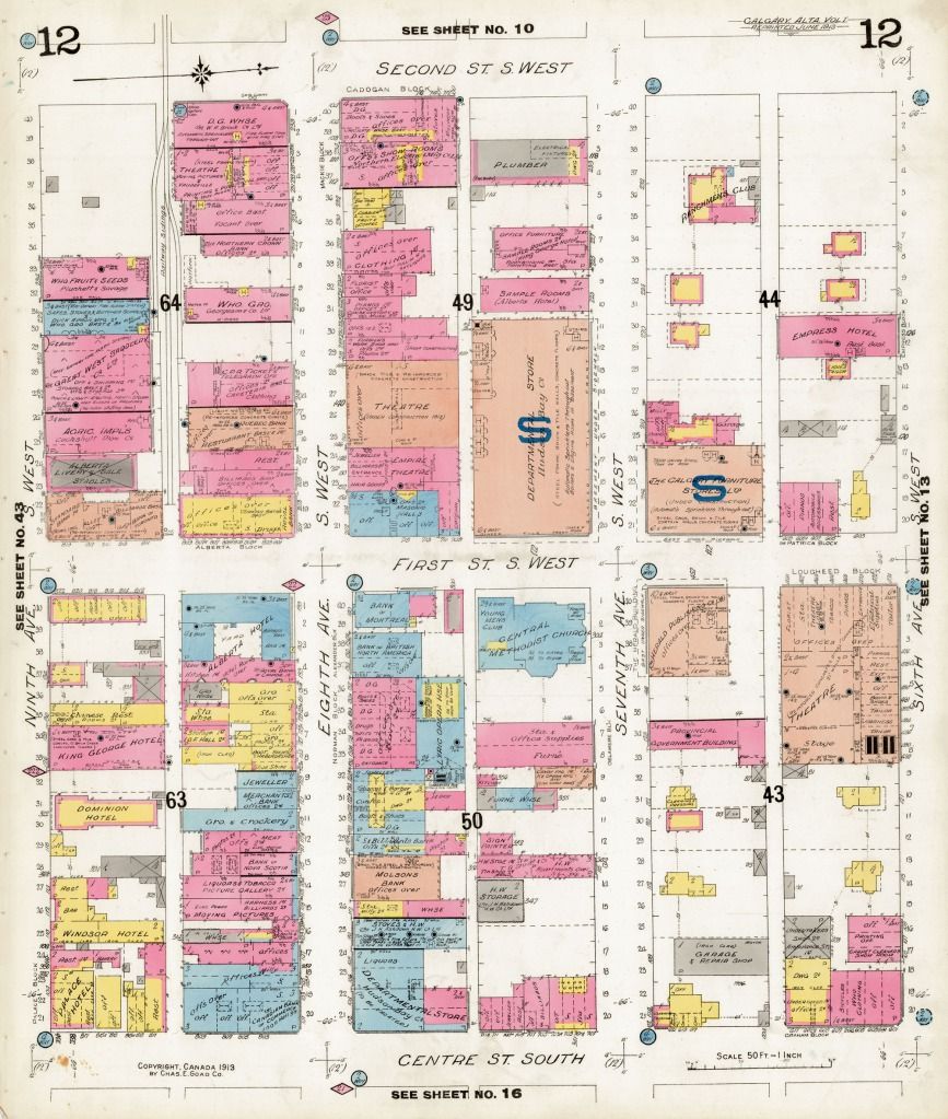
With the talk of Herald Square and the vibrancy of the 7th ave corridor going on recently, I thought I would share this map I found. It's a very detailed map of the 1st street/7th/8th ave area from 1911 (an insurance map) that shows all of the buildings and their uses (and construction in some cases)

Click here for a really hi-res version. Everything readable:
http://data2.archives.ca/e/e338/e008445298-v8.jpg

Reply With Quote
     
     
End


Go Back   SkyscraperPage Forum > Regional Sections > Canada > Alberta & British Columbia > Calgary > Calgary Area Photos & Videos
Forum Jump


Forum Jump


All times are GMT. The time now is 2:16 AM.

     
SkyscraperPage.com - Privacy Statement - Top

Powered by vBulletin® Version 3.8.7
Copyright ©2000 - 2026, vBulletin Solutions, Inc.