I assume they built it where it is to centre it on the Hill, between the East and West blocks. I don't think they gave it any thought to the street grid of the adjacent lumber town.
I'm not entirely sure, but I think Barrack Hill Cemetery might still have been there when Ottawa was chosen capital and during much of the construction, but the grid plan had already been established (which included moving the cemetery).
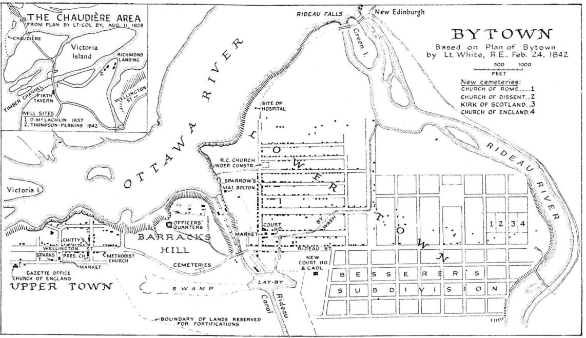
This is a plan of ByTown in 1842, 16 years before Ottawa was chosen as capital.
 http://www.bytown.net/
 and
https://www.historicalsocietyottawa....ing-going-gone
This is also supposedly 1842, with the future street grid superimposed on the cemetery.
 http://passageshistoriques-heritagep...town/carte-map
Maps continue to show the cemetery up until 1853, with the grid, or part of the grid superimposed. Available maps then seem to skip to 1876, a decade after Parliament was built.
http://passageshistoriques-heritagep...town/carte-map