Texas Central HSR looked at several possible routes and has identified two as the most viable for the project.
They are the BNSF (option 1) and Utility corridors. The other BNSF, UP, and I-45 alternatives scored low in three matrixes.
Here's a few pages from the presentation.
Three matrixes
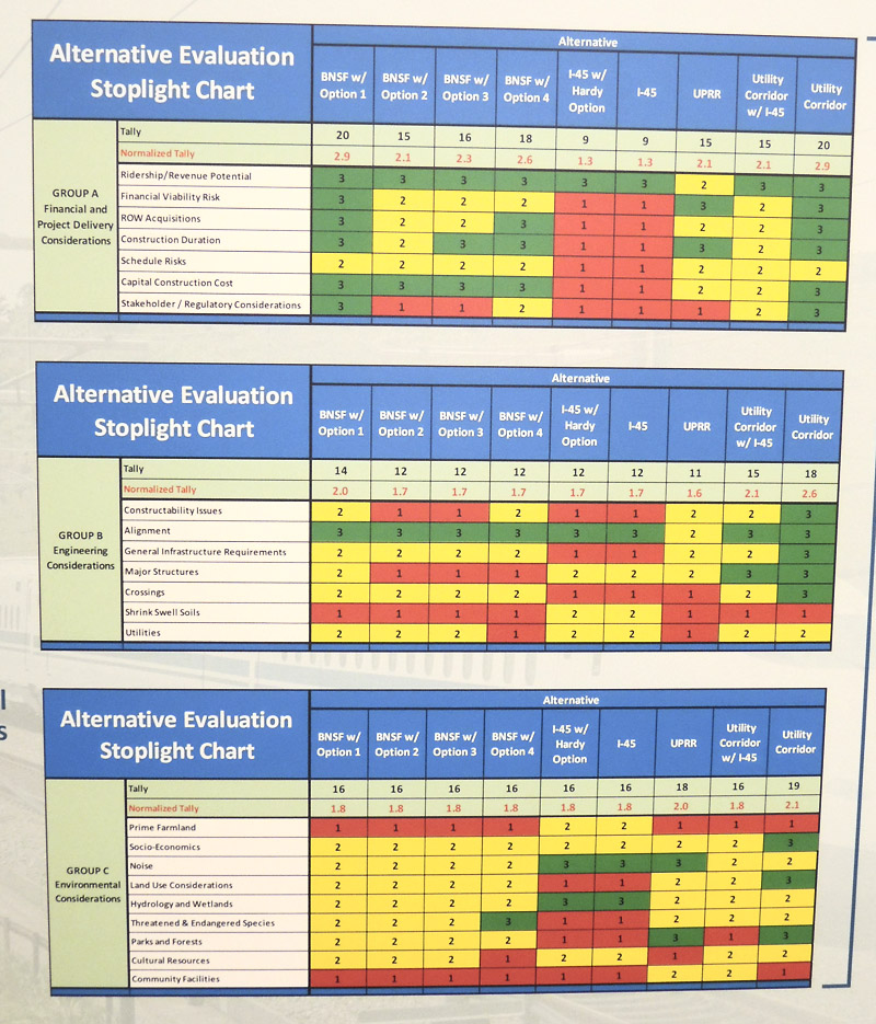
Adding up the various alternatives points:
Utility = 57
BNSF (option 1) = 50
Utility with I-45 = 46
BNSF (option 4) = 46
BNSF (option 3) = 44
BNSF (option 2) = 43
UP = 42
I-45 = 37
I-45 with Hardy = 37

Note: BNSF option 1 corridor is red above, Utility corridor is gray above
Potential Houston station locations
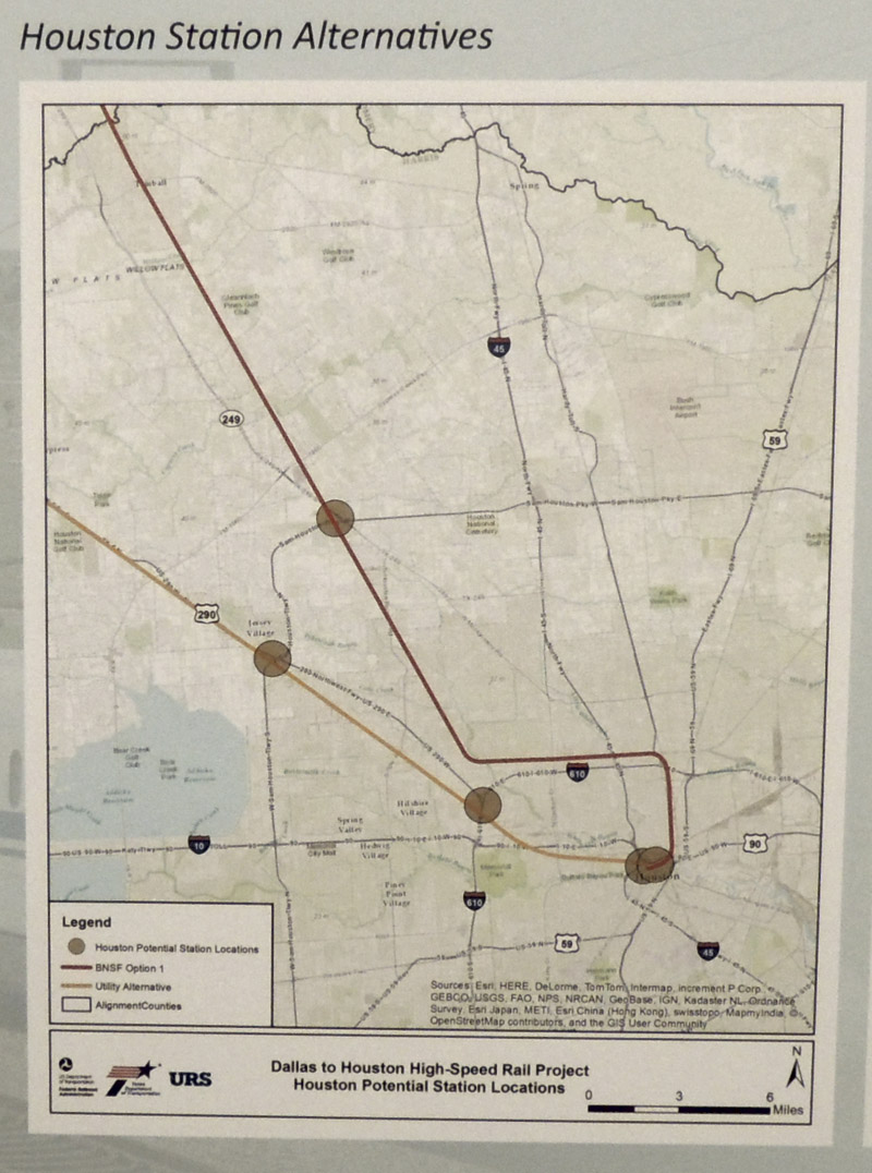
BNSF option 1 corridor is dark brown above, Utility corridor is light brown above
Potential Dallas station locations
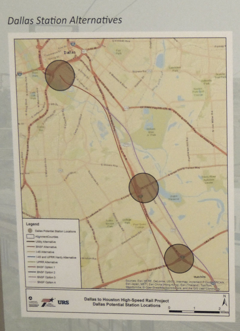
BNSF option 1 corridor is dark brown above, Utility corridor joins BNSF around the Dallas-Ellis County line 10 miles or so off the map.
The Utility Corridor follows high voltage lines most of the way between Lancaster and Hockley, avoiding and bypassing every town between them. It basically follows the BNSF tracks into Dallas north of Lancaster, and UP tracks south of Hockley into Houston. BNSF option 1 follows BNSF tracks all the way between Dallas and Houston, what reduces its score somewhat is that the tracks would be routed through towns instead of avoiding them. The I-45 alternatives have the lowest scores - therefore I would place them last and very unlikely to be chosen.