Quote:
Originally Posted by HossC

This may be a good time to mention that I recently came across a copy of the 1921 Baist map in the USCDL. They've scanned each page separately rather than each plate, and the images can be zoomed further than the version at Historic Map Works. At the moment there's no sign of the 1910 or 1914 maps.
Here's the area from Flyingwedge's post. I think it actually says "ORD'S SURVEY".
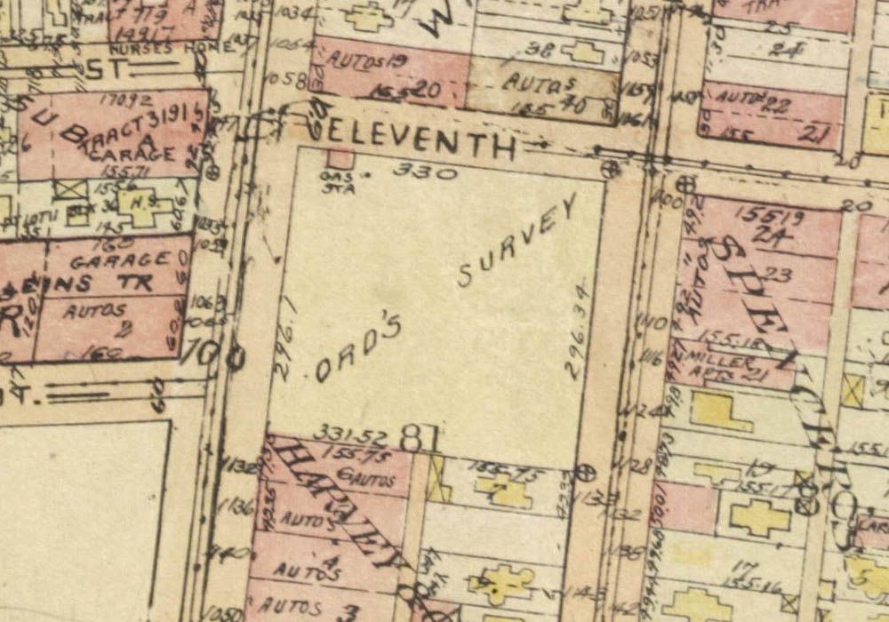 USC Digital Library
 |
Thanks,
Hoss (and you too,
e_r). It's great to know about the new version of the Baist map that's available.
I recently came across a discovery at the USC Digital Library as well. It's
The New Los Angeles Plat Book (1958),
published by The Realty Map and Ownership Service. Here's that same block from the plat book.
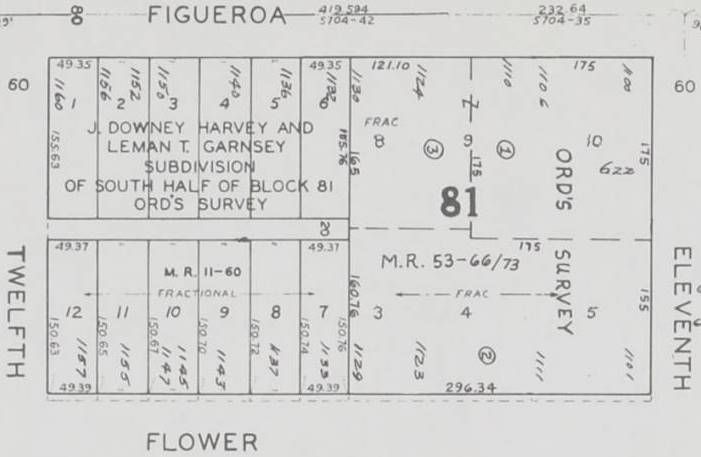 USCDL
USCDL
The north end of the block is vacant on every pre-1921 map I checked, including the 1894 Sanborn (The 1888
Sanborn does not go that far south).
The 1909 Gates' Birdseye View of Los Angeles shows a high fence around
three sides of the vacant lot. I wonder what the story of that property is?