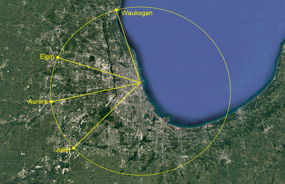
here's a 35 mile radius circle centered on state/madison in chicago's loop, with radial lines drawn out to waukegan, elgin, aurora, and joliet.
the map also does a decent job of showing the northern/western bias of chicagoland, as development tapers off quicker when you head due south from the city, possibly because there was no historical ring city located down that way to draw sprawl out to it?