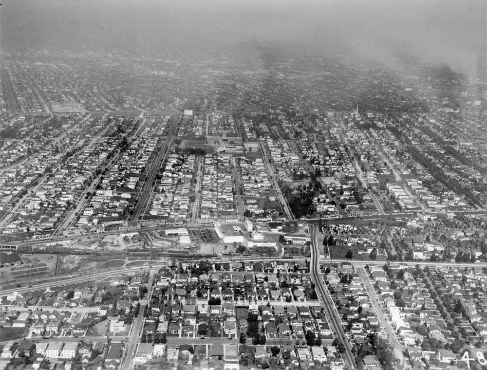
A couple of days ago I posted a 1940 aerial picture of Lafayette Square. The aerial below shows the area slightly west. This one has "48" in the lower right corner and the Lafayette Square one has "49", so I assume they are part of a set which was taken at the same time. On the far left is the Red Car viaduct over Pico at San Vicente.
FredH wrote about the viaduct in
post #5381.
 USC Digital Library
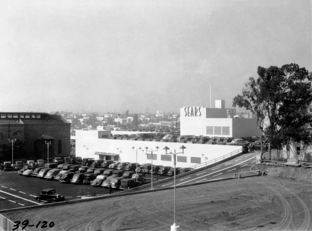
Just below center, the large white structure is Sears. The picture below is from 1939.
 USC Digital Library
When I first saw the aerial shot, I thought there was some sort of race track to the left of Sears. When I zoomed in, I realized it was the Pico & Rimpau Loop. The curved structure with all the arches near the top left is the Plaza Market. Check out
post #19202 to see the picture that
e_r posted in January (they sold lutfisk there!).
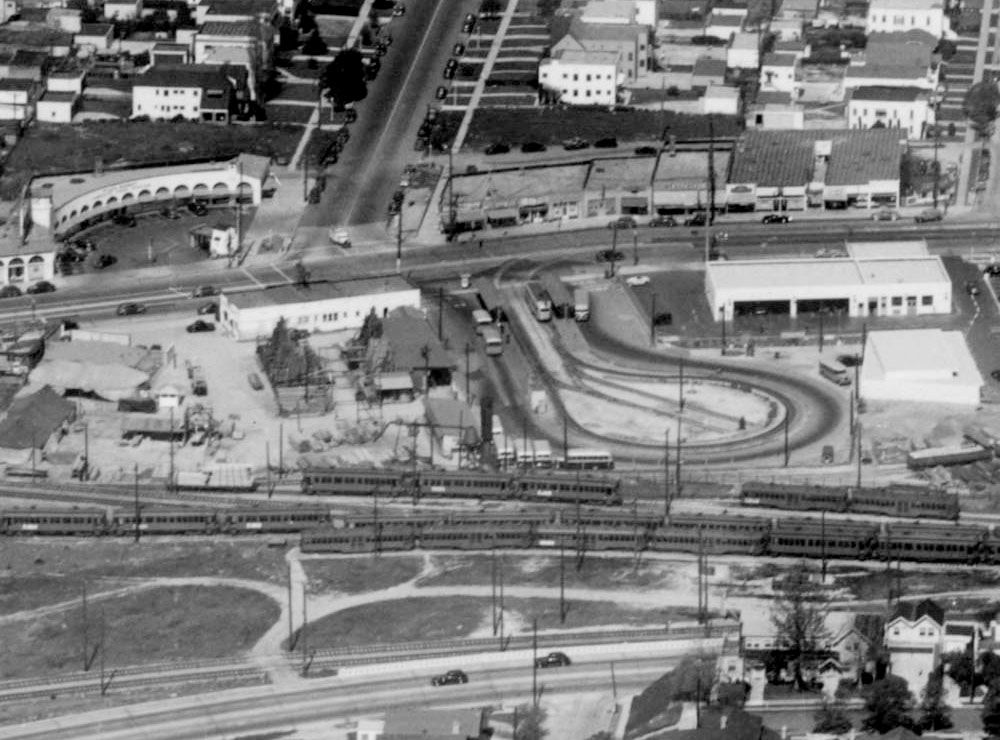
Detail of aerial above.
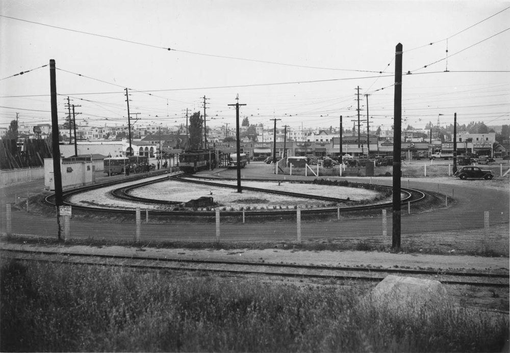
The Pico & Rimpau Loop was used to transfer passengers between streetcars and buses. USC has several ground-level shots. The following three are all dated April 12, 1937.
 USC Digital Library
A little closer.
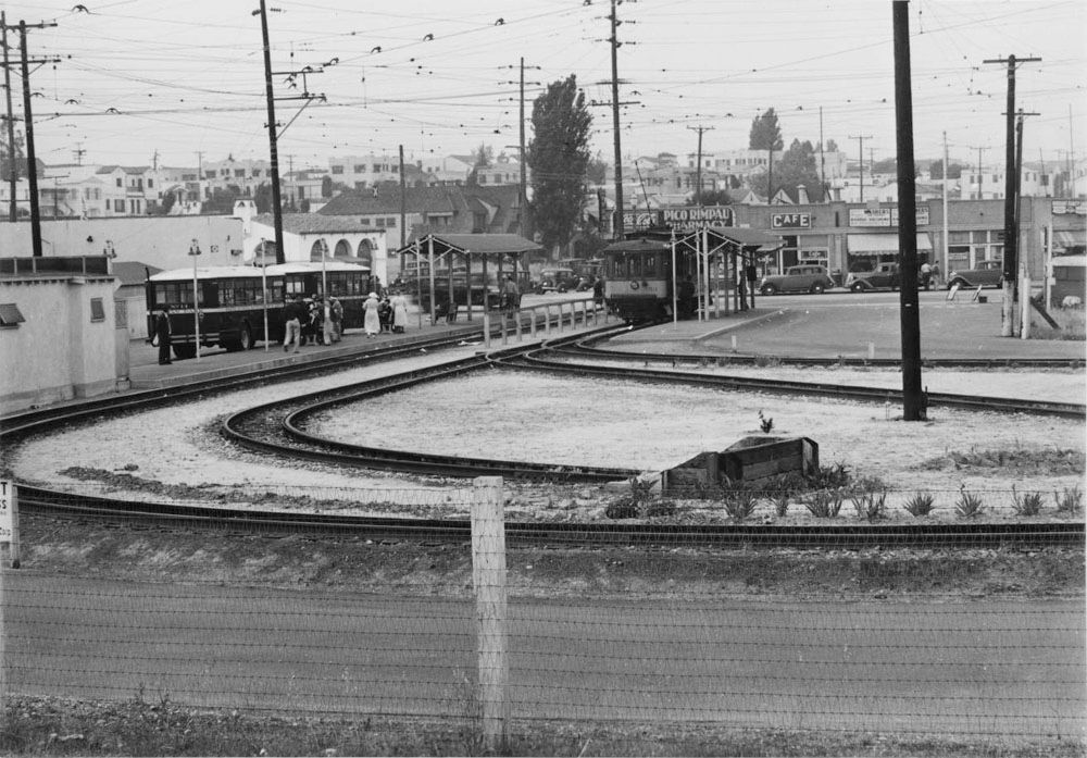 USC Digital Library
And from the opposite direction.
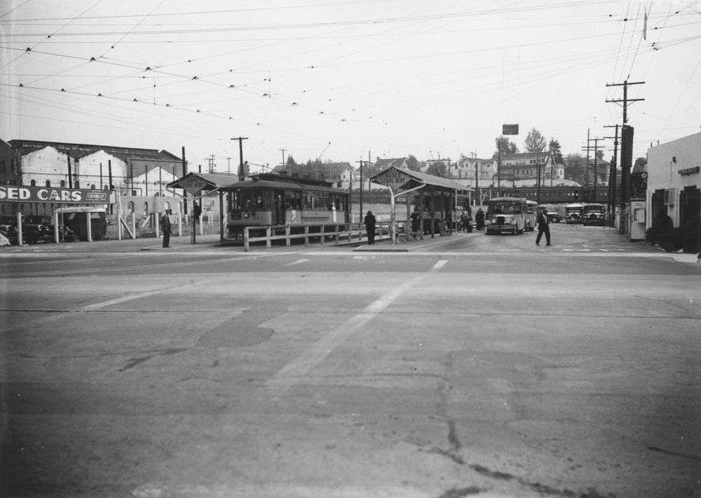 USC Digital Library
The Ebay seller of this picture dates it at 1942.

Ebay
The area between Venice and Pico has now been redeveloped. Sears and the streetcar loop have made way for a Lowe's hardware store and a parking structure. There is still a small bus terminal next door. Google's 45 degree views all show the Lowe's building under construction (as do the ones on Bing). Some of the Streetview images and the overhead view (below) do show the new buildings.
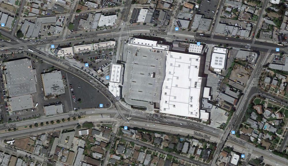
Google Maps