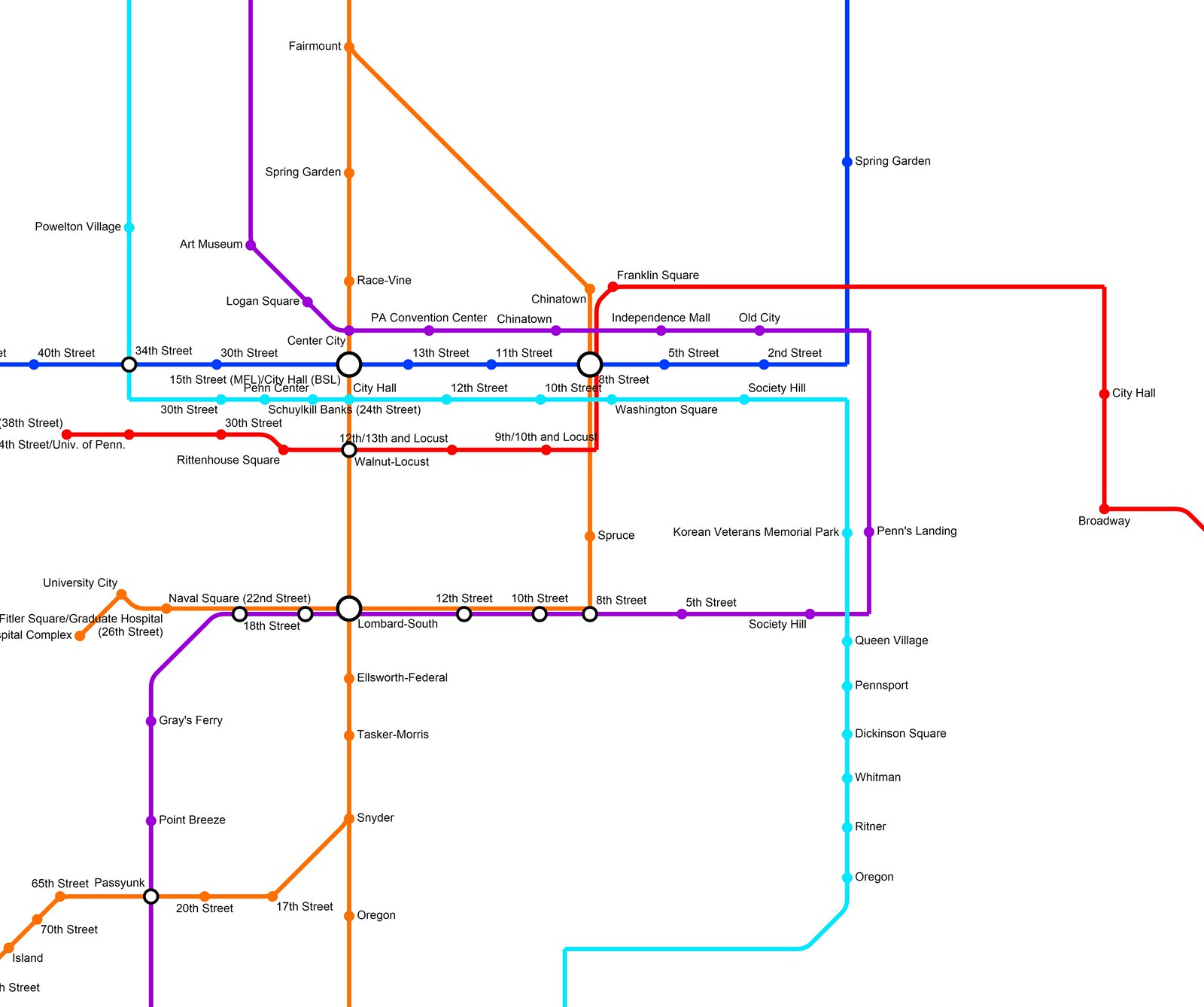
As a college student who is in the honors program, I have to do an undergraduate thesis to graduate
cum laude. My thesis will revolve around transportation in my city, Philadelphia. I have been working on this map for nearly a year (since last June), and I think I FINALLY have it perfected! Here are the lines:
Broad Street Line:
Ogontz Transportation Center (Ogontz and Cheltenham Avenues) to Gloucester City via Broad Street
Health Complex Line:
Divergence from BSL mainline at Fairmount (Lower level) to Health Complex (Civic Center Boulevard and University Avenue) via 8th and South Streets
Lindbergh Avenue Line:
Divergence from BSL mainine before Snyder to 84th and Lindbergh Boulevard via Passyunk Avenue and Lindbergh Boulevard
Roosevelt Boulevard Line:
Divergence from BSL mainline at Erie to Southampton Park-and Ride (Roosevelt Boulevard and Southampton Road) via Roosevelt Boulevard
***When it comes to BSL mainline operations, the local BSL will run from Gloucester City to Ogontz, skipping Fern Rock. The Roosevelt Boulevard Line will come in at Erie and diverge at Fairmount to become the Health Complex Line. Finally, the Lindbergh Boulevard Line will start at Fern Rock and operate as express until its divergence point just before Snyder.***
Market-Frankford Line:
69th Street Terminal to Busleton Transportation Center (Busleton Avenue and Roosevelt Boulevard)
PATCO High-Speed Line:
University City (38th and Walnut Streets) to Lindenwold
Airport-Andorra Line:
PHL Terminal A to Andorra (Ridge Avenue and Cathedral Road) via 25th Street Viaduct, South Street, Arch Street, Ben Franklin Parkway, 29th Street, Henry Avenue, and Ridge Avenue
Airport-Torresdale Line:
PHL Terminal A to Torresdale (Torresdale Avenue and Rhawn Street) via 25th Street Viaduct, South Street, Arch Street, Ben Franklin Parkway, 29th Street, Sedgley Avenue, Erie Avenue, and Torresdale Avenue
Front-Chestnut Line:
Sports Complex (Darien and Pattison Avenues) to City Avenue (City Avenue and Presidential Boulevard) via Front Street, Chestnut Street, 34th Street, and City Avenue
Here is the link to the entire system in Scribble Maps:
http://www.scribblemaps.com/maps/view/K1g74aM4dg
Here is a link to the urban core of my new system:
https://www.flickr.com/photos/131346...posted-public/
Enjoy! I thought it was worth sharing. This is also my first post on SkyscraperPage (I've been a long time forum viewer, however), so this post is special!


 Linear Mode
