HomeDiagramsDatabaseMapsForum About
     

Go Back   SkyscraperPage Forum > Regional Sections > Canada > Ontario > Ottawa-Gatineau > Urban, Urban Design & Heritage Issues


Reply

 
Thread Tools Display Modes
     
     
  #41  
Old Posted Apr 1, 2009, 4:00 AM
waterloowarrior's Avatar
waterloowarrior waterloowarrior is offline
National Capital Region
 
Join Date: Nov 2005
Location: Eastern Ontario
Posts: 9,244
Reply With Quote
     
     
  #42  
Old Posted Apr 1, 2009, 1:25 PM
Mille Sabords's Avatar
Mille Sabords Mille Sabords is offline
Elle est déjà vide!
 
Join Date: Sep 2006
Location: Big Bad Ottawa
Posts: 2,079
Quote:
Originally Posted by waterloowarrior View Post
That is an excellent, well researched and thought-out submission.
Reply With Quote
     
     
  #43  
Old Posted Apr 1, 2009, 11:25 PM
eternallyme eternallyme is offline
Registered User
 
Join Date: Mar 2009
Posts: 5,243
Their plan is unrealistic, as it would just create sprawl in surrounding municipalities who would love the extra tax base.

40 units per hectare? That is forcing everyone to live in apartments. While definitely along key transit corridors there should be intensification, it does not make sense to force it citywide.
Reply With Quote
     
     
  #44  
Old Posted Apr 2, 2009, 5:29 AM
waterloowarrior's Avatar
waterloowarrior waterloowarrior is offline
National Capital Region
 
Join Date: Nov 2005
Location: Eastern Ontario
Posts: 9,244
40 units per hectare would be similar to new suburban home development in the UK.
Reply With Quote
     
     
  #45  
Old Posted Apr 4, 2009, 12:44 AM
eternallyme eternallyme is offline
Registered User
 
Join Date: Mar 2009
Posts: 5,243
Quote:
Originally Posted by waterloowarrior View Post
40 units per hectare would be similar to new suburban home development in the UK.
This isn't Europe though.
Reply With Quote
     
     
  #46  
Old Posted Apr 4, 2009, 1:42 AM
waterloowarrior's Avatar
waterloowarrior waterloowarrior is offline
National Capital Region
 
Join Date: Nov 2005
Location: Eastern Ontario
Posts: 9,244
Quote:
Originally Posted by eternallyme View Post
This isn't Europe though.
It's higher than we're used to for new suburbs, but my point is that it's not 'forcing everyone to live in apartments'.

BTW for developing communities the proposed OP requires minimum overall suburban densities of 32 units per hectare and a minimum of 25 units per hectare for SF homes

Last edited by waterloowarrior; Apr 4, 2009 at 2:27 AM.
Reply With Quote
     
     
  #47  
Old Posted Apr 6, 2009, 4:49 PM
waterloowarrior's Avatar
waterloowarrior waterloowarrior is offline
National Capital Region
 
Join Date: Nov 2005
Location: Eastern Ontario
Posts: 9,244
our discussion was mentioned on Ken Gray's blog
http://communities.canada.com/ottawa...es-sprawl.aspx
Reply With Quote
     
     
  #48  
Old Posted Apr 6, 2009, 4:54 PM
waterloowarrior's Avatar
waterloowarrior waterloowarrior is offline
National Capital Region
 
Join Date: Nov 2005
Location: Eastern Ontario
Posts: 9,244
a summary on the stittsville situation
http://www.yourstittsville.com/Stitt.../article/11712

Quote:
Who’s in and who’s not
Planners put forth recommendations
April 03, 2009
BY JOHN CURRY
What a difference a few weeks can make.
A February report, albeit preliminary, about candidate sites to be included in an expanded urban area boundary for the city of Ottawa included five Stittsville area sites in the 21 sites that scored the highest in the preliminary assessment process.

Now, in a March 20 report and following more detailed examination of the sites, four, not five, Stittsville area sites are identified as among the preferred sites for inclusion in the expanded urban area boundary, giving them potential for development.

However, only three of the sites are the same as in the earlier report. Two other sites have been downgraded, leaving them beyond the 850 hectare threshold that the city planners say is the acreage needed to take the city forward until the next Official Plan review in five years’ time. But while these two sites, both south of the West Wind Farms/Hartsmere Drive area of Stittsville, have been downgraded, one other Stittsville area site which had previously missed the cut has now been included within the recommended areas for inclusion in the urban boundary. Another Stittsville area which had earlier been excluded still has not been recommended.

So, who’s in and who’s not.

The highest scoring area, with 77 points out of a possible 83 points, is the Craig farm site along Hazeldean Road just west of the Carp River. This site has 105 hectares of developable land and is surrounded by the Fernbank Community Design Plan lands which have already been approved for urban development.

Another site in a similar situation is a 57 hectare parcel along the west side of Shea Road south of the Goulbourn Recreation Complex. It abuts the Fernbank Community Design Plan lands to the east of the Shea Road.

Also included in the recommended areas to be included in the expanded urban boundary of the city is the Davidson homestead, a 26 hectare parcel south of Fernbank Road and west of Shea Road and immediately east of the West Wind Farms subdivision.

Making the cut this time is a 79 hectare parcel north of the unopened Maple Grove Road allowance, west of the Kanata West development area and east of Lloydalex Crescent. It is right at the cutoff point among the recommended sites.

Missing the cut in this final report which is now going to an Ottawa city council committee meeting on Tuesday, March 31 for presentation and public comment are a 38 hectare parcel immediately west of the existing Timbermere subdivision and two smaller areas, one 12.3 hectares and one 19.8 hectares which are located immediately south and adjacent to the West Wind Farms/Hartsmere Drive area of Stittsville. The 19.8 hectare parcel abuts a country estate lot subdivision to the south.

At a recent public meeting in Stittsville about the proposed expansion of the urban boundary, particularly in the Stittsville area, there was much comment and input from the public about this 19.8 hectare site and the possible adverse impacts of its development on the country estate lot development to the south. However, in the rating criteria, location adjacent to a country estate lot development is only worth a couple of points.

Much more the reason for the downgrading of this area and the 12.3 hectare parcel immediately east of it would seem to be difficulty in servicing the areas with piped water. Because of an identified very weak piped water supply for these two areas, their development would require a major upgrade to a future Stittsville pumping station and also would require installation of a new water main on Stittsville Main Street, running all the way from the Hazeldean Road.

The recommendations now being made changed from those in the preliminary report because consultants working for the city did a more in-depth analysis of the servicing requirements for the various proposed development sites. In addition, city planning staff reconsidered their preliminary findings after receiving public comments about the criteria used and also the weight given to the various criteria. City planning staff also reviewed the information again before putting out this report with revised recommendations of areas which should be included in the city’s expanded urban area.

City planners have taken the approach of adding small amounts of land to the urban boundary in a number of locations across the city, using residual capacity in existing infrastructure where possible and recommending areas which provide the highest probability of integration with the existing community.

City planners assessed each parcel based on a number of evaluation criteria and judged against an expected absorption rate in various areas of the city.

Out of 2,035 hectares identified as candidate areas, city planners are recommending that 795 hectares be included in the urban boundary. To provide some perspective, the Fernbank lands between Stittsville and Kanata which the Ontario Municipal Board ruled as urban area are 470 hectares in size. The Kanata West development area around Scotiabank Place is 685 hectares in size.

City planners evaluated each candidate area based on the criteria of servicing, transportation, community facilities, potential land conflicts, physical characteristics and the demand for development land in an area. Servicing or serviceability deals with water, sewer and storm water facilities. Transportation involves road capacity and availability of public transit. Other things rated were accessibility to existing or planned retail/commercial areas, the ability to work in the community, accessibility to community facilities, availability of existing or planned emergency services, conflicting land uses such as adjacent agricultural land or country estate lot development, soil constraints and depth to bedrock and the absorption rate for development land in the area.

The report states that the recommended area north of the unopened Maple Grove Road allowance and east of Lloydalex Crescent will require no upgrading to piped water facilities and will be able to be served by waste water sewers from the Kanata West development area to the east.

With regard to the area immediately west of the Timbermere subdivision which has not been recommended for inclusion in the urban area in the report, servicing the area with piped water would require a minor expansion of the future Stittsville pumping station and also would require some piping upgrades to the system. Sanitary sewer service would be provided by extension of the system from the area east of Lloydalex Crescent.

The report also points to possible challenges with regard to storm water drainage of this area. The area drains to Feedmill Creek but there are challenges to this because of constraints to such drainage created by the existing Timbermere subdivision east of this site.

john.curry@metroland.com
Reply With Quote
     
     
  #49  
Old Posted Apr 6, 2009, 10:15 PM
eternallyme eternallyme is offline
Registered User
 
Join Date: Mar 2009
Posts: 5,243
Quote:
Originally Posted by waterloowarrior View Post
our discussion was mentioned on Ken Gray's blog
http://communities.canada.com/ottawa...es-sprawl.aspx
Excellent mention there...it is definitely a good debate between the lower density types (like myself) and the higher density types (like you).

I think the highest densities should be near transit stations, including in redevelopment areas.
Reply With Quote
     
     
  #50  
Old Posted Apr 8, 2009, 10:22 PM
waterloowarrior's Avatar
waterloowarrior waterloowarrior is offline
National Capital Region
 
Join Date: Nov 2005
Location: Eastern Ontario
Posts: 9,244
Density targets to add new dimension to OMB hearings: city lawyer
Homebuilders 'deeply concerned' with intensification ambitions
By Peter Kovessy, Ottawa Business Journal Staff
Wed, Apr 8, 2009 2:00 PM EST
http://www.ottawabusinessjournal.com...9201439049.php

Ottawa's proposed residential intensification targets could be a new tool for developers and community groups battling over building densities at the Ontario Municipal Board, a city lawyer has said.

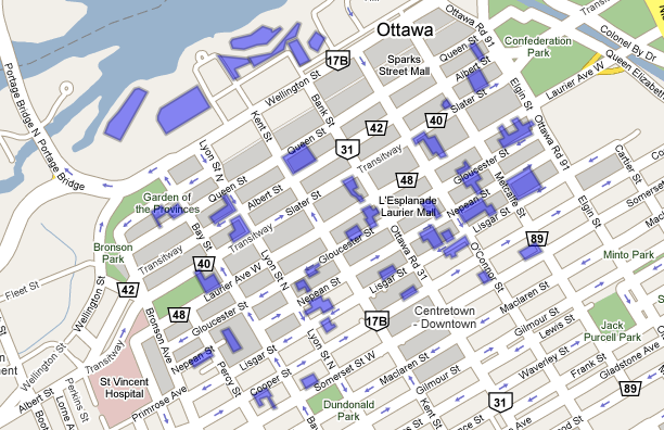
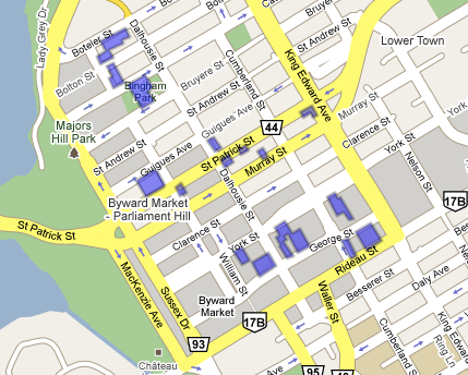
As part of Ottawa's five-year official plan review, city planners are recommending an average of 40 per cent of new homes in the city be built through intensification, namely infill and redevelopment projects, through to 2031.

This target is directed to occur in 10 per cent of the urban area and will be achieved by introducing minimum densities for new construction in the downtown, around major employment hubs and key transit transfer stations as well as suburban town centres.

During a technical briefing for councillors, staff and the media on the proposal late last month, senior legal counsel for the city Tim Marc said the targets could carry weight at the OMB, which hears appeals of municipal planning and development decisions.

In response to a question from Rideau-Rockcliffe Coun. Jacques Legendre, Mr. Marc said that if the city is not meeting its intensification targets, a developer could use that to argue for increasing the permitted density of a particular project.

But, he added, the same argument could also work in reverse.

"If we are achieving our goal, then we could use it to oppose a development," said Mr. Marc.

However, one municipal observer said the planned minimum densities, and accompanying zoning provisions, for specific areas of the city will introduce more predictability for developers and residents alike and prevent many of the battles over density.

"Everybody (will) know where (intensification) is going," said Bell Baker LLP partner Paul Webber, who specializes in land use planning.

"For the developer, it becomes much harder to argue for a highrise somewhere else. For the resident near those areas (targeted for intensification), it gets even harder to argue against it because the zoning is in place."

The province now requires municipalities to establish intensification targets and incorporate those targets into its official plan, according to a spokesperson for Ontario's Ministry of Municipal Affairs and Housing.

Additionally, municipalities must look to intensification and redevelopment before expanding their boundaries to accommodate residential growth.

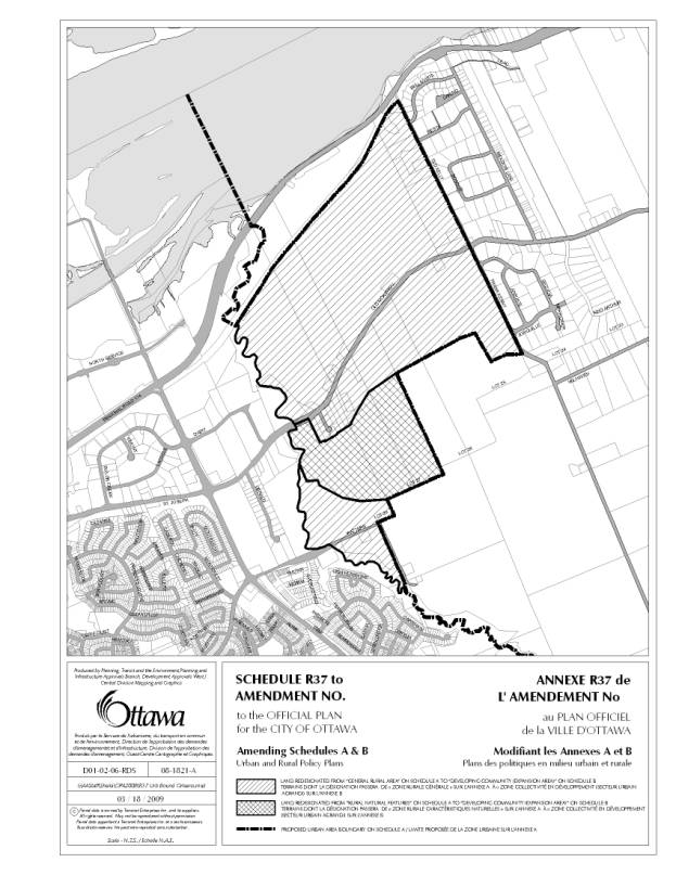
Along with its target of 40-per-cent intensification, the city is proposing to expand the urban boundary by 850 hectares, an amount deemed insufficient by Ottawa's home construction industry, which suggested 2,000 hectares is more appropriate.

John Herbert, the executive director of the Greater Ottawa Home Builders' Association, said his organization is "deeply concerned" that the province may not allow subsequent expansions of Ottawa's urban boundary because the city can not meet its own intensification targets.

He argued the city's goals are unachievable, in part because the downtown sites most conducive to intensification projects have already been developed.

Additionally, said Mr. Herbert, high-density suburban developments are unlikely to occur in the absence of mass transit, a position at odds with the city, which has argued suburban densities must come first to justify the expansion of costly transit lines.

"There will be no reason for people to buy or rent in a location that doesn't provide them with the transportation service they need," said Mr. Herbert.
Reply With Quote
     
     
  #51  
Old Posted Apr 8, 2009, 10:27 PM
waterloowarrior's Avatar
waterloowarrior waterloowarrior is offline
National Capital Region
 
Join Date: Nov 2005
Location: Eastern Ontario
Posts: 9,244
re: "He argued the city's goals are unachievable, in part because the downtown sites most conducive to intensification projects have already been developed."

the Ottawa Project blog had an interesting map of surface parking lots in parts of the core. Here's a link to the post
http://ottawaproject.wordpress.com/2...parking-space/

and here are the maps he came up with

north of somerset


market


Of course that's just parking lots... there are many other underdeveloped sites in the core and many other areas not pictured in those maps.
Reply With Quote
     
     
  #52  
Old Posted Apr 8, 2009, 10:54 PM
AuxTown's Avatar
AuxTown AuxTown is offline
Registered User
 
Join Date: Apr 2006
Location: Ottawa, Canada
Posts: 4,109
I think two of the most under-used sites in the downtown core are those two surface lots on Somerset (O'Connor and Metcalfe). It's one of the city's designated pedestrian corridors with great sidewalks and beautiful buildings so it's a real shame to waste prime locations with ugly gravel parking lots when there could be great-looking mixed use buildings. You can mark two of those off the list because they included Mondrian and the EDC site on that map.
Reply With Quote
     
     
  #53  
Old Posted Apr 8, 2009, 10:58 PM
Rathgrith's Avatar
Rathgrith Rathgrith is offline
I'm just joking.
 
Join Date: Sep 2007
Location: Ottawa
Posts: 1,176
Good luck forcing the federal government to do something about those parking spots.
Reply With Quote
     
     
  #54  
Old Posted Apr 10, 2009, 3:26 PM
Mille Sabords's Avatar
Mille Sabords Mille Sabords is offline
Elle est déjà vide!
 
Join Date: Sep 2006
Location: Big Bad Ottawa
Posts: 2,079
Quote:
Originally Posted by Rathgrith View Post
Good luck forcing the federal government to do something about those parking spots.
The feds are a small part of the problem when it comes to parking lots, they own very few (the best one being the one behind the Lorne building). A bigger problem is that parking lots operate at a profit, so the land has to be purchased at a price that would give the owner better than current revenue. A further complication for parking lots that have been under mom-and-pop ownership for several decades (and there are several) is that the capital gains taxes that are triggered by the land sale are unaffordable to mom-and-pop operations.

So, whatever replaces those parking lots has to generate enough revenue to cover the land sale plus construction, marketing, and all the costs that go with.

If the zoning is so far below the building enveloppe needed to make redevelopment possible, chances are the parking lot will get passed over, unless a developer is in the mood for a jihad with Diane Holmes et.al.

And zoning doesn't necessarily have to imply supertall - it does have to imply some height and some urban-level lot coverage (FSI is a hindrance).
Reply With Quote
     
     
  #55  
Old Posted Apr 14, 2009, 2:20 AM
highdensitysprawl's Avatar
highdensitysprawl highdensitysprawl is offline
Highrise
 
Join Date: Nov 2008
Posts: 310
Quote:
Originally Posted by Mille Sabords View Post
If the zoning is so far below the building enveloppe needed to make redevelopment possible, chances are the parking lot will get passed over, unless a developer is in the mood for a jihad with Diane Holmes et.al.
That is one scary imagery.....I'm not sure which would aid in prolonging various activities...thinking of Golda Meir or Diane Holmes
Reply With Quote
     
     
  #56  
Old Posted Apr 15, 2009, 7:30 PM
waterloowarrior's Avatar
waterloowarrior waterloowarrior is offline
National Capital Region
 
Join Date: Nov 2005
Location: Eastern Ontario
Posts: 9,244
Residents protest proposed urban boundary expansion
by Laura Cummings
View all articles from Laura Cummings
Article online since April 15th 2009, 13:36
Be the first to comment on this article
http://www.eastottawa.ca/article-326...expansion.html


Dozens of rural residents came out to protest a proposed urban boundary extension last night, slamming the suggested move that would push the border further east.
Cumberland's Maple Hall literally overflowed with people – many waiting outside in line for entrance into the at-capacity room – a Tuesday, April 14 public meeting on the urban boundary extension, organized by the Cumberland Village Community Association (CVCA).

Though there are two areas in the east end up for inclusion in the revised urban boundary as part of the city's mandated, five-year Official Plan review, it's the section east of Cardinal Creek in Cumberland Ward – 337 gross hectares of general rural area land – that has raised the ire of residents. While concerns voiced at the meeting ranged from overburdened infrastructure to crowded roads to destruction of rural culture, the issue at the core was the potential future creation of an "Orléans-type" subdivision there.

"This represents about 28 per cent of the total (being considered for urban boundary extension) for the entire city of Ottawa," said Tamara Belle-Isle, the CVCA's city liaison and community development coordinator. "It looks like nothing to city councillors, but to us, we might recognize it as a beautiful stretch of land."

Her concerns lay with a preliminary proposal put forward by Tamarack Homes for a portion of the property at a March 31 city committee meeting, which she suggested calls for more than 4,000 homes and an additional 12,500 residents.

"It opens the floodgates to all kinds of development," Belle-Isle continued. "We can imagine what 12,500 additional (individuals) would do to the existing infrastructure. The implications are enormous."

But that documentation was "simply a vision" of what could be proposed in the future, stressed Cumberland Coun. Rob Jellett, not an official application for development. Both Jellett and city staff emphasized that the proposal given to them by Tamarack Homes was preliminary, and that numerous requirements would have to be satisfied before the land was even deemed suitable for development.

Future development is being directed to both set the groundwork for light rail and create targets that all future applications must meet, currently working with a two-decade timeframe, explained Lesley Paterson, a program manager in the city's planning and growth management branch, at the meeting.

"We try to be realistic about what can happen in 20 years," she continued, indicating their goal of creating a more urbanized, convenient network for residents, especially with an aging population.

Part of that, Paterson said, will be accommodating the demand for single-family dwellings. Intensification can only generally provide for new townhomes and apartments, she explained, creating the need for urban boundary expansion.

"We still have an unmet demand for single, detached houses," Paterson added, with the city trying to establish a framework to support intensification. "(But in the meantime) that demand cannot be met in the existing urban boundary."

For more on this story, please see the April 17 edition of the East Ottawa Star.
Reply With Quote
     
     
  #57  
Old Posted Apr 15, 2009, 8:07 PM
eternallyme eternallyme is offline
Registered User
 
Join Date: Mar 2009
Posts: 5,243
Quote:
Originally Posted by waterloowarrior View Post
Residents protest proposed urban boundary expansion
by Laura Cummings
View all articles from Laura Cummings
Article online since April 15th 2009, 13:36
Be the first to comment on this article
http://www.eastottawa.ca/article-326...expansion.html


Dozens of rural residents came out to protest a proposed urban boundary extension last night, slamming the suggested move that would push the border further east.
Cumberland's Maple Hall literally overflowed with people – many waiting outside in line for entrance into the at-capacity room – a Tuesday, April 14 public meeting on the urban boundary extension, organized by the Cumberland Village Community Association (CVCA).

Though there are two areas in the east end up for inclusion in the revised urban boundary as part of the city's mandated, five-year Official Plan review, it's the section east of Cardinal Creek in Cumberland Ward – 337 gross hectares of general rural area land – that has raised the ire of residents. While concerns voiced at the meeting ranged from overburdened infrastructure to crowded roads to destruction of rural culture, the issue at the core was the potential future creation of an "Orléans-type" subdivision there.

"This represents about 28 per cent of the total (being considered for urban boundary extension) for the entire city of Ottawa," said Tamara Belle-Isle, the CVCA's city liaison and community development coordinator. "It looks like nothing to city councillors, but to us, we might recognize it as a beautiful stretch of land."

Her concerns lay with a preliminary proposal put forward by Tamarack Homes for a portion of the property at a March 31 city committee meeting, which she suggested calls for more than 4,000 homes and an additional 12,500 residents.

"It opens the floodgates to all kinds of development," Belle-Isle continued. "We can imagine what 12,500 additional (individuals) would do to the existing infrastructure. The implications are enormous."

But that documentation was "simply a vision" of what could be proposed in the future, stressed Cumberland Coun. Rob Jellett, not an official application for development. Both Jellett and city staff emphasized that the proposal given to them by Tamarack Homes was preliminary, and that numerous requirements would have to be satisfied before the land was even deemed suitable for development.

Future development is being directed to both set the groundwork for light rail and create targets that all future applications must meet, currently working with a two-decade timeframe, explained Lesley Paterson, a program manager in the city's planning and growth management branch, at the meeting.

"We try to be realistic about what can happen in 20 years," she continued, indicating their goal of creating a more urbanized, convenient network for residents, especially with an aging population.

Part of that, Paterson said, will be accommodating the demand for single-family dwellings. Intensification can only generally provide for new townhomes and apartments, she explained, creating the need for urban boundary expansion.

"We still have an unmet demand for single, detached houses," Paterson added, with the city trying to establish a framework to support intensification. "(But in the meantime) that demand cannot be met in the existing urban boundary."

For more on this story, please see the April 17 edition of the East Ottawa Star.
The area east of Cardinal Creek as urban? Much of that is either environmentally sensitive (undevelopable) or exurban/rural subdivisions - good luck getting those landowners to sell the land en masse. I'd freeze the Orleans eastern boundary at Cardinal Creek.

If they need 337 extra hectares (over 840 acres) of new suburban development in Orleans, they should focus it along the Cumberland Transitway corridor, perhaps in the Millennium Park area and southeast of Chapel Hill.

Development within the Greenbelt is an option in certain areas, but the Greenbelt separating Orleans, for the most part, is environmentally sensitive and should be preserved no matter what. (The bulk of the developable Greenbelt is in the Airport and Hunt Club areas and near Bayshore and Bells Corners, IMO.)
Reply With Quote
     
     
  #58  
Old Posted Apr 15, 2009, 8:43 PM
waterloowarrior's Avatar
waterloowarrior waterloowarrior is offline
National Capital Region
 
Join Date: Nov 2005
Location: Eastern Ontario
Posts: 9,244
this would be the area they are talking about.

Reply With Quote
     
     
  #59  
Old Posted Apr 15, 2009, 9:22 PM
highdensitysprawl's Avatar
highdensitysprawl highdensitysprawl is offline
Highrise
 
Join Date: Nov 2008
Posts: 310
Quote:
Originally Posted by waterloowarrior View Post
this would be the area they are talking about.

I went through a development application in Cumberland Village a year or so ago and the natives out there like their Status Quo (and I don't mean the 70's three chord band) just the way it is.

The rumour mill out there is pretty active and half truths easily get twisted.
Reply With Quote
     
     
  #60  
Old Posted Apr 15, 2009, 9:26 PM
waterloowarrior's Avatar
waterloowarrior waterloowarrior is offline
National Capital Region
 
Join Date: Nov 2005
Location: Eastern Ontario
Posts: 9,244
Quote:
Originally Posted by highdensitysprawl View Post
I went through a development application in Cumberland Village a year or so ago and the natives out there like their Status Quo (and I don't mean the 70's three chord band) just the way it is.

The rumour mill out there is pretty active and half truths easily get twisted.
I took a look at an aerial of the area. Looks like the Manotick/Greeley of the East.
Reply With Quote
     
     
This discussion thread continues

Use the page links to the lower-right to go to the next page for additional posts
 
 
Reply

Go Back   SkyscraperPage Forum > Regional Sections > Canada > Ontario > Ottawa-Gatineau > Urban, Urban Design & Heritage Issues
Forum Jump


Forum Jump


All times are GMT. The time now is 2:00 PM.

     
SkyscraperPage.com - Archive - Privacy Statement - Top

Powered by vBulletin® Version 3.8.7
Copyright ©2000 - 2024, vBulletin Solutions, Inc.