HomeDiagramsDatabaseMapsForum About
     

Go Back   SkyscraperPage Forum > Regional Sections > Canada > Ontario > Ottawa-Gatineau > Urban, Urban Design & Heritage Issues


Reply

 
Thread Tools Display Modes
     
     
  #61  
Old Posted Apr 7, 2010, 6:33 PM
Uhuniau Uhuniau is offline
Registered User
 
Join Date: Jan 2010
Posts: 8,034
Quote:
Originally Posted by ajldub View Post
I actually think that when you compare architectural style, location, and layout, our buildings are in contention for the most beautiful parliament buildings in the world. I wouldn't change them at all. Except maybe build the Bank Street Building.
At the NE corner of Bank and Wellington? Hells yeah.

I'd also fill in the gaps in the gap-toothed parts of the Wellington street wall. The former Rideau Club site, now a pointless NCC plaza, should have been infilled thirty years ago; ditto the parking lot to the west of the former US embassy (only not thirty years ago).

Some Holt-style buildings would be awesome on those sites, as well as filling the gap between the archives (which could use additional space) and the Supreme Court.

Now if only we could put something useful on the "Garden of the Provinces". Blech.
Reply With Quote
     
     
  #62  
Old Posted Apr 7, 2010, 8:37 PM
c_speed3108 c_speed3108 is offline
Registered User
 
Join Date: May 2007
Posts: 1,808
Quote:
Originally Posted by Uhuniau View Post

Some Holt-style buildings would be awesome on those sites, as well as filling the gap between the archives (which could use additional space) and the Supreme Court.
This space is supposed to be the eventual location for the federal court and has been reserved for such use.
Reply With Quote
     
     
  #63  
Old Posted Apr 7, 2010, 10:10 PM
Mille Sabords's Avatar
Mille Sabords Mille Sabords is offline
Elle est déjà vide!
 
Join Date: Sep 2006
Location: Big Bad Ottawa
Posts: 2,079
Quote:
Originally Posted by Ryersonian View Post
So we're back on this...Sweet...We have a large scanner at work so perhaps (If I can clear it with a director) we can do it here. I never asked my neighbour about this, but I will now that I am reminded. It would be incredible to get this digitized and distributed...It's the only way to get this out there.
Let me know. PM me if you set it up so that we can get this done. The copyrights are long expired...
Reply With Quote
     
     
  #64  
Old Posted Apr 7, 2010, 10:14 PM
Mille Sabords's Avatar
Mille Sabords Mille Sabords is offline
Elle est déjà vide!
 
Join Date: Sep 2006
Location: Big Bad Ottawa
Posts: 2,079
Quote:
Originally Posted by Uhuniau View Post
Now if only we could put something useful on the "Garden of the Provinces". Blech.
Yes. Or at least, frame it to the west with something that continues the Wellington Street corridor toward Lebreton. Wellington trails off into highway-land past that point, and the Garden of the Provinces is left hanging at the end, by a thread, pretty much as a residual space.

For that matter, Wellington should be straightened into Lebreton. There is no need for that big curve toward the bridge. There again, the street could be extended as a normal city street (ie. with buildings along it) rather than trail of into the dead zone that it becomes, functionally, past the Archives. Were it not for the recreational pathways, there would not be any reason ever to go there. The pathways are good, but not enough in such a central piece of downtown.
Reply With Quote
     
     
  #65  
Old Posted Apr 7, 2010, 10:21 PM
Mille Sabords's Avatar
Mille Sabords Mille Sabords is offline
Elle est déjà vide!
 
Join Date: Sep 2006
Location: Big Bad Ottawa
Posts: 2,079
Quote:
Originally Posted by ajldub View Post
Personally I think it's a shame the British Parliament is just another building on the corner of a block. The only memorable view of it is from the other side of the river. Ours, on the other hand, stick out quite beautifully from any angle they are viewed.

I actually think that when you compare architectural style, location, and layout, our buildings are in contention for the most beautiful parliament buildings in the world. I wouldn't change them at all. Except maybe build the Bank Street Building.
I completely agree with you. And by this, I also mean that the front lawn of Parliament is the right way to present the monument to the city - no more, no less. Something that was challenged no later than the 1990's with the Chrétien plan to widen Metcalfe and provide an even grander view of Parliament.

Not needed.

Besides, this has already been done, in the 1920's and 30's. When the decision was made to locate the War Memorial where it is today, there was a continuous urban fabric between Sparks and Rideau Streets, with buildings right up to either edge of the canal. By clearing those buildings, the FDC created an angled view (as opposed to Metcalfe's straight-on view)toward Parliament Hill that could be enjoyed by visitors arriving by rail into Union Station, which is how most out-of-towners arrived into Ottawa back then.

So, Metcalfe was the automobile age's rendition of a majestic view toward Parliament: off the Queensway off-ramp and into the View.

The underlying question is: how many views are we going to create? Isn't the existing, original view the One? The one you get from the foot of the Lawn?
Reply With Quote
     
     
  #66  
Old Posted Apr 7, 2010, 11:17 PM
ajldub ajldub is offline
Registered User
 
Join Date: Oct 2006
Posts: 433
We really don't need to tinker with the federal precinct, other than getting the Fed Court, Portrait Gallery, and Bank Street Building up. The Metcalfe widening was never really taken seriously when it was first proposed; just another navel-gazing session from the NCC that all gave us a laugh.

The loss of the old post office, and the burning of the Russell Hotel and old City Hall are punishing losses to that area, though.
Reply With Quote
     
     
  #67  
Old Posted Apr 8, 2010, 1:48 AM
Uhuniau Uhuniau is offline
Registered User
 
Join Date: Jan 2010
Posts: 8,034
Quote:
Originally Posted by c_speed3108 View Post
This space is supposed to be the eventual location for the federal court and has been reserved for such use.
Was reserved for such; hasn't this project been shelved?
Reply With Quote
     
     
  #68  
Old Posted Apr 8, 2010, 1:51 AM
Uhuniau Uhuniau is offline
Registered User
 
Join Date: Jan 2010
Posts: 8,034
Quote:
Originally Posted by Mille Sabords View Post
For that matter, Wellington should be straightened into Lebreton. There is no need for that big curve toward the bridge.
Of course there is: it makes things nice and fast for car commuters, who are, and will forever be, the only ones who matter to the NCC and the municipalities.

And yes, it would have been nice to revitalize Wellington west of the Archives. A once-in-forever chance to do has has been blown by the NCC and City with their fixation on green space and open space and green open space and open green space and six, or is it eight, lanes of traffic.
Reply With Quote
     
     
  #69  
Old Posted Apr 8, 2010, 6:36 PM
gjhall's Avatar
gjhall gjhall is offline
Registered User
 
Join Date: Aug 2009
Location: Ottawa
Posts: 1,297
Just to feed into the discussion on the Parliamentary Precinct, thought eveyone should see the long term plan: http://www.parliamenthill.gc.ca/modern/bbs-bsf-eng.html

If there is already a thread for this, my apologies, if not, we should probably start one.

You'll note that the present plan is for three new buildings, one NE of Bank/Wellington, one between Justice and Confederation buildings, and a third SW of the Supreme Court.
Reply With Quote
     
     
  #70  
Old Posted Jul 16, 2010, 7:54 PM
waterloowarrior's Avatar
waterloowarrior waterloowarrior is offline
National Capital Region
 
Join Date: Nov 2005
Location: Eastern Ontario
Posts: 9,244
LeBreton Flats - 131 m tower + 2 more towers DND HQ - they decided to go downtown instead

from http://www.nccwatch.org/blunders/lebreton.htm


17 storey tower on top of The Bay @ 99 Rideau :o


Pinecrest Plaza... originally proposed to be on both sides of the Queensway with a pedestrian bridge over the highway

Carling Avenue extension through the Glebe

Last edited by waterloowarrior; Jul 16, 2010 at 9:44 PM.
Reply With Quote
     
     
  #71  
Old Posted Jul 16, 2010, 9:43 PM
waterloowarrior's Avatar
waterloowarrior waterloowarrior is offline
National Capital Region
 
Join Date: Nov 2005
Location: Eastern Ontario
Posts: 9,244
Google News Archives is great...


image link


Details on the building

what actually got built is a lot uglier
Reply With Quote
     
     
  #72  
Old Posted Jul 16, 2010, 10:34 PM
drawarc's Avatar
drawarc drawarc is offline
Registered User
 
Join Date: Jul 2001
Posts: 471
Nice finds. That cylindrical tower on Rideau street would've been different from the usual boxes that dot the skyline. That proposal above the Bay store would've been horrible if built like that though.
Reply With Quote
     
     
  #73  
Old Posted Jul 16, 2010, 11:35 PM
Dado's Avatar
Dado Dado is offline
National Capital Region
 
Join Date: Jul 2007
Location: Ottawa, Canada
Posts: 2,521
Quote:
Originally Posted by waterloowarrior View Post
And those proposing it were... wait for it... consultants Deleuw-Cuther, who also proposed the Transitway when they ran out of oversized roads to promote... and now the Ottawa office of Delcan.
__________________
Ottawa's quasi-official motto: "It can't be done"
Ottawa's quasi-official ethos: "We have a process to follow"
Reply With Quote
     
     
  #74  
Old Posted Dec 3, 2013, 1:13 AM
waterloowarrior's Avatar
waterloowarrior waterloowarrior is offline
National Capital Region
 
Join Date: Nov 2005
Location: Eastern Ontario
Posts: 9,244


1961 - Proposal for a highway to connect Baseline Road and Carling
-starting at Baseline, swing along the canal, build over rail ROW with an interchange at Carling/Preston
-take down all wooden buildings in experimental farm
-expand arboretum and turn into National Botanical Garden
-build a plantatarium (for plants)


http://news.google.com/newspapers?id...6068%2C5966800


FYI Baseline was a two lane road at this point and the Heron Road Bridge didn't exist
be sure to check out http://maps.ottawa.ca/geoottawa/ for historical aerials
Reply With Quote
     
     
  #75  
Old Posted Feb 15, 2015, 4:25 PM
GernB GernB is offline
Registered User
 
Join Date: Jun 2012
Location: Lethbridge AB
Posts: 863
Very interesting thread, for some reason this has really caught my inerest lately. Anyone know of any more information on the DND proposal or the idea for a STOLport at Lebreton, or the 1970s idea for a Parliamentary office building on Wellington? Or anything that hasn't been covered by this thread and/or its links?

Last edited by GernB; Feb 15, 2015 at 4:44 PM.
Reply With Quote
     
     
  #76  
Old Posted Apr 7, 2018, 5:10 PM
waterloowarrior's Avatar
waterloowarrior waterloowarrior is offline
National Capital Region
 
Join Date: Nov 2005
Location: Eastern Ontario
Posts: 9,244
https://www.facebook.com/LostOttawa/...10849582347592

On April 4, 1911 Engineer W.F. Tye proposed “the closing of the [Rideau] canal from the deep cut to the Ottawa River” in order to facilitate the building of a new railway tunnel, in turn constructing “a new piece of canal… from Dow’s Lake northerly across Hintonburg and Mechanicsville to the Ottawa River, the locks to be located about where the present timber slides at the Chaudière are.”

Imagine how different Ottawa would look if his plan had been accepted!

[Ottawa Journal, April 4, 1911]

Reply With Quote
     
     
  #77  
Old Posted Apr 8, 2018, 12:50 AM
lrt's friend lrt's friend is offline
Registered User
 
Join Date: Dec 2006
Posts: 11,874
Cool! This is the first time I saw a city map featuring the Inter-urban railway running down Main Street heading for Morrisburg.
Reply With Quote
     
     
  #78  
Old Posted Apr 8, 2018, 1:32 AM
waterloowarrior's Avatar
waterloowarrior waterloowarrior is offline
National Capital Region
 
Join Date: Nov 2005
Location: Eastern Ontario
Posts: 9,244
Quote:
Originally Posted by lrt's friend View Post
Cool! This is the first time I saw a city map featuring the Inter-urban railway running down Main Street heading for Morrisburg.
Found these summaries... the rail to Morrisburg looked like it might happen but got killed during WWI
https://churcher.crcml.org/circle/Pa...20Electric.pdf
https://churcher.crcml.org/circle/Ca...waElectric.pdf
Reply With Quote
     
     
  #79  
Old Posted Feb 23, 2024, 10:48 PM
rocketphish's Avatar
rocketphish rocketphish is offline
Planet Ottawa and beyond
 
Join Date: Feb 2009
Location: Ottawa
Posts: 12,339
1915 — when a better plan for Ottawa existed
You've never heard of the Holt-Bennett Plan either? It just might have given us a beautiful — and functional — urban landscape.

Brigitte Pellerin
Published Feb 23, 2024 • Last updated 8 hours ago • 3 minute read


Last weekend, the National Capital Commission got my attention on social networks. “Have you heard of the Holt-Bennett Plan of 1915? Had it been carried out, Ottawa would have looked like a European capital, had its first subway line, and mapped its growth differently,” the Holt-Bennett Plan of 1915?

The very first step, of course, was to confess to not having the faintest clue what the Holt-Bennett Plan of 1915 was. And no wonder; it was shelved shortly after it was tabled (so many furniture-related metaphors) and has been collecting dust for more than a century. If you google even just a little, you will find that some people in Ottawa are far more knowledgeable about this than yours truly, and have written very interesting things about it.

The man behind the plan, which was for both Ottawa and what was then Hull, was Edward Bennett, described as a leading “City Beautiful architect.” That led straight to my second confession: I’d never heard the term “City Beautiful architect” before.

I learned that City Beautiful was a movement invented in the United States to beautify cities, which, at the time, were overcrowded with factory workers and not always very clean or pleasant. Originally associated with Chicago (Bennett, it is worth noting, co-wrote the 1909 Plan of Chicago), the movement flourished in the 1890s and 1900s and was based on the belief that beautification would lead to harmonious societies and better quality of life. Critics such as Jane Jacobs, who reportedly called it a “cult,” thought it favoured esthetics over social reform.

What I want to know is why we should have to choose between the two?

The attention-grabbing image in the plan, known as Illustration #5, is the one that shows a view of the proposed space between and around Parliament and the old rail station that is open to people and is vaguely reminiscent of the Mall in Washington, D.C., with lovely public places and basic amenities such as public toilets. Every time I visit the American capital, I ask why we can’t have that here.

Apparently it’s too hard. We threw away the one opportunity we had to make something other than a car tunnel out of Wellington Street by doing nothing whatsoever with the space after we closed it to motor vehicles following the convoy protest. Just last week, the city released statistics showing vehicular traffic was almost back to pre-pandemic levels. This left Coun. Tim Tierney, chair of the transportation committee, feeling awesome. “People are very happy,” he said. “They don’t have to take that extra commute through Gatineau to be able to get to the other side of Ottawa.” Someone please send the councillor a map of downtown Ottawa that shows all the east-west streets that aren’t Wellington.

The most beautiful thing about the Holt-Bennett Plan is that it was comprehensive and looked at the growth of the area in a holistic manner. It connected things — places to be with places to live and places to work, and it put humans first. Edward Bennett understood that sustainable growth could not happen without robust public transit. But he was not against other forms of transportation, not even private motor vehicles. It was a balanced approach.

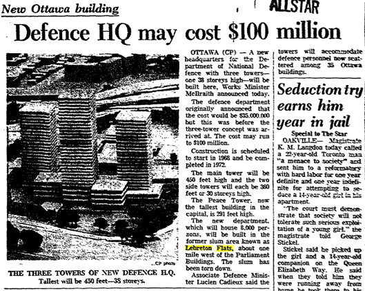
We never implemented his plan. Instead, we eventually went with the 1950 Gréber Plan that replaced rail with parkways, led to the horrendous Queensway and distributed federal departments all over everywhere, encouraging sprawl.

Maybe it’s time to dust off Edward Bennett’s old document and dare to let it inspire us.

Brigitte Pellerin (they/them) is an Ottawa writer.

https://ottawacitizen.com/opinion/pe...ty-is-possible
Reply With Quote
     
     
  #80  
Old Posted Feb 26, 2024, 2:25 PM
Badyouken's Avatar
Badyouken Badyouken is offline
Registered User
 
Join Date: Feb 2016
Posts: 237
A bit too much asphalt for my taste, but otherwise this would of course be lovely.
Reply With Quote
     
     
This discussion thread continues

Use the page links to the lower-right to go to the next page for additional posts
 
 
Reply

Go Back   SkyscraperPage Forum > Regional Sections > Canada > Ontario > Ottawa-Gatineau > Urban, Urban Design & Heritage Issues
Forum Jump


Forum Jump


All times are GMT. The time now is 12:59 PM.

     
SkyscraperPage.com - Archive - Privacy Statement - Top

Powered by vBulletin® Version 3.8.7
Copyright ©2000 - 2024, vBulletin Solutions, Inc.