Quote:
Originally Posted by Flyingwedge

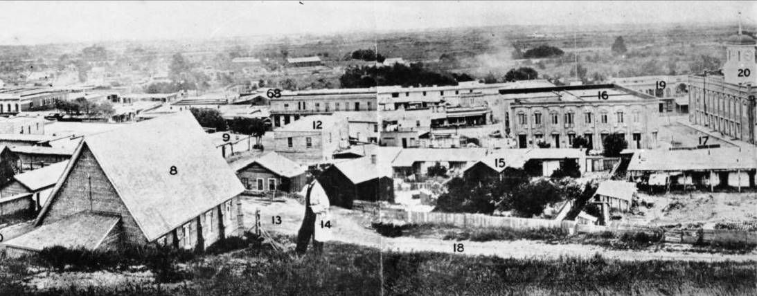
In the east-facing section of the Rendall photo below, 18 is New High Street, 8 is St. Athanasius Church on the SW corner
of New High and Temple Streets, 16 is the southern part of the Temple Block, and 20 is the Temple Clocktower Courthouse.
Number 12 is the Allen Block, on the SW corner of Spring and Temple, with that same angled drainpipe on its west wall:
 CHS-7179
 @ USCDL |
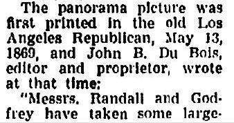
I came across an article that describes some of the history behind this famous 1869 panoramic photo. In the
portion copied above, #14 is photographer Stephen Rendall; he's visible in the photo reproduction below to the
right of the Episcopal Church:
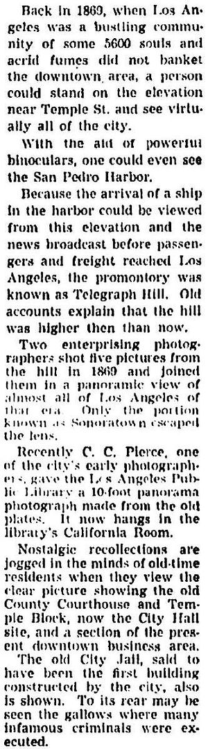
This is from a little farther down in the same article; the photographers were
Stephen Rendall and
William Godfrey.
I don't recall seeing Godfrey credited with the 1869 panorama before. Maybe Godfrey actually took the photo, which
allowed Rendall to be in it:
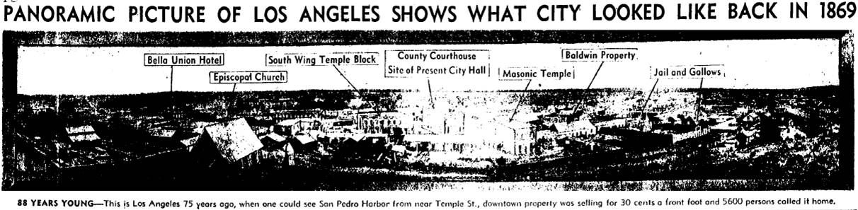
November 26, 1944,
Los Angeles Times @ ProQuest via LAPL
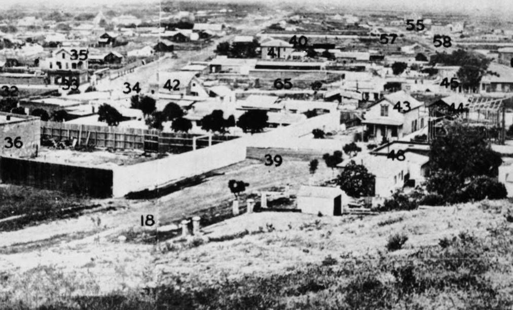
This portion of the May 1869 Rendall/Godfrey panorama looks south. A few of the numbered landmarks are . . .
18 = New High Street
34 = Spring Street
35 = J. D. Hick's residence
36 = Brick Jail (1853)
39 = Franklin Alley (Changed to Franklin
Street in
April 1872, then apparently later renamed Jail Street before
being changed back to Franklin and then finally to Court Street)
40 = Third Street
41 = School No. 1 (1855) at NW corner of 2nd and Spring
43 = Dan Scheck's residence
44 = A. G. Mappa's residence (under construction at right center edge)
CHS-7179 @
USCDL
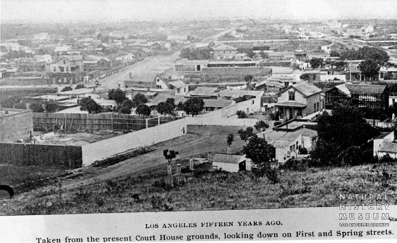
This photo is not part of the Rendall/Godfrey panorama, but it appears to have been taken just a short time after
from almost the same spot. I can see only two differences between this photo and the panorama: a) below, the
Mappa home (#44) has a little more roof; and, b) those two white objects to the right of #18 have either been
removed or are out of view and hidden by the bottom of the hill:
P-010-0406B at
Seaver Center
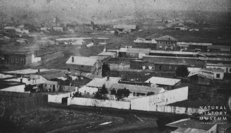
The photo below looks in the same basic direction as the other two, is credited to Godfrey, and also dated 1869, but I
think this photo is older than that. There are several differences between this photo and the previous two. Such as . . .
1) Homes #35 (upper left corner) and 43 (south side of Franklin opposite the end of New High) are missing.
2) The trees in front of the home to the left of #43, on the south side of Franklin, across from the jail yard, are smaller.
3) The New High Street side of the jail yard fence is not painted. Also, the fence seems farther from New High than in the
other two photos. Does the rear jail yard fence align with the tall white fence south across Franklin in this photo as it
does in the others? I'm not sure. If the jail yard fence wasn't moved, I guess New High was graded, widened, or realigned.
gpf.0926 at
Seaver Center
The trees in front of School No. 1, visible in the two 1869 photos, don't seem to be in the last photo. However, they were
deciduous
black locust trees, so whatever year the last photo was taken, it must have been in the winter.


 Prev
Prev


 )
)

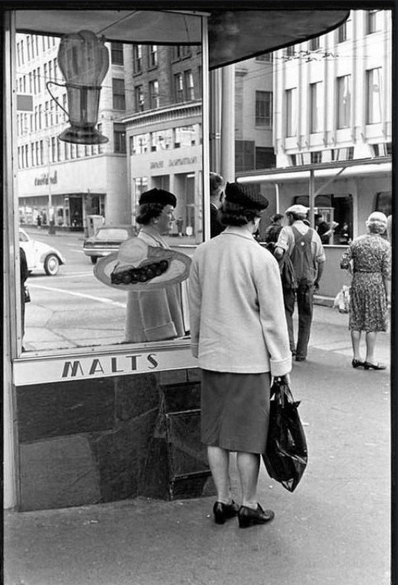
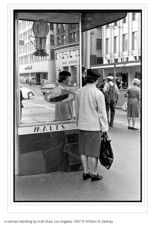
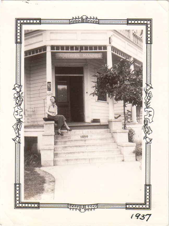
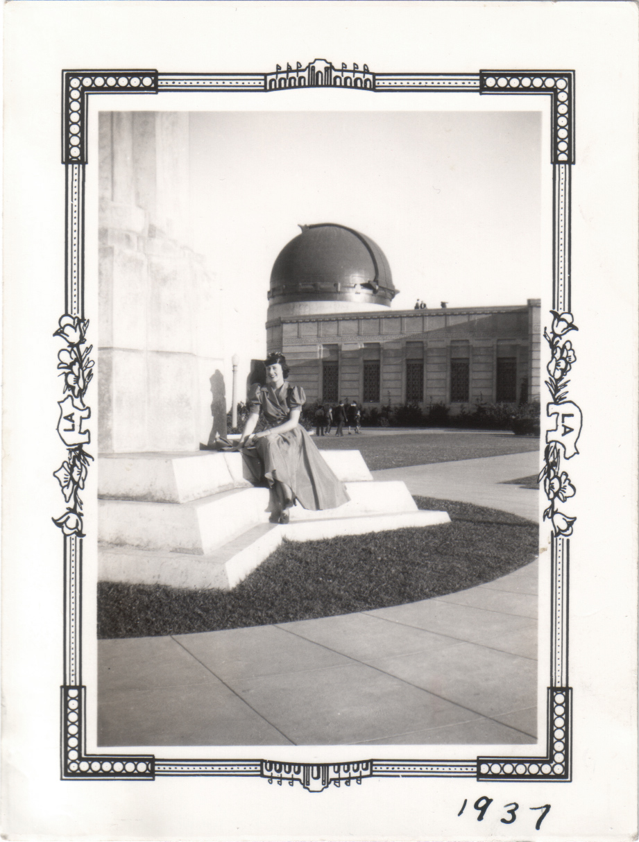
 The touch of vanity that runs in my family is having a good day today... My mother enjoyed turning heads. And so do I.


 But I’m still nowhere near as skillful as the rest of you folks!


 LAPL
LAPL  I appreciate how you added an annotated key to the photograph above.
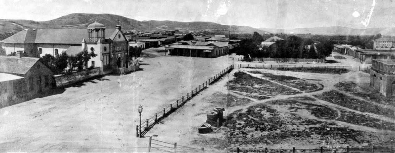

 .
.

 Linear Mode
