Quote:
Originally Posted by ethereal_reality

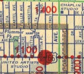
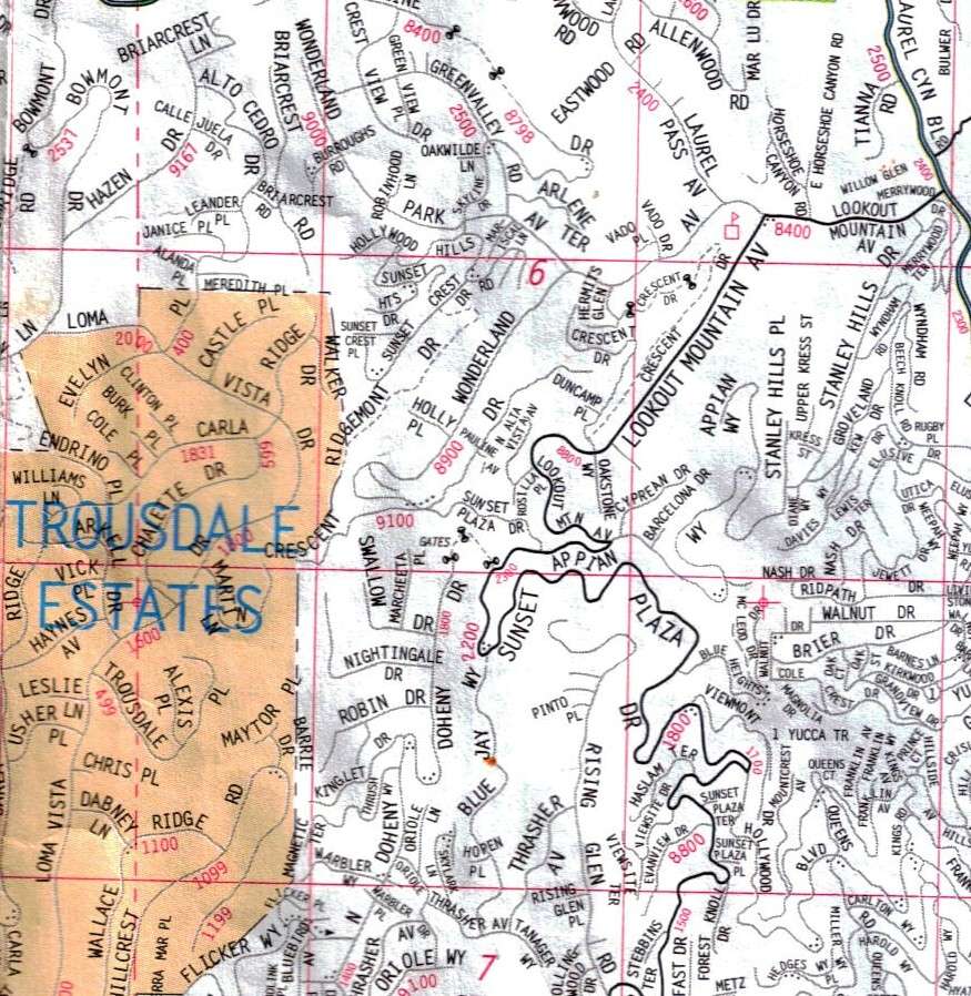
David/3940dxer, when you were on your Lookout Mtn. Inn quest I didn't realize it's noted by a square on my 1947 map. This is many years after the inn burnt so why the square at Lookout Mountain? Was there anything there in the late 1940s?
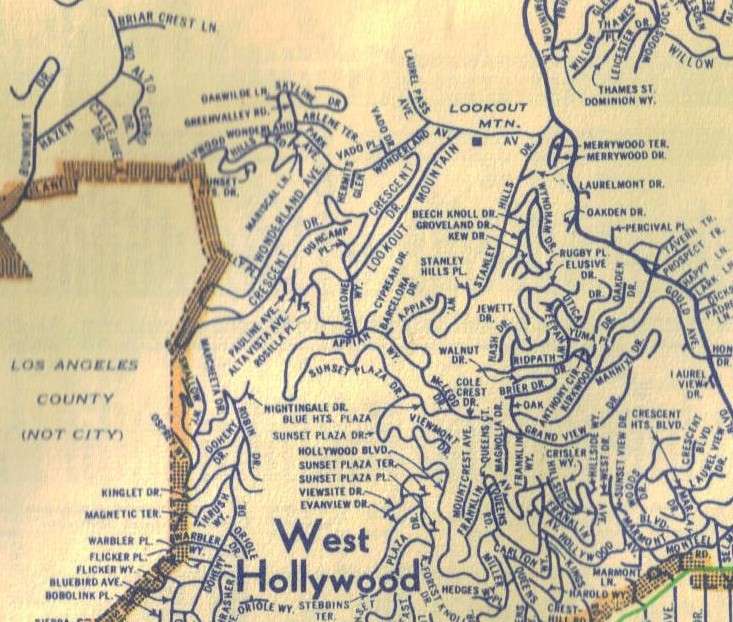
1947 street map |
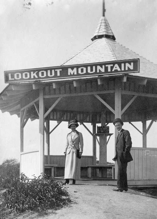
e_r, the cartographer put that square in the wrong place. Do you see the label that says "McLeod Dr."? The summit of Lookout Mountain (and the marker in the photo I posted weeks ago) is about where the period is, in "Dr.". The Inn was located about where the little arrow is, beneath the "Cole Crest Dr." label.
However, I'm glad you posted this map, because I noticed an interesting detail on it. McLeod Drive is shown as a through street that connects with Appian way at its north end. Today, McLeod just goes about half that distance and then dead ends. When I was exploring that area I found what looked like the remains of an old road beneath Appian Way, and wondered if it might have been some kind of shortcut between Cole Crest and Appian Way. In fact, it's probably what's left of that short section of McLeod.
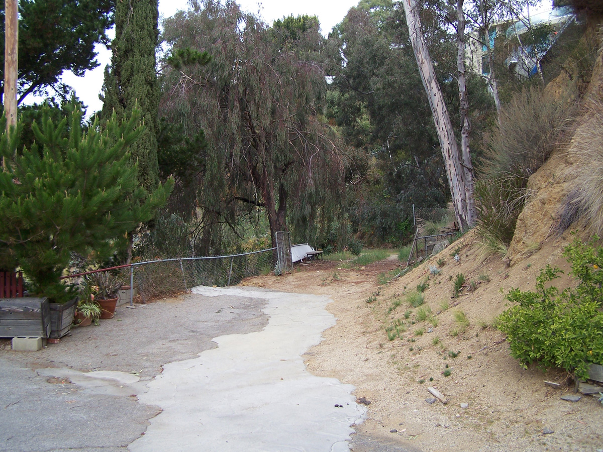
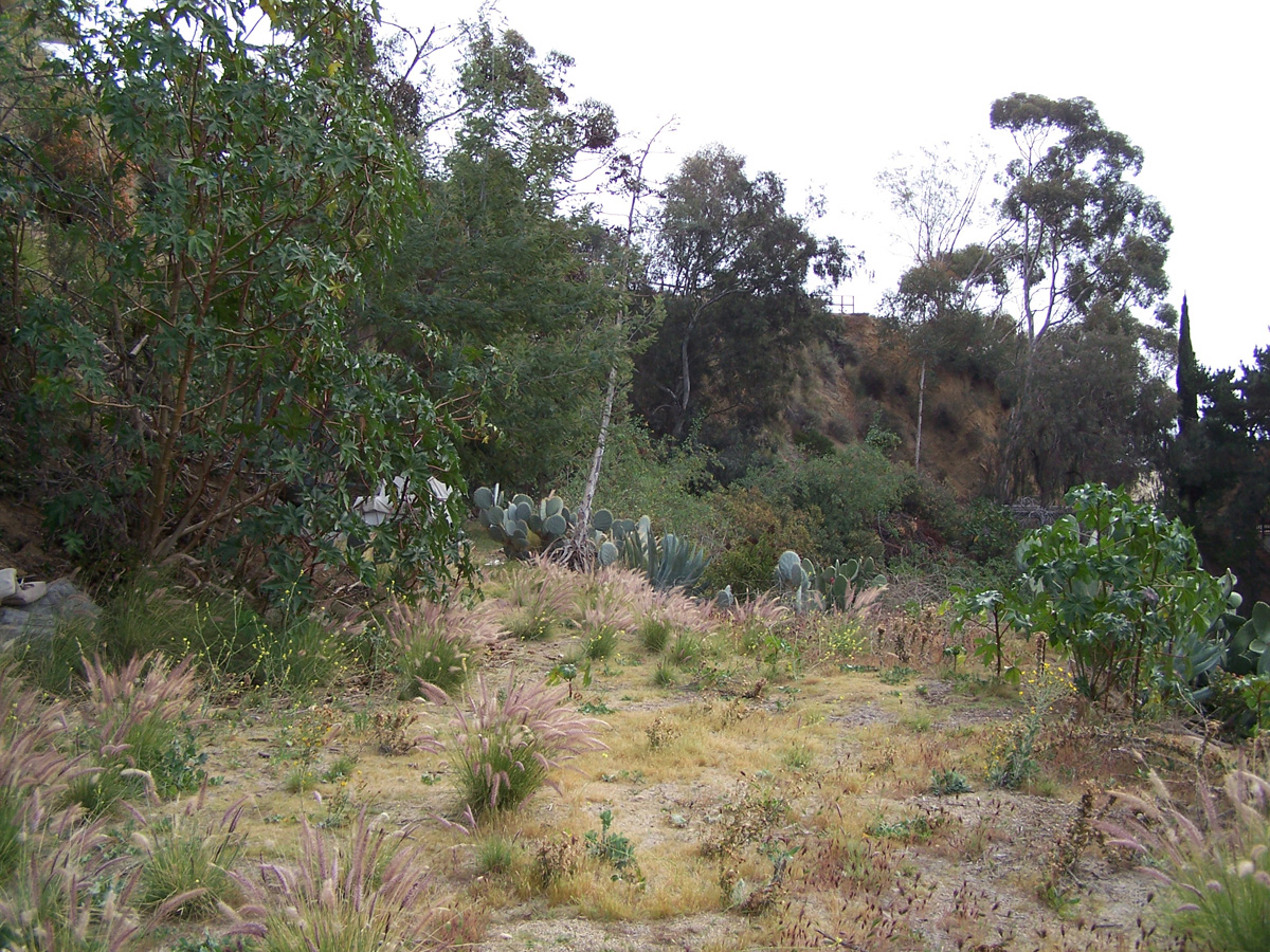
Here are a couple of photos that I took that day. The first one shows what is basically the end of McLeod, near the last home on that street. The second one shows a graded area further up, now overgrown, with Appian way in the background. In between those two sections, there was a short stretch with scraps of old white wooden fence; the type seen in the old roads around there. Maybe the connection to Appian was destroyed by flood or fire.
I still want to learn more about the roads in in that area and am still trying to set up an appointment with the curator of AAA's map archive, at their (beautiful old) building on Figueroa near West Adams.


 Prev
Prev


 Linear Mode
