Quote:
Originally Posted by Martin Pal

Hollywood's Bar of Music
7351 Beverly Blvd.
 Cardboard America Archives
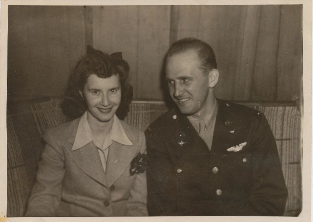
Marjorie Casper and Lt. Michael R. Rusnak
This photo was taken on March 7, 1943.
Michael attached a note on the back of the picture:
Midge,
These wings I send to you my love
To keep my spirit at your side
Till I come winging from above
To claim you as my loving bride
Michael
___ |
Quote:
Originally Posted by Noircitydame
What a sweet poem. I found more than one Lt. of that name so couldn't be sure which was the one of the photo; hope he & Midge had a good life.
|
NCD, Apparently Midge and Michael were not to be. In looking at the source I got the photo from and reading more that
some followers of it wrote, and who believe their findings to be accurate, there's more information about these two:
Michael R. Rusnak was born in 1915, and was from Beaver, Pennsylvania, and enlisted in the Army Air Corps
as a private in December, 1940, at Fort MacArthur, San Pedro, CA.
Judging from the shape of the wings he is wearing, Michael was most likely a bombardier.
Lt. Michael R. Rusnak, only three months and 20 days after this photo was taken, was involved in an accident
and killed on June 27th, 1943, in a B-25, serial number: B-25C 41-12493, along with Horace S. Bowen, Jr.,
a Sgt. from Pennsylvania, Daniel F. Hall, SS (Staff Sgt.?) from Alabama, Gilbert P. Johnson, the pilot, a
2Lt. from Illinois, Mourse A. Nielsen, a 2Lt. from California and Joseph E. Redmen, a Sgt. from UN.
-- (UN - ? - might stand for unknown as another entry of his was blank.)
-- (In the report, Michael Rusnak is listed as a 2nd Lieutenant.)
(Michael Rusnak's brother (or other relative) also from Beaver, PA, John G. Rusnak, was also KIA on January 10, 1945.)
Michael was assigned to the 377th Bombardment Squadron of the 309th Bombardment Group, based at
Columbia Army Air Base in South Carolina and was killed when his ship crashed about 18 miles East
of Sandersville, Georgia while being piloted by 2Lt. Gilbert P. Johnson. The Action Code 'KCRU' indicates that
there were 6 fatalities (K) and that the aircraft crashed (CR). The 'U' most likely stands for 'unknown' or an
'undetermined' reason, as in 'cause unknown'.

Sources:
www.usaafdata.com
http://www.aviationarchaeology.com/s...493&Submit4=Go
http://www.aviationarchaeology.com/src/help.htm#ACTION
http://www.ancestry.com
http://www.ww2wings.com/wings/usaaf/...mbardier.shtml
According to one of these sources that I was looking at that details USAAF accidents or worse in the Untied States,
I was pretty surprised at how many of them there are that have occurred over the years.


 Prev
Prev


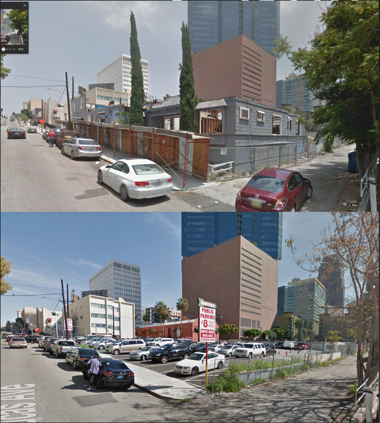
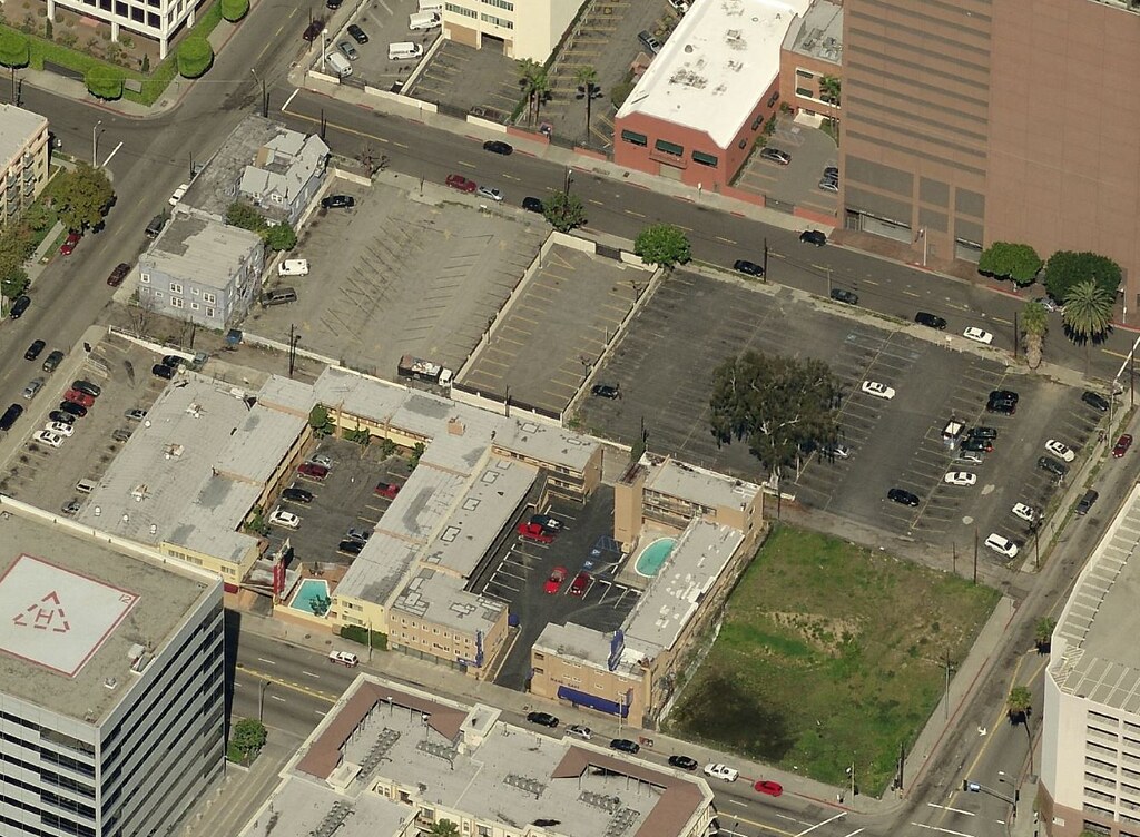
 GSV
GSV


 Linear Mode
