I normally don't like to create one photo threads, but I just discovered this gem tonight, and thought it was too good to keep it to myself.
This aerial photograph of Downtown Cincinnati was taken in the 1920s and shows all of Downtown (before the Carew Tower, and the demolition of "The Bottoms"), most of the West End (before Union Terminal, Laurel Homes, Lincoln Court, and Interstate 75), The southern portion of Over-The-Rhine & Mount Auburn, and the western portion of Mount Adams (before Interstate 71).

Photo from:
http://cincinnativiews.net (photographer unknown)
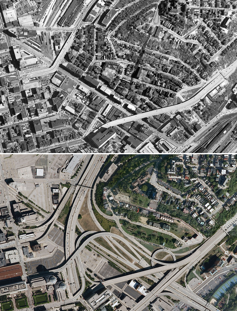
A quick comparison with this photo, and any equivalent aerial view from Google Maps/Bing Maps/Mapquest, etc. will show that the majority what you see was wiped off the face of the earth.
However most of the area of Over-the-Rhine & Prospect Hill (sub-neighborhood of Mt. Auburn) seen in this photo has remained intact.
Most of the West End was obliterated by glorious urban renewal, facilitated in large part by a desire beginning in the 1950s to "clean up" what was referred to as America's "worst slum."
Millions of Federal dollars allowed the city to systemically buy up, and tear down many of the structures, displacing thousands of residents (mostly poor African-Americans - BTW, the West End was long considered to be the heart of Cincinnati's black community).
This urban renewal plan -which consolidated almost a dozen districts in the West End down to two (Queensgate I & Queensgate II) culminated in the construction of I-75 in the early 1960s
- Only in the late 60s did community activism manage to preserve what was left of the West End (most notably part of Dayton Street).
Okay, well because I'm in a good mood...
Here's another aerial view showing a closer view of the central and western portion of the West End from the late 1950s:

(This photo has been making the rounds on the internet for at least 5 years, and I think was originally posted on cincinnati-transit.net.
I believe it was originally scanned from the book: "Cincinnati Then & Now" by Iola Hessler Silberstein, published in 1982)
A nice view of the West End, Over-the-Rhine, and the southern part of Camp Washington, and northern part of Downtown (in the central basin),
along with Clifton Heights, Clifton, Fairview, University Heights, Corryville, Mt. Auburn & Walnut Hills from 1949:
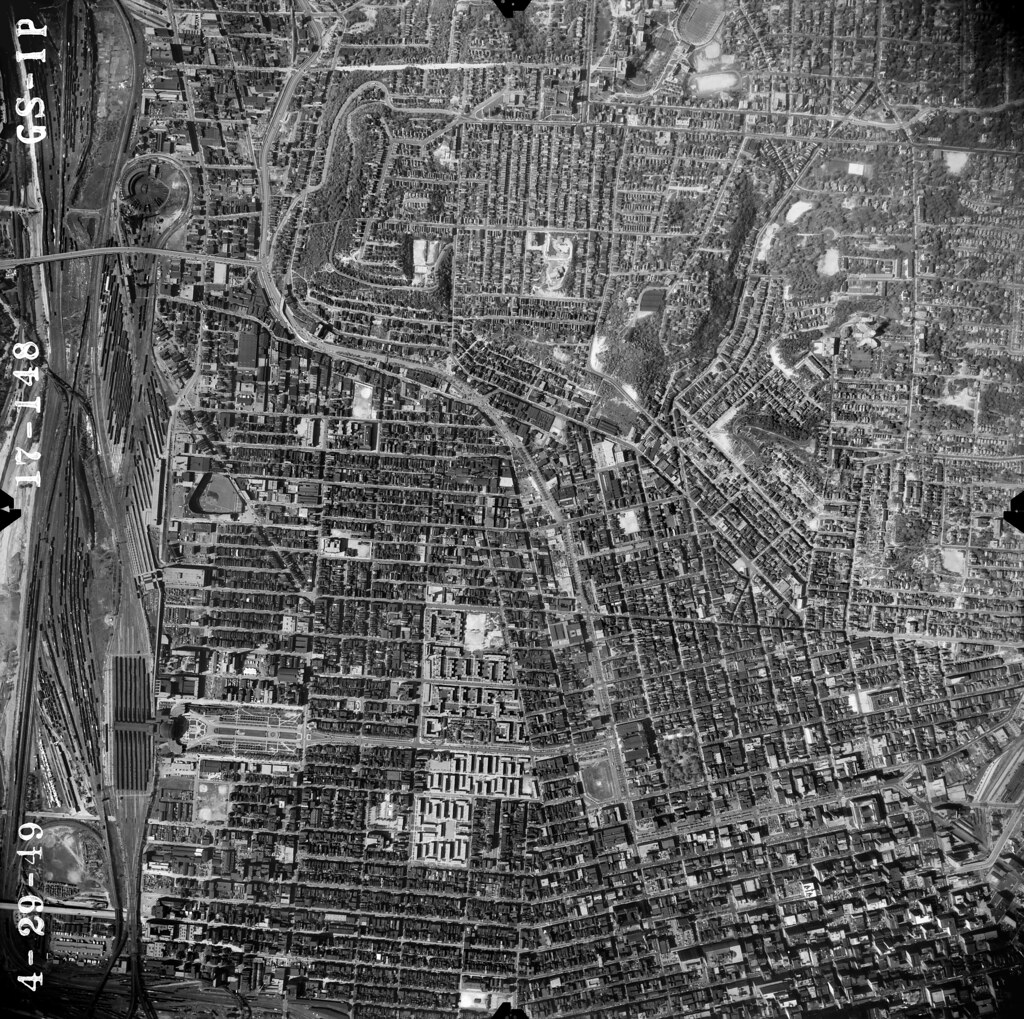
(from: flickr.com/mgsmith)
Mgsmith has posted a gold mine of vintage views of cincinnati on his flickr page. Among them, here are some great color photos showing how much
change can be made in less than a decade - taken from the Carew Tower:
Looking west (towards the southern part of the West End)

Photo taken by Nelson Ronsheim, June 1, 1958
(from flickr.com/mgsmith)
Annnnnnnd after:

Photo taken by Nelson Ronsheim, October 10, 1966
(from flickr.com/mgsmith)
Hooray for urban renewal!

....
Two more interesting before and after shots:
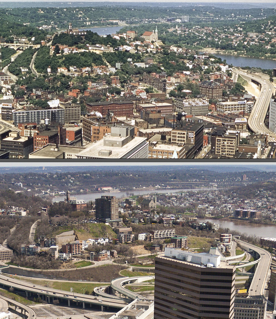
Looking west (towards Mount Adams)-

Photo taken by Nelson Ronsheim, June 1, 1958
(from flickr.com/mgsmith)
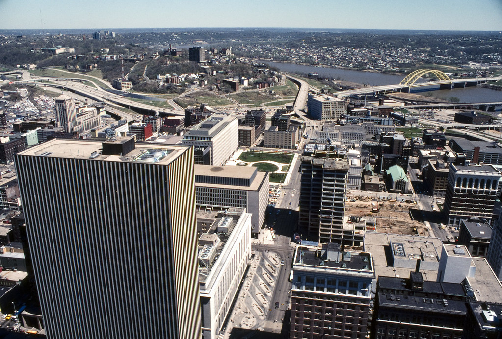
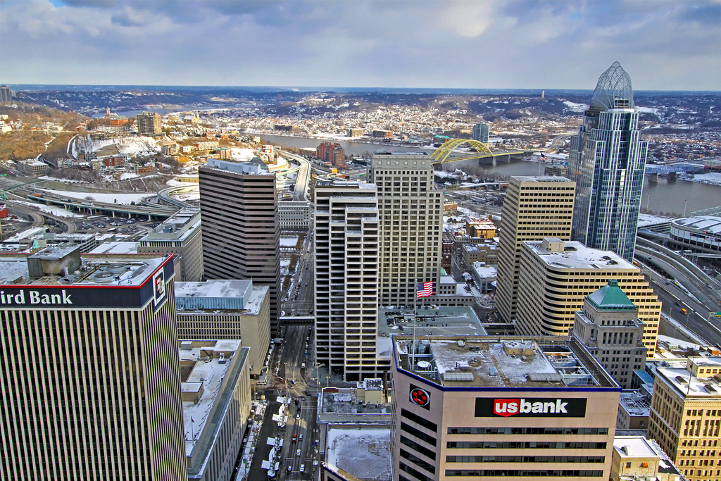
Photo taken by Nelson Ronsheim, May 1, 1978
(from flickr.com/mgsmith)
And what the hell - for good measure, a photo taken recently (in miserably overcast weather) - by me:
Hoped you enjoyed trip back (and forward) in time.


 Linear Mode
