(I apologize if this has been covered, but with such an enormous thread my computer will not allow me to open this thread in nested view.)
In addition to
ProphetB's correction, to which I have taken the liberty to add a link in
tovangar2's quote below: Plaza Street was originally the southern edge of the Plaza, skirting the old fire house and the Pico House, and then continuing more or less into Republic Street west of Main. The north side of the Plaza was Marchessault Street, which continued into Church (or Bread) Street.
Tovangar2's initial guess regarding Sunset is basically correct. As initially routed, Sunset Boulevard began more or less as a westward continuation of Marchessault just north of the old church, replacing Church Street; even to this day the original alignment is visible as the main entrance to and driveway through the huge accretion of parking lots that has spread over most of the area. But Bellevue is closer to the modern alignment.
As we all know, Sunset was later realigned to join Macy Street, and still later renamed, in honor of Cesar Chavez. When the realignment took place, I don't know, but it can't have been any earlier than the mid 1950s; maps exist from that time which still show the old alignment for Sunset. For many years, allusions in old sources to the Plaza Church at "Main and Sunset" had puzzled me, and it was only a few weeks ago that I learned the explanation. Perhaps the realignment of Sunset happened when the Plaza was closed to motor traffic.
Some confusion may commonly result from the fact that "Paseo de la Plaza" is a apparently retronym, if you will, devised by the park authorities to mean the entire Plaza, and often used that way when they give their address--125 Paseo De La Plaza.
Quote:
Originally Posted by tovangar2

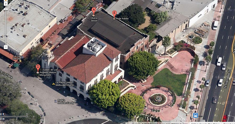
I think that's Sunset passing the north end of the Plaza then turning into Bellevue as it rounds the corner with the white building on it before meeting Alameda at an angle. Ferguson on the left. Olvera St buried in the block on the right. (?) (My '48 Gillespie's Guide has tiny type.) Anyway, we're on the Union Station block, corner of Macy. (see ProphetM's corrections on the next page)
P.S.
google maps
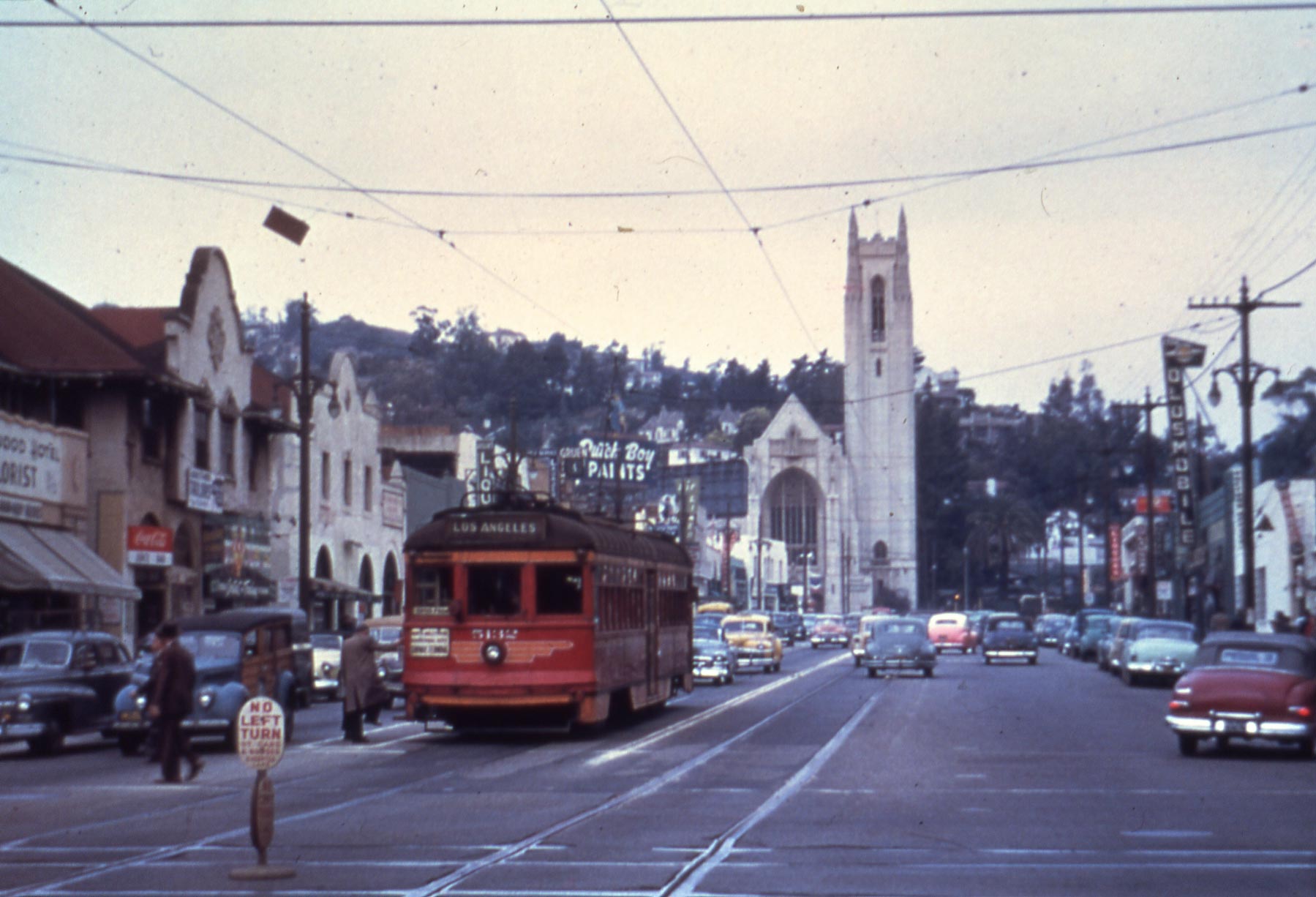
The building with the stepped gable ends is still there, the white building in the old photo is next to it, now with a peaked roof and some new "Spainish" arches at its base (man, Christine Sterling musta been working overtime). The church behind it also appears in both images. One can also see the shadow of the triangular block in the foreground of the old photo in the google maps image. And hey, there's the Avila Adobe |


 Prev
Prev


 Linear Mode
