Big thanks to HossC and Chuck for their Laurel Canyon posts of 2 weeks ago that I am only now getting around to read. It is easy to get behind reading this thread

Here is the first picture HossC posted.
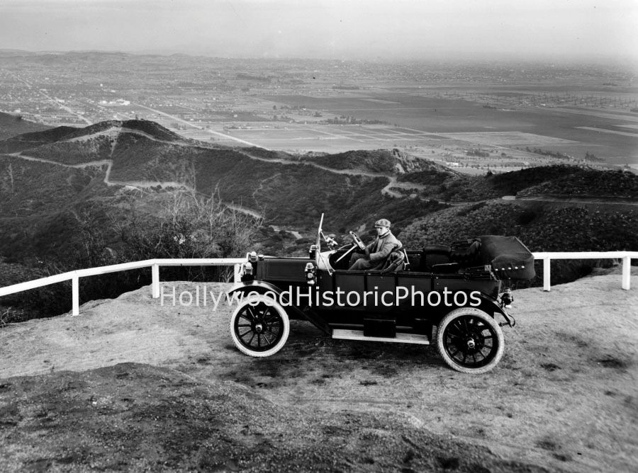
HossC mentioned that this photo was labelled "Lookout Mountain 1916" - a lower limit could be set by the car experts on the thread identifying this 4 (?) seater, I have no doubt. The jaunty driver seems to be dressed for warmth so I am guessing winter; also the air looks very clear.
Next is an annotated version of the same shot. I spent a few hours tonight looking at old and new topo and street maps, but the view was already familiar: I walk my beagle dog every day right past where that picture was taken. As HossC's caption said, it was taken from Lookout Mountain (pre 1917 and 1918 fires that burned the canyons) looking ESE over Hollywood. The exact spot is just north of 8766 Appian Way at the hairpin turn.
Looking down towards the flats, it is fascinating to see what was built up and what was fields (beans and oil) back in the day.
 http://www.hollywoodhistoricphotos.com
Street 1 is now Yucca Trail on its way up from the Kirkwood Bowl; the key to recognizing it is the sharp kinked bend lined up with the view from Lookout Mountain. Street 2 above it is Grand View Drive, on its way up to Cole Crest, off the right edge of the photograph.
Today, Street 3 is Hollywood Boulevard leading east to a developed area. Street 4 is Selma Avenue (Hawthorn further east), and Street 5 is today Sunset Boulevard. 6 is Fountain Avenue and you can see that four blocks have been laid out but not developed between Fountain and Street 10 which is Santa Monica Boulevard. East-West Streets 7, 8 and 9 are Hampton, Lexington, and Norton Avenues. The key to identifying these is to see how the streets running north and south off Fountain are staggered between Genesee on the west and Curson on the east and to compare this photo with a modern street map: the arrangements are the same.
The trees running north-south just above the red numbers 6 - 10 mark the present site of Plummer Park. 11 is, I believe La Brea leading south to the Salt Lake Oil Field.
Thanks again guys for posting these wonderful pictures, I'll have a few comments about the other pictures HossC posted "soon".


 Prev
Prev


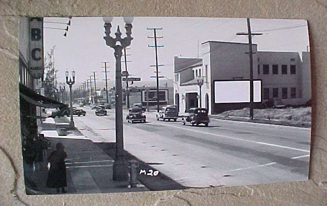
 Thanks for the information unihikid. I thought it had just pulled into a Pep Boys (notice the sign).


 from John Bengston's great


 )
)


 Linear Mode
