Quote:
Originally Posted by sopas ej

^^^^^^
How creepy!
(Protestantism baffles me!).
|
Right there with you buddy, only it's all of Monotheism that baffles me. I'm like....
what?
In other old news:
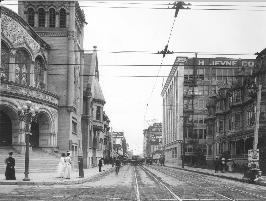
Looking up something else in Sarah Bixby Smith's
Adobe Days, I read again her very brief description of her childhood memory of the visit of President and Mrs. Hayes to Los Angeles in 1880, the first US president to come to California. A grandstand was set up in front of the Baker Block and, after the speeches, Mrs Hayes was taken across to the "fashionable parlors" of the St Elmo Hotel by the ladies of the town for tea. That evening there was a public reception followed by a formal dinner at the Horticultural Pavilion "destroyed a few years later by fire". Smith recalled seeing Gilbert & Sullivan's comic opera, "HMS Pinafore", at the Horticultural Pavilion just a year after its 1878 debut in London.
Smith wrote that the Pavilion, "a barn-like, wooden building", forerunner of Hazard's and the Auditorium Building, was opposite from her first LA home, a house on Temple near Charity. The Pavilion was across Temple "on top of a hill that is now gone". It was built under the auspices of the Horticultural Society. Prudent Beaudry donated the land for it in 1878. E.F. Kysor was the architect.
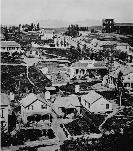
I don't recall ever seeing a picture of the Horticultural Pavilion before, but found one taken ca 1878-1879 from our first high school on Poundcake Hill.
The Pavilion is on the southern slope of Fort Moore Hill on the right. This is an early shot of the building as it's not landscaped yet and the steps have yet to be built down to Temple. :
uscdl (url)
http://digitallibrary.usc.edu/cdm/si...0/rec/1099/url)
Sand St runs behind the Pavilion, out of shot to the right in the image above, with the Protestant Cemetery north of that. The Pavilion was built on it's own little block, with two small access streets running south off Sand Street which met in front of the building. The one on the west was "Pavilion" and the one on the east was named "Stockton".
Horticultural Pavilion, looking south. Temple is at top with Sand st running along the bottom edge, separating the Pavilion from the cemetery. Stockton is on the left (east) side of the Pavilion and Pavilion St on the right:
 calisphere
Quote:
Originally Posted by rick m
The image with the Horticultural Pavilion also has very early home of J.W. Gillette center right-with extensive walled backyard. Was the Angel's Flight's builder hired by Col. Eddy
|
The other venues:
Baker Block in 1880:

St Elmo Hotel in 1890. In 1928 Smith wrote that the St Elmo "is still standing, but fallen to very low estate":

usc (previously posted by e_r, #1907)
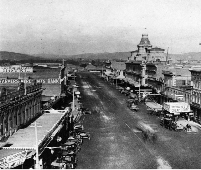
Main looking north from Temple, 1882, showing the relationship between the St Elmo (now marked "Cosmopolitan Hotel" at the roofline)
on the west side of the street and the Baker Block, on the east. The St Elmo/Cosmopolitan is across from the Bella Union Hotel.
The Downey Block is at lower left on the NW corner of the then intersection of Temple, Spring and Main:
 waterandpower.org/museum
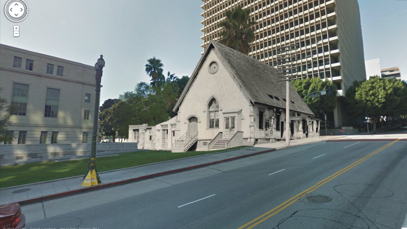
That was then. Now:
First Los Angeles home of the Bixbys/Horticultural Pavilion: Temple looking west, mid-block between Hill and Grand: Hall of Administration on the left,
RC Cathedral of Our Lady of the Angels on the right:
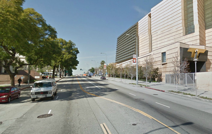
gsv
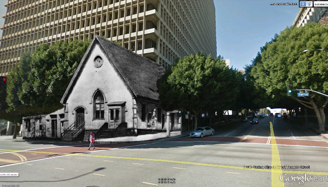
St Elmo/Bella Union/Baker Block. Main looking north: Federal Courthouse on the left, Fletcher Bowron Square/Entrance to Civic Center Mall on the right.
(the Vickry-Brunswig Building, 1888, may be seen in the distance on the left at the Plaza.)

gsv


 Prev
Prev


 [/IMG]


 Linear Mode
