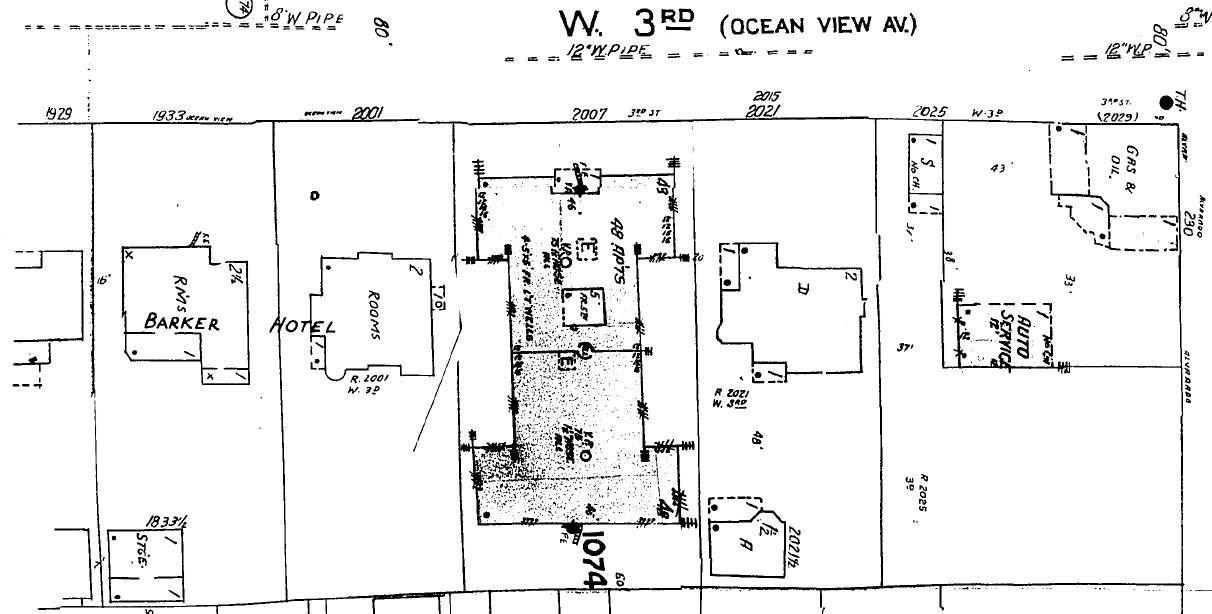
With north at the bottom, here is the 1906 Sanborn Map showing the first several houses east of Alvarado on Ocean View,
now West Third Street:
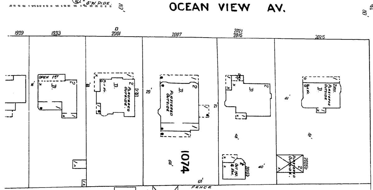
ProQuest via LAPL
In this c. 1900 photo looking northeast, we see (left to right) 2025, 2021/2015, 2007, and I believe 1929 Ocean View.
Between the rear of 2025 and the oil derricks is a bit of 2025's barn/carriage house:
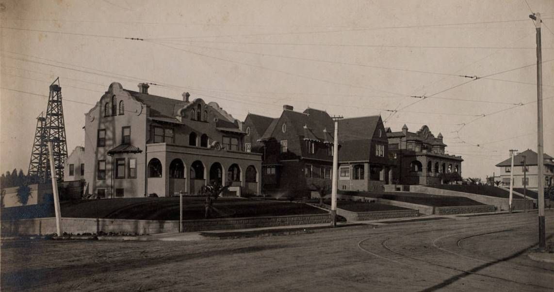 486898
 at HDL
We mostly see 2007 Ocean View in this c. 1901 photo looking northwest across Westlake Avenue, just below Ocean View.
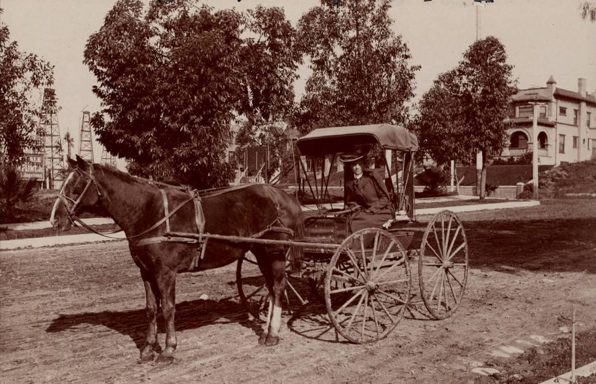 486892
 at HDL
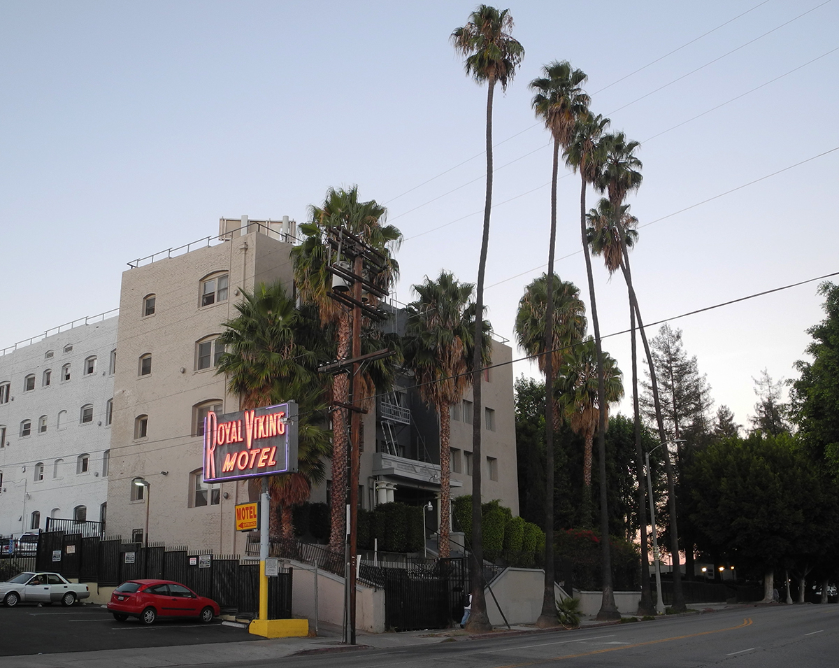
August 1913 BPs show that the house at 2007 Ocean View was moved around the block, behind its original location,
to 2020 Miramar Street, and an apartment building now apparently known as the
Mariposa Apartments was built at
2007 Ocean View (the Royal Viking Motel, now the Pod Inn, is on the corner of Alvarado and 3rd):
Quote:
Originally Posted by 3940dxer

All photos mine. |
This photo looking northwest was taken from the apartment building at 2007, with 2021 and 2025 in the foreground.
There is no HOLLYWOODLAND sign (1923), and the house above the red X, 140 S. Carondelet, was built in 1917, so
the photo's c. 1920 date is probably pretty close:
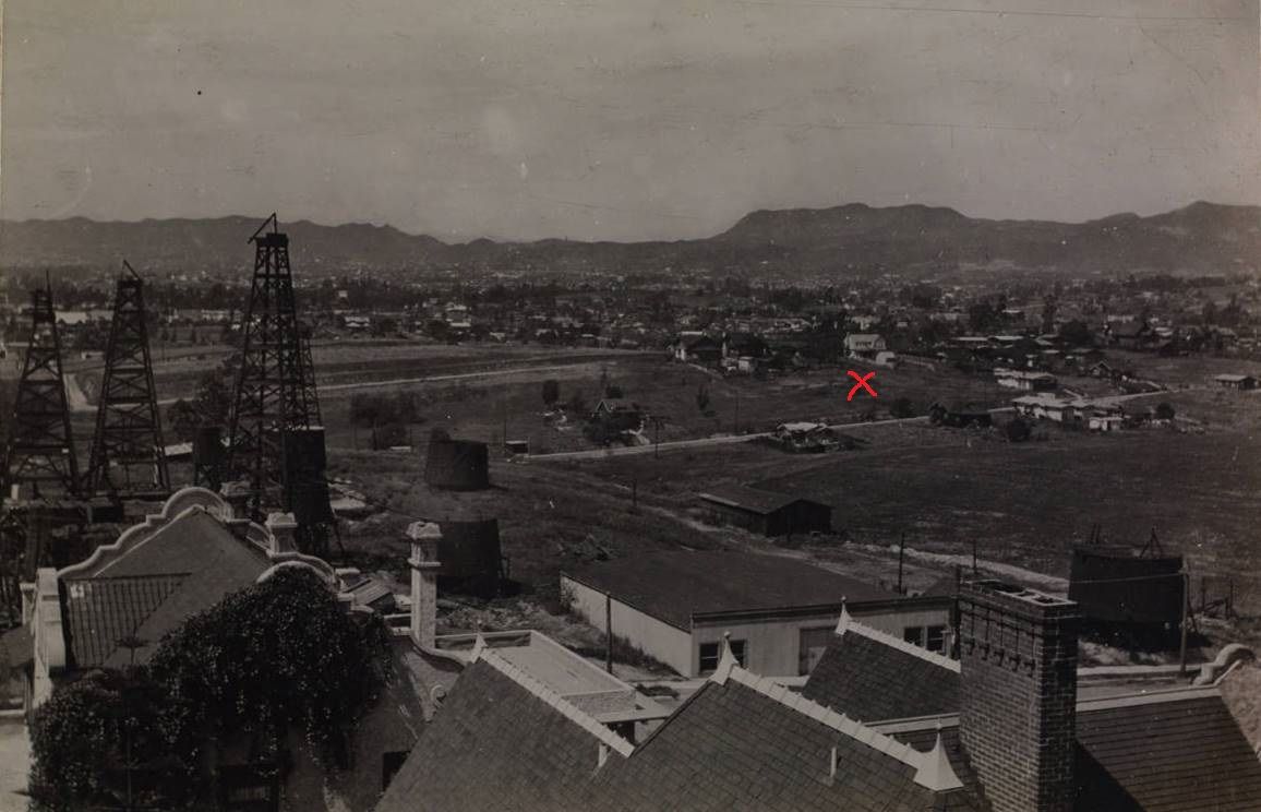 486884
 @ HDL
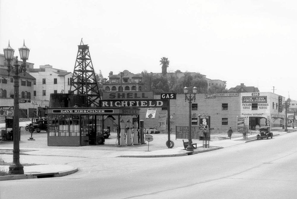
HossC posted this 1933 photo looking south on Alvarado at Valley, which is one block north of Miramar. To the right of
the oil derrick you can see 2020 Miramar (ex-2007 Ocean View), for which there is a March 1, 1966 demo permit.
Quote:
Originally Posted by HossC
|
From the same set of photos as
HossC's shot, here is a closeup of the rear of 2025's carriage house, with the little
cupola. Above the carriage house is the roof of 2021. To the right of the carriage house is a sign for the Barker Hotel,
which we've seen here
before.
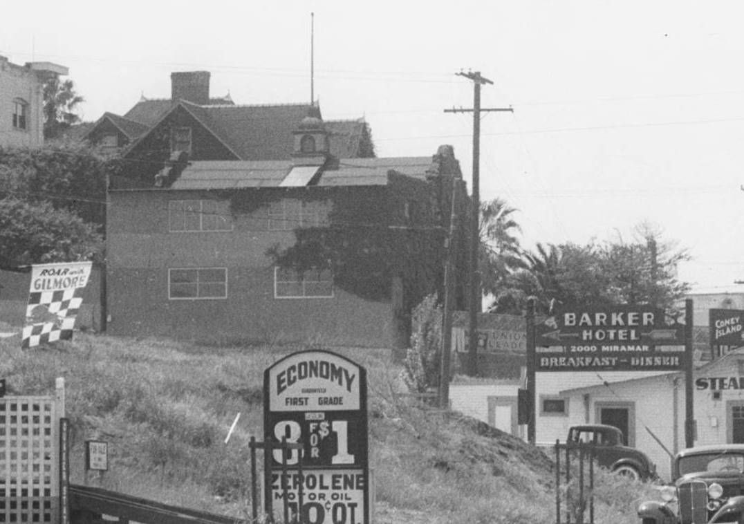 DW-1933-05-01-04~01
 at USCDL
We again see 2025's carriage house (and 2021 and its carriage house) in this 1936 aerial looking east on Third St.
The demo permit for the house at 2025 is dated January 24, 1933; the demo permit for the carriage house at 2025
is dated July 24, 1941:
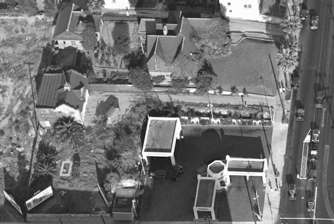 AAA-NG-4129-W
 at USCDL
Again with north at the bottom, here is the 1950 Sanborn Map showing the same stretch of 3rd Street as the 1906 map.
Both the home at 2021 and its carriage house have January 1957 demo permits. It looks like the Barker Hotel on Miramar
had annexes on 3rd Street:
ProQuest via LAPL


 Prev
Prev


 .
.


 Linear Mode
