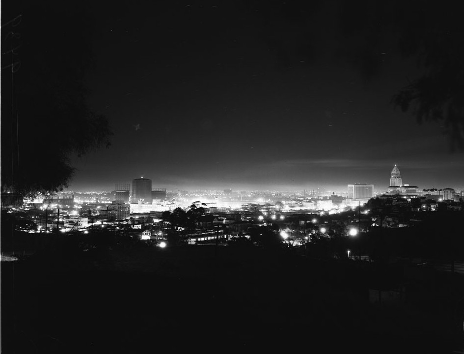
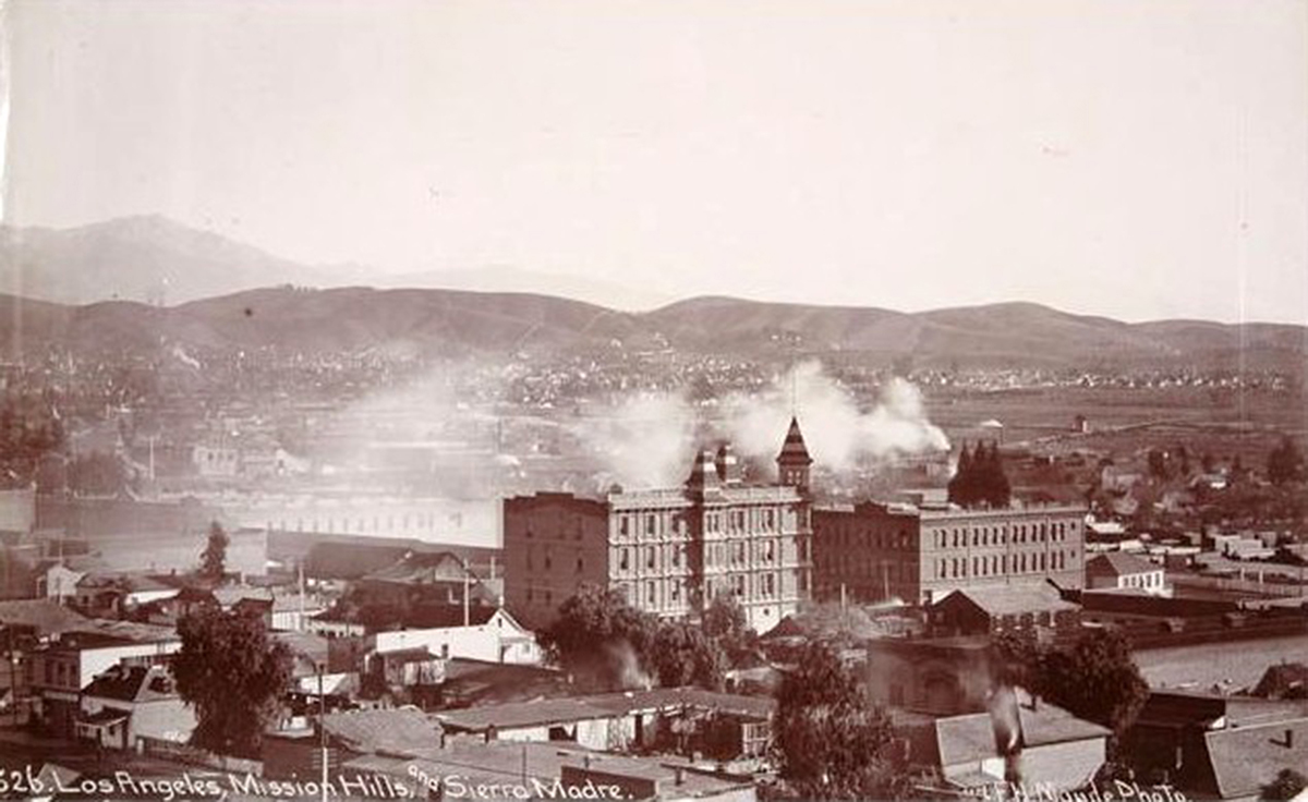
On June 10 2009, ethereal_reality started this amazing thread, kicking it off with a beautiful shot of downtown L.A., taken on New Year's Eve, 1951. It's a wonderful and somewhat mysterious photo, that has never really gotten an in depth analysis here. I started thinking about this shot about a year ago, and thought it would be terrific to capture a "now" version of e_r's first contribution here.
Like many Noirish photo and research projects, the task seemed to grow exponentially once I dived into it! But it's been great fun, and I'm finally ready to share my findings here. I'll present this in at least two posts. This first one will address the original image and the more important buildings in the scene. In the next one I'll post a modern view of this scene and discuss some changes that have taken place in this view of the skyline over downtown Los Angeles.
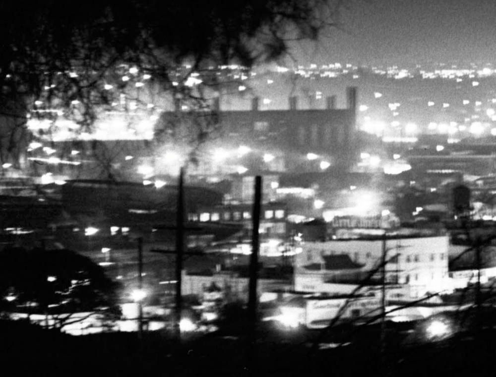
Here's the original photo that e_r saw on the USC site and posted here:
 http://digitallibrary.usc.edu/cdm/se...1/order/nosort
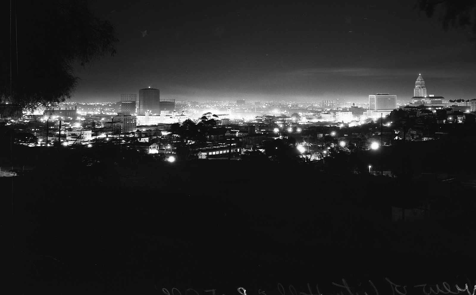
Since then USC has revamped their site, moving to higher resolution zoom-able, scroll-able images. As some here have discovered, with a little effort one can now zoom in to capture an image in sections, and then stitch those sections together, to create a complete, large, hi-res image. You could probably wallpaper your bedroom with this image, by using the highest possible resolution and stitching maybe 100 images. I haven't gone that far, but to get a nicer version of the original photo I stitched 3 portions of the panorama, which gave me a 3519 x 2178 pixel file. If I attached it here you wouldn't be able to see the whole image on any normal size monitor, so I also created a 1200 pixel wide version for this post, which appears below. But I've also put a full size version on my server, and you can see it at
http://wwww.dkse.net/david/NYE51/_USC.composite.jpg. Both of these newer versions are clearer and more detailed. (I was tempted to touch them up a bit in Photoshop, but decided not to.)
 http://digitallibrary.usc.edu/cdm/se...1/order/nosort
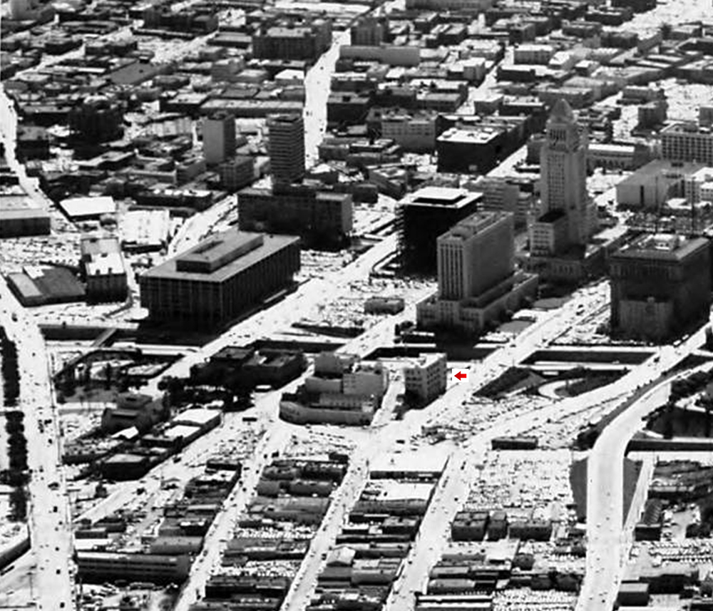
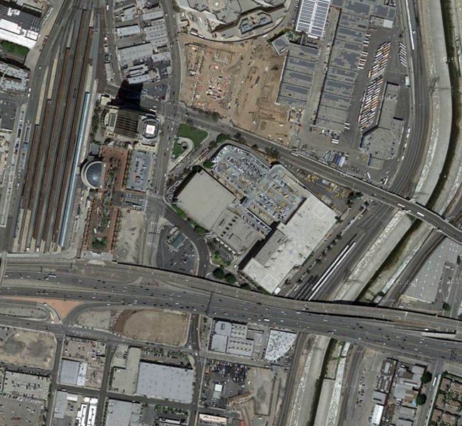
I believe that the original photo was taken near Lilac Avenue, north of Centennial St. and Beaudry Ave. I'll discuss the exact location in detail in my next post, but for now here's a map of the area, with a circle representing the approximate locale and an arrow showing the direction of the center of the shot:
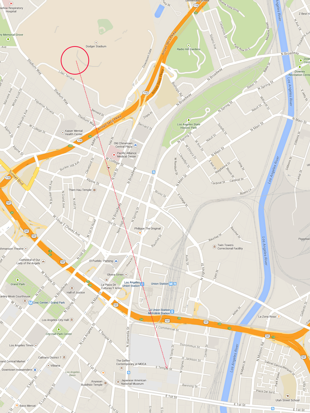 https://www.google.com/maps/@34.0452...18.2232483,12z
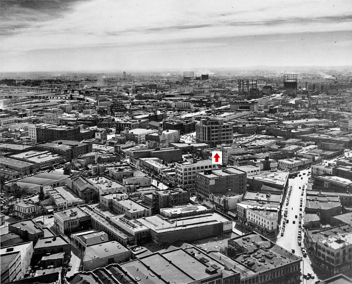
Allow me to set the stage a bit. The 110 freeway (Arroyo Parkway) had already been built through the old Figueroa roadway but it turned into surface streets north of the 101 section downtown, which was not completed until 1954. But the 101 (Santa Ana) freeway downtown was completed after the photo was taken, in 1954. Union Station and Terminal Annex had long since been completed, but Chavez Ravine was still intact. Demolition of the residential neighborhoods in the ravine would not begin until 1959, and the Stadium did not open until 1962. One's eye is invariably drawn to the "sea of light" in the middle of the image. I've got to think that since it was New Year's Eve, the city was very busy and noisy. Here's my annotated version of it:
 http://digitallibrary.usc.edu/cdm/se...1/order/nosort
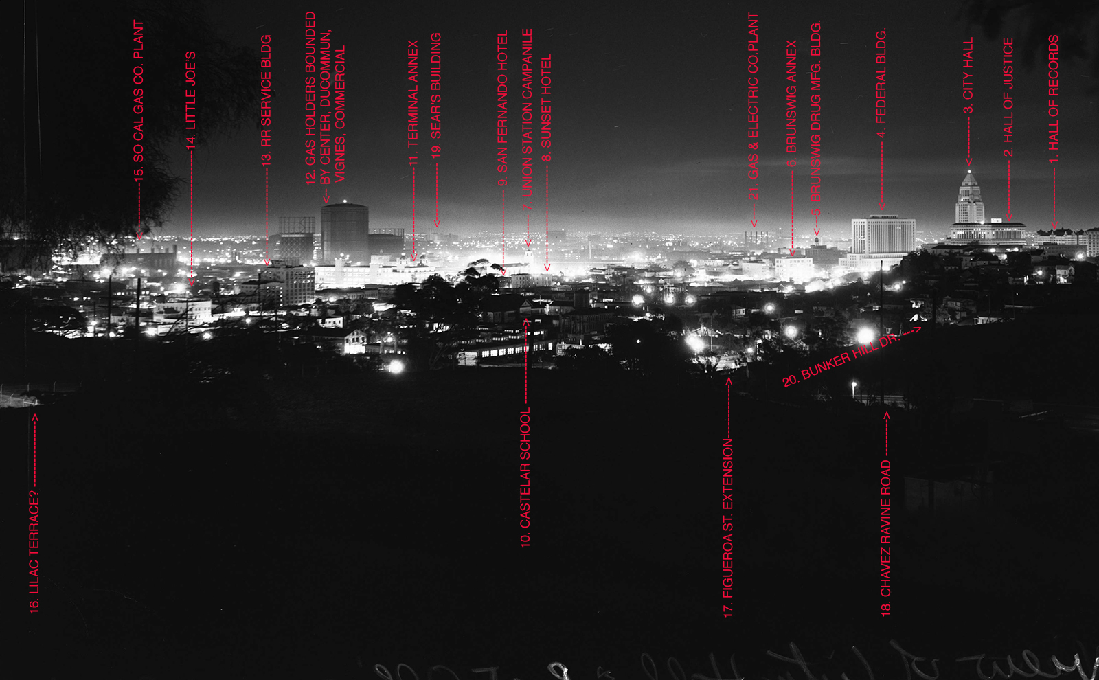
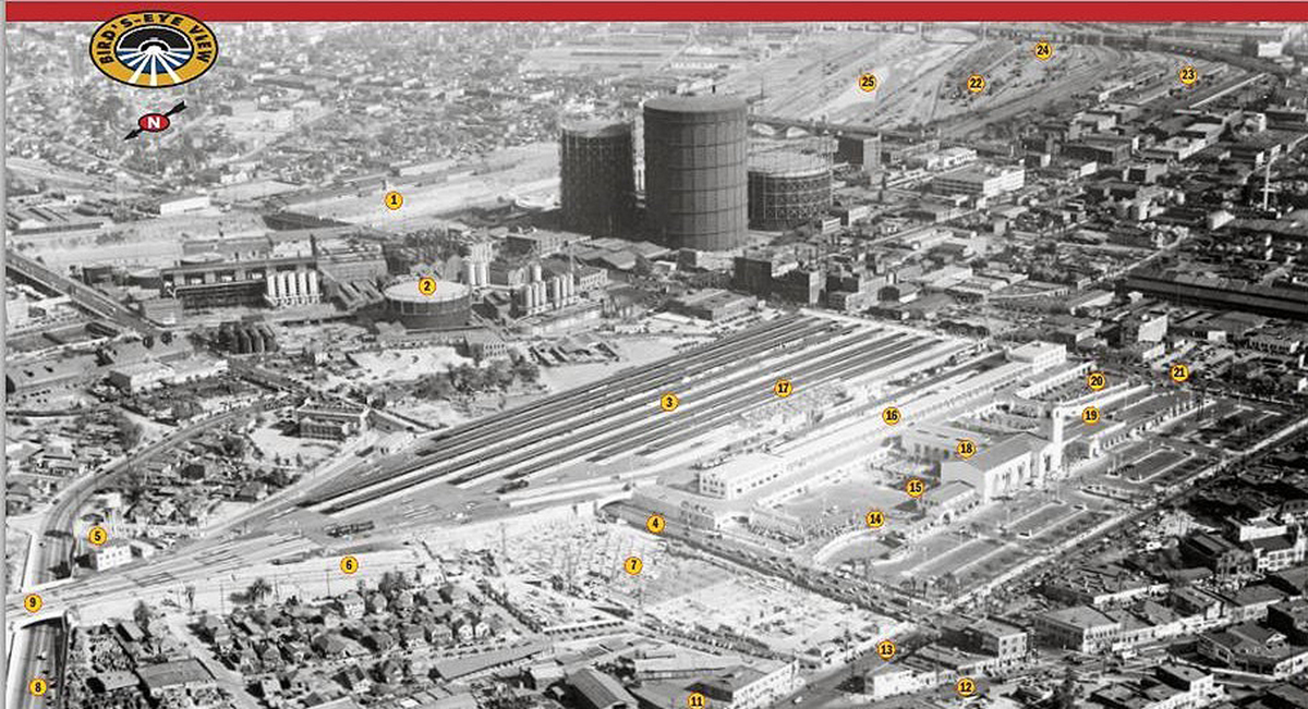
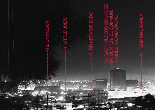
Let's jump in and appreciate some of the buildings and details in this marvelous shot. To identify them, here's yet another version of the photo with annotations, numbered 1-17. I'll start from the right, with the better known structures. The large Civic Center buildings will be familiar to most readers here, but I have a few comments about them, too. (And BTW, it's quite possible that I've gotten some details wrong here. If you spot an error, please feel free to correct me, either on the thread or by PM.)
The distinctive, ornamental Hall Of Records (1) at the right edge of the frame was built between 1909 and 1912, and demolished in 1973. Sited in alignment the an early street plan, it lay at an angle to the Civic Center area's current grid layout.
Next we have the Hall Of Justice (2) and behind it, of course, City Hall (3). The former was built in 1926 but was heavily damaged by the 1994 Northridge earthquake. A major renovation began in 2011 and the building is set to reopen October 8, 2014. Our iconic City Hall, built in 1928, needs to introduction and if you don't know this building, you have have clicked on the wrong thread. But if you look closely at the two buildings, you can see that the upper left corner of the Hall Of Justice roof lines up with the left edge of City Hall. You can also see that 7 stories of City Hall's center section are visible above the hall Of Justice roof. I used these two clues (among others) to locate and match the place where the photographer stood when the original image was captured. To the left of City Hall we have an excellent view the Federal Building with its stepped lower floors (4).
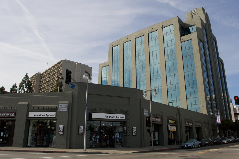
With number 5, the scene gets a little more interesting. This is the Brunswig Square building, on the south side of 2nd St., between San Pedro and Central. Note the water tank atop the roof. The building dates from the 1920's and was renovated in the 1980's. Here's a period photo from USC, with the building mid frame, the angled intersection of 2nd and Central to the building's left. (The water tower is there but it's a bit hard to see.) The building still stands minus water tank; a modern post-renovation image follows the older one. (Thank you to Michael Ryerson for identifying this building, and several others in the image.)
 http://Looking south-east down Welle...ngton, ca.1939
 http://www.skyscrapercity.com/showpo...postcount=2593
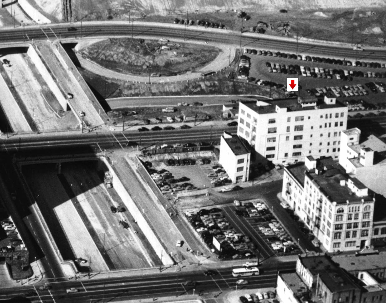
Number 6 is another Brunswig buiding, the 5 story "Annex". This structure was on the west side of the New High St. extension, slightly east of Spring St. and about midway between Sunset and the 101. In this photo from 1953 we see it on the right, sandwiched below Spring St. and above New High, the narrow angled alley. The 101, under construction, dominates the left side of the image. South of New High we see the Vickrey-Brunswig building, still standing and now fully restored. (There were many Brunswig buildings downtown, and making sense of them and their confusing nicknames was rather tricky. Thanks again to Michael Ryerson for helping with this.) The Brunswig Annex was built in about 1910, and demolished in 2007. (EDIT: Per ProphetM, the building was demolished in 2001, per to an article in the L.A. Times.)
 http://digitallibrary.usc.edu/cdm/si.../id/3424/rec/1
Here's a snip from another aerial, that reveals its location west of the Plaza. It looks a bit isolated:
 http://www.lapl.org/
Amidst the "sea of light" in the center is number 7, the clock tower campanile near the main entrance of Union Station. Exactly in front of the clock tower we see the Sunset Hotel (8), on the Northwest corner of Spring and Ord. (Because of the way the hotel is lit in the exposure it looks like two separate buildings but this really is one structure, aligned east-west. To the immediate left of the Sunset, dark and barely visible, is the San Fernando Hotel (9). Below is an old shot from the opposite direction, that shows the Sunset with its 3 distinctive turrets, with the less ornate San Fernando Hotel on the right. I don't know when these structures were built, or when they were demolished. (EDIT: ProphetM advises that Michael Ryerson and FredH researched these hotels earlier in the thread and determined that both of these structures were reduced to one story some years ago, and still stand in that condition.)
 http://www.ebay.com
Number 10 (directly in line with Sunset Hotel) is the Castelar Elementary School in Chinatown, bounded by Yale, College, and Hill Streets. (This section of Hill Street was previously named Castelar Street.) Opened in the 1880's Castelar is the second oldest surviving schools in Los Angeles. In e_r's original photo we see it's distinctive A-frame roof, with a round feature in the center. The original main building has been replaced by newer construction in other parts of the block, but at least one of the early out buildings survives.
Number 11 is Terminal Annex, bathed in light and easily recognized by its massive size, with two round turrets that face Alameda St. A postal facility built to process all of L.A.'s incoming and outgoing mail, Terminal Annex opened in 1940. It closed in 1989 but the customer service windows in its ornate lobby remain open.
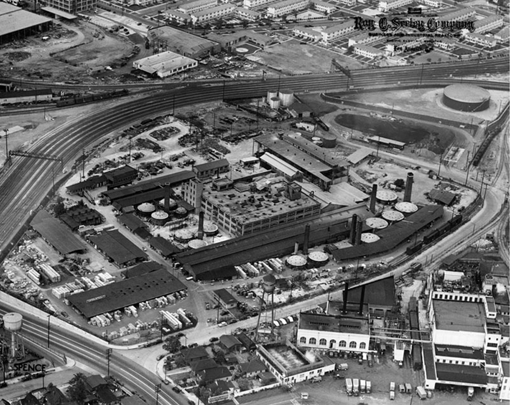
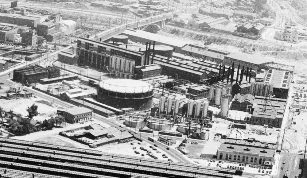
At number 12 we have an oddly attractive collection of gas holders (gasometers), perrenial NLA favorites. I've read that the biggest of thee monsters was 300 feet high, the taller than any downtown building for a number of years. These three main ones were on a block bounded by Ducommun, Center, and Commercial streets. The 300 footer, on the Northwest corner of Commercial and Vignes, held ten million cubic feet of gas, half the amount used by L.A. at the time on an average day. The undated but pre-101 aerial below shows them pretty clearly, with that 300 foot monster in front.
 http://ctr.trains.com/~/media/Files/...930s%20BEV.pdf
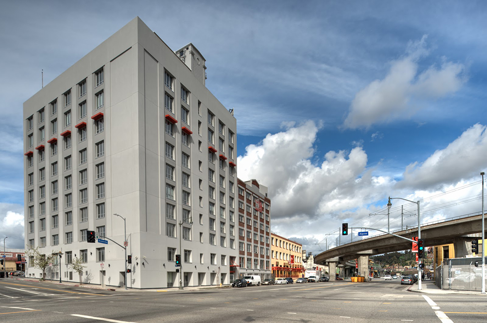
Number 13 is what I've been calling (for lack of a better or more official name) the railroad service building, on the Northwest corner of Alpine and Spring. The building still stands and is now called The Metro at Chinatown Senior Lofts:
 http://2.bp.blogspot.com/-Q7bToFxQlT...inatown-15.jpg
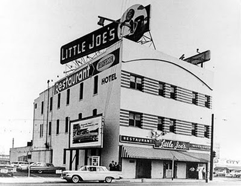
Number 14 is our old friend Little Joe's. The Joe's building had at least two locations and a few iterations -- in this view we see it as a two story building, topped by the distinctive skeleton key sign. Look at the NYE photo closely; you can actually see the restaurant name on the sign.
 http://kim-reynolds.blogspot.com/201...estaurant.html
Number 15 is a mystery building, whose identity has eluded me thus far. I think Its location must be close to Main and College or Rondout, or near Vignes and Bauchet. where the Men's Jail and Twin Towers jail were built. The Los Angeles Pressed Brick Company later acquired by Gladding, McBean & Company) had several buildings in this area over the years, and my hunch is that #15, which appears to have a group of chimneys that face Northwest, is the Gladding, McBean facility on or near Date Street, near the present day intersection of Vignes and Bauchet. The location is very close and chimneys face the right direction but something does not quite square. Perhaps someone else can help ID this one, which I have pondered for many hours.

Here's a USC photo -- it's dated 1928 but I think it must have been later: North of the plant we see the large group of railway tracks coming from the East, which curve and head down towards Union Station. This aerial shot from USC looks Northwest:
 http://digitallibrary.usc.edu/cdm/si...id/13529/rec/1
EDIT: HossC determined that this is the Southern California Gas Plant, near the southwest corner of Keller and Macy/Sunset.
At Number 19 we have the Sear's building,
way out on the South Side of Olympic, near Boyle Ave. This was about 9 miles from the photographer's location!
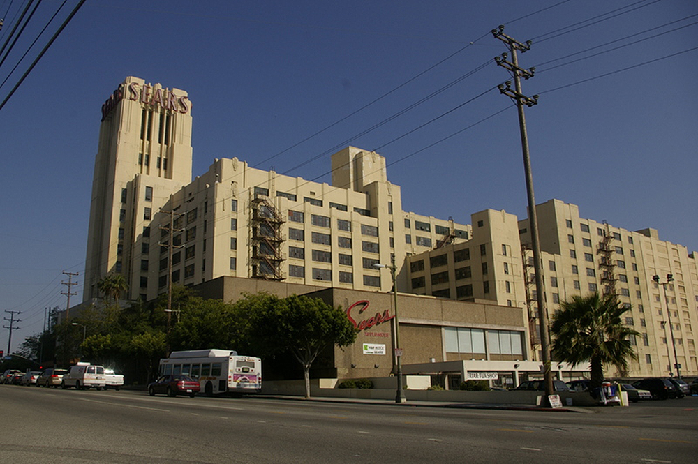 boyle heights pic-viewfromaloft.typepad.com
The chimneys in number 21 (identified by HossC) are part of the Gas & Electric Co. power plant, at the northeast corner of Alameda and Factory Place.
A few comments on some of the roads seen in the foreground: #18 is a short section of Chavez Ravine Road that is now Stadium Way. At #17 we see a small section of the Figueroa St. extension. (If we were higher up Figueroa / Arroyo Parkway would be seen extending horizontally all the way across the shot, but the hillside blocks our view of it, and just a small chunk is visible here. Finally, I believe that #16 is a section of Lilac Terrace with chain link fence near the right shoulder. #20 is a section of Bunker Hill Drive, between New Depot and Alpine Streets.
So there you have it. No doubt many more of these buildings can be identified, including perhaps some around The Plaza, but one has to stop somewhere. If others here can ID more of these I'll try to update the annotated version when I have time. Apologies in advance for any errors, there are probably several. I'll revise the post with any corrections that are pointed out.
In my second post on this topic, I'll include one or two "now" photos. The panorama has changed drastically and while I hope you'll enjoy the now views that are coming, let me warn you the scene won't be nearly as interesting as what the original photographer saw, standing on the Chavez Ravine hillside on New Year's Eve, 1951.


 Prev
Prev


 Excellent research 3940dxer. One of my favorites posts.


 Linear Mode
