HomeDiagramsDatabaseMapsForum About
     

Go Back   SkyscraperPage Forum > Photography Forums > Found City Photos

Reply

 
Thread Tools Display Modes
     
     
  #31981  
Old Posted Nov 9, 2015, 5:50 PM
oldstuff oldstuff is offline
Registered User
 
Join Date: Aug 2012
Posts: 623
Morgan himself lived with his family at 819 Westlake Avenue. He was born in England in about 1850 and the censuses lists him as an architect. He first appears in the US census in Los Angeles in 1900, but is listed in an LA directory in 1884 as a Los Angeles architect. He is noted in that directory to have been naturalized as a US citizen in Leadville, Colorado in 1878. His residence address, in the 1890 directory was 402 Temple. Octavius Morgan died in 1922.

Morgan was apparently the architect for the original Pantages Theater in Los Angeles, later the Arcade Theater. It was built in 1910 and was located at 534 S. Broadway. The building, now a video store and apparently offices, is still there and mostly unchanged, save for the "modernized" marquee and security doors on the storefronts
Reply With Quote
     
     
  #31982  
Old Posted Nov 9, 2015, 7:56 PM
tovangar2 tovangar2 is offline
Registered User
 
Join Date: Nov 2012
Location: West Los Angeles
Posts: 2,625
Octavius Morgan 402 Temple & 819 Westlake Ave

Quote:
Originally Posted by oldstuff View Post
Morgan himself lived with his family at 819 Westlake Avenue. He was born in England in about 1850 and the censuses lists him as an architect. He first appears in the US census in Los Angeles in 1900, but is listed in an LA directory in 1884 as a Los Angeles architect. He is noted in that directory to have been naturalized as a US citizen in Leadville, Colorado in 1878. His residence address, in the 1890 directory was 402 Temple. Octavius Morgan died in 1922.
Thank you oldstuff. that's really interesting. I wondered who owned that handsome house at No. 402 Temple (SW corner Temple and Hill). I also thought Morgan must have lived somewhere around there.

The sequence:

After 1906. I don't have a building permit for the Morgan home (1890 or before), but the demo permit was pulled in 1910:

seaver center previously posted by Flyingwedge (detail)

1910 or before. The Majestic apartments and the Montana Grocery (plus the house behind it) are now in place:

uscdl previously posted by HossC (detail)


historic mapworks baist 1910 plate 7 (detail)

Between 1911 and 1914, 402 Temple was an empty lot:

historic mapworks baist 1914 plate 7 (detail)

1915-1950. Morgan pulled the permit for the single-story commercial structure in 1915. The building was demolished in 1950:

silent locations previously posted by t2

After 1915:

historic mapworks baist 1921 plate 7 (detail)

Looking south on Hill from Temple. Octavius Morgan's commercial building, with its handsome brickwork, is on the right margin. At left is the City of LA garage with its open lot, once the site of the Montana Grocery (which was demolished in 1925). In the left distance is the New Broadway Hotel and the Law Building. The Stevens apartments top Court Hill, now with its double-barreled tunnel (train bore, 1909, vehicle bore, 1912):

seaver center


I don't have a building permit for 819 Westlake Ave, but Morgan got a permit to build a tool shed behind his new house in 1913. The home was demolished in 1961.

819 Westlake Ave seems to have changed shape and turned into brick between 1910 and 1914. I couldn't find the permits to explain that.

1910:

historic mapworks baist 1910 plate 15 (detail)

1914:

historic mapworks baist 1914 plate 15 (detail)

The wiki pages:
Kysor and Morgan
Morgan, Walls & Clements

PCAD professional bio

Press Reference Library bio

Morgan came to the US in 1871 and LA in 1874.
He married Margaret Susan Weller Offenbacker in 1884.
Two children, Octavius Weller and Jessie Caroline.

John A. Walls, ten years younger than Morgan, died the same year as his partner.

20 Oct 1850 - 29 Mar 1922:

press reference library

Inglewood Park Cemetery:

find a grave


__

Last edited by tovangar2; Nov 10, 2015 at 1:47 AM. Reason: add 5 images and 4 links
Reply With Quote
     
     
  #31983  
Old Posted Nov 9, 2015, 9:19 PM
HossC's Avatar
HossC HossC is offline
Registered User
 
Join Date: Aug 2013
Posts: 4,245
This is the University Elementary School, as photographed by Julius Shulman in 1951. It's "Job 956: Robert Evans Alexander, University Elementary School (Los Angeles, Calif.), 1951". From laconservancy.org:
The two sections of the campus sit on either side of the ravine, leaving the natural space undisturbed for use as a learning environment. On one side is the Elementary Training School, its original one-story building designed by Robert Alexander and completed in 1950. In 1957, two separate one-story additions designed by Neutra and Alexander were added to the building.


The 10636 address refers to its original location on Sunset Boulevard.


The entrance seen above is on the far left of this shot. That looks like an interesting sculpture on the right.


Some of the buildings at the rear of the site, as seen from near the entrance. The sculpture is in the center.


The children in the picture above are walking on this bridge over the small river/creek.


That creek looks pretty dry!


Here are the backs of the buildings at the rear of the site.


All from Getty Research Institute

Here's the entrance today.


GSV

The building is now the UCLA Lab School, and the address is now 330 Charles E Young Dr N (see below).


GSV

To explain the address change, here's the site in 1947. The University Elementary School is still three years away, but many of the current Marymount High School buildings are already standing on the west side of Sunset Boulevard.


Historic Aerials

Here are the new University Elementary School buildings in 1952.


Historic Aerials

I think I can make out the addition of Charles E Young Drive running parallel to Sunset in the 1994 image. Here's a current view showing the original and subsequent buildings among the trees.


Google Maps

I'll finish with this west-looking angled view. It's a little blurry, but shows the bridge and the creek running through the site. The north-looking view shows what could be the original sculpture, but I can't zoom in close enough to be sure.


Google Maps
Reply With Quote
     
     
  #31984  
Old Posted Nov 9, 2015, 9:48 PM
tovangar2 tovangar2 is offline
Registered User
 
Join Date: Nov 2012
Location: West Los Angeles
Posts: 2,625


There's an illustrated history of the school, founded in 1882, here with press clippings and more Getty images re the current building.

Last edited by tovangar2; Nov 9, 2015 at 9:53 PM. Reason: add a date
Reply With Quote
     
     
  #31985  
Old Posted Nov 9, 2015, 10:12 PM
HossC's Avatar
HossC HossC is offline
Registered User
 
Join Date: Aug 2013
Posts: 4,245


Thanks for the link, tovangar2. Now we can get a better view of the sculpture, and know that it's still there!


blogspot.com
Reply With Quote
     
     
  #31986  
Old Posted Nov 10, 2015, 5:30 PM
Roy W Roy W is offline
Registered User
 
Join Date: Nov 2015
Posts: 4
Quote:
Originally Posted by ethereal_reality View Post
The first pay telephone at 228 S. Spring Street, ca. 1899
All three photos are slightly different.


state library of louisiana


I wonder what building is being reflected in the window.


state library of louisiana


state library of louisiana

"Talk to San Francisco 50c a Minute"
Hi all, Just joined the forum, i`m in Ireland and doing research on a g g g uncle who left Belfast for your shores on a `famine boat` in 1850, he became one of the pacific slopes old pioneers, first a miner, then a liquor dealer and finally Real Estate in and around San Francisco. I have found old newspaper digital records of him owning several bars in Prescott and Tombstone, one of note was The BirdCage (time of the Earp brothers Holliday etc).
So taking you back a few years to the 1899 photos posted here of 228 S Spring St, L.A. he (Hugh McCrum) owned The Exchange Bar at that same address. I wonder are those photos cropped? To the right i can make out what maybe is "Heritage Old ?? Whiskey" which maybe is the entrance to The Exchange?
Would there be somewhere online that has a photograph of that part of the street?

Thanks for any help.
Roy
Reply With Quote
     
     
  #31987  
Old Posted Nov 10, 2015, 7:05 PM
srk1941 srk1941 is offline
Registered User
 
Join Date: Aug 2011
Location: Los Angeles
Posts: 67
Yes, I'm the same SRK1941. What I can tell you is that this shopping center was part of the plan for Baldwin Hills Village (Clarence Stein, consulting architect; Reginald D. Johnson, lead architect; Lewis E. Wilson, Edwin Merrill, and Robert E. Alexander, associated architects; Fred Barlow, Jr., landscape architect). Planned to be an integral part of the community, which actually opened the first parcel of the nearly 70 acre superblock on December 7, 1941. So construction on the shopping center didn't take place until after the war, but designed by members of the Baldwin Hills Village design team. Baldwin Hills Village was meant to be basically a self-contained community, so the Thriftimart grocery store and Baldwin Hills shops (Robert E. Alexander, architect; Merrill Winans, landscape architect) and the Baldwin Hills Theatre (Lewis E. Wilson, architect; Merrill Winans, landscape architect http://rosettaapp.getty.edu:1801/del...s_pid=IE112397) were built first. The Hody's (Lewis E. Wilson and Wayne MacAllister, architects; Merrill Winans, landscape architect) came next. There was also a community church at La Brea and Coliseum (Robert E. Alexander, architect; Garrett Eckbo, landscape architect) and the Baldwin Hills Elementary School at Rodeo and Hauser (Robert E. Alexander, architect; Garrett Eckbo, landscape architect http://rosettaapp.getty.edu:1801/del...dps_pid=IE6608) completed the ensemble.

Here is a good image of the corner with the shopping center, taken during the 1963 Baldwin Hills flood. The triangular building is Hody's, and across the street on the right of the image is the Baldwin Hills shops. There is a Hody's take-home window annex on that side of the street too. Across La Brea and Rodeo you see the Thrifty's sign, which is still there (AC Martin and Associates, 1951).

https://www.flickr.com/photos/srk194...7594550635129/


Quote:
Originally Posted by HossC View Post
These are the Baldwin Village Shops, as photographed by Julius Shulman in 1952. It's his "Job 1281: Robert Evans Alexander, Baldwin Village Shops (Los Angeles, Calif.),1952". The first shot shows the back of the shops from the parking lot. The nearest one seems to be a fine foods store called The Penguin.


An open-ended courtyard between the stores.


The parking lot with the Baldwin Hills behind.


The second half of the photoset shows the stores at night.


The Liquor and Spice House was at the front.


Next door was a laundry/cleaners and a Thriftimart.


The reason for this detail shot will become clear below.


All from Getty Research Institute

A post on groceteria.com gave me an address of "3621 S La Brea at Rodeo" for the Thriftimart. The 1956 CD also lists a Van de Kamp's Holland Dutch Bakers at 3621 S La Brea. The laundry/cleaners is listed at 3625 S La Brea, and the Liquor & Spice House at 3629. The groceteria.com post has links to several pictures of the Thriftimart (including the last two images above) hosted by Flickr user srk1941. I'm assuming that's the same srk1941 (aka Steven Keylon) who posts on these pages, so, Steven, any extra info you have would be appreciated.

The detail image above shows a Mobiloil station at the right. Next to it is a neon-lit pylon. Even zoomed-in I couldn't read the sign, but when I worked out the location, I realized we'd seen it before. From my earlier post #25841, here's a daytime shot of Hody's.


eBay

To help visualize where all these stores and restaurants were, here's a 1952 aerial view. Thriftimart is just below the center, with the other Baldwin Village Shops below that. Hody's is the triangular building just north of Rodeo Road.


Historic Aerials

If this block seems familiar, we visited it recently for Julius Shulman's 1963 photoset of Gibraltar Savings.
Reply With Quote
     
     
  #31988  
Old Posted Nov 10, 2015, 9:30 PM
HossC's Avatar
HossC HossC is offline
Registered User
 
Join Date: Aug 2013
Posts: 4,245


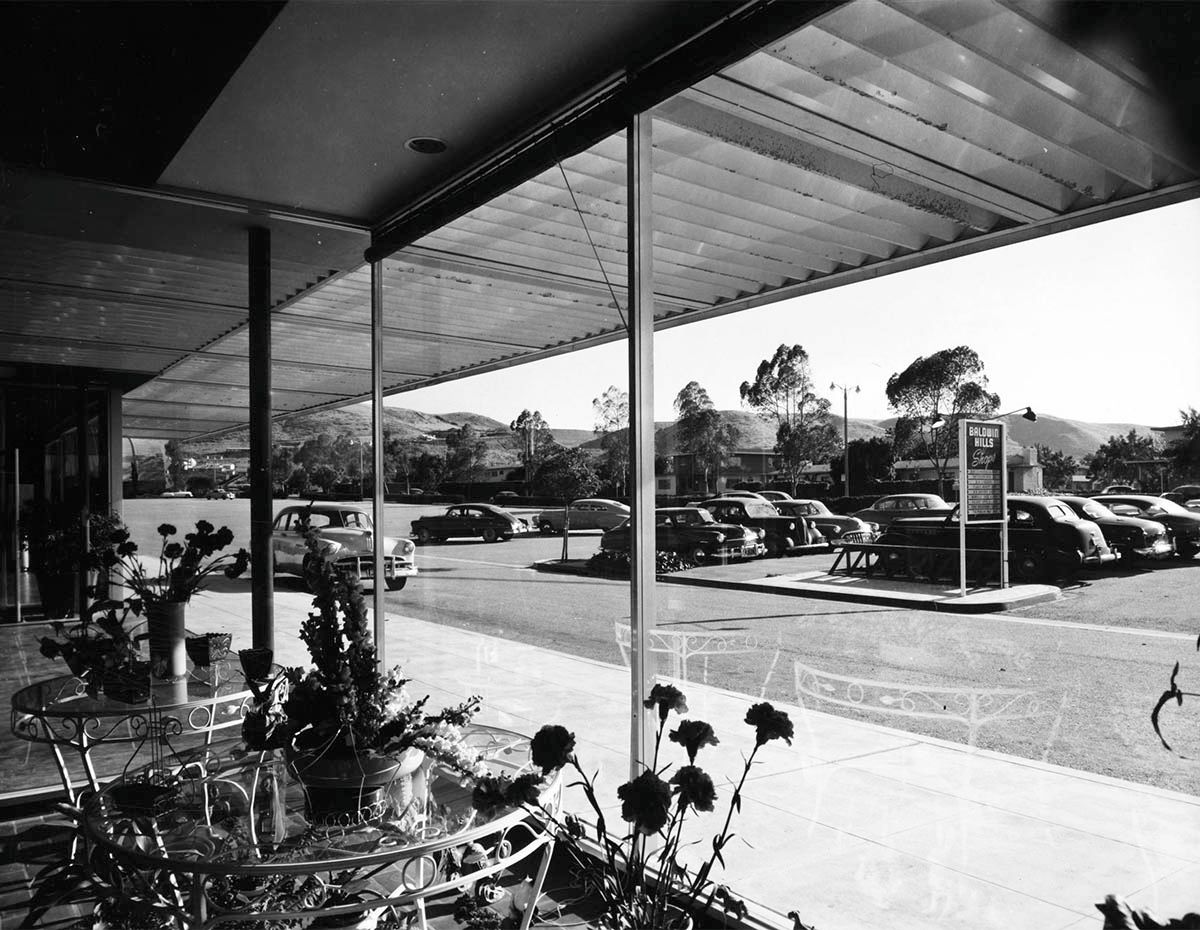
Thanks for the follow-up on the Baldwin Village Shops, srk1941. I knew you'd have loads of extra information. That 1963 flood image is fascinating - I can just see Gibraltar Savings at the far right.


---------------


We've seen the Panorama Market sign twice recently during my round-up of Julius Shulman/Bank of America branches (see post #30534 and post #31106). We also saw it in a follow-up by e_r in post #30543. These pictures are from 1956 (my earlier posts have pictures from 1951 and 1952), and show the shops on both sides of Van Nuys Boulevard, rather than just the east side. They also show the parking lots. This is Julius Shulman's "Job 2165: Fritz Burns, Panorama City Scenes (Los Angeles, Calif.),1956".

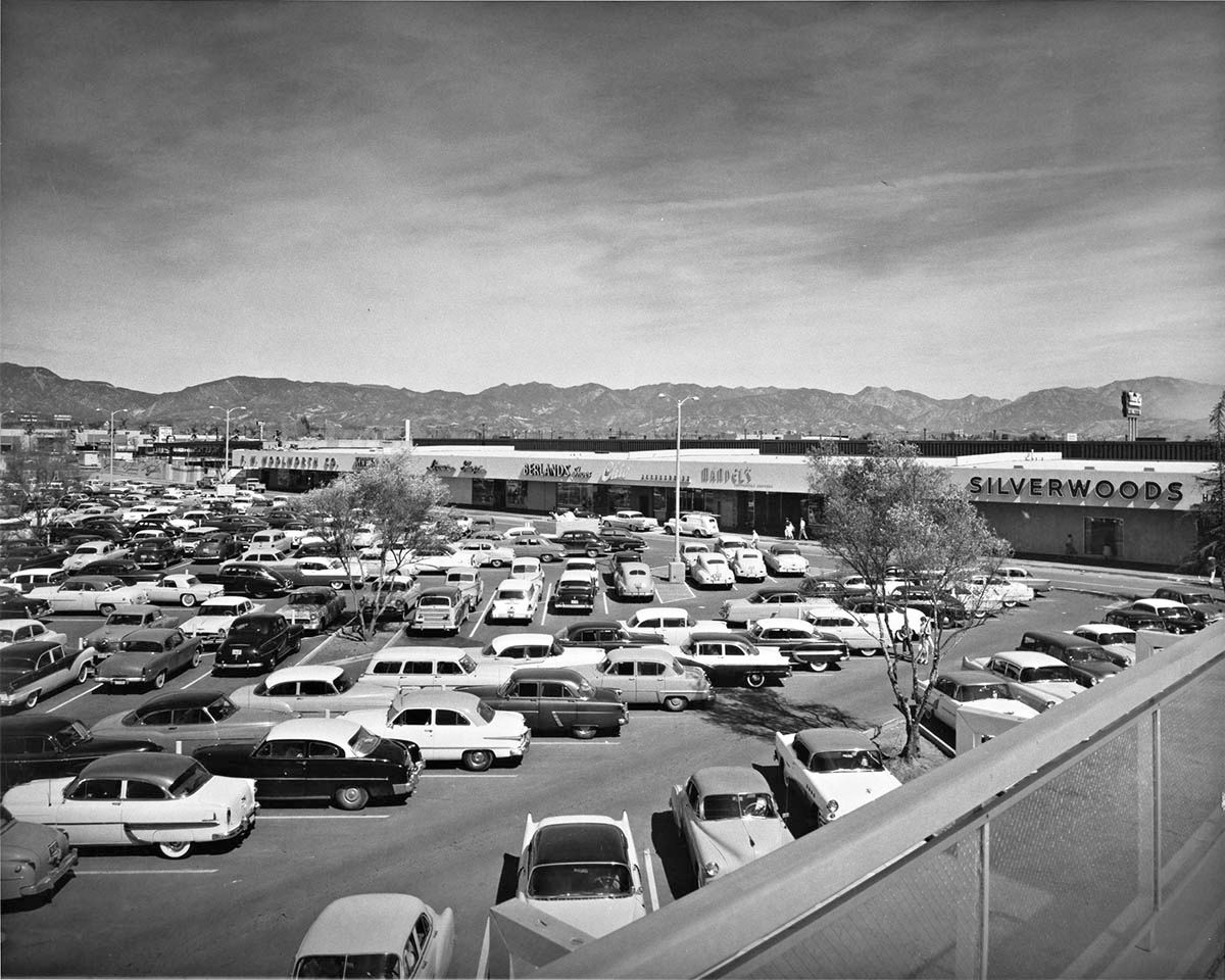
The first shot shows the parking lot behind the stores on the west side of Van Nuys Boulevard. Readable signs include F W Woolworth, Berlands Shoes, Chic Accesories, Mandel's and Silverwoods.


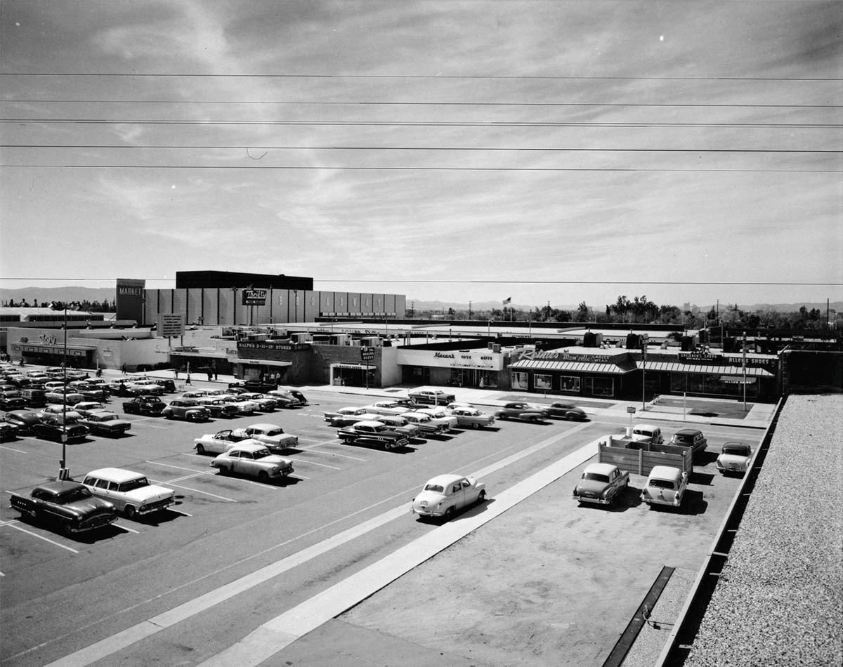
Now we're looking west at the backs of the stores on the east side of Van Nuys Boulevard. The stores here include Thrifty, Ralph's 5-10-25, The Baker's Dozen, Maxan's Toys & Gifts, Reinie's Mam'zelle Ladies' Wear, Kay's Children's Shops and Allen's Shoes. In the background is the Broadway store from where the photo above was taken.


This shot is looking north on Van Nuys Boulevard, and shows the fronts of the stores on the west side.


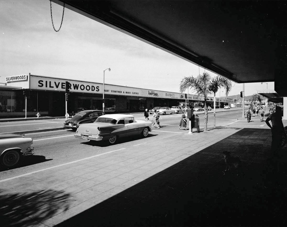
In the 1951 Shulman photoset (post #31106), the Bank of America branch was next to Allen's Shoes in the place occupied by Kay's Childen's Shops in this picture.


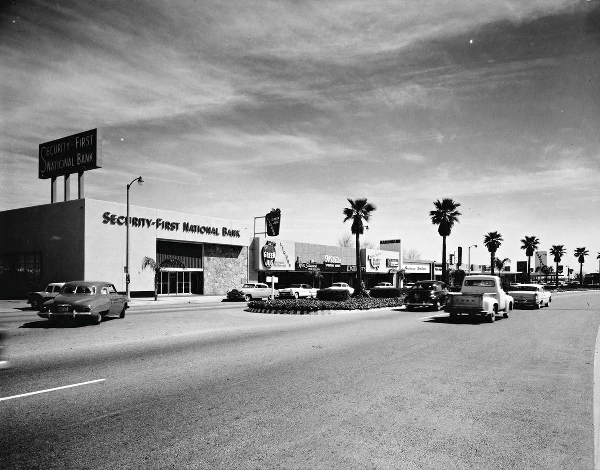
Although my previous post included a south-looking view from north of Chase Street, we didn't get a good look at the stores. Here we have Security-First National Bank, Green Jug Liquor, Wm Stevens Store For Men, Willis Sporting Goods and a Beauty Room, hardware store and pet shop with unreadable names.


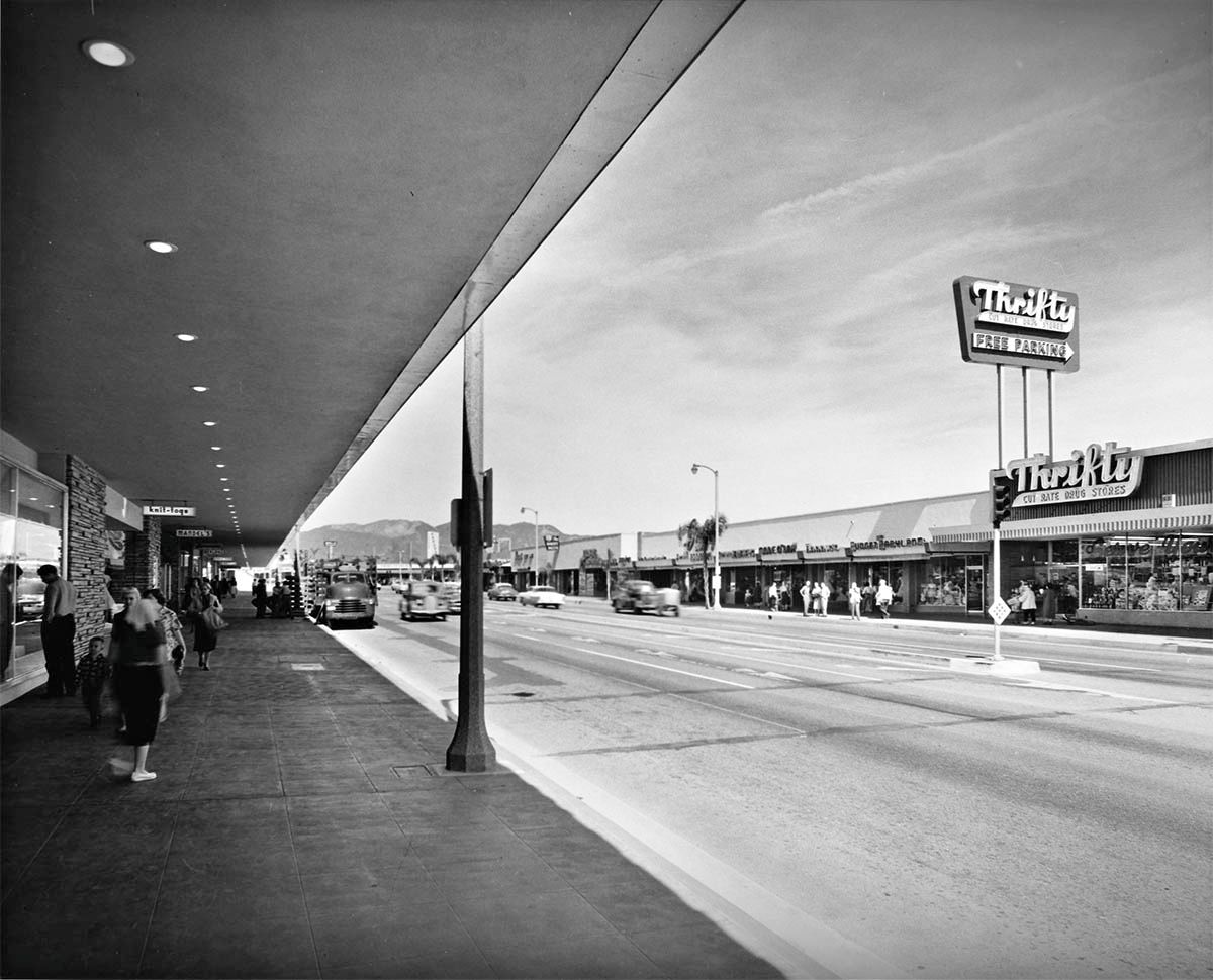
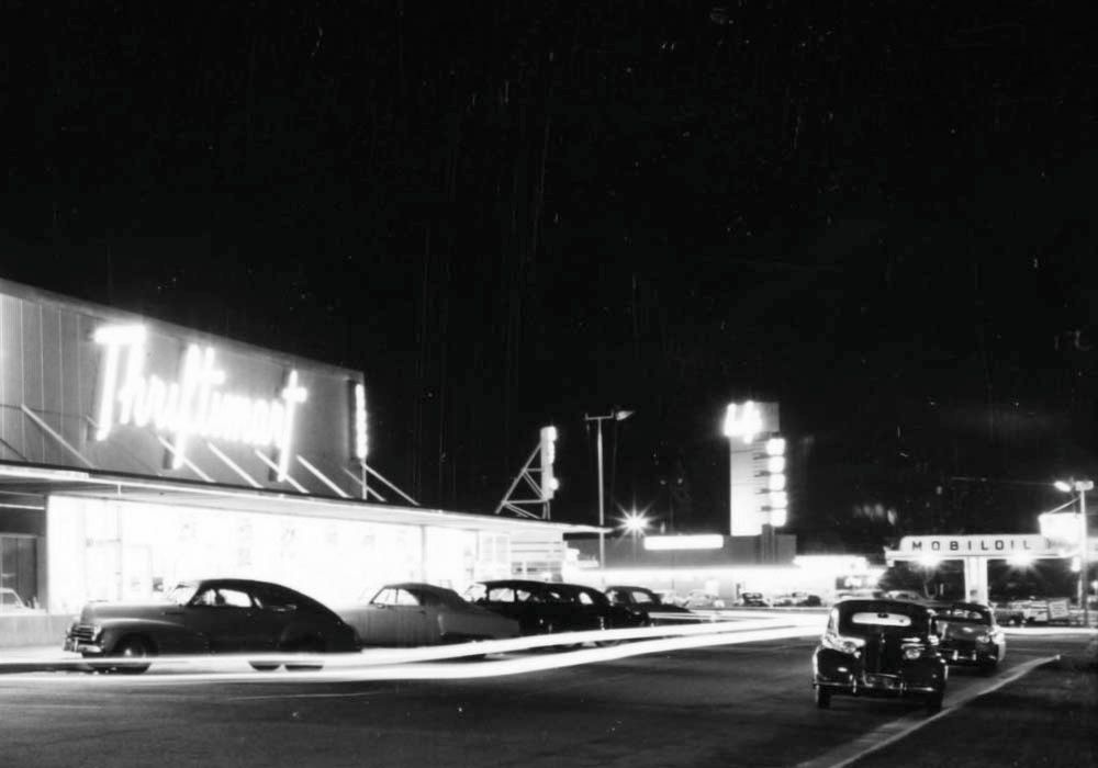
Jumping back south, we're in the parking lot of Thrifty once again.


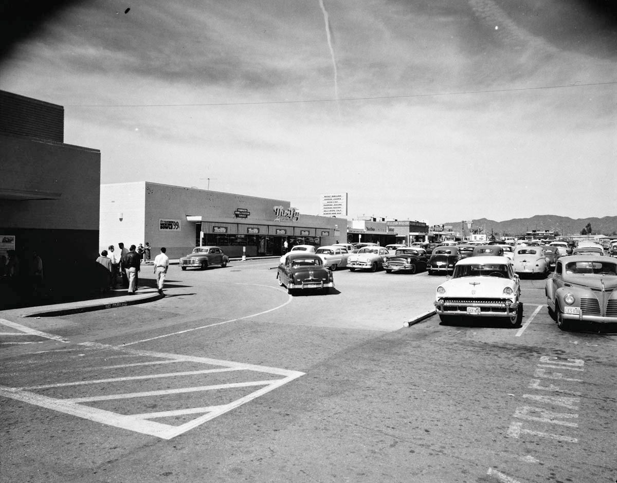
The parking was free at Thrifty!


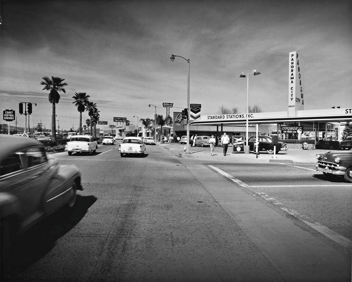
The Standard gas station was on the corner of Chase Street, with a 24-hour branch of Biff's just behind. I can't see any sign of the funfair which appeared in the earlier posts.


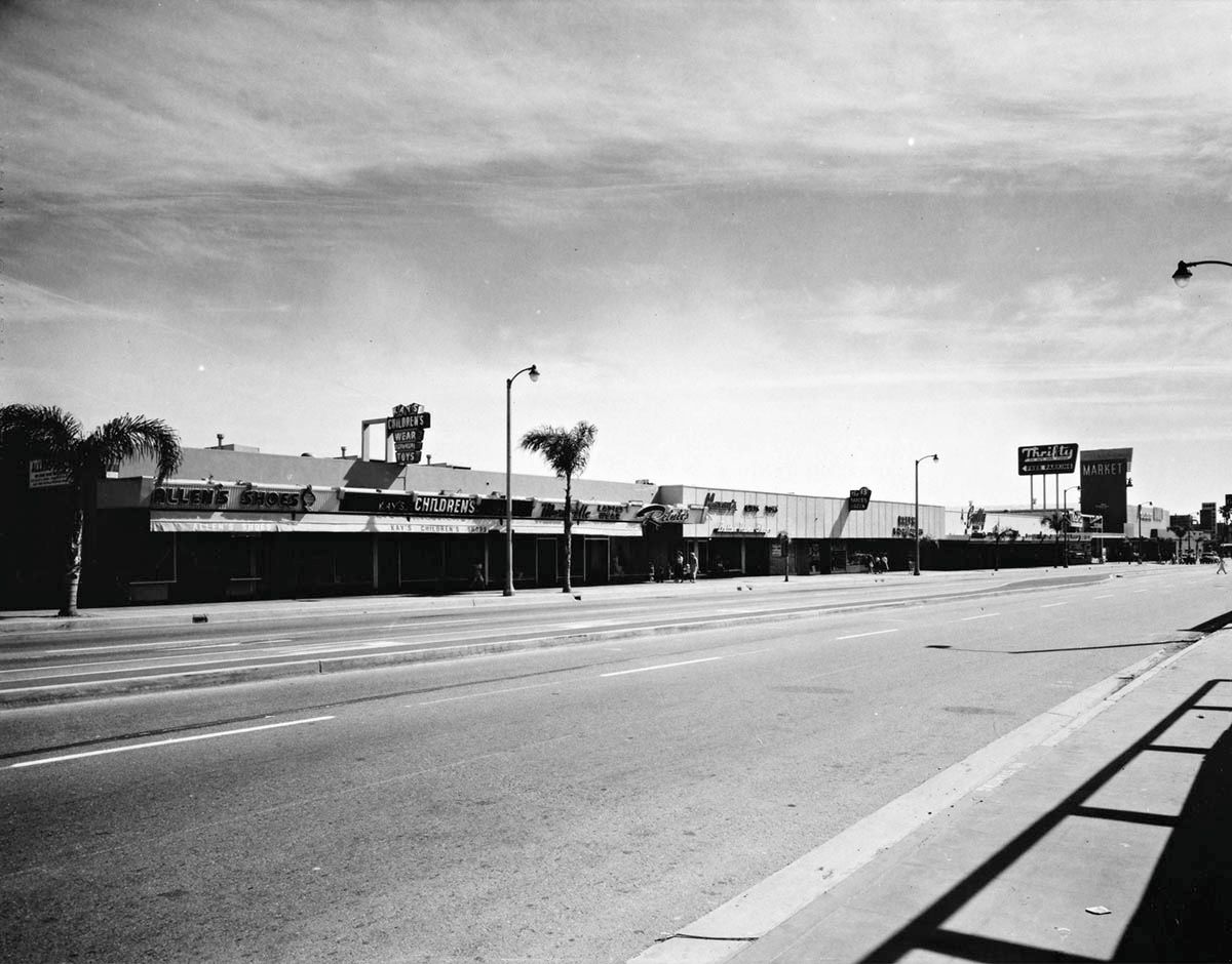
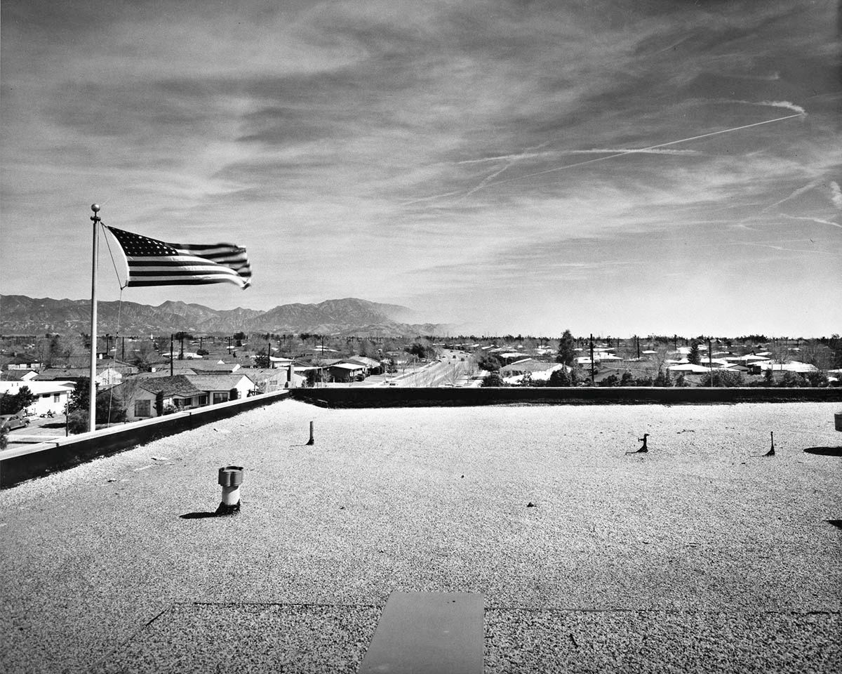
I'm not sure which roof this last shot was taken from, but I've included it for completeness, and because it's picturesque.


All from Getty Research Institute
Reply With Quote
     
     
  #31989  
Old Posted Nov 10, 2015, 9:44 PM
tovangar2 tovangar2 is offline
Registered User
 
Join Date: Nov 2012
Location: West Los Angeles
Posts: 2,625
Quote:
Originally Posted by Roy W View Post
...(Hugh McCrum) owned The Exchange Bar at that same address...
Would there be somewhere online that has a photograph of that part of the street?
What year are we talking about? That would really help with a search.

The photo below was taken after 1872 and shows a few buildings on the east side of Spring between 2nd and 3rd (in the background, just this side of St Vib's):

Quote:
Originally Posted by ethereal_reality View Post

ebay

Last edited by tovangar2; Nov 10, 2015 at 9:56 PM.
Reply With Quote
     
     
  #31990  
Old Posted Nov 10, 2015, 9:44 PM
HossC's Avatar
HossC HossC is offline
Registered User
 
Join Date: Aug 2013
Posts: 4,245
Quote:
Originally Posted by Roy W View Post

Hi all, Just joined the forum, i`m in Ireland and doing research on a g g g uncle who left Belfast for your shores on a `famine boat` in 1850, he became one of the pacific slopes old pioneers, first a miner, then a liquor dealer and finally Real Estate in and around San Francisco. I have found old newspaper digital records of him owning several bars in Prescott and Tombstone, one of note was The BirdCage (time of the Earp brothers Holliday etc).
So taking you back a few years to the 1899 photos posted here of 228 S Spring St, L.A. he (Hugh McCrum) owned The Exchange Bar at that same address. I wonder are those photos cropped? To the right i can make out what maybe is "Heritage Old ?? Whiskey" which maybe is the entrance to The Exchange?
Would there be somewhere online that has a photograph of that part of the street?

Thanks for any help.
Roy
Welcome to NLA, Roy W. Here's a clearer version of the image from LAPL. I'm still looking for wider shots which show the store.


LAPL

I could only find Hugh McCrum in the 1894 CD (below). His home residence is listed as San Francisco. By 1898, the proprietor of The Exchange had changed to Daniel B Jerrue.
McCrum Hugh, proprietor Exchange Saloon, 228 S.
Spring, r. San Francisco, Cal.
The address was obviously quite busy - I found another two businesses listed there in 1894.
Caledonian Coal Co., George C. Hickey general agent,
228 S. Spring.

Worth & Morrill (Conrad Worth, Herbert L. Morrill),
real estate and ticket brokers, 228 S. Spring.

Last edited by HossC; Nov 10, 2015 at 10:32 PM. Reason: Added CD info.
Reply With Quote
     
     
  #31991  
Old Posted Nov 10, 2015, 10:18 PM
ethereal_reality's Avatar
ethereal_reality ethereal_reality is offline
Registered User
 
Join Date: Feb 2008
Location: Lafayette/West Lafayette IN, Purdue U.
Posts: 16,344
Any idea what that white pot is in the lower right corner? (I thought it might be a spittoon, but it doesn't have that classic spittoon shape)

...and it looks like there are tiny little stairs leading up to it.
__

Welcome to "noirish Los Angeles" Roy W.

Last edited by ethereal_reality; Nov 10, 2015 at 10:48 PM.
Reply With Quote
     
     
  #31992  
Old Posted Nov 10, 2015, 10:37 PM
ethereal_reality's Avatar
ethereal_reality ethereal_reality is offline
Registered User
 
Join Date: Feb 2008
Location: Lafayette/West Lafayette IN, Purdue U.
Posts: 16,344
'mystery' photograph.

Here's how the seller describes it;

"Vintage Photograph 1924 Los Angeles Long Beach California Main Street Old Photo"


eBay

most intriguing is the tall "structure" in the middle of the street (behind the two posing 'flappers').


below: I've tried to improve the quality of the photo (without much success).


Does anyone on NLA recognize where this was taken? I'm thinking it's probably Long Beach.

You can view it on eBay here:
http://www.ebay.com/itm/VINTAGE-PHOT...YAAOSw9mFWNU2p


__

Last edited by ethereal_reality; Nov 10, 2015 at 11:32 PM.
Reply With Quote
     
     
  #31993  
Old Posted Nov 10, 2015, 10:51 PM
Roy W Roy W is offline
Registered User
 
Join Date: Nov 2015
Posts: 4
Many thanks HossC, ethereal_reality and tovangar2, the year was 1893 when it was opened again after a major fire in that area (stowell block)


Cali Newspaper digital record 11th Nov. 1893

Yes, that white pot, just what i thought at first glance - a spitoon!
Reply With Quote
     
     
  #31994  
Old Posted Nov 10, 2015, 10:54 PM
HossC's Avatar
HossC HossC is offline
Registered User
 
Join Date: Aug 2013
Posts: 4,245
Quote:
Originally Posted by ethereal_reality View Post

'mystery' photograph.

Here's how the seller describes it;

"Vintage Photograph 1924 Los Angeles Long Beach California Main Street Old Photo"


eBay

What's most intriguing to me is the tall "structure" in the middle of the street (behind the two posing 'flappers').
I think it's just a utility pole that's been cropped by the top of the photograph.

Reply With Quote
     
     
  #31995  
Old Posted Nov 10, 2015, 11:25 PM
ethereal_reality's Avatar
ethereal_reality ethereal_reality is offline
Registered User
 
Join Date: Feb 2008
Location: Lafayette/West Lafayette IN, Purdue U.
Posts: 16,344
You're right. It's quite obvious..........now.
I see one in the distance.

I thought it might be something special, and that's why the two girls were posing in front of it.
-like a large advertisement (for some silent movie epic), and we were just seeing the side of it.

I blame it all on my unbridled imagination .

Last edited by ethereal_reality; Nov 10, 2015 at 11:37 PM.
Reply With Quote
     
     
  #31996  
Old Posted Nov 10, 2015, 11:34 PM
HossC's Avatar
HossC HossC is offline
Registered User
 
Join Date: Aug 2013
Posts: 4,245
Quote:
Originally Posted by Roy W View Post

Many thanks HossC, ethereal_reality and tovangar2, the year was 1893 when it was opened again after a major fire in that area (stowell block)


Cali Newspaper digital record 11th Nov. 1893

Yes, that white pot, just what i thought at first glance - a spitoon!
Here are two undated pictures of the Stowell Block. The first shows members of the Los Angeles Athletic Club posing for a group portrait. We can see the signs for excursions and coal on 228, but the bar is just out of shot again.


LAPL

Here's the whole Stowell Block. I found S Magnus, ticket broker, and A J Stevens, dentist, listed in the building in the 1896 CD. Incidentally, it looks like Tom Jones had taken over as proprietor of The Exchange by 1896.


LAPL
Reply With Quote
     
     
  #31997  
Old Posted Nov 10, 2015, 11:36 PM
rbpjr rbpjr is offline
Registered User
 
Join Date: Mar 2011
Posts: 117
Looking for photos of the Dickens Street school in Sherman Oaks...attended there around 1946...not sure it is still there...
Reply With Quote
     
     
  #31998  
Old Posted Nov 10, 2015, 11:39 PM
Flyingwedge's Avatar
Flyingwedge Flyingwedge is offline
Registered User
 
Join Date: Jun 2012
Location: Los Angeles
Posts: 1,126
Stowell Block

Quote:
Originally Posted by Roy W View Post
Many thanks HossC, ethereal_reality and tovangar2, the year was 1893 when it was opened again after a major fire in that area (stowell block)


Cali Newspaper digital record 11th Nov. 1893

Yes, that white pot, just what i thought at first glance - a spitoon!
The 1894 LA City Directory is the only one to show your ancestor as the proprietor of the Exchange Saloon:


(Both) 1894 LA City Directory @ fold3.com

In the 1895 LA City Directory, T. A. Jones is listed as the proprietor of the Exchange Saloon. By 1896 the proprietor
is that Jerrue guy HossC mentioned.
Reply With Quote
     
     
  #31999  
Old Posted Nov 11, 2015, 12:43 AM
ethereal_reality's Avatar
ethereal_reality ethereal_reality is offline
Registered User
 
Join Date: Feb 2008
Location: Lafayette/West Lafayette IN, Purdue U.
Posts: 16,344
"1920 Leonard B. Slosson Lawyer Los Angeles Home"


eBay


The seller didn't include a street address, but I found Leonard B. Slosson listed in the 1923 city directory (below).


lapl


Here's the house as it appears today.


gsv

The home was built in 1917. It features 4 bedrooms and 4 baths.
I wasn't able to find the name of the architect.
Reply With Quote
     
     
  #32000  
Old Posted Nov 11, 2015, 2:31 AM
sopas ej's Avatar
sopas ej sopas ej is offline
Registered User
 
Join Date: Jul 2007
Location: South Pasadena, California
Posts: 6,852
Looking south on what is now the 405 at the 101, July 3, 1958. This would be Sherman Oaks, but it looks like it's out in the middle of nowhere. I guess Sherman Oaks *was* in the middle of nowhere, back then.

USC Archive
__________________
"I guess the only time people think about injustice is when it happens to them."

~ Charles Bukowski
Reply With Quote
     
     
This discussion thread continues

Use the page links to the lower-right to go to the next page for additional posts

Reply

Go Back   SkyscraperPage Forum > Photography Forums > Found City Photos
Forum Jump


Thread Tools
Display Modes

Forum Jump


All times are GMT. The time now is 12:41 PM.

     
SkyscraperPage.com - Archive - Privacy Statement - Top

Powered by vBulletin® Version 3.8.7
Copyright ©2000 - 2024, vBulletin Solutions, Inc.