Quote:
Originally Posted by ethereal_reality

-mid-century modern:
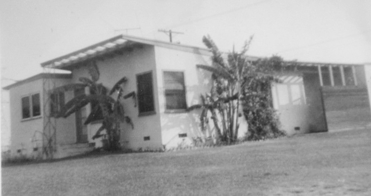
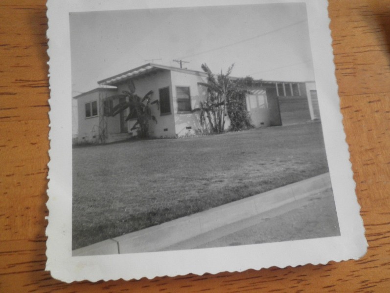
Snapshot of 3000 Clyde Avenue, 1950s. (just north of W. Jefferson Blvd.)
eBay
and today
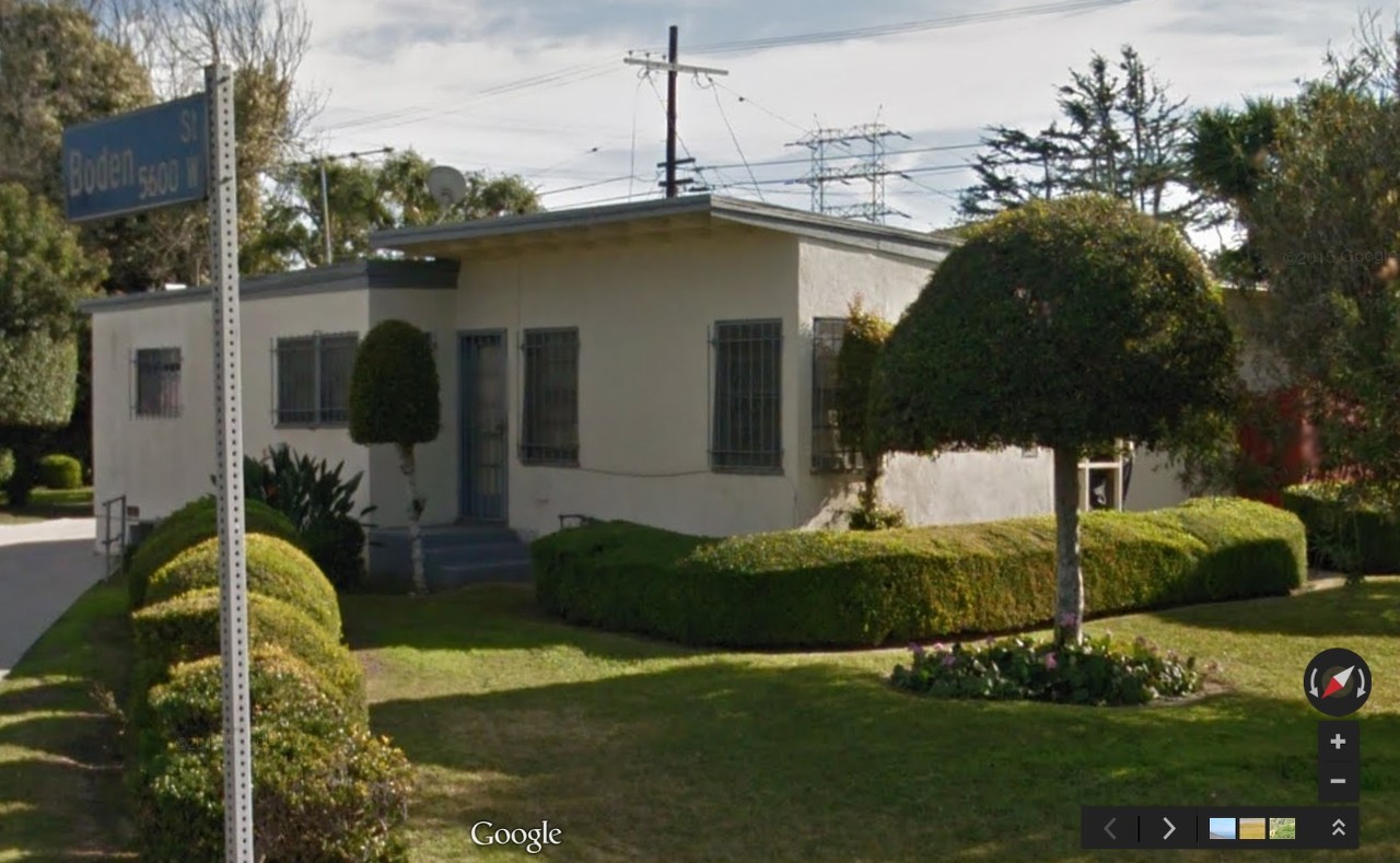
gsv
It's located next to some pretty intense looking power lines.
In this aerial the power lines are at top. (there's a second garage in the back) -or maybe it's a rental property.
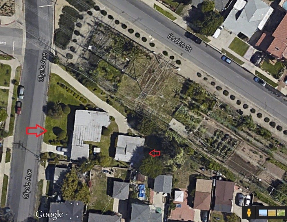
google earth
notice that the high-voltage power-lines are missing in the 1950s views. the owner must have been pretty pissed when they erected them so close to his house. |
3000 Clyde was built on the site of short-lived Spartan Field, which was at 2801 Clyde. On the lower map, the street that hits Jefferson in the lower right corner is probably Hauser Blvd:
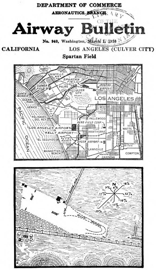
Airway Bulletin No. 940, March 1, 1930 @ HathiTrust --
http://babel.hathitrust.org/cgi/pt?i...ew=1up;seq=285
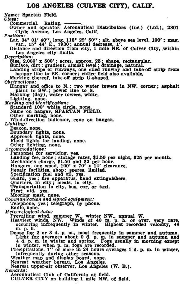
Airway Bulletin No. 940, March 1, 1930 @ HathiTrust --
http://babel.hathitrust.org/cgi/pt?i...ew=1up;seq=286
Spartan Field was gone by February 1931:

Air Commerce Bulletin v. 2 No. 15, February 2, 1931 @ HathiTrust --
http://babel.hathitrust.org/cgi/pt?i...ew=1up;seq=404
This c. 1940 Spence Air Photo looks south at the Baldwin Hills. The two streets entering the hills are La Brea at left and Moynier Lane (now La Cienega) at right by the 57.
The former Spartan Field site is in the triangular area near the lower right corner. The intersection at the area's southwest corner is Moyner/La Cienega and Jefferson Blvd.
The street that runs through houses left to right near the bottom of the photo is Blackwelder Street, whose western terminus is at Clyde. Clyde's southern terminus is at
the edge of the old Spartan Field site, about where the utility line right-of-way is today.
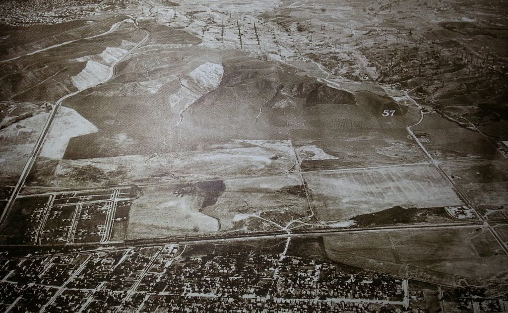
Photo from
Rancho Cienega o Paso de la Tijera by Virginia French (John D. Roche, Inc., Los Angeles, 1970)
The Spartan Field site today, looking north:
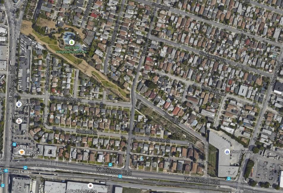
GoogleEarth


 Prev
Prev


 Linear Mode
