Quote:
Originally Posted by SignalHillHiker

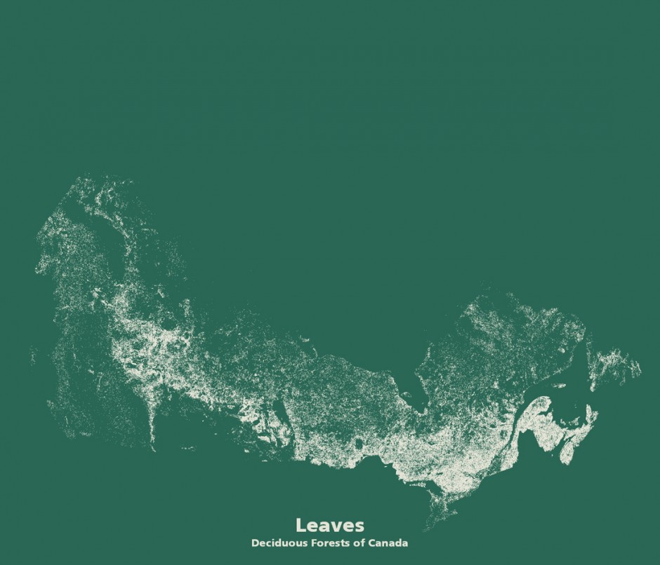
Very nice. I'm surprised by the amount of deciduous forests we have. I know a few areas where they occur naturally but mostly they seem to be an urban introduction.
|
The "leaves" map must include shrubs...
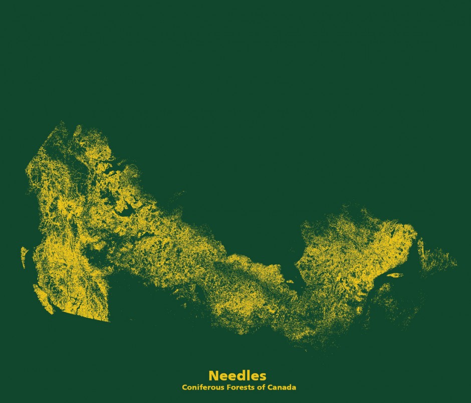
Also, the "needles" map is obviously incorrect for southern Quebec. Looking at the first two maps, it's all deciduous with no conifers at all.
While those two maps represent pretty correctly for this area what would be the long-term stable result of ecological succession (a mostly Sugar Maple + American Beech forest cover:
https://en.wikipedia.org/wiki/Beech-maple_forest ) as well as the state the first Europeans found the land (... this is just saying the exact same thing in different words) it doesn't accurately show what's currently growing there. There are many, many areas that have been replanted with conifers for economical reasons, or that have been cut more or less recently and, left to their own devices, are currently a mix of birch, aspen, spruce, and balsam fir (all of those grow faster than maple, oak, etc.)
Clearly, showing zero conifers (total lack of dots) in some areas where I'm very familiar with the current forest cover, it's not accurate.
Edit: those maps are very interesting, I don't want to sound like I'm complaining too much


 Prev
Prev


 Linear Mode
