How California is turning drainage canals back to rivers
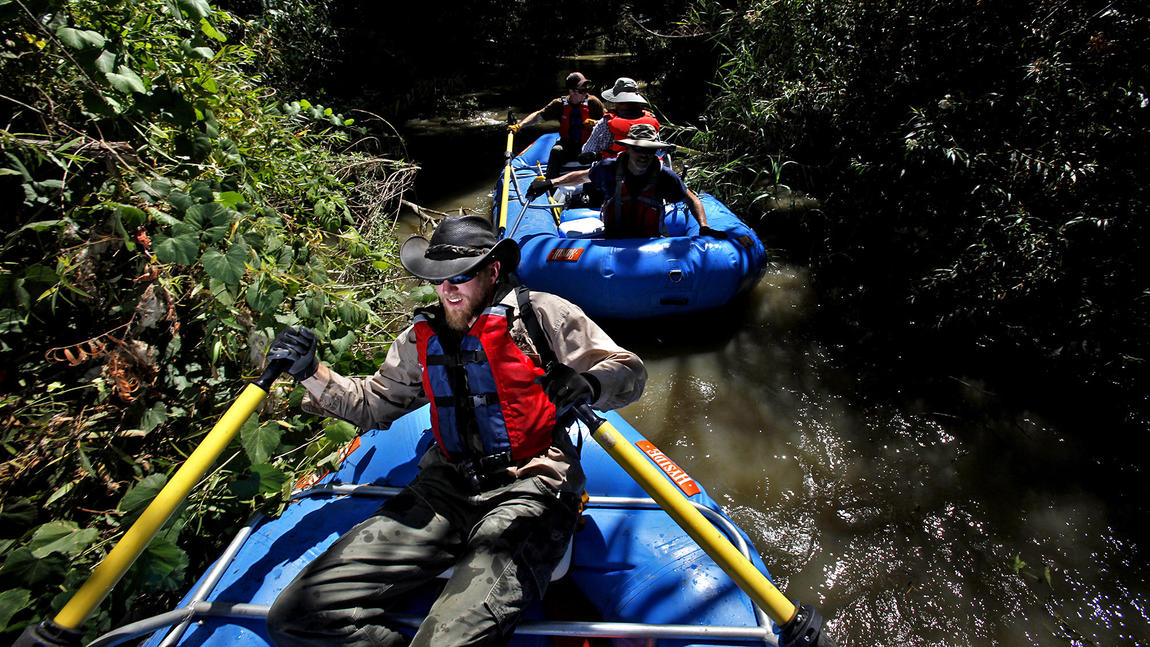
Under recently approved legislation, long stretches of the flood control channel's banks will have trails, parks and natural areas, and portions of the river itself will be cleared of boulders, low-hanging limbs and other entanglements to open the waterway to kayaking and rafting.
Under the legislation by state Sen. Lou Correa (D-Santa Ana), the Santa Ana River Conservancy Program will operate within the state Coastal Conservancy to improve conditions for wildlife and provide amenities for hiking, biking, picnicking, fishing, horseback riding and other activities in one of the fastest-growing regions in the nation.
Correa's measure was modeled after a 17-year-old Coastal Conservancy program dedicated to improving public access to open space and wildlife habitat in the Bay Area.
The Santa Ana, formally known in Orange County as Flood Control Channel EO 1, has numerous hidden, shady places that support a remarkably rich variety of species.
The 2,150 acres of wetlands behind Prado Dam near the Orange-Riverside county border, for instance, comprise a labyrinth of channels, ponds and forests. Despite a development boom in neighboring Chino, Corona and Norco, the wetlands area is still a haven for threatened and federally endangered species including red-sided garter snakes and least Bell's vireos.
High on Correa's wish list of recreational projects is construction of 30 miles of trail to complete a 110-mile-long trail from Big Bear Lake to Huntington Beach.
Ultimately, the trail could link a network of river-bottom parks. The city of Redlands, for example, plans to develop riverside green space beneath the San Bernardino Mountains to attract hikers and bicyclists, some of whom would shop and dine in its nearby historic downtown district.


 Prev
Prev


 Linear Mode
