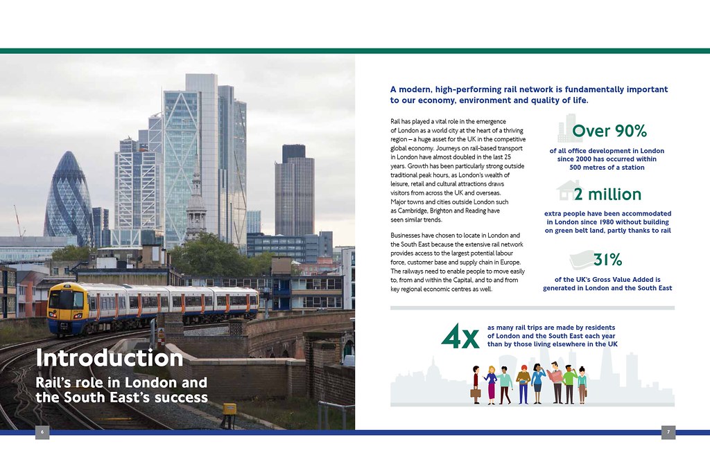
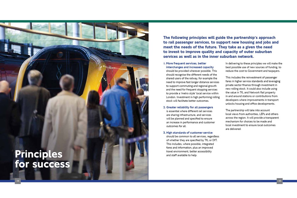
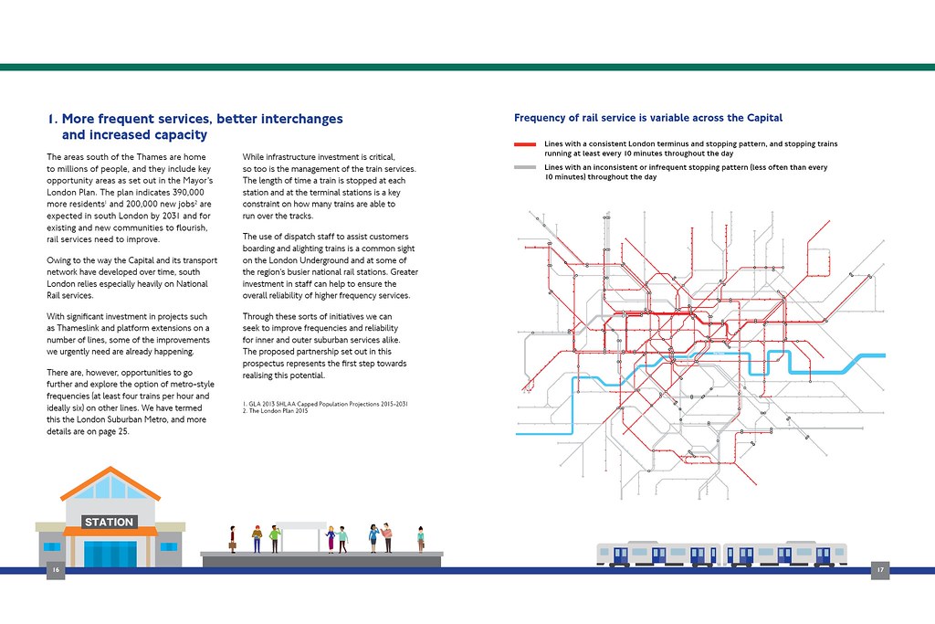
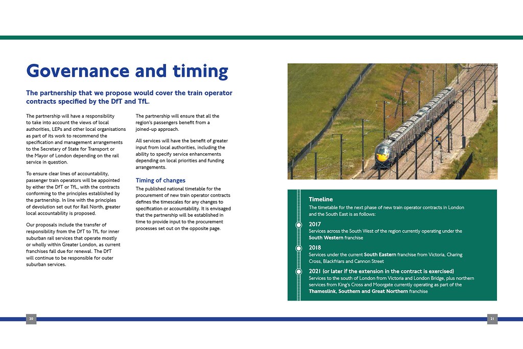
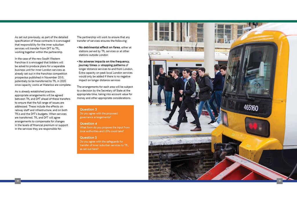
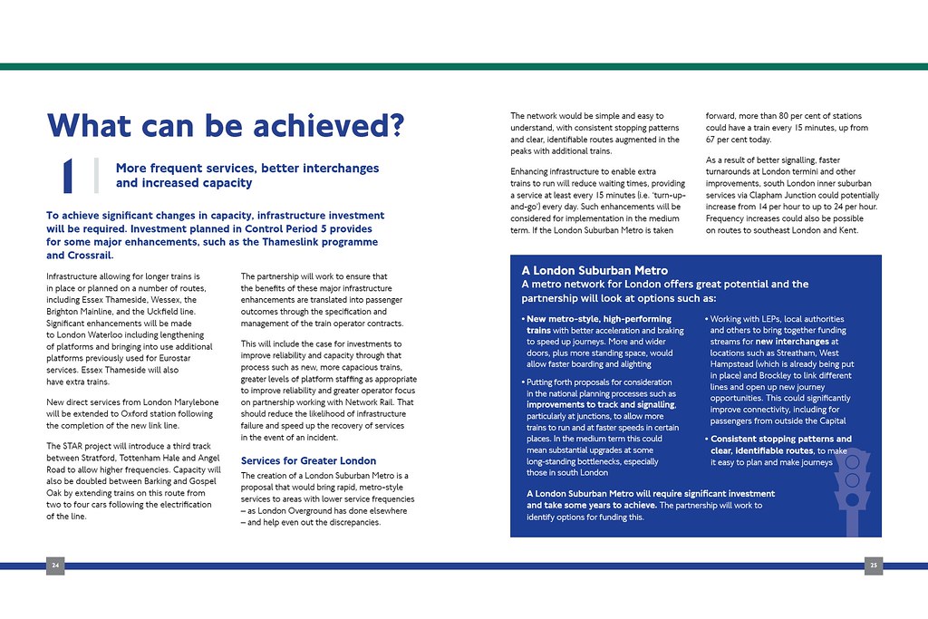
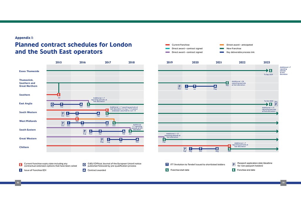
Crossrail
• Video Link
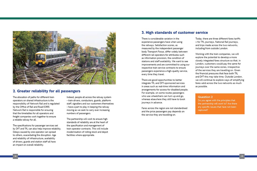
• Video Link
And because I’m kind an overly dramatic video of one of the ventilation shaft at Bond Street (it has to be so tall due to the surrounding development that will be built atop the station box).
• Video Link
Gospel Oak to Barking Line (GOBLin) Upgrade
The GOBLin is an orbital route that runs across north/north-east London that is currently undergoing a significant £133mn upgrade to electrify the route and enable longer trains and increased frequencies. I use the line quite a lot and it is busy at all hours of the week
• Video Link
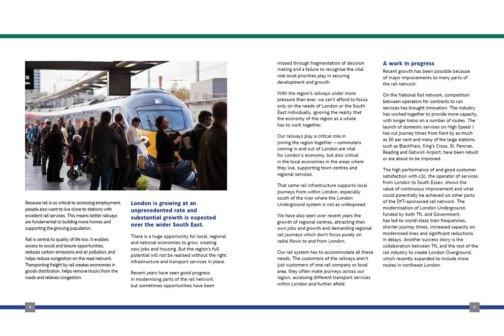
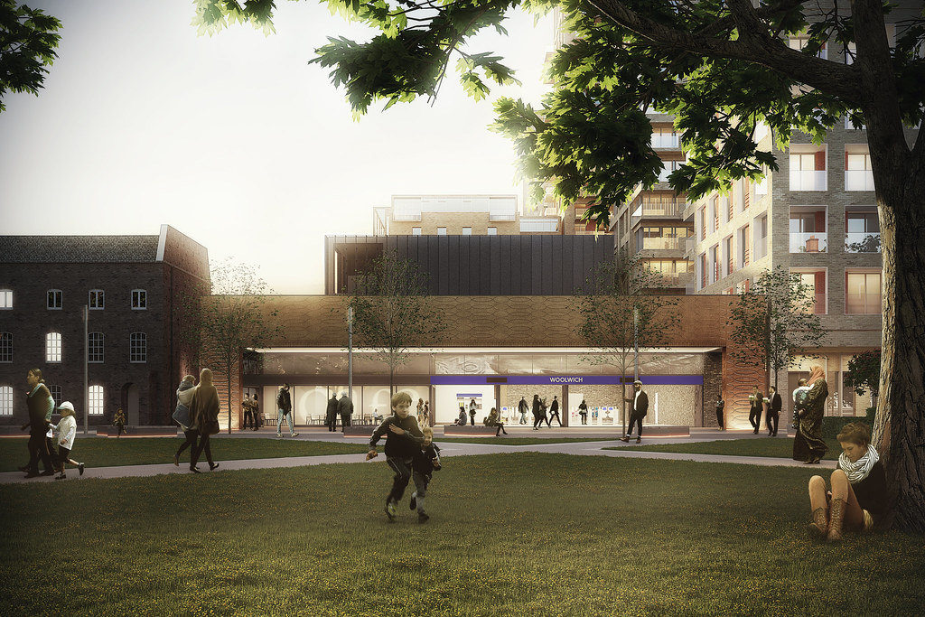
Rochester Station
A new £26mn station opened in Kent in December on the Chatham Main Line, replacing the old congested station which was half a kilometre down the line. One of the key attributes of the station is the ability to now handle 12-car trains across each of its three platforms. This now means that an extra five trains depart Rochester (three to Victoria, two to Cannon Street) in the peak hours helping to relieve congestion on the north Kent lines.
The new station also provides improved access to the bus network, is closer to the town centre and its historic castle and cathedral, as well as providing improved redevelopment opportunities along the Medway river to the north. A multi-storey car park will follow later in the year.
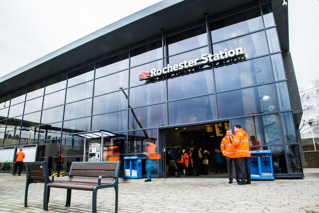 Image sourced from Network Rail: http://www.networkrailmediacentre.co...e-regeneration
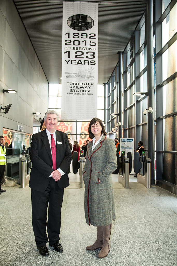 Image sourced from Network Rail: http://www.networkrailmediacentre.co...e-regeneration
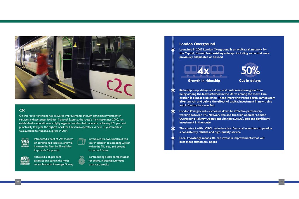
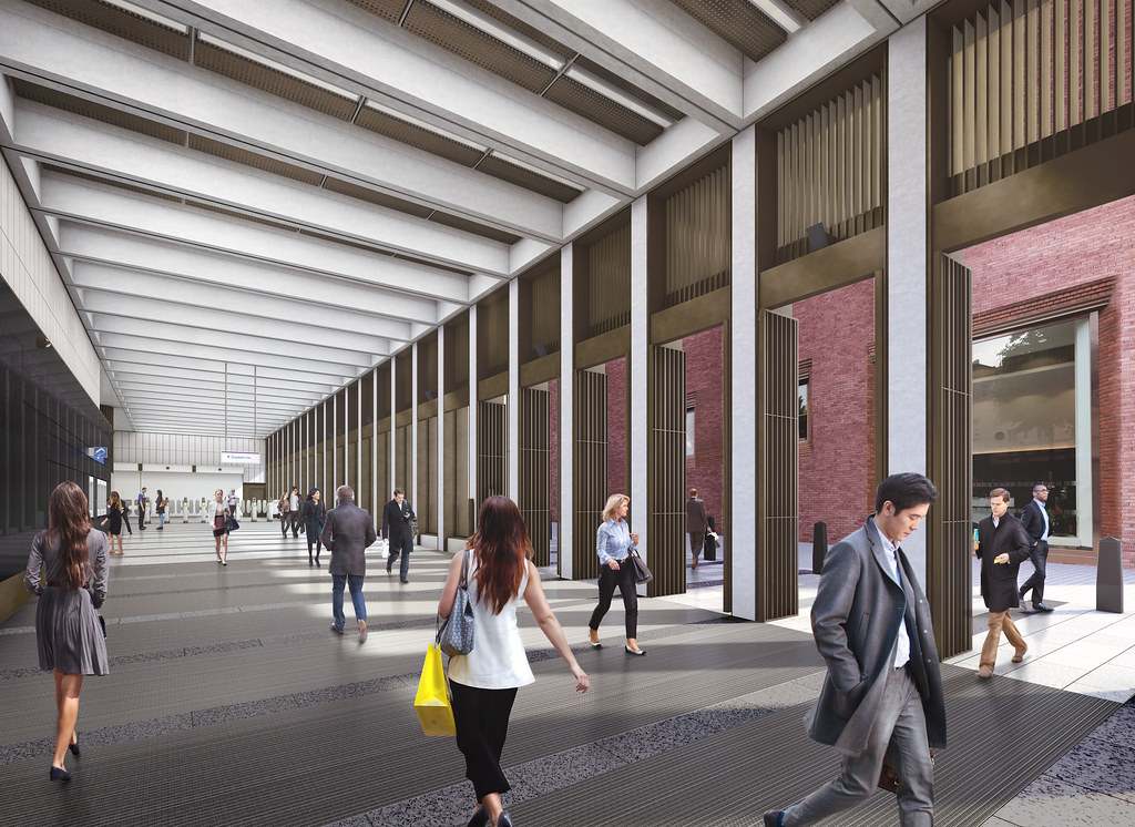
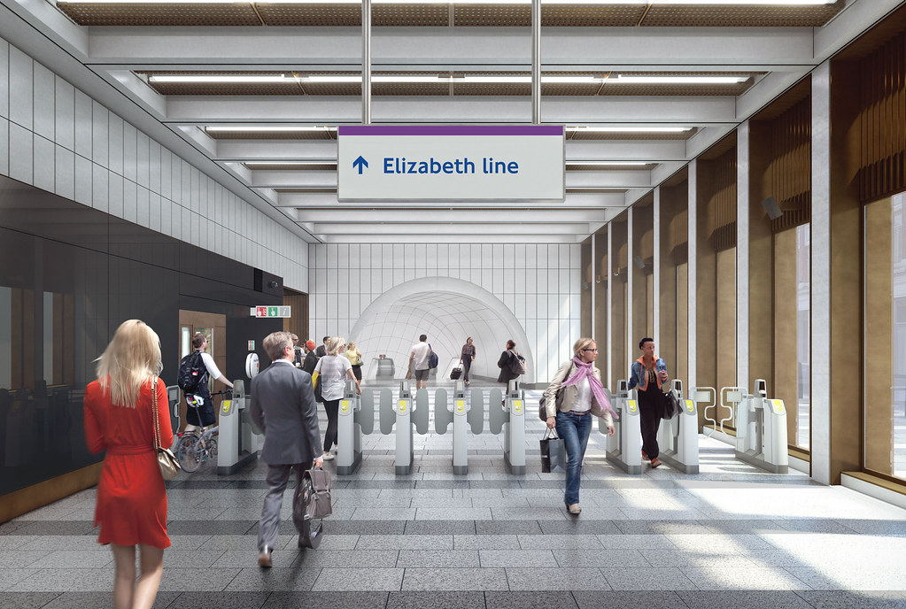
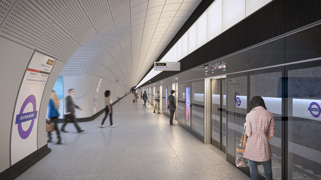
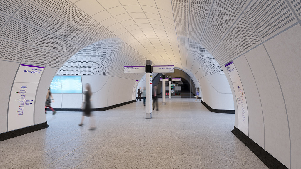
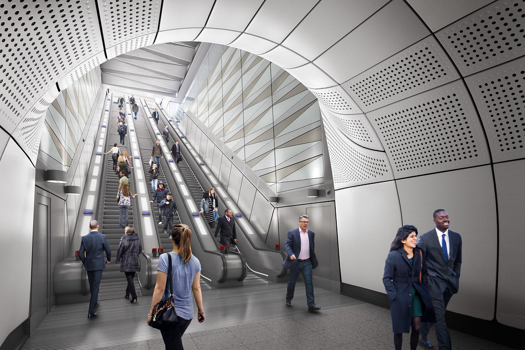
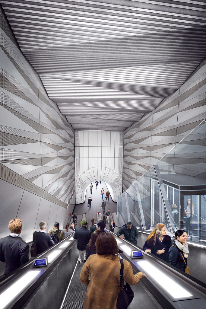
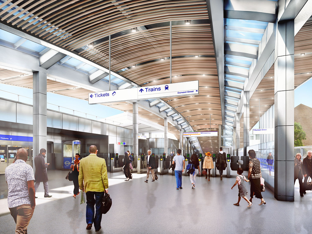
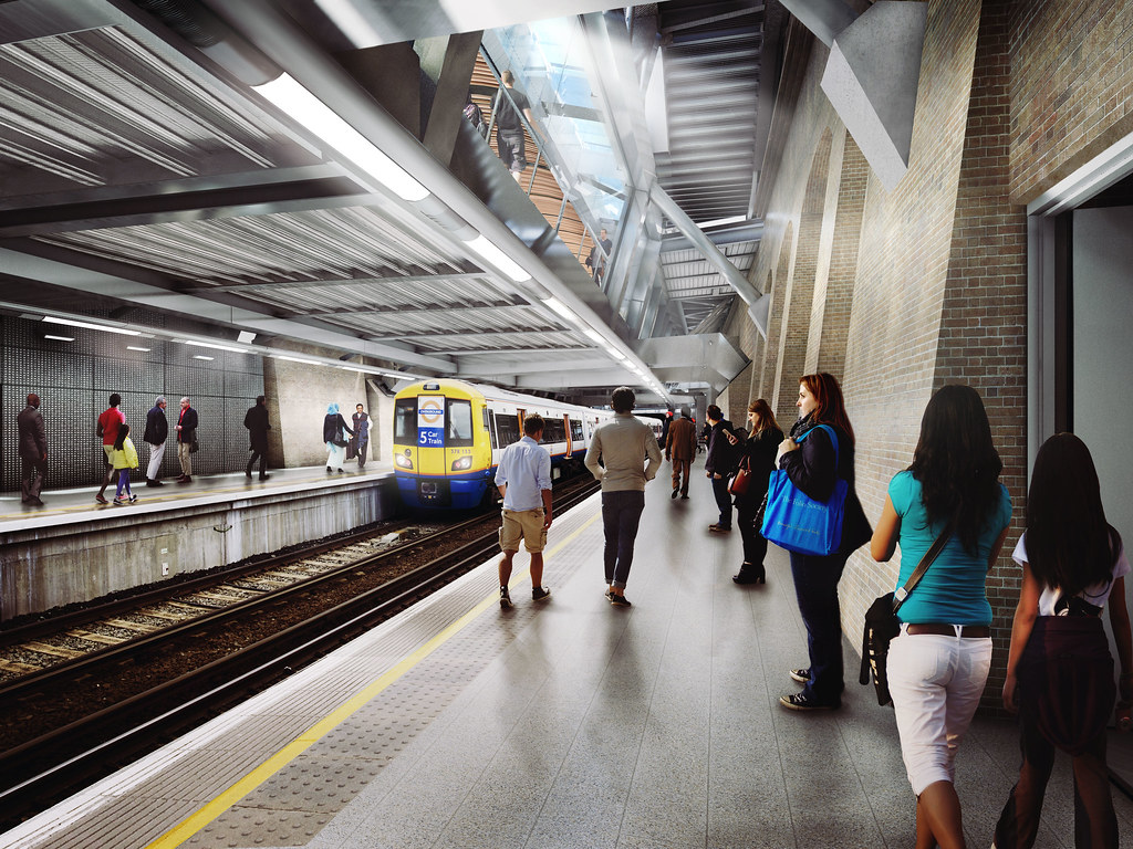
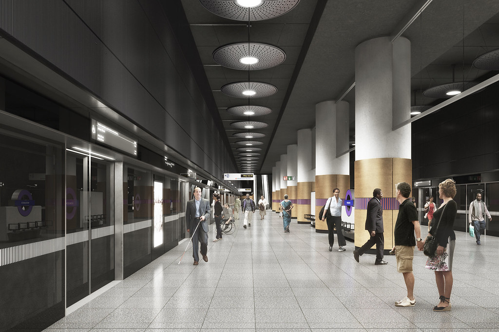
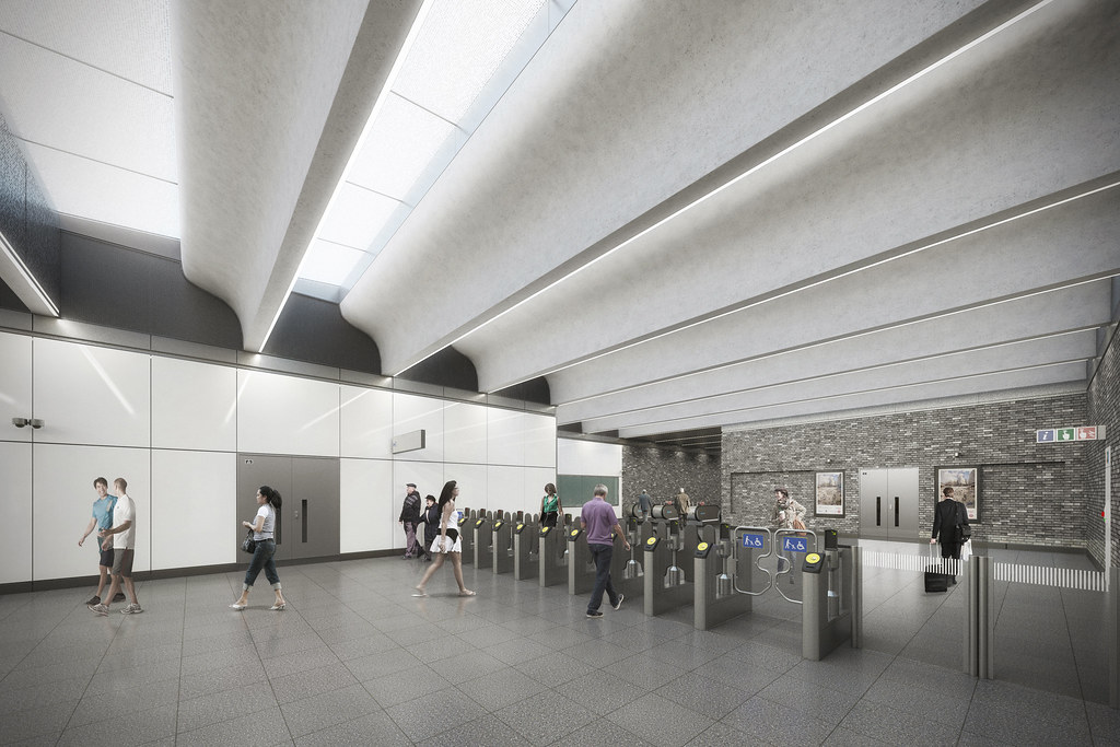
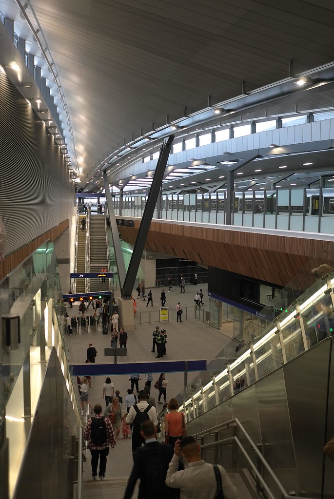
Tottenham Court Road Station
Image sourced from Network Rail: http://www.networkrailmediacentre.co...e-regeneration
Tottenham Court Road Station
Work has been completed on the new TCR South Plaza Entrance #1
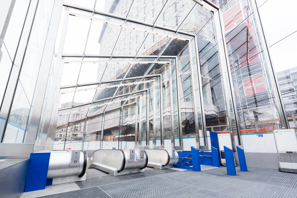 Image sourced from Transport for London Press Images: https://www.flickr.com/photos/tflpre...077773/sizes/l
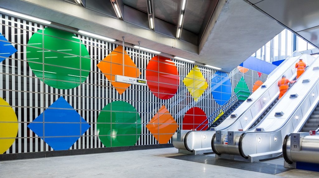 Image sourced from Transport for London Press Images: https://www.flickr.com/photos/tflpre...679691/sizes/l
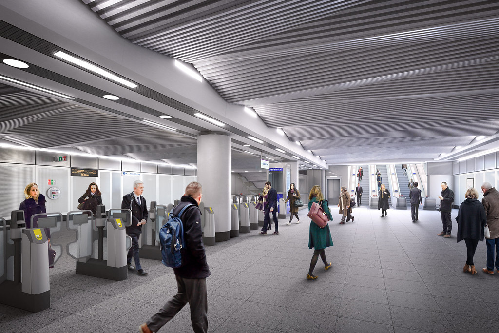
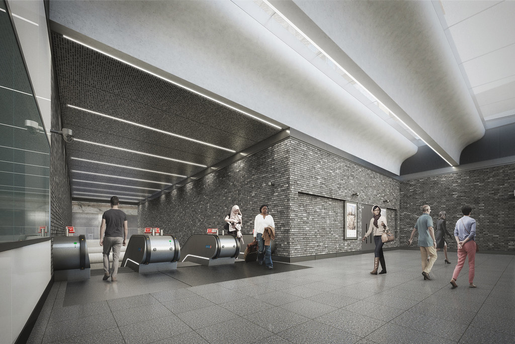
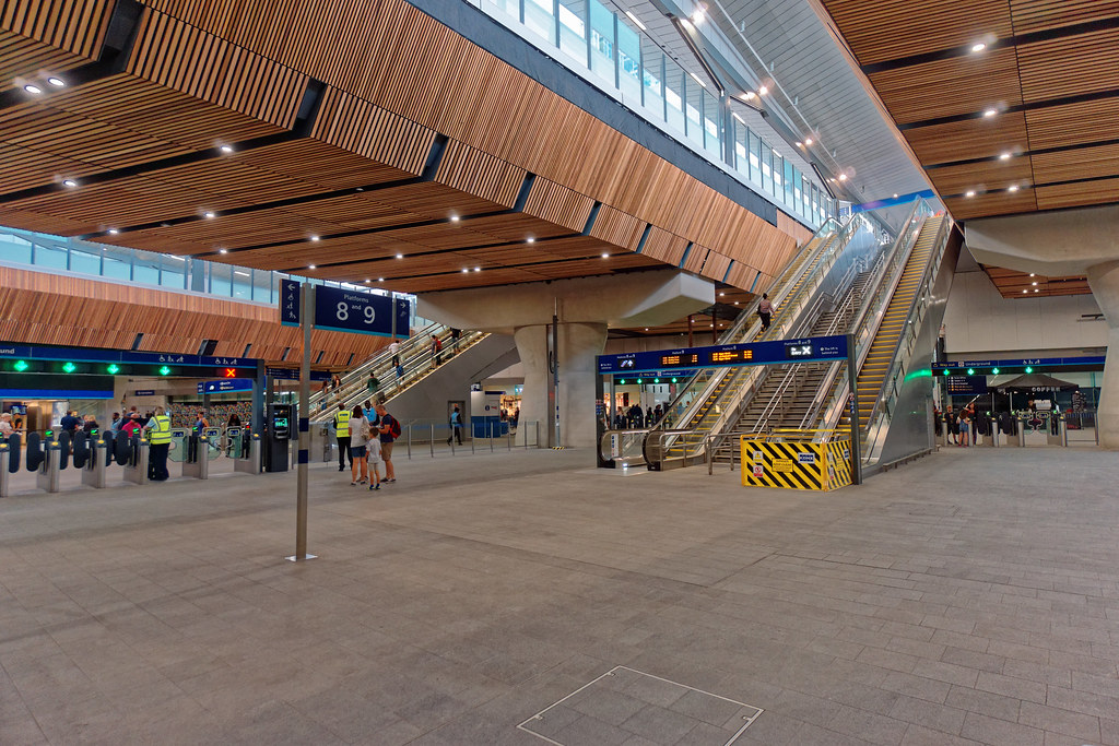
In addition a picture of the massively expanded ticket hall at Tottenham Court Rail. Another ticket-hall on Dean Streetdue west is under construction and will enable more direct access to Crossrail. Another two ticket-halls are planned as part of Crossrail 2
 Image sourced from MoreToJack: https://www.flickr.com/photos/bluego...145139/sizes/l
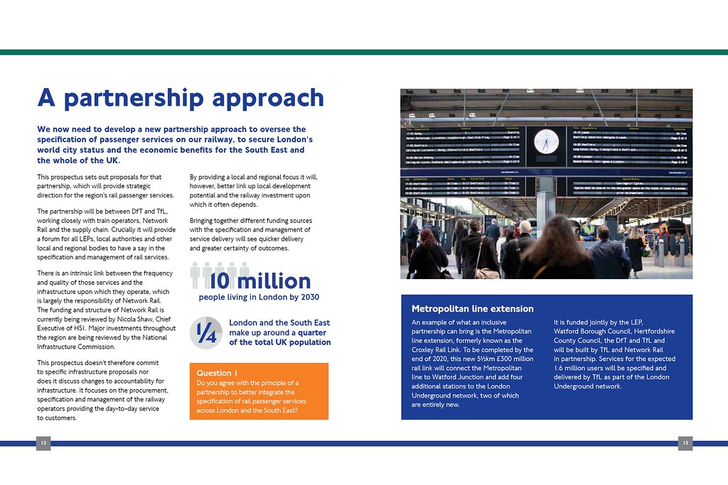
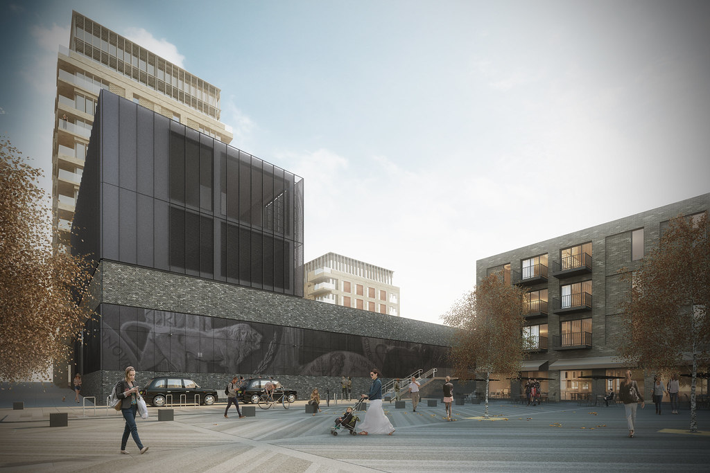
New River Crossings for London
Image sourced from MoreToJack: https://www.flickr.com/photos/bluego...145139/sizes/l
New River Crossings for London
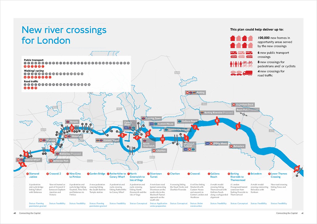 Image sourced from Transport for London Press Images: https://www.flickr.com/photos/tflpre...341551/sizes/l
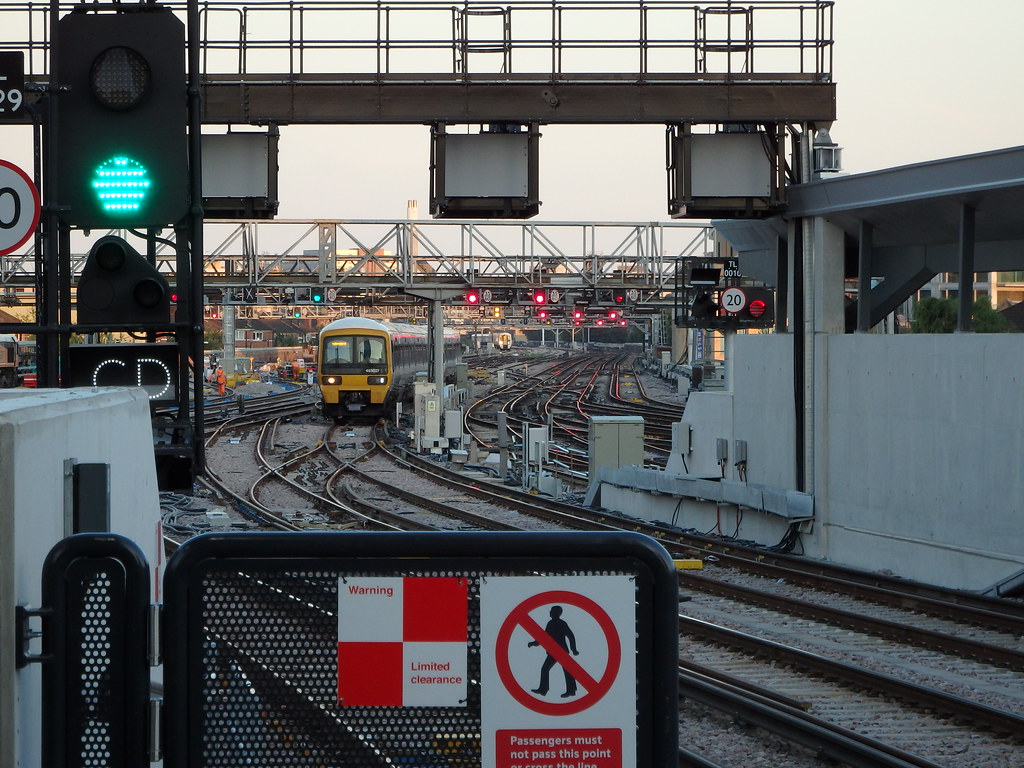
Lower Thames Crossing
Image sourced from Transport for London Press Images: https://www.flickr.com/photos/tflpre...341551/sizes/l
Lower Thames Crossing
The present Dartford Crossing is a heavily congested vehicular crossing on the Eastern fringes of London. As per the above graphic, there are various developments to increase the number of crossings in East London, but one of the perennial reasons for congestion at Dartford is freight traffic from the continent heading up north and the orbital traffic skirting around London. In the following image, southbound traffic heads over the QEII Bridge, whilst northbound traffic uses the two tunnels. Also visible in the foreground is High Speed 1 which weaves between the tunnel exit and bridge approach before making its decent into a tunnel under the Thames.
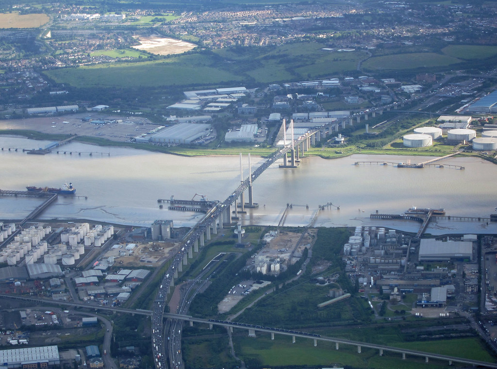 Image taken by Neil Pulling on Flickr: https://www.flickr.com/photos/270458...218166/sizes/l
In recent years the Department for Transport has been undertaking consultations on to appropriate solution, and they have now come up with a proposed scheme which consists of a two mile tunnel (Location C) under the Thames, a connection to the M25 orbital motorway south of Junction 29 (route 3) and a southern connection to the M2 at Junction 1. Of interest, the ever ongoing plans for a Thames Estuary airport advised of a tunnel crossing in this vicinity.
 Image sourced from Highways England: https://highwaysengland.citizenspace...g-consultation
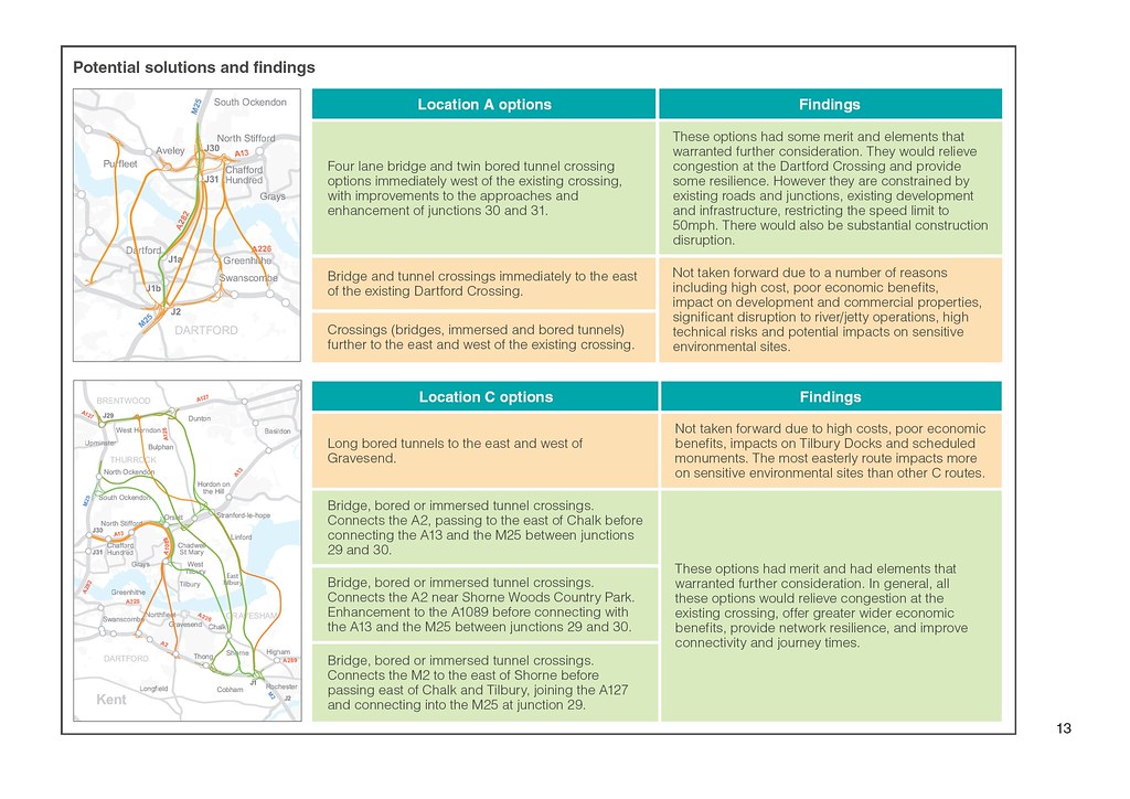 Image sourced from Highways England: https://highwaysengland.citizenspace...g-consultation
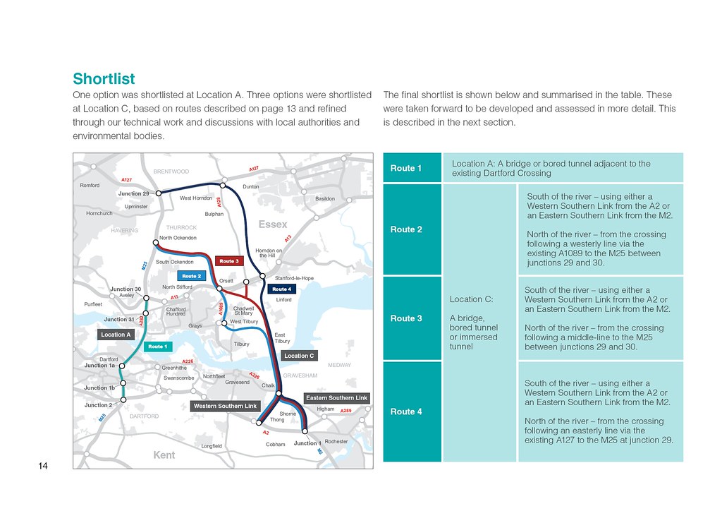 Image sourced from Highways England: https://highwaysengland.citizenspace...g-consultation
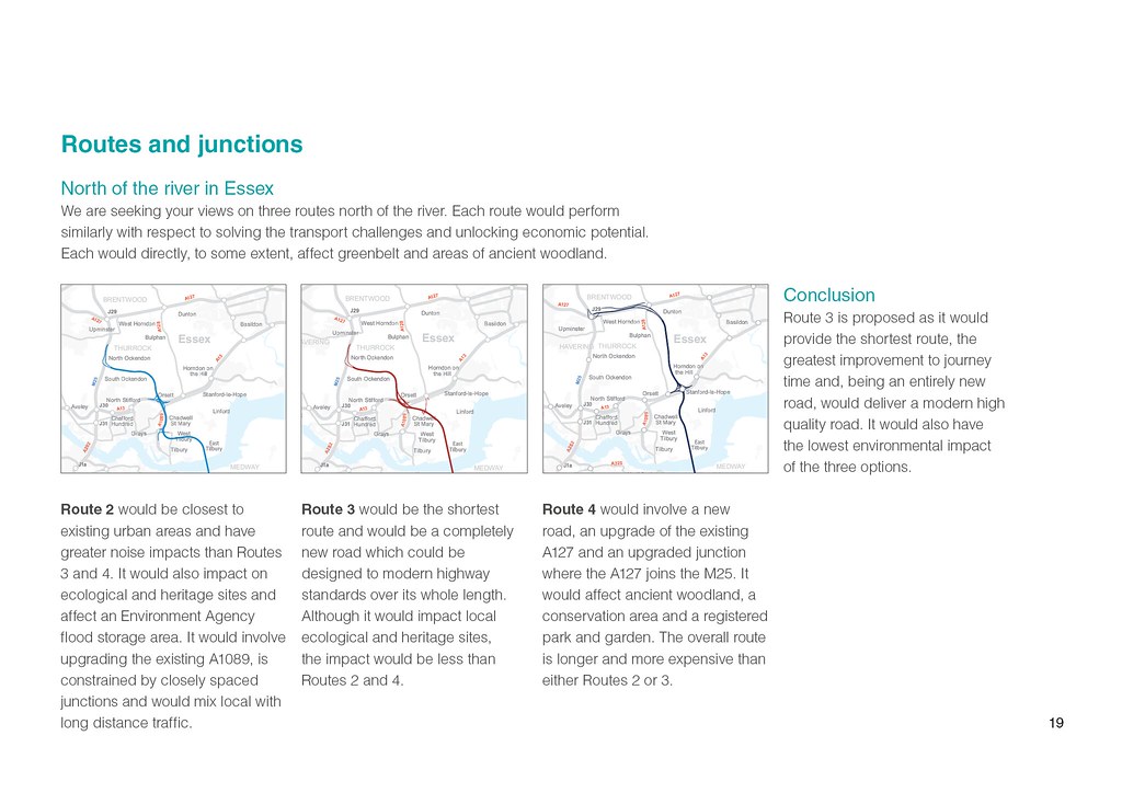 Image sourced from Highways England: https://highwaysengland.citizenspace...g-consultation
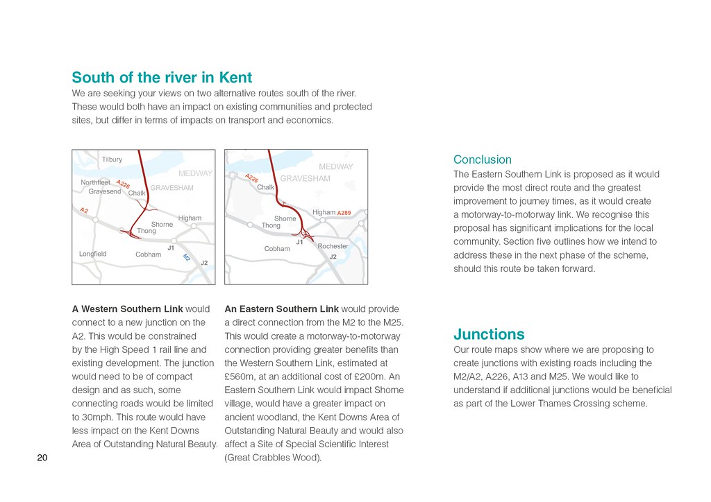 Image sourced from Highways England: https://highwaysengland.citizenspace...g-consultation
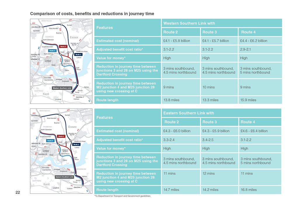 Image sourced from Highways England: https://highwaysengland.citizenspace...g-consultation
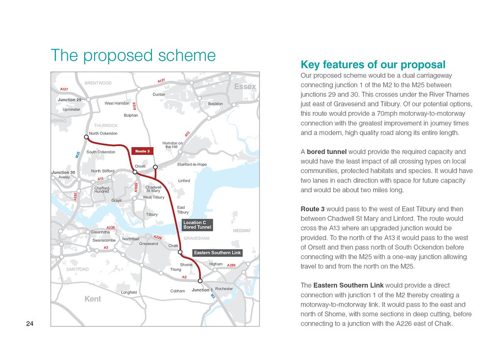 Image sourced from Highways England: https://highwaysengland.citizenspace...g-consultation
Highbury Corner Redevelopment
Image sourced from Highways England: https://highwaysengland.citizenspace...g-consultation
Highbury Corner Redevelopment
Highbury Corner is a rather crude roundabout that is being replaced with a two-way system. The following text is from the TfL Consultation page (
https://consultations.tfl.gov.uk/roa...r-roundabout):
A large number of pedestrians use the area resulting in crowded footways around Highbury & Islington station.
The roundabout can also be difficult for cyclists to navigate and has been identified as a key barrier to cycle movement. Although cyclists make up 22 percent of all traffic at Highbury Corner roundabout in the morning rush-hour, there are currently limited cycle facilities there.
The proposed changes would make Highbury Corner a more welcoming area and balance the needs of all users more effectively.
- Improved pedestrian crossings would allow pedestrians to move around Highbury Corner more safely and directly, without having to use staggered crossings (two separate crossings with an island in the middle). The reallocation of road space would provide a better experience for pedestrians by providing additional footway space
- Rail and tube passengers would be able to leave Highbury & Islington station and walk directly into a new public space, leading from the new station square to the junction of Upper Street and Canonbury Road
- Cyclists would have dedicated, segregated cycle lanes, reducing the risk of conflicts with vehicles and making cycling more enjoyable
There are two options for the treatment of the green space at the heart of Highbury Corner.
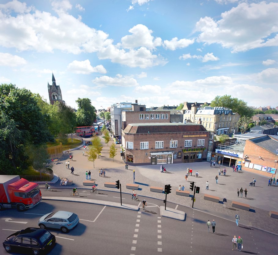 Image source from Transport for London: https://consultations.tfl.gov.uk/roa...ner-roundabout
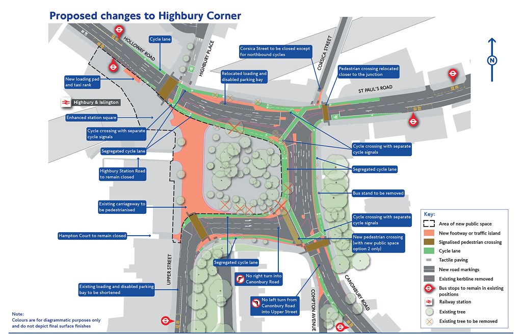 Image source from Transport for London: https://consultations.tfl.gov.uk/roa...ner-roundabout
Option 1
We would pedestrianise the western side of the roundabout, linking it to the station forecourt, and plant a number of new trees in the pedestrianised area.
Image source from Transport for London: https://consultations.tfl.gov.uk/roa...ner-roundabout
Option 1
We would pedestrianise the western side of the roundabout, linking it to the station forecourt, and plant a number of new trees in the pedestrianised area.
To make Highbury Corner a more pleasant, well-designed environment, the new public space could contain a local community facility such as a café or market stalls, subject to future consultation and planning permission. We would also provide a seating area around the western border of the arboretum (which would remain closed to the public) to enable people to enjoy the new space.
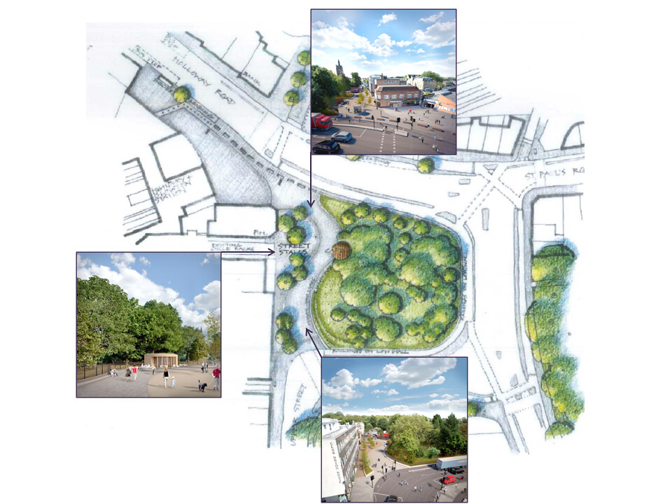 Image source from Transport for London: https://consultations.tfl.gov.uk/roa...ner-roundabout
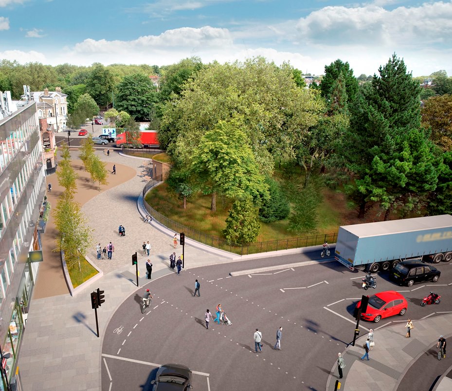 Image source from Transport for London: https://consultations.tfl.gov.uk/roa...ner-roundabout
Option 2
This option would include the changes proposed in Option 1, but also transform the area to a greater extent. We are proposing:
Image source from Transport for London: https://consultations.tfl.gov.uk/roa...ner-roundabout
Option 2
This option would include the changes proposed in Option 1, but also transform the area to a greater extent. We are proposing:
- New paths through the centre of the arboretum to enable public access, which would require the loss of up to 4 additional trees compared to Option 1
- A new pedestrian crossing, from the top of Canonbury Road to the south east corner of the arboretum, connecting with the new paths through the arboretum, to provide pedestrians with a more direct route to Highbury & Islington station
- To open up the centre of the arboretum into a space that can be enjoyed by the public
 Image source from Transport for London: https://consultations.tfl.gov.uk/roa...ner-roundabout
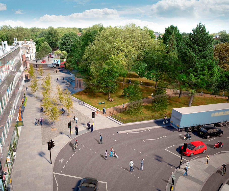 Image source from Transport for London: https://consultations.tfl.gov.uk/roa...ner-roundabout
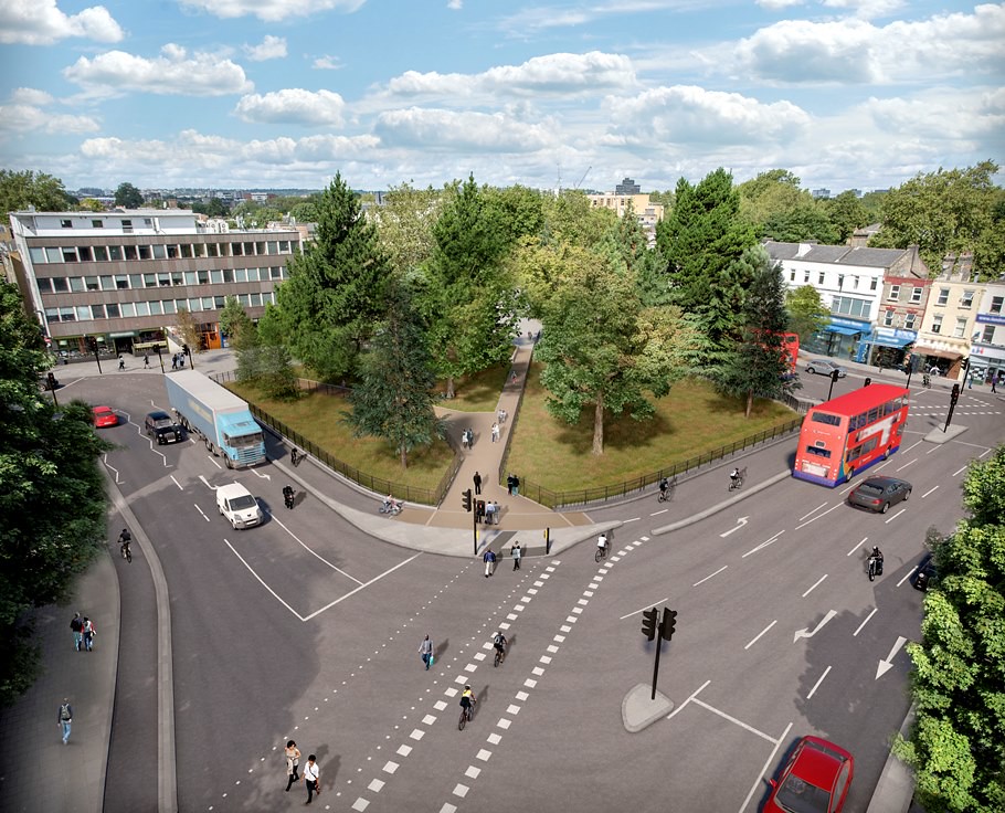 Image source from Transport for London: https://consultations.tfl.gov.uk/roa...ner-roundabout
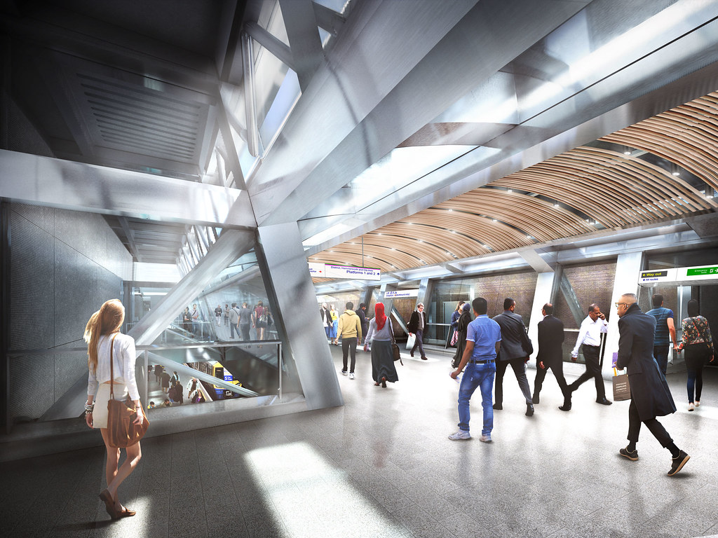
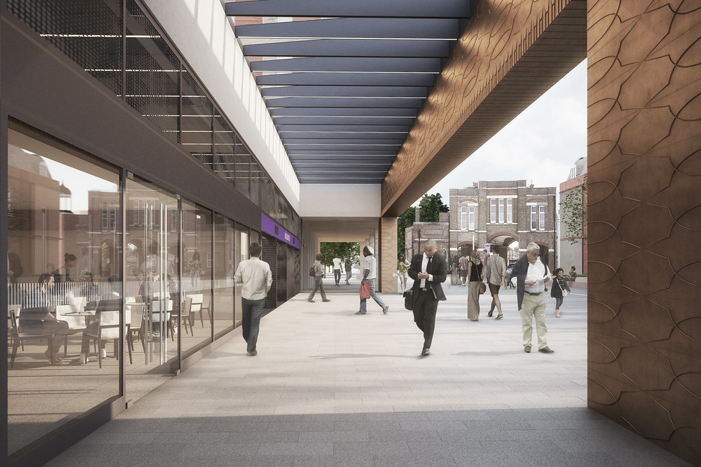
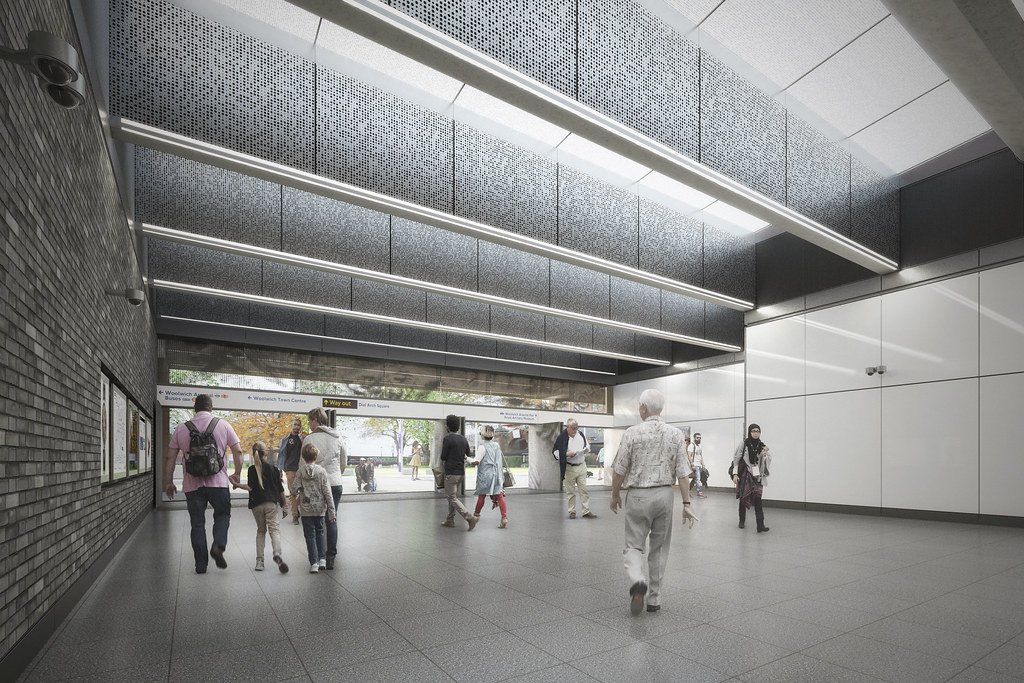
Bank Station Upgrade
Image source from Transport for London: https://consultations.tfl.gov.uk/roa...ner-roundabout
Bank Station Upgrade
Transport for London have unveiled more detailed renders of their plans for the new entrance to Bank station, step-free access, new Northern Line platform, new travelator connection between the Central and Northern lines, and improved connectivity to the DLR.
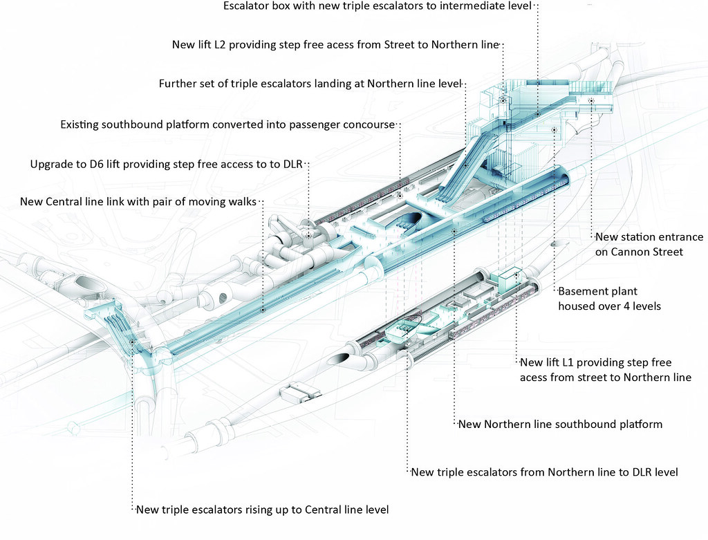 Image sourced from Transport for London Press Images: https://www.flickr.com/photos/tflpre...384656/sizes/l
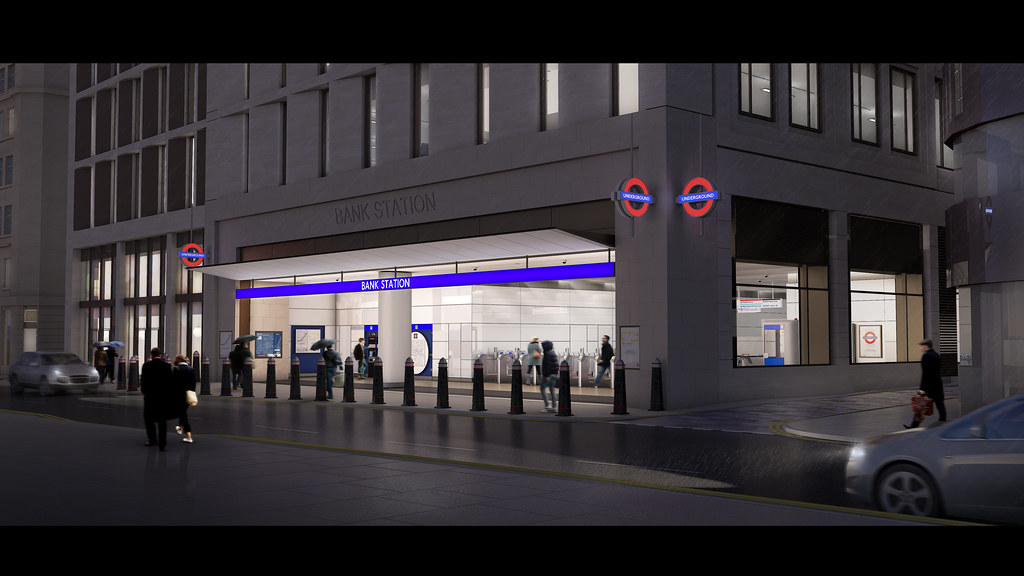 Image sourced from Transport for London Press Images: https://www.flickr.com/photos/tflpre...686873/sizes/l
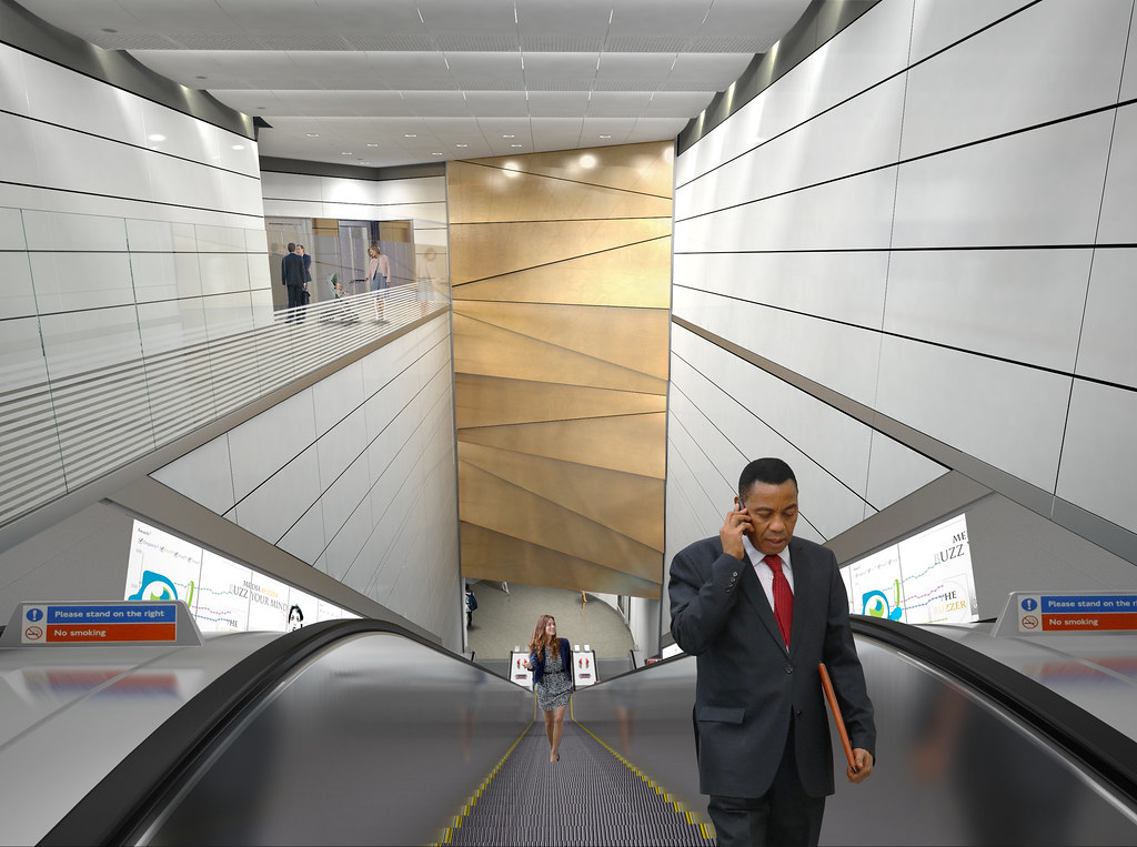 Image sourced from Transport for London Press Images: https://www.flickr.com/photos/tflpre...354214/sizes/l
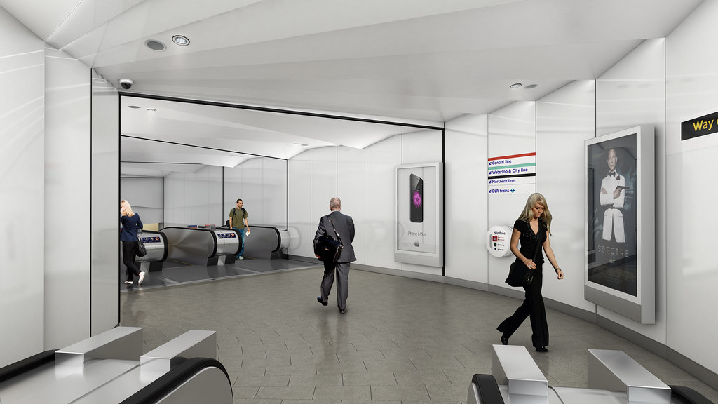 Image sourced from Transport for London Press Images: https://www.flickr.com/photos/tflpre...349744/sizes/l
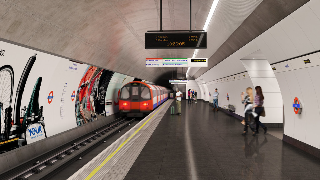 Image sourced from Transport for London Press Images: https://www.flickr.com/photos/tflpre...027911/sizes/l
Another entrance to Bank station is also being built beneath Bloomberg’s new campus which will enable step-free and more direct access to the Waterloo & City Line platforms.
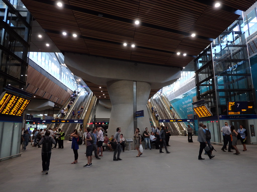
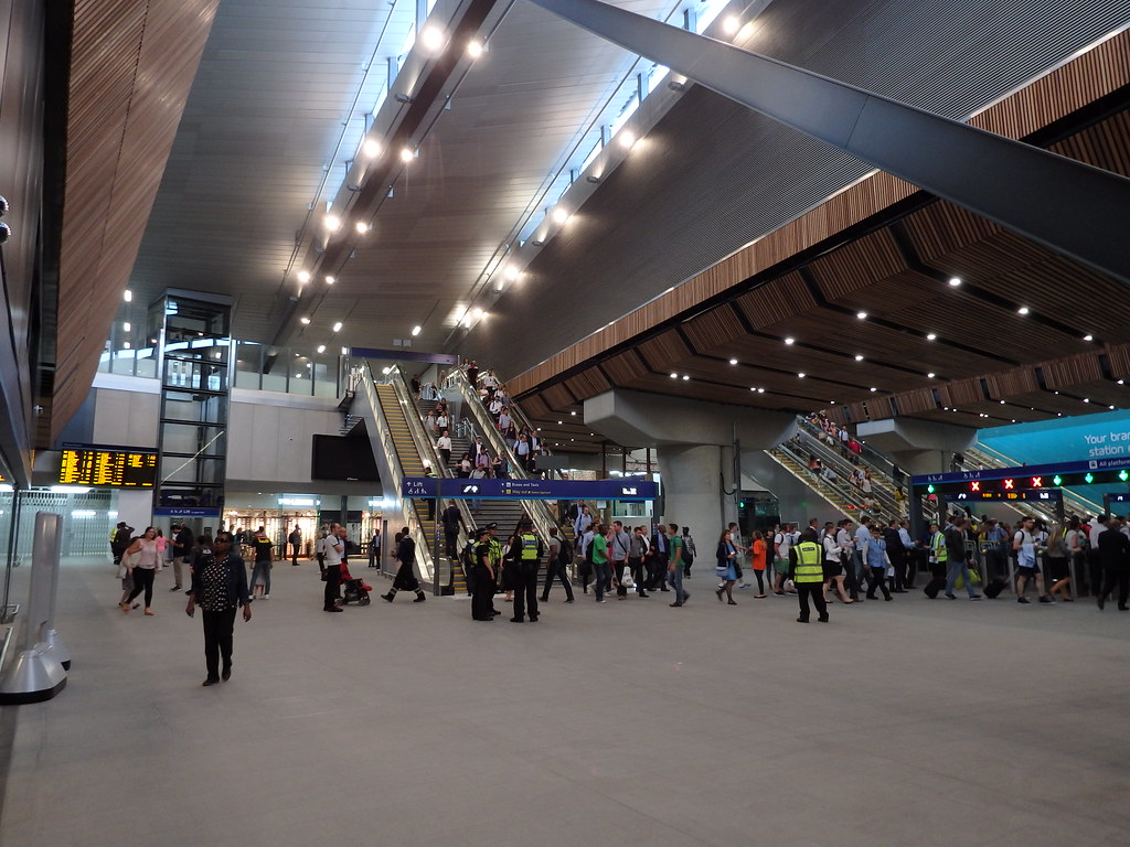
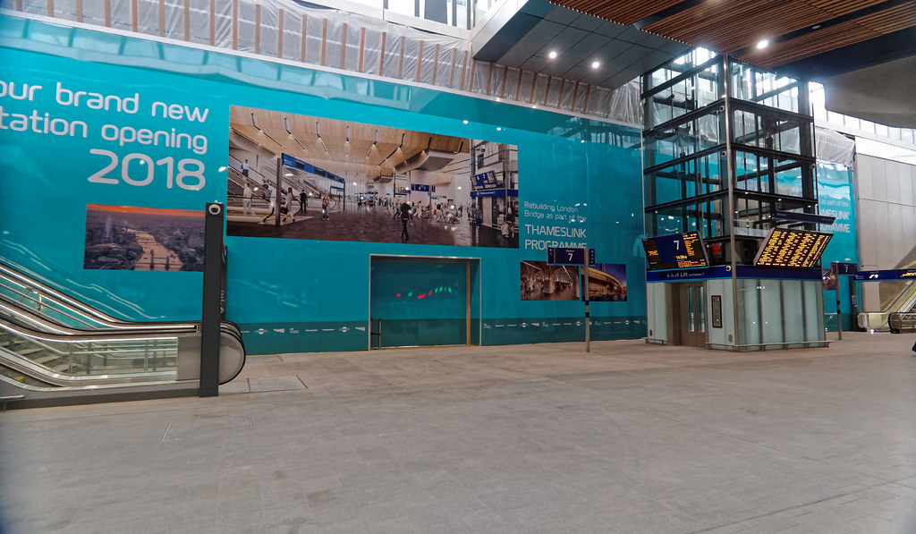
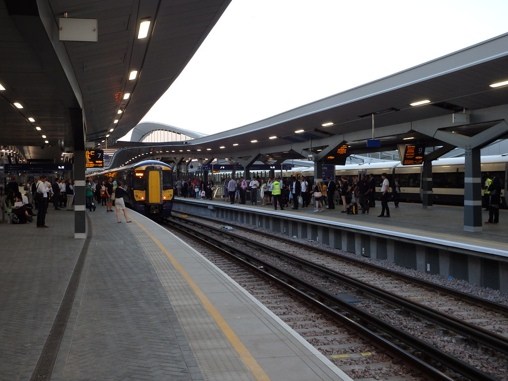
Thameslink
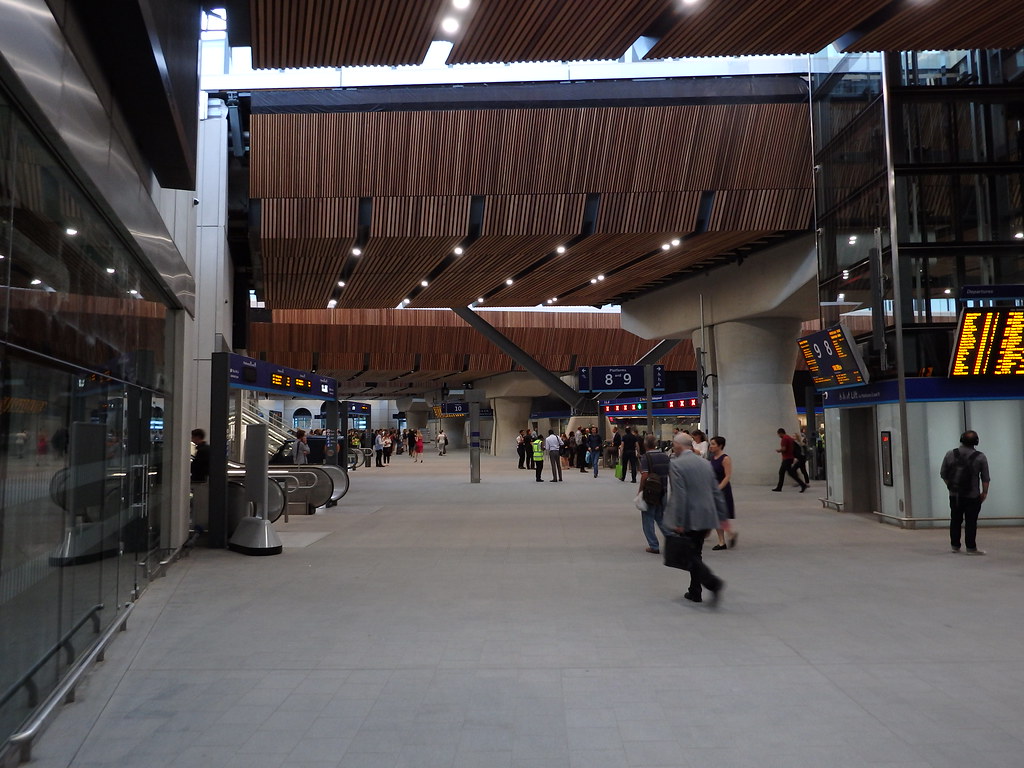
The new Borough Viaduct has also now been brought into use (visible at the bottom of the following image). The new viaduct will be used by trains heading to Charing Cross, allowing for Thameslink trains (heading to Blackfriars) to have full unobstructed utilisation of the old viaduct (which hugs the buildings just to the north of the new viaduct).When London Bridge station is finished, the lines to Charing Cross, Thameslink and Cannon Street will be grade separated enabling for faster and more frequent services.
• Video Link
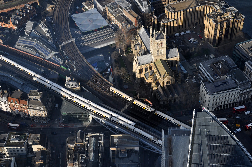 Image taken by stevekeiretsu on Flickr: https://www.flickr.com/photos/stevek...772696/sizes/l
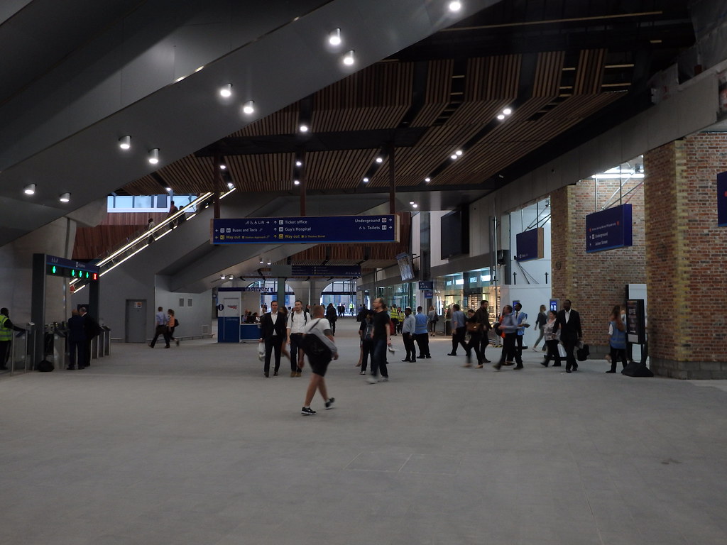
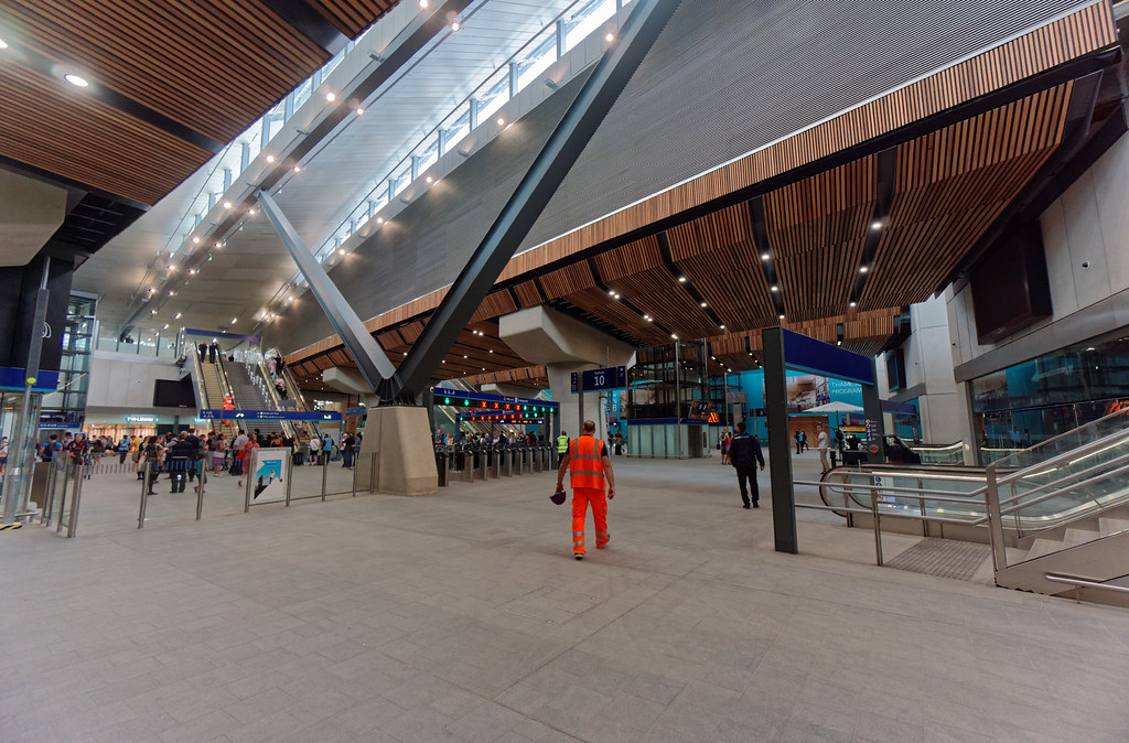
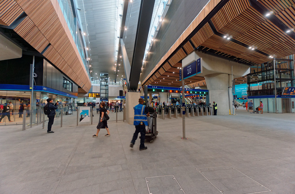
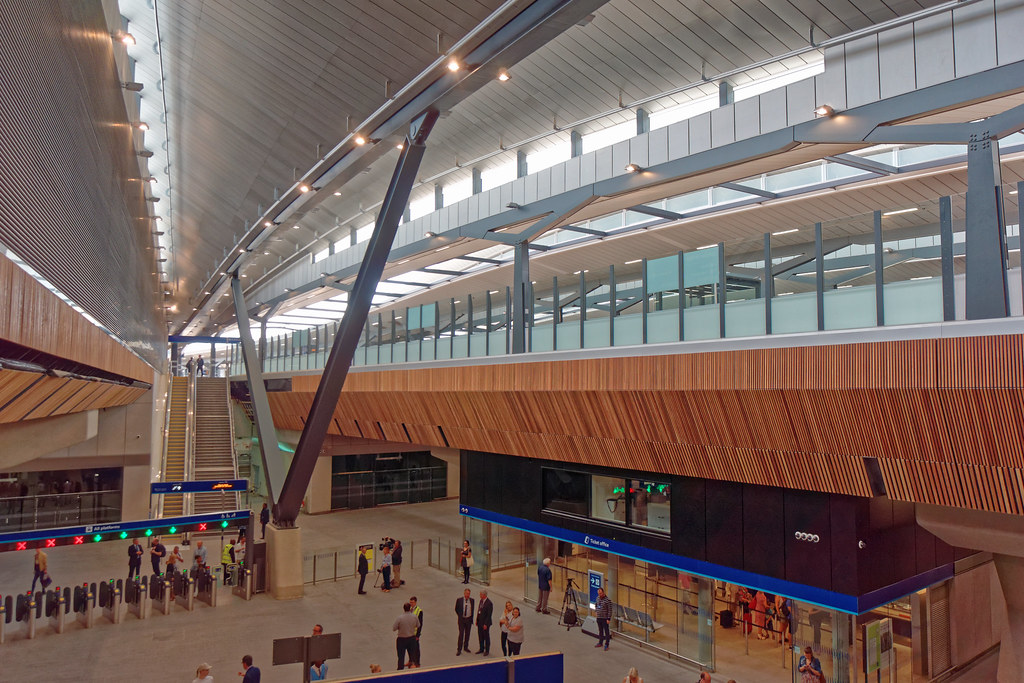
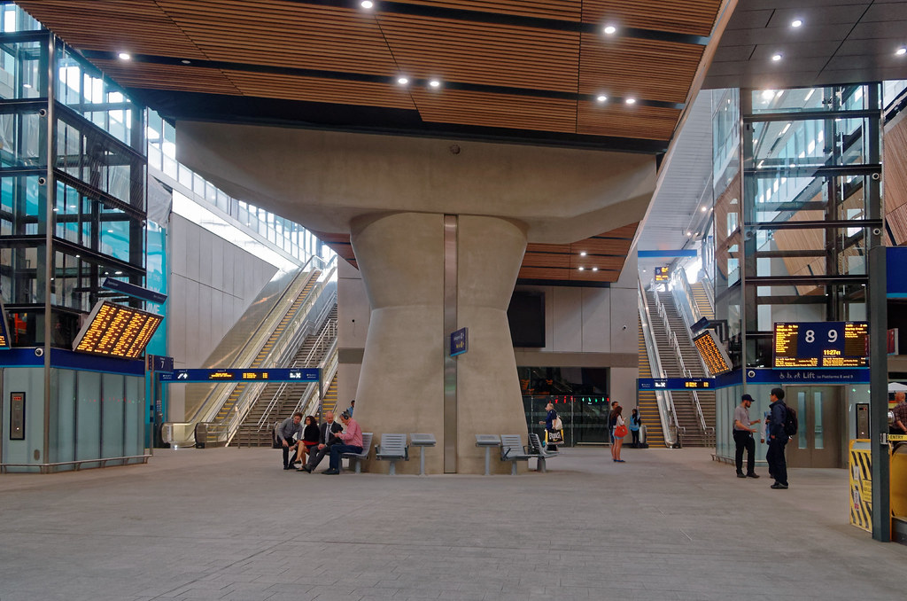
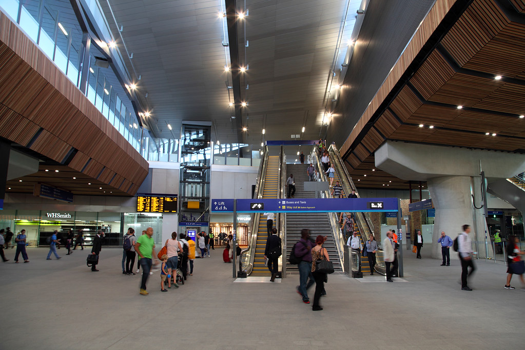
And for reference, what the London Bridge station redevelopment looks like at the minute:
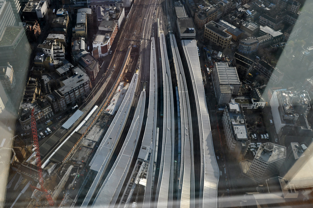 Image taken by stevekeiretsu on Flickr: https://www.flickr.com/photos/stevek...686115/sizes/l
• Video Link
• Video Link
Image taken by stevekeiretsu on Flickr: https://www.flickr.com/photos/stevek...686115/sizes/l
• Video Link
• Video Link
Network Rail also released a video showing the rebuild of Purley junction just to the south of Croydon on the Brighton Main Line
• Video Link
Old Oak Common
Old Oak Common is a large parcel of land in west London that currently consists of rail lands, scrap yards, and other disused land. The original plan was for Crossrail to locate its primary train maintenance depot here, but when HS2 came along, it advocated a station at Old Oak Common for interchange to increasing connectivity to HS2 across London. The proposed Old Oak Common station would come in two segments.
The Great Western Main Line (and Crossrail) section would likely have eight platforms, with all GWML services calling here before carrying onto Paddington. There is also potential to create a Crossrail spur (likely in a tunnel) heading north-westwards up to the West Coast Main Line, which would enable trains to be diverted onto Crossrail whilst Euston is being rebuilt in preparation of HS2.
HS2 approaches Old Oak Common from two tunnels; the 14km long Northolt tunnel from the west (out to Birmingham and the north), and the 7.4km Primrose Hill tunnel from the east (towards Euston). To incorporate straight platforms for 400m+ train sets, the platforms will be built in a giant trench, much as how Stratford International was developed, but on a larger scale to handle the far higher passenger volumes as all HS2 trains will stop here (more of that below). However unlike Stratford International, and to avoid the chasm situation that project created, the station box will be built over.
The combined station complex makes a lot of sense: it allows HS2 passengers to transfer to Crossrail for journeys heading east/west, including the West End (10mins) City, Canary Wharf, and importantly Heathrow (only 8mins away), which gets around the requirement of a HS2 loop spur down to the airport. Likewise, passengers from the West of England would then be able to transfer onto HS2 for journeys heading north. Old Oak Common alleviates one of the big concerns of HS2 overloading Euston (even with Crossrail 2, the Tube Modernisation, integration of Euston Square station and even a Northern Line split), because of the intense volume of passengers. To put this insanity into context, the projections for the number of people using the line between London and Birmingham (which would be within a reasonable commuting distance of London) would be about 50% greater than the volume of people that use Amtrak across the entire US. Indeed some people have started to speculate that HS2 ought to be quad-tracked.
In addition to the Old Oak Common station, two new Overground stations will be built; to the west: Old Oak Common Lane, and to the north-east: Hythe Road. Willesden Junction to the north would be extensively rebuilt.
• Video Link
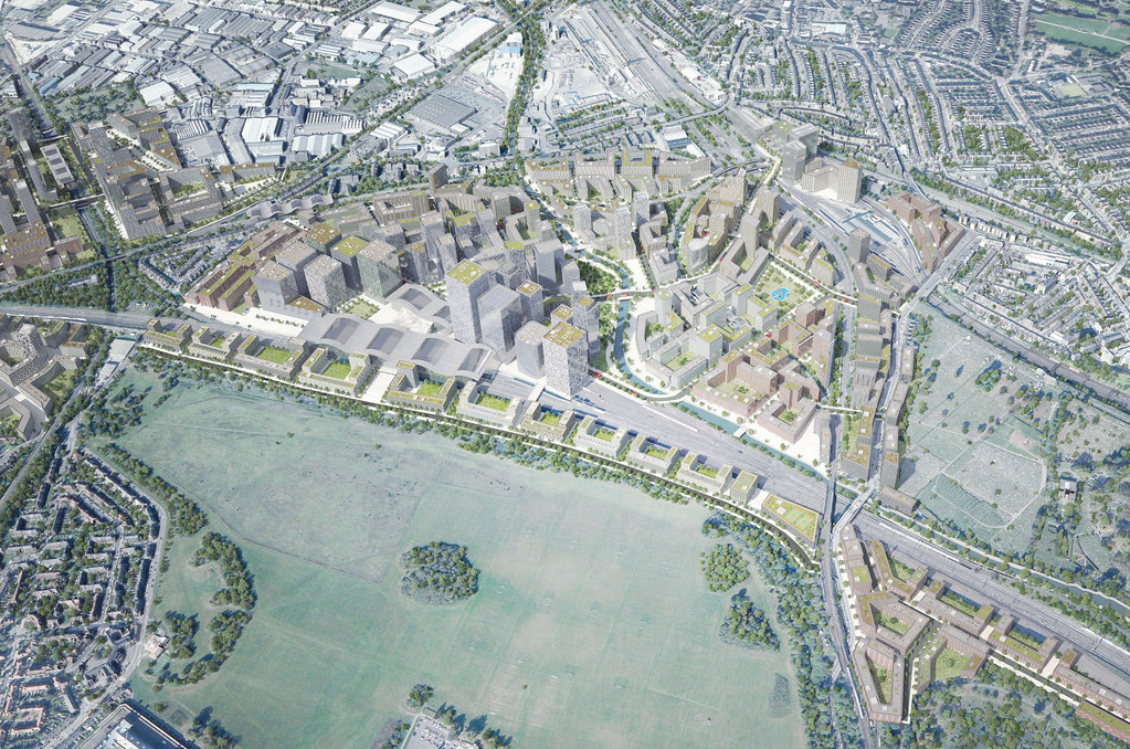 Image sourced by skyscrapercity forum member Jon10: http://www.skyscrapercity.com/showpo...&postcount=941


 Prev
Prev


 Linear Mode
