Quote:
Originally Posted by ethereal_reality

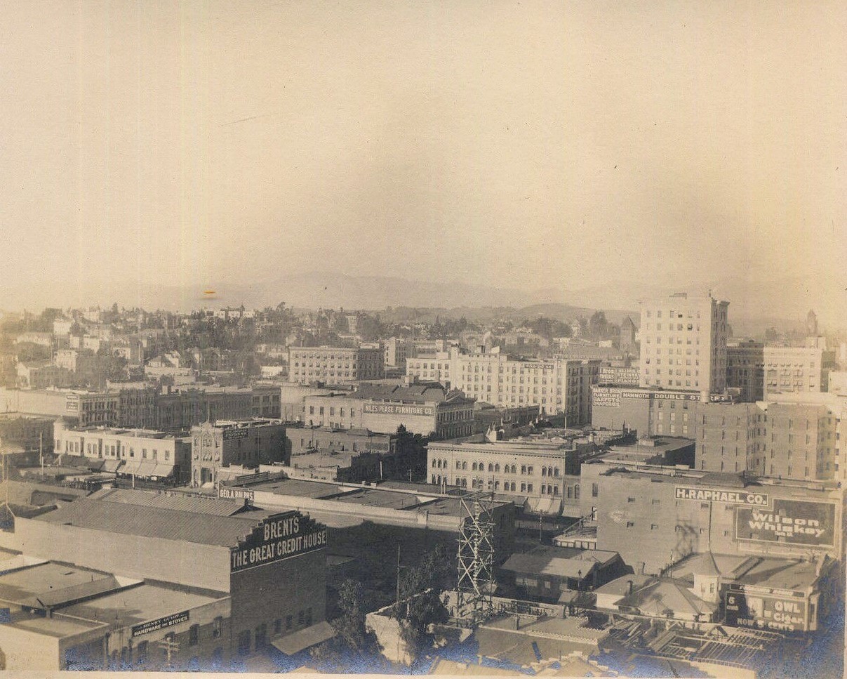
I just came across this photo earlier this afternoon on ebay.
 http://www.ebay.com/itm/DOWNTOWN-LOS...item4190bffc73
Take a look at that precarious scaffolding. Obviously there's construction going on...but that seems ridiculously tall.
-also note the white house with the turret next to the construction. -anyone recognize the house? It looks like a real charmer. |
Seeing as the seller dates this as 1900s, from the 1900/01 CD, here are the details of some of the buildings with visible signs:
422 S Spring - Barker Bros, furniture and carpets
439-441 S Spring - Niles Pease Furniture Co, furniture, carpets and draperies
530 S Spring - Edwin J Brent, furniture
507 S Main - H Raphael Co, glass doors and windows
And a few more for businesses without visible signs on South Main:
513 S Main - Chas Whealand, upholsterer
515 S Main - M Kalisher & Co, billiard and pool supplies
519 S Main - Chas P Walker, second-hand goods
523 S Main - John W Griffin, resident
527 S Main - Mrs Louie Y Garner, resident
533 S Main - Jas A Donahue, resident
Back in the 1898 CD, 533 S Main was the address of the Silver Republican Club. The house in the picture above does not match the one posted by
e_r in
post #23681, but that photo didn't come with an address. Then again, when I compare the photo above to the 1910 Baist map below, 533 S Main should back onto the building with the "Brent's The Great Credit House" sign i.e. just off the bottom of the picture. That would mean that the building under construction was the Brennan Hotel, and the turreted house was later replaced by the Interlaken/Interlacken Hotel (listed at 521½ S Main in the 1909 CD). The 1910 Baist map below is from my reply about the Silver Republican Club in
post #23689, which also includes a link to
tovangar2's
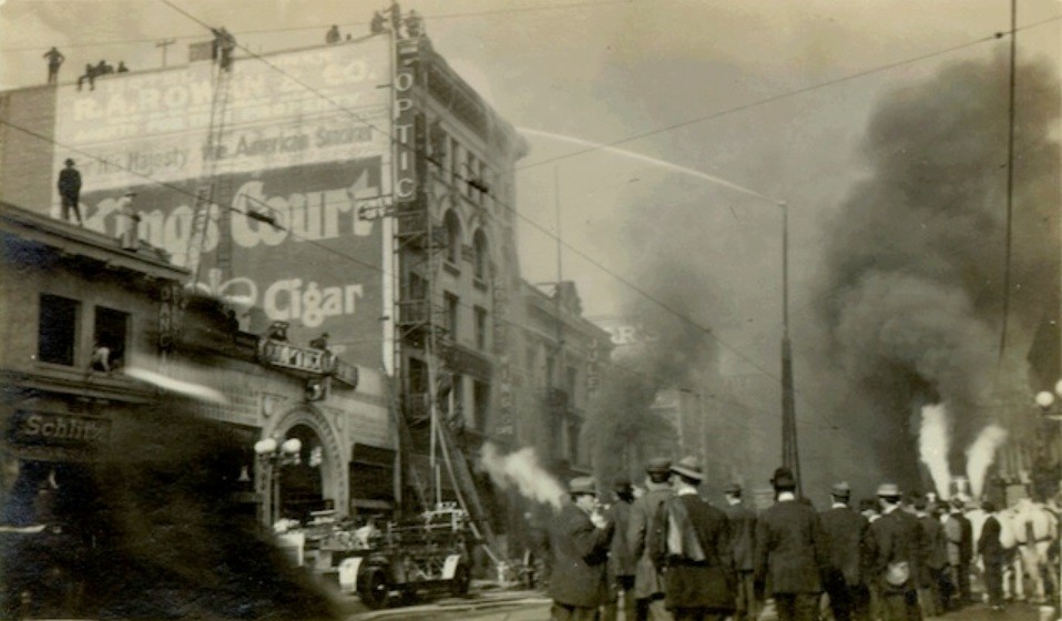
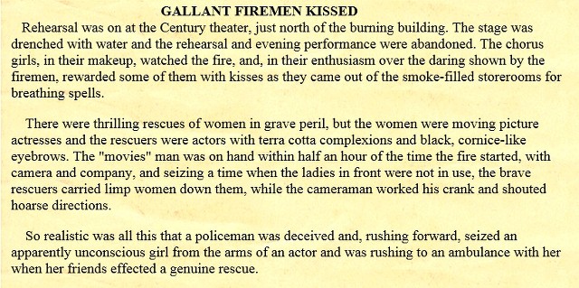
post about the Brennan Hotel fire of 1913.
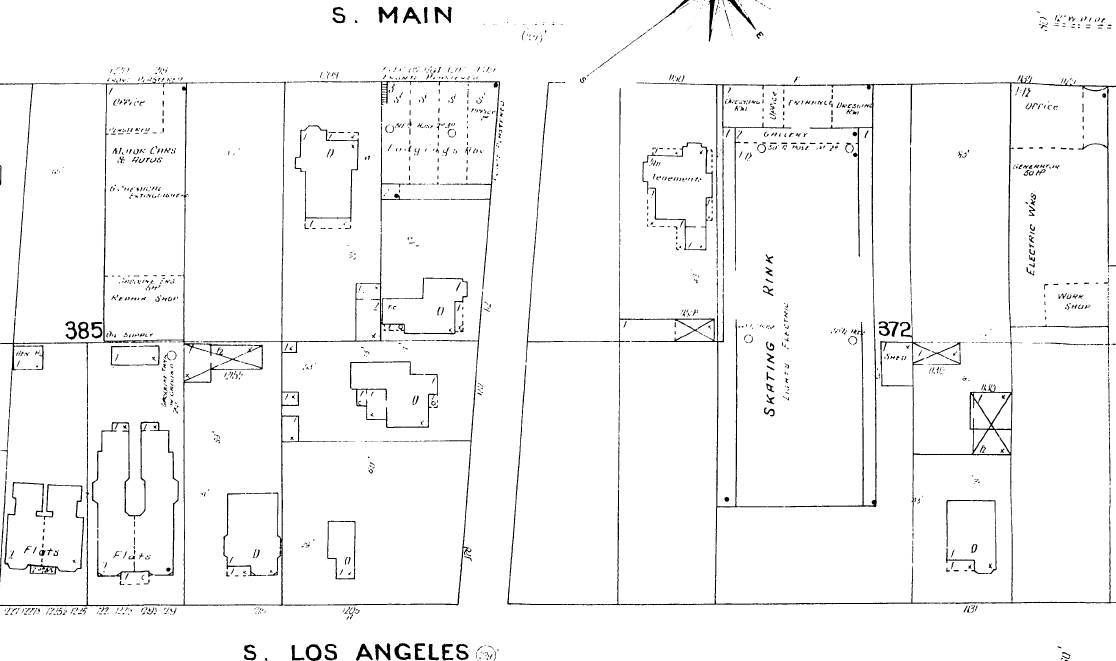
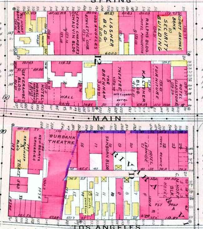 www.historicmapworks.com


 Prev
Prev


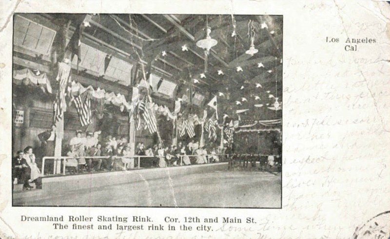
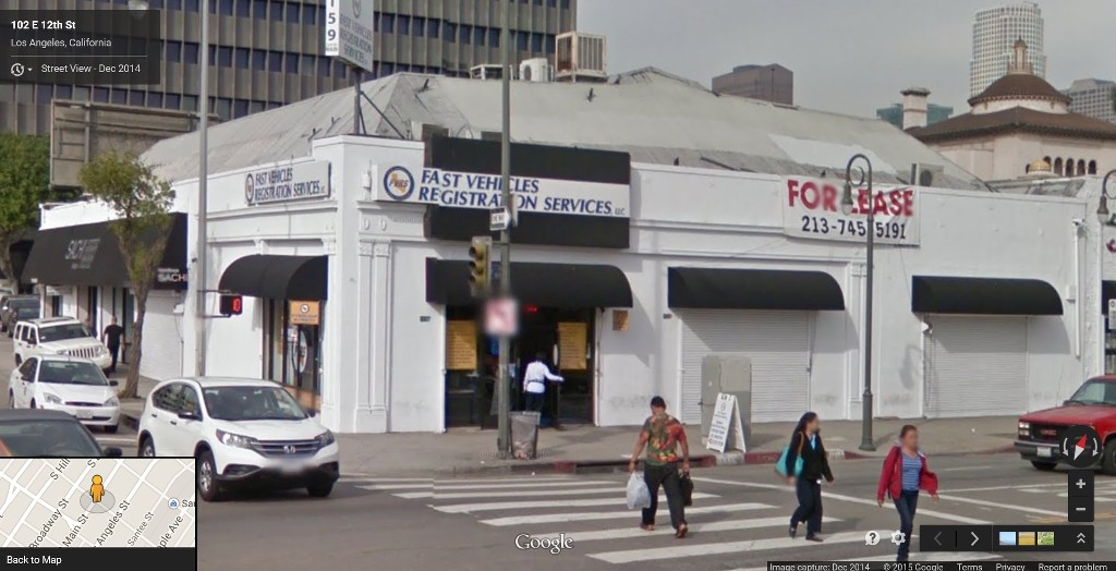
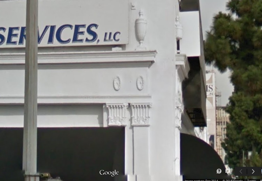
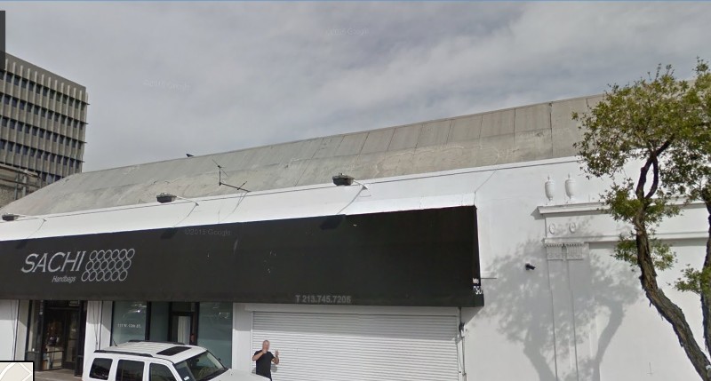

 Again, there's that lighter area along the roof / could that have been the row of windows in your postcard?


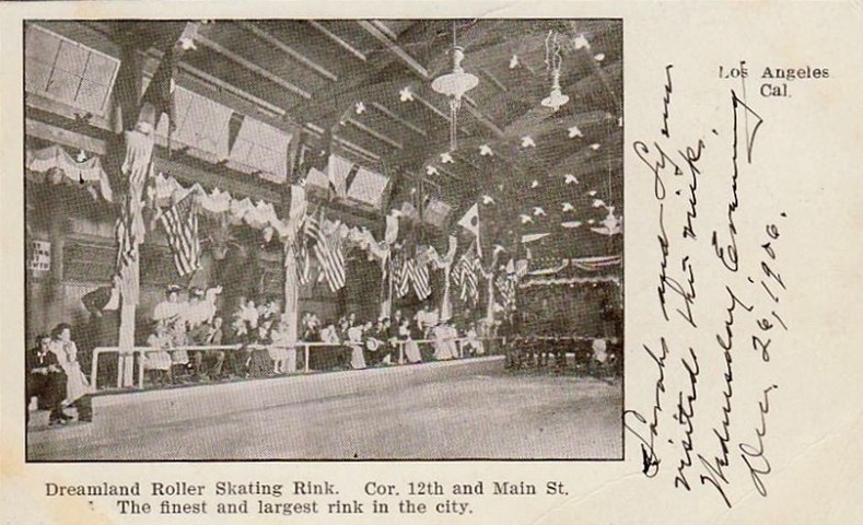


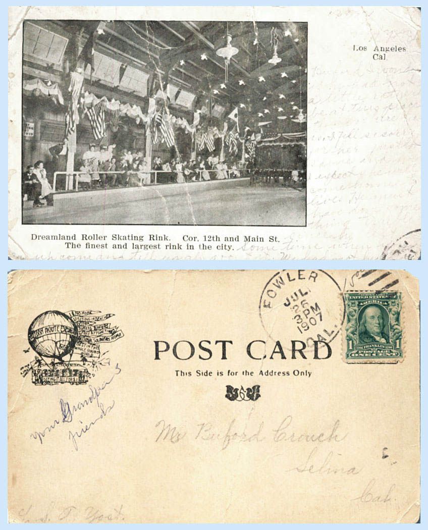

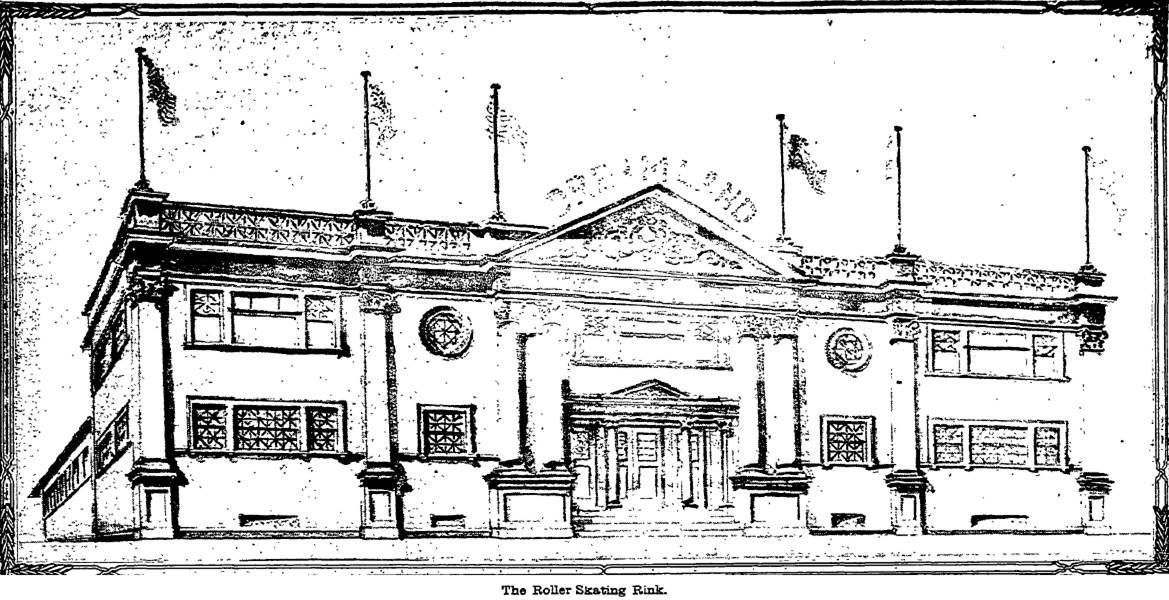

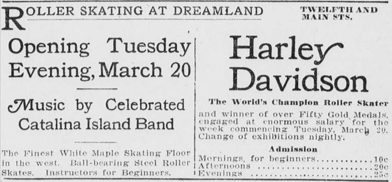
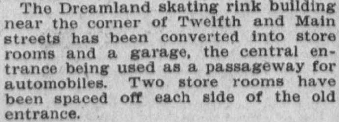
 Here's a photo of him with another story about the rink:
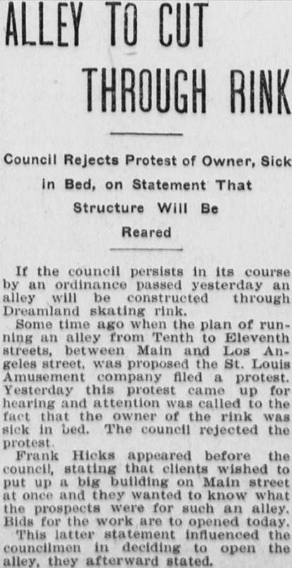


 Linear Mode
