HomeDiagramsDatabaseMapsForum About
     

Go Back   SkyscraperPage Forum > Photography Forums > Found City Photos

Reply

 
Thread Tools Display Modes
     
     
  #23841  
Old Posted Sep 26, 2014, 3:15 AM
Lorendoc Lorendoc is offline
Registered User
 
Join Date: May 2013
Location: Los Angeles, California
Posts: 428
Quote:
Originally Posted by Martin Pal View Post
Does the Out of Bounds map have any addresses for the ones missing an address below?
Biltmore:
Brass Rail:
Cellar: 521 S. Main
Crown Jewel: 754 S. Olive
Harold's 555 Club: 555 S. Main
Jolie's:
Maxwell's: 214 W 3rd Street (from HossC's post)
Numbers:
326: 326 S. Spring
Waldorf:
Burbank: 548 S. Main

The Biltmore was I am sure referring to the bar in the Biltmore Hotel. There was a Brass Rail at 6321 Hollywood Boulevard. Noircitydame had a good post on it at #19591. There is no mention of it or Jolie's or Numbers in the Out of Bounds list. The Waldorf Cellar/The Waldorf Annex was at 521 S. Main, which is the same address as "The Cellar" listed above.

In the 80s there was a hustler bar called The Numbers at 8029 West Sunset in West Hollywood. At that address there was an "Apple Inn" in the 1973 street directory, and in 1950 it was under the auctioneer's hammer as "The Black Watch." It was a bookie spot in the 30s. Pre-1961 city directories list the Geary Hotel at 334 S. Hill.
Reply With Quote
     
     
  #23842  
Old Posted Sep 26, 2014, 3:17 AM
FredH's Avatar
FredH FredH is offline
Registered User
 
Join Date: Aug 2011
Posts: 676


GSV

Wow! That is a great find HossC. Do you think that is the same wall too? Looks like it might be a little shorter.
Reply With Quote
     
     
  #23843  
Old Posted Sep 26, 2014, 3:42 AM
loyalton's Avatar
loyalton loyalton is offline
Registered User
 
Join Date: Jul 2014
Posts: 29
Quote:
Originally Posted by HossC View Post


The same postcard appears in a 2009 LA Times article titled A thorny history with the cactus. It contains this explanation of Watt Moreland's Gasifier engines:

"Nominated by his peers as Mr. Truck of California, Watt Moreland was an early Los Angeles inventor. In 1909, at an auto show held in Hamburger's department store in downtown L.A., he introduced a long-range motor. The following year Moreland opened the Moreland Motor Truck Co. He manufactured six models with a Gasifier engine fueled by distillate, a form of diesel. Distillate got 60 miles to a gallon and was cheaper than oats for a horse."
First of all, it's the other way around, diesel is a form of distillate.

And I'm calling shenanigans on the LA Times. 60 mpg would be possible with a Laurel and Hardy-driven truck going down Mt. Lowe, not under normal conditions. The truck on the PPC runs on #1 distillate/diesel which has less energy (BTUs/gal) than #2 distillate/diesel which is about the same as gasoline.
Reply With Quote
     
     
  #23844  
Old Posted Sep 26, 2014, 4:52 AM
Those Who Squirm!'s Avatar
Those Who Squirm! Those Who Squirm! is offline
Registered User
 
Join Date: Jan 2011
Location: In my specially built chair
Posts: 376
Quote:
Originally Posted by HossC View Post
The street layout to the west of the rail tracks is still recognizable on this 1948 aerial, even though there have been several changes.


Historic Aerials

Just four years later, and all the housing has gone. The old streets can still be seen, but they just have parking lots between them.


Historic Aerials
Given the proximity to Union Station and all the train noises that go with a large above-ground train station, I wouldn't be surprised if the owners of these houses found them difficult to sell or rent out--or to live in, particularly.
__________________
The new Wandering In L.A. post is published!

This Is Probably The Oldest Intact School Building In L.A.
Reply With Quote
     
     
  #23845  
Old Posted Sep 26, 2014, 5:07 AM
ethereal_reality's Avatar
ethereal_reality ethereal_reality is offline
Registered User
 
Join Date: Feb 2008
Location: Lafayette/West Lafayette IN, Purdue U.
Posts: 16,347
Fanchon and Marco girls pose by the Cascades at the ill-fated Midwick View Estates development in Monterey Park CA, circa 1930.


http://digitallibrary.usc.edu/cdm/co...d/16159/rec/57


and it's still there!


http://la-explorer.com/visiting-el-e...monterey-park/


El Encanto and the Cascades were built in the 1920s to showcase a high-end development called MidWick View Estates.
Unfortunately, the stock market crashed and Midwick View Estate never came to be.


In this view we're looking in the opposite direction towards the club house El Encanto where the grand opening ceremonies are taking place on October 6th 1929.

note the Midwick View Estates sign on the hilltop

http://www.markkeppelhighschoolreuni...buildings.html


El Encanto is still there as well.


http://la-explorer.com/visiting-el-e...monterey-park/


http://la-explorer.com/visiting-el-e...monterey-park/


http://la-explorer.com/visiting-el-e...monterey-park/


http://la-explorer.com/visiting-el-e...monterey-park/


http://la-explorer.com/visiting-el-e...monterey-park/


-interior of El Encanto.

http://www.markkeppelhighschoolreuni...buildings.html


Now lets return to the day that held so much promise, Oct. 6, 1929.


http://digitallibrary.usc.edu/cdm/co...d/33894/rec/19


starlet?

http://digitallibrary.usc.edu/cdm/co...d/33894/rec/19


http://digitallibrary.usc.edu/cdm/co...d/33894/rec/19


another starlet perhaps?

http://digitallibrary.usc.edu/cdm/co...d/33894/rec/19


-there's part of that ship tile work that you saw earlier in the color photo. (looks like it might have been a hot day )

http://digitallibrary.usc.edu/cdm/co...d/33894/rec/19


comfort station


http://digitallibrary.usc.edu/cdm/co...d/33894/rec/19


-another look at the Cascades.


http://digitallibrary.usc.edu/cdm/co...d/33302/rec/66


-many more trees in this photo compared with the preceding photo.

http://www.markkeppelhighschoolreuni...buildings.html


once again, looking toward El Encanto...this time in the 1970s or 80s.

http://www.markkeppelhighschoolreuni...buildings.html


a good view of El Encanto.

http://www.markkeppelhighschoolreuni...buildings.html


one last look at the Cascades and the statue Athena.

http://la-explorer.com/visiting-el-e...monterey-park/


-here's how it all looks on google-earth.

__


After Midwick View Estates went down the tubes, El Encanto and the area around the Cascade was home to a refugee camp in the early 1930s.
(there are several photos of this on the google)

Oh, and one other neat tidbit, during WWll El Encanto was turned into an USO.


http://www.markkeppelhighschoolreuni...buildings.html

__

Last edited by ethereal_reality; Nov 12, 2015 at 7:18 PM.
Reply With Quote
     
     
  #23846  
Old Posted Sep 26, 2014, 7:57 AM
BDiH BDiH is offline
Registered User
 
Join Date: Jan 2012
Posts: 265
Quote:
Originally Posted by Lorendoc View Post
Biltmore:
Brass Rail:
Cellar: 521 S. Main
Crown Jewel: 754 S. Olive
Harold's 555 Club: 555 S. Main
Jolie's:
Maxwell's: 214 W 3rd Street (from HossC's post)
Numbers:
326: 326 S. Spring
Waldorf:
Burbank: 548 S. Main

The Biltmore was I am sure referring to the bar in the Biltmore Hotel. There was a Brass Rail at 6321 Hollywood Boulevard. Noircitydame had a good post on it at #19591. There is no mention of it or Jolie's or Numbers in the Out of Bounds list. The Waldorf Cellar/The Waldorf Annex was at 521 S. Main, which is the same address as "The Cellar" listed above.

In the 80s there was a hustler bar called The Numbers at 8029 West Sunset in West Hollywood. At that address there was an "Apple Inn" in the 1973 street directory, and in 1950 it was under the auctioneer's hammer as "The Black Watch." It was a bookie spot in the 30s. Pre-1961 city directories list the Geary Hotel at 334 S. Hill.
La Cita at 336 S. Hill Street was previously called The Brass Rail.
Reply With Quote
     
     
  #23847  
Old Posted Sep 26, 2014, 11:08 AM
HossC's Avatar
HossC HossC is offline
Registered User
 
Join Date: Aug 2013
Posts: 4,245


I found this picture of South Hill Street which shows Brass Rail behind the red truck. It's dated 6/10/66.


Detail of picture in Huntington Digital Library

BDiH mentioned La Cita. Looking at Historic Aerials, the building seems to occupy the same footprint as the one that housed Brass Rail. Is this the first floor of the old building?


GSV
Reply With Quote
     
     
  #23848  
Old Posted Sep 26, 2014, 1:56 PM
transitfan transitfan is offline
Registered User
 
Join Date: Dec 2010
Posts: 71
Quote:
Originally Posted by HossC View Post

The video link was posted by alanlutz in post #14425. The Amoco Tower appears at just over four minutes in, and Dominguez Junction can be seen at around 9:15. You can find the video here:

Ride The Last Red Car Los Angeles April 1961


YouTube
That is an excellent video! I purchased it during my first visit to the Orange Empire Railway Museum in April 1990
Reply With Quote
     
     
  #23849  
Old Posted Sep 26, 2014, 2:17 PM
transitfan transitfan is offline
Registered User
 
Join Date: Dec 2010
Posts: 71
Quote:
Originally Posted by HossC View Post
After seeing HenryHuntington's impressive identification of this location, I had a look at Historic Aerials. The 1948 image (below) appears to show a streetcar on the right side of the northern end of the right-of-way at W 3rd Street.


Historic Aerials

I then took the Googlemobile there to see if anything remained. Looking south from W 3rd Street there's no longer any trace of the right-of-way (NB. I went back to a 2011 Streetview image to get a wider view, but it looks the same today).


GSV

Spin the camera around by 180 degrees and it's a different story. The little garage from the original picture is still there. I think the house on the left is also the one from the original picture, but it's now hidden by bushes.


GSV
For years after the streetcars were discontinued, LAMTA/SCRTD/LACMTA used the right of way as a layover zone for various bus routes. More recently (don't know the exact year), it was abandoned in favor of a new terminal near the Wilshire/Western Purple Line station.


GSV
Reply With Quote
     
     
  #23850  
Old Posted Sep 26, 2014, 4:12 PM
oldstuff oldstuff is offline
Registered User
 
Join Date: Aug 2012
Posts: 623
Quote:
Originally Posted by ethereal_reality View Post
Fanchon and Marco girls pose by the Cascades at the ill-fated Midwick View Estates development in Monterey Park CA, circa 1930.


http://digitallibrary.usc.edu/cdm/co...d/16159/rec/57


and it's still there!


http://la-explorer.com/visiting-el-e...monterey-park/


El Encanto and the Cascades were built in the 1920s to showcase a high-end development called MidWick View Estates.
Unfortunately, the stock market crashed and Midwick View Estate never came to be.


In this view we're looking in the opposite direction towards the club house El Encanto where the grand opening ceremonies are taking place on October 6th 1929.

note the Midwick View Estates sign on the hilltop

http://www.markkeppelhighschoolreuni...buildings.html


El Encanto is still there as well.


http://la-explorer.com/visiting-el-e...monterey-park/


http://la-explorer.com/visiting-el-e...monterey-park/


http://la-explorer.com/visiting-el-e...monterey-park/


http://la-explorer.com/visiting-el-e...monterey-park/


http://la-explorer.com/visiting-el-e...monterey-park/


-interior of El Encanto.

http://www.markkeppelhighschoolreuni...buildings.html


Now lets return to the day that held so much promise, Oct. 6, 1929.


http://digitallibrary.usc.edu/cdm/co...d/33894/rec/19


starlet?

http://digitallibrary.usc.edu/cdm/co...d/33894/rec/19


http://digitallibrary.usc.edu/cdm/co...d/33894/rec/19


another starlet perhaps?

http://digitallibrary.usc.edu/cdm/co...d/33894/rec/19


-there's part of that ship tile work that you saw earlier in the color photo. (looks like it might have been a hot day )

http://digitallibrary.usc.edu/cdm/co...d/33894/rec/19


comfort station


http://digitallibrary.usc.edu/cdm/co...d/33894/rec/19


-another look at the Cascades.


http://digitallibrary.usc.edu/cdm/co...d/33302/rec/66


-the trees have grown a bit in this photo.

http://www.markkeppelhighschoolreuni...buildings.html


once again, looking toward El Encanto...this time in the 1970s or 80s.

http://www.markkeppelhighschoolreuni...buildings.html


a good view of El Encanto.

http://www.markkeppelhighschoolreuni...buildings.html


one last look at the Cascades and the statue Athena.

http://la-explorer.com/visiting-el-e...monterey-park/


-here's how it all looks on google-earth.

__


After Midwick View Estates went down the tubes, El Encanto and the area around the Cascade was home to a refugee camp in the early 1930s.
(there are several photos of this on the google)

Oh, and one other neat tidbit, during WWll El Encanto was turned into an USO.


http://www.markkeppelhighschoolreuni...buildings.html

__
Some background on the people in the photos.

Blenda Irene Ostler, born in Utah in 1902 of Danish immigrant parents.

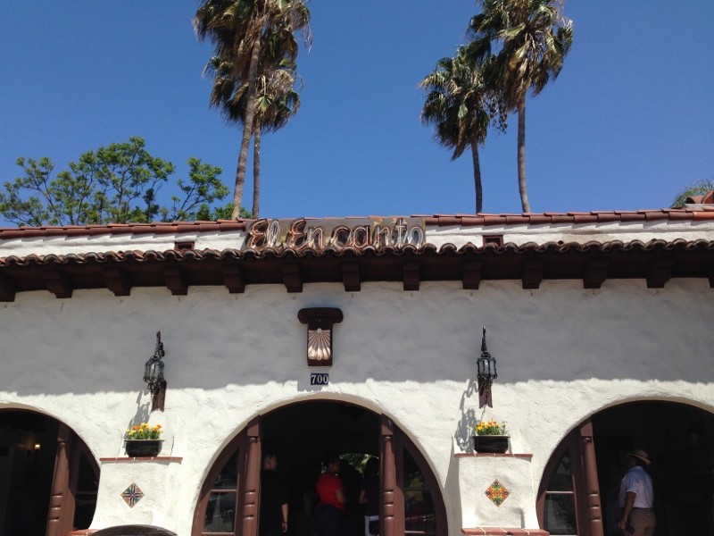
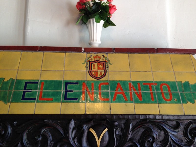
She married Nephi Clifford Ostler, (called Cliff) who was born in Utah in 1903. They were married in Alhambra, CA in 1923. The Article below shows that they were married in El Encanto

They appear in Monterey Park in the 1930 Census, living in a house at 608 W. Harding Avenue, Monterey Park. At that time, he is noted to be a cement contactor, but in later listings he works for the city, in various capacities until he is mentioned as being retired from being the Superintendent of City Buildings

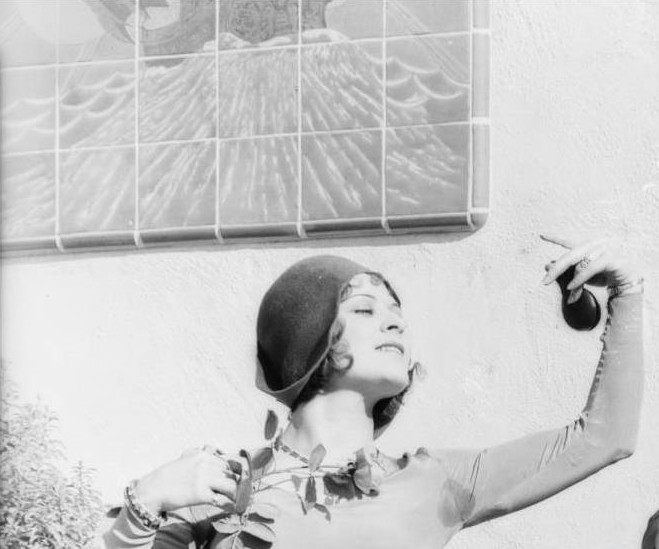
They had two children Donald Ostler and Marie Ostler, (she is shown with her father in the background of one of the pictures)

The Betty Bradbury, who appears in the photos is the future wife of Donald Ostler.

Jimmie Marcus, who appears in Navy Uniform, became the husband of the Ostler's daughter Marie

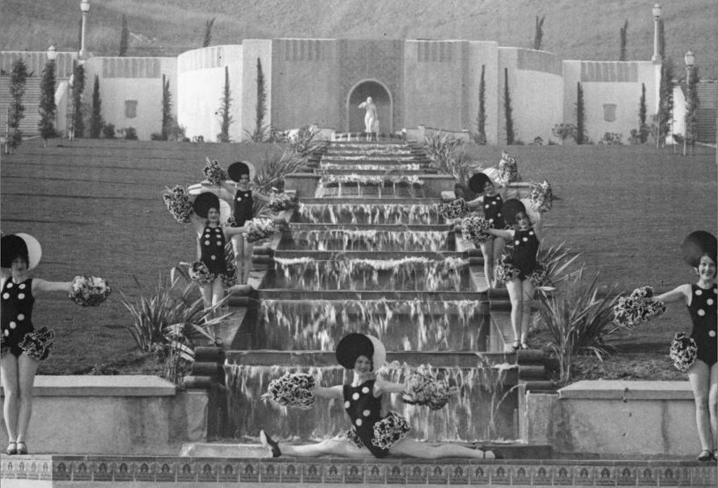
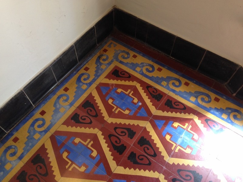
The Ostler family lived in El Encanto and were responsible for keeping the USO open during the war, according to an article about the installation of officers for the Monterey Park Chamber of Commerce. They apparently purchased the property in the 1940s and lived in the main El Encanto building.

" Excerpt from the article appearing online in THE CITIZEN'S VOICE"

Electronically Serving Monterey Park, Alhambra, San Gabriel, & Rosemead

Posted by Nancy Arcuri on 8/19/14 • Categorized as Articles

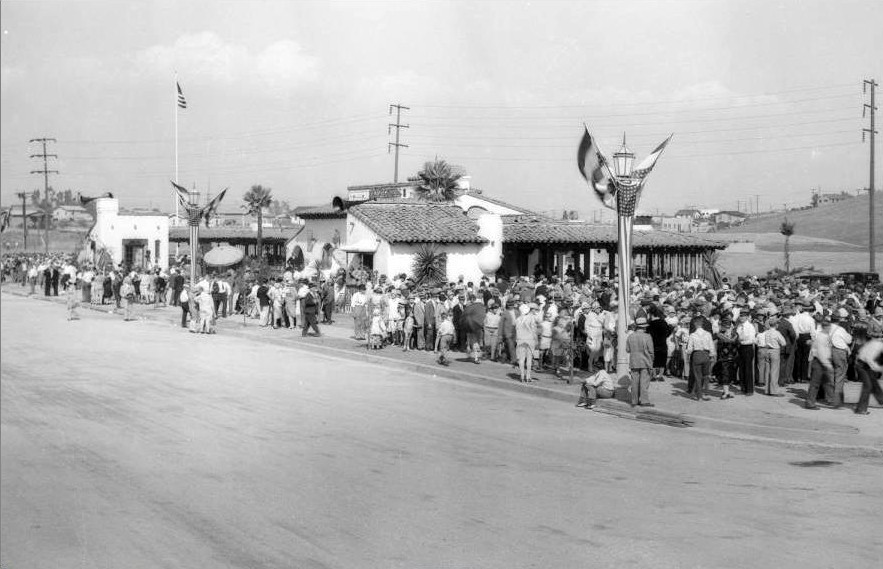
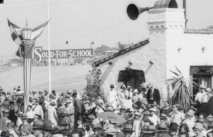
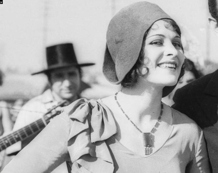
Damien Orozco gave a brief history of the early El Encanto. He spoke about the pictures of the building on the cover of the program. He discovered the name of the young lady looking down in one of the pictures was Marie Marcus who lived in El Encanto in the 1940s. He introduced the family members to the audience.

"Susan Byard and her sister, Karen Call with their mother Marie Marcus and Karen’s husband, Gary Call. The family lived with Cliff and Irene Ostler in El Encanto in the 1940s. They purchased the property and kept the USO opened without government funding. Each side house had six beds for servicemen to use. This USO was a peaceful setting and no drinking was allowed.
Susan Byard and Karen Call recalled their childhood memories of living in El Encanto with their parents, Marie and Jimmy Marcus and grandparents, Cliff and Irene Ostler. Their parents were married in El Encanto. The family lived in the main house as well as the two side houses. They remembered that their parents and grandparents all volunteered in the city. Their grandfather and father helped to design the Barnes Park Pool. Their grandmother, Irene was a famous cook in the city. It was a great time for their family in Monterey Park. They love the city. The family thanked the Chamber for inviting them to El Encanto. It is part of our city’s heritage."
Reply With Quote
     
     
  #23851  
Old Posted Sep 26, 2014, 6:06 PM
Martin Pal Martin Pal is offline
Registered User
 
Join Date: Sep 2013
Posts: 2,450
Quote:
Originally Posted by rick m View Post
Gee-- Jolies was popular with the older set-most of the late 50s to early 70s it sited on s/w corner of Vermont 2 doors down from Beverly Blvd.. The Waldorf was at 527 S. Main- pix in early Life magazine expose of urban homo scene--Brass Rail was at 334 S.Hill near Angels Flight- mjr teen dance floor scene in early 60s according to a fan who bussed there fresh off the plane from Romania - now its La Cita... At least a dozen others rose and fell pre-Stonewall here..

Biltmore: 506 S. Grand Ave
Brass Rail: 334 S.Hill
Cellar: 521 S. Main
Crown Jewel: 754 S. Olive
Harold's 555 Club: 555 S. Main
Jolie's:
Maxwell's: 214 W 3rd Street (from HossC's post)
Numbers:
326: 326 S. Spring
Waldorf: 527 S. Main
Burbank: 548 S. Main

Hi, thanks all for some new information. In various places The Waldorf and Cellar are mentioned as separate establishments, but there's also places that call it The Waldorf's Cellar or The Cellar at the Waldorf. Info provided also has come up with an address for each 521 & 527 S. Main. No photos have appeared showing either as yet. Numbers must also have been another location downtown, as well as Sunset Blvd., whether they were related or not.

When the bar at the Biltmore is recalled, was there only one bar and did it have a name? Currently it's listed as the Gallery Bar and the Cognac Room.

Rick M in the quote above has Jolie's at Vermont near Beverly. This article I discovered this morning has it at a different location:

Maxwell’s, the Waldorf, the Brass Rail, the Biltmore, the Numbers, the Crown Jewel and other bars were popular downtown for decades, as was Jolie’s on Western at First. Bunker Hill downtown was a gay neighborhood for decades, from at least the time when Stockton’s sailors started building a fortification there in 1848 until most of the crumbling old houses on the hill were raised in the mid-’60s.

It also says this, which surprised me:

Barney’s Beanery, once a gay bar, put up the “Fagots Stay Out” sign in the ’30s to ward off police pressure, but management and clientele later took the sign literally.

http://tangentgroup.org/mediawiki/in..._LA_Early_Days
Reply With Quote
     
     
  #23852  
Old Posted Sep 27, 2014, 9:17 PM
rick m rick m is offline
Registered User
 
Join Date: Sep 2011
Posts: 225
Quote:
Originally Posted by Martin Pal View Post
Biltmore: 506 S. Grand Ave
Brass Rail: 334 S.Hill
Cellar: 521 S. Main
Crown Jewel: 754 S. Olive
Harold's 555 Club: 555 S. Main
Jolie's:
Maxwell's: 214 W 3rd Street (from HossC's post)
Numbers:
326: 326 S. Spring
Waldorf: 527 S. Main
Burbank: 548 S. Main

Hi, thanks all for some new information. In various places The Waldorf and Cellar are mentioned as separate establishments, but there's also places that call it The Waldorf's Cellar or The Cellar at the Waldorf. Info provided also has come up with an address for each 521 & 527 S. Main. No photos have appeared showing either as yet. Numbers must also have been another location downtown, as well as Sunset Blvd., whether they were related or not.

When the bar at the Biltmore is recalled, was there only one bar and did it have a name? Currently it's listed as the Gallery Bar and the Cognac Room.

Rick M in the quote above has Jolie's at Vermont near Beverly. This article I discovered this morning has it at a different location:

Maxwell’s, the Waldorf, the Brass Rail, the Biltmore, the Numbers, the Crown Jewel and other bars were popular downtown for decades, as was Jolie’s on Western at First. Bunker Hill downtown was a gay neighborhood for decades, from at least the time when Stockton’s sailors started building a fortification there in 1848 until most of the crumbling old houses on the hill were raised in the mid-’60s.

It also says this, which surprised me:

Barney’s Beanery, once a gay bar, put up the “Fagots Stay Out” sign in the ’30s to ward off police pressure, but management and clientele later took the sign literally.

http://tangentgroup.org/mediawiki/in..._LA_Early_Days
Got into One Archives to put in some hours -- looking up Joly's (the actual spelling) I find it had been sited at 117 S. WESTERN - just below First St-- I stand corrected--- The red tag for Harold's shows it not on Main but the alley in middle of block- I entered it once through their front door on Main st. waay back in late70s looking for any fliers for the super early gay archives...It was doors away from 6th St corner...
Reply With Quote
     
     
  #23853  
Old Posted Sep 27, 2014, 9:37 PM
Lorendoc Lorendoc is offline
Registered User
 
Join Date: May 2013
Location: Los Angeles, California
Posts: 428
Quote:
Originally Posted by rick m View Post
Got into One Archives to put in some hours -- looking up Joly's (the actual spelling) I find it had been sited at 117 S. WESTERN - just below First St-- I stand corrected--- The red tag for Harold's shows it not on Main but the alley in middle of block- I entered it once through their front door on Main st. waay back in late70s looking for any fliers for the super early gay archives...It was doors away from 6th St corner...
Thanks for the update, rick_m. I don't know why Google Maps put Harold's on an alley.

Speaking of questionable night spots, we have:


my files

which today looks not that different:


GSV

"Lysol Hill" was a new one to me, although I now see that it's mentioned in Hurewitz's book as "Crown Hill" just west of downtown "in the Wilshire district."
Reply With Quote
     
     
  #23854  
Old Posted Sep 28, 2014, 5:48 AM
CityBoyDoug CityBoyDoug is offline
BANNED
 
Join Date: Apr 2013
Posts: 2,868
Quote:
Originally Posted by Lorendoc View Post
Thanks for the update, rick_m. I don't know why Google Maps put Harold's on an alley.

Speaking of questionable night spots, we have:


"Lysol Hill" was a new one to me, although I now see that it's mentioned in Hurewitz's book as "Crown Hill" just west of downtown "in the Wilshire district."
What would I say if my mother asks me where I was last night?

I don't think she would like me to say....."...Oh, we were over on Lysol Hill."

Last edited by CityBoyDoug; Sep 29, 2014 at 12:41 AM.
Reply With Quote
     
     
  #23855  
Old Posted Sep 28, 2014, 4:10 PM
HossC's Avatar
HossC HossC is offline
Registered User
 
Join Date: Aug 2013
Posts: 4,245
I had a quick look through the USC library for pictures of Joly's, but the images I've found so far are either from the wrong time period or the wrong part of Western Avenue. The picture below fits into the latter category. It shows a traffic accident at 36th Place and Western Avenue in February 1952. The caption names the traffic officer as J. I. Massey, and says that the lady in the car is 25-year-old Alyce L. Hanson, who was one of the drivers involved. There are two pictures in the set, but they both have virtually the same view. I was hoping to see the other car. I'm going to stick my neck out here and say that the car is a 1950 Chevy convertible.


USC Digital Library

When I first arrived at this intersection in the Googlemobile, I wasn't hopeful that any of these buildings would still be there. Three of the corners are occupied by an equipment rental yard, an auto repair shop and a parking lot, but the fourth has stayed relatively unchanged for the last 60 years (the most recent GSV image is from October 2012).


GSV

The Western Public Market, a block away at 3601 S Western Avenue, was discussed in post #18895, post #18902 and post #18969
Reply With Quote
     
     
  #23856  
Old Posted Sep 28, 2014, 8:43 PM
austlar1 austlar1 is offline
Registered User
 
Join Date: May 2007
Location: Austin
Posts: 3,431
Quote:
Originally Posted by rick m View Post
Got into One Archives to put in some hours -- looking up Joly's (the actual spelling) I find it had been sited at 117 S. WESTERN - just below First St-- I stand corrected--- The red tag for Harold's shows it not on Main but the alley in middle of block- I entered it once through their front door on Main st. waay back in late70s looking for any fliers for the super early gay archives...It was doors away from 6th St corner...
I think Jolie's may have still been in business when I lived nearby in the early 1980s. I lived on S. Ardmore and 2nd. There was at that time a gay bar near 1st and Western that catered to an older crowd and supposedly had been open for many years This link may have been posted before. I found it pretty interesting.

http://tangentgroup.org/mediawiki/in..._LA_Early_Days

Last edited by austlar1; Sep 28, 2014 at 8:53 PM.
Reply With Quote
     
     
  #23857  
Old Posted Sep 29, 2014, 12:48 AM
CityBoyDoug CityBoyDoug is offline
BANNED
 
Join Date: Apr 2013
Posts: 2,868
LA's man in blue.....

Quote:
Originally Posted by HossC View Post
I had a quick look through the USC library for pictures of Joly's, but the images I've found so far are either from the wrong time period or the wrong part of Western Avenue. The picture below fits into the latter category. It shows a traffic accident at 36th Place and Western Avenue in February 1952. The caption names the traffic officer as J. I. Massey, and says that the lady in the car is 25-year-old Alyce L. Hanson, who was one of the drivers involved. There are two pictures in the set, but they both have virtually the same view. I was hoping to see the other car. I'm going to stick my neck out here and say that the car is a 1950 Chevy convertible.


USC Digital Library
Baby face cop. Is he old enough to order a beer?


Library image
Reply With Quote
     
     
  #23858  
Old Posted Sep 29, 2014, 1:04 AM
Godzilla Godzilla is offline
Registered User
 
Join Date: Sep 2012
Posts: 725
Quote:
Originally Posted by westcork View Post
I've been walking past this place on Valley for a while now. I've been guessing it was a tea cup or a coffee cup. But it turns out to be a chili bowl. And there were several them...


waterandpower.org


waterandpower.org


weirdca.com


weirdca.com

12281 W Pico Blvd
12281WPicoBlvd by Westcork, on Flickr
GSW

501 W Valley Blvd
501WValleyBlvd by Westcork, on Flickr
GSV


Quote:
This structure's shape and size give away its former life as a Chili Bowl restaurant; it has since been demolished.
1961 - Theater Ninety, located at 972 Vine Street at Willoughby Avenue (lower left)
http://jpg2.lapl.org/theater1/00014695.jpg
Reply With Quote
     
     
  #23859  
Old Posted Sep 29, 2014, 1:18 AM
Godzilla Godzilla is offline
Registered User
 
Join Date: Sep 2012
Posts: 725
Quote:
Originally Posted by BifRayRock View Post


Pontiac Dealers - mostly post '40s


A.E. England Pontiac - Date unknown 6161 Hollywood Blvd (Parts or Paris?)
http://www.flickr.com/photos/boston_...5866/lightbox/

Bldg still there:
gggoogle

1947
http://jpg1.lapl.org/00104/00104369.jpg


1948 - A.E. England Pontiac
http://jpg1.lapl.org/00104/00104370.jpg
Reply With Quote
     
     
  #23860  
Old Posted Sep 29, 2014, 1:35 AM
ethereal_reality's Avatar
ethereal_reality ethereal_reality is offline
Registered User
 
Join Date: Feb 2008
Location: Lafayette/West Lafayette IN, Purdue U.
Posts: 16,347
-unknown parade, downtown Los Angeles 1915.

Are those 'hoists' on top of the Bullocks bldg?

ebay

The marchers appear to be women (Salvation Army?). There's also a white Shriner's flag visible above the parade route.


__

Last edited by ethereal_reality; Sep 29, 2014 at 2:21 AM.
Reply With Quote
     
     
This discussion thread continues

Use the page links to the lower-right to go to the next page for additional posts

Reply

Go Back   SkyscraperPage Forum > Photography Forums > Found City Photos
Forum Jump


Forum Jump


All times are GMT. The time now is 4:25 AM.

     
SkyscraperPage.com - Archive - Privacy Statement - Top

Powered by vBulletin® Version 3.8.7
Copyright ©2000 - 2024, vBulletin Solutions, Inc.