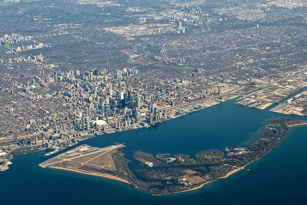
Heres an aerial showing a few clusters of Toronto:
Downtown obviously.
The leftmost one, north of the two other clusters is Yonge and Eglinton (which is getting a 200+m building

)
The small one directly south of that is Yonge and Davisville
and south of that one is Yonge and St. Clair.
Going south is Yorkville which is essentially connected to downtown skyline wise.
Near the top right corner is Thorncliffe Park
and you if you look closely right at the top left corner you can see a few buildings east of North York's main skyline.
it would be awesome if this photo was more zoomed out or taken from even higher up as North York and Scarborough would both be fully visible; maybe even Etobicoke and Markham.
Photo by Thingsmelissamakes on Flickr
 Toronto From Above
 by
thingsmelissamakes, on Flickr


 Prev
Prev


 ) a lot from people in regards to the MOA and every single time all I can think of is "what were you expecting?"!


 Linear Mode
