HomeDiagramsDatabaseMapsForum About
     

Go Back   SkyscraperPage Forum > Photography Forums > Found City Photos

Reply

 
Thread Tools Display Modes
     
     
  #10781  
Old Posted Dec 10, 2012, 1:38 AM
rick m rick m is offline
Registered User
 
Join Date: Sep 2011
Posts: 224
Quote:
Originally Posted by tovangar2 View Post
Thx, this one's a beaut. Flower at 7th looking south with the Barker Bros Bldg on the right. The older building on the near left is great, much better than the Broadway (now Macy's) Plaza's blank wall we have now (there were many 19th century bits throughout DTLA right through the 70's. Mostly gone now.) The little two-story, frame house beyond Barker Bros. looks very brave but doomed. The Ritz Hotel is still with us, but not much else. Bit of a wasteland now of empty lots and parking structures.

The base of Barker Bros (Curlett & Beelman, 1925) is so similar to the Roosevelt Building (Curlett & Beelman, 1926), diagonally across the intersection, that I got turned around for a moment.
The wooden structure on the rt was the block long Martz Flats - a favorite with lux retail - razed to be replaced by current Macys/Sheraton mall --
Reply With Quote
     
     
  #10782  
Old Posted Dec 10, 2012, 1:55 AM
ProphetM ProphetM is offline
Registered User
 
Join Date: Jul 2012
Posts: 439
Quote:
Originally Posted by tovangar2 View Post
One has to love how water, gas and oil keep rising to the surface in LA, no matter how much we pretend otherwise. Sacatela Creek can still cause havoc at Wilshire and Mariposa.

BTW, the last well of the Los Angeles City Oil Field is supposed to be still pumping somewhere on two-block-long S Mountain View Ave, but I'll be darned if I find it.
Mountain View Ave. just north of Miramar St. - that looks suspiciously like a tan-colored pumpjack next to the tanks in the center of this pic from Google Maps:


Here's another angle via Bing Maps, with the object in question circled:


A gate blocks visibility on Google Street View, but the little bit sticking up above the gate sure looks like the top of a pumpjack:

Reply With Quote
     
     
  #10783  
Old Posted Dec 10, 2012, 2:01 AM
rick m rick m is offline
Registered User
 
Join Date: Sep 2011
Posts: 224
Quote:
Originally Posted by rick m View Post
The wooden structure on the left was the block long Martz Flats - a favorite with lux retail - razed to be replaced by current Macys/Sheraton mall --
Just corrected - location of Martz Flats on left side of image--- Whew!
Reply With Quote
     
     
  #10784  
Old Posted Dec 10, 2012, 2:04 AM
tovangar2 tovangar2 is offline
Registered User
 
Join Date: Nov 2012
Location: West Los Angeles
Posts: 2,625
Martz Flats

Quote:
Originally Posted by rick m View Post
The wooden structure on the left was the block long Martz Flats - a favorite with lux retail - razed to be replaced by current Macys/Sheraton mall --
Thanks so much, I knew it was something familiar based on the pretty foliate banding detail under the eaves, but failed to put two and two together. And like I said, the 19th century has all but been erased from DTLA.

Last edited by tovangar2; Dec 10, 2012 at 11:03 AM.
Reply With Quote
     
     
  #10785  
Old Posted Dec 10, 2012, 2:15 AM
tovangar2 tovangar2 is offline
Registered User
 
Join Date: Nov 2012
Location: West Los Angeles
Posts: 2,625
Los Angeles City Oil Field: the Last Well.

Quote:
Originally Posted by ProphetM View Post

A gate blocks visibility on Google Street View, but the little bit sticking up above the gate sure looks like the top of a pumpjack:

Thx :-) I saw the tanks, but missed the pump jack. Mystery solved.

Another field come and (almost) gone.


wiki

Years ago a pumper/tank trunk used to regularly empty a pool of accumulated oil though a manhole on the Miracle Mile, the remains of the old Salt Lake Field, the one that caused the Fairfax Ross to explode in '85. Is that still going on?
Reply With Quote
     
     
  #10786  
Old Posted Dec 10, 2012, 2:39 AM
BifRayRock BifRayRock is offline
Registered User
 
Join Date: Apr 2012
Posts: 1,366
Quote:
Originally Posted by Godzilla View Post
Thanks for this image and your recent color finds!

The manicured outdoor space is interesting. The landscaped configuration struck me as being a memorial. I thought it would be depicted on period maps, but it seems to have been omitted (due to strategic significance?) or I haven't found the right map - yet.

This 1940 aerial shows a dark rectangular image that appears to be the same 200 block of La Brea. Whatever it was, this image suggests lots of foliage.
Lapl
Another 1940 Aerial
From this vantage, I can make out the arched windows in the 271 La Brea building. Flowerland - yes, lots of foliage.


USC Digital

Last edited by BifRayRock; Dec 10, 2012 at 4:40 AM.
Reply With Quote
     
     
  #10787  
Old Posted Dec 10, 2012, 2:42 AM
tovangar2 tovangar2 is offline
Registered User
 
Join Date: Nov 2012
Location: West Los Angeles
Posts: 2,625
Sacatela Creek & John Marshall High

Quote:
Originally Posted by ethereal_reality View Post
A view from below... (Sacatela Creek has long been covered over)


http://bigorangelandmarks.blogspot.c...re-bridge.html


__
Blimey e_r, I wouldn't live in the Sacatela Creek bed no matter how much they paid me. I don't care how many old Red Cars were dumped in it.

It's fun to see JMHS pre-landscaping. It became a favorite filming location after the lushness grew in.

The homes shown in this shot are still there:

2719hyperion

Last edited by tovangar2; Dec 10, 2012 at 3:14 AM. Reason: remove image
Reply With Quote
     
     
  #10788  
Old Posted Dec 10, 2012, 2:57 AM
BifRayRock BifRayRock is offline
Registered User
 
Join Date: Apr 2012
Posts: 1,366
Quote:
Originally Posted by gsjansen View Post
[Wilshire Bowl] nightclub located at 5665 wilshire boulevard


Source: LAPL

The location of the nightclub is the North East Corner of Wilshire and masselin, the future site of van de kamps wilshire coffee shop


Source: LAPL[/SIZE][/FONT]
1939 - Masselin and Wilshire


. . . same image as above with a closer view of the south side and Coulter's beautiful facade. Was it faced in travertine?

USC Digital
Reply With Quote
     
     
  #10789  
Old Posted Dec 10, 2012, 3:01 AM
DouglasUrantia DouglasUrantia is offline
Closed account
 
Join Date: Nov 2012
Location: Paramount, CA
Posts: 77
Yes I do remember that fire.

Quote:
Originally Posted by tovangar2 View Post
Yes, that's the 1000-well Los Angeles City Oil Field.
If anyone remembers the Fairfax Ross Dress-for-Less blast in 1985, then they know what can happen if one builds on old oil fields without precautions:

LAT
@tovangar:

I used to own a little apartment building back in '85. My five tenets put their rent checks in a mailbox in that gas fire area. I didn't get any of that mail for two or three months. Oh well....that was then.

Last edited by DouglasUrantia; Dec 10, 2012 at 10:18 AM.
Reply With Quote
     
     
  #10790  
Old Posted Dec 10, 2012, 3:02 AM
BifRayRock BifRayRock is offline
Registered User
 
Join Date: Apr 2012
Posts: 1,366
1939 - A companion image of Miracle Mile and Coulters.

USC Digital
Reply With Quote
     
     
  #10791  
Old Posted Dec 10, 2012, 3:09 AM
BifRayRock BifRayRock is offline
Registered User
 
Join Date: Apr 2012
Posts: 1,366

1951 - Quite a view from the Wilshire May Co roof.
Company execs entertain international contingent of girl scouts.


Gilmore Baseball Stadium? (bottom right corner)


Last edited by BifRayRock; Dec 10, 2012 at 4:29 AM.
Reply With Quote
     
     
  #10792  
Old Posted Dec 10, 2012, 3:17 AM
BifRayRock BifRayRock is offline
Registered User
 
Join Date: Apr 2012
Posts: 1,366
One more Miracle Mile . . . for the road.

1929


USC Digital
Reply With Quote
     
     
  #10793  
Old Posted Dec 10, 2012, 3:39 AM
ethereal_reality's Avatar
ethereal_reality ethereal_reality is offline
Registered User
 
Join Date: Feb 2008
Location: Lafayette/West Lafayette IN, Purdue U.
Posts: 16,344
Quote:
Originally Posted by FredH View Post
By the way, what was the thing with Chop Suey back then?
It seems like every Chinese restaurant had a big neon Chop Suey sign.

One of those ubiquitous Chop Suey signs shadowing Angels Flight in the 1950s.


slide/ebay


Yet another Chop Suey sign in 'After Midnight with Boston Blackie'. (unknown Los Angeles street)


http://ladailymirror.com/2012/05/01/...ery-photo-125/
__

Last edited by ethereal_reality; Dec 10, 2012 at 4:00 AM.
Reply With Quote
     
     
  #10794  
Old Posted Dec 10, 2012, 3:43 AM
sopas ej's Avatar
sopas ej sopas ej is offline
Registered User
 
Join Date: Jul 2007
Location: South Pasadena, California
Posts: 6,852
Ah, the Shakespeare Bridge. I drove over that today, after I went here:

LAPL

---and started taking pictures...

Photo by me

View down the stairs, called "Radio Walk."

Photo by me

View of the Prospect Studios...

Photo by me

Northeast corner of Franklin Ave. and Radio St., 1938. This house was built in 1936.

LAPL

The same house today. While I was taking pictures around this intersection with my back to this house, I heard a voice loudly say "You know, you could get the same pictures from Google." I turned around and saw a guy standing on the upper deck, and I told him "yeah, but they wouldn't be as clear." I thought, 'What an asshole.' I took a few more pictures and noticed out of the corner of my eye that he was still standing on the deck. He didn't go back inside the house until he saw me get into my car. Anyway, the address of this house is 3863 Franklin Avenue. It looks nicer in the older photo.

Photo by me

I figured it was only about 3 or 4 miles away from the intersection of Radio and Franklin, so I drove to the house used in "Double Indemnity."

From "Double Indemnity"

The house today.

Photo by me

Another still from "Double Indemnity."


An approximate view from today:

Photo by me

Yet another "Double Indemnity" still:


The view is now obscured.

Photo by me
__________________
"I guess the only time people think about injustice is when it happens to them."

~ Charles Bukowski
Reply With Quote
     
     
  #10795  
Old Posted Dec 10, 2012, 4:00 AM
tovangar2 tovangar2 is offline
Registered User
 
Join Date: Nov 2012
Location: West Los Angeles
Posts: 2,625
Oil Field/Coulter's/Howards Flowerland/Radio Walk/Shakespeare Bridge

Quote:
Originally Posted by DouglasUrantia View Post
tovangar
Oh well....that was then.


Then and now. Some things in LA really are eternal. Building & Safety is a lot more vigilant these days though, according to wiki, thousands of LA buildings now have subsurface barriers, ventilation systems, methane detectors, and alarms.

Quote:
Originally Posted by BifRayRock View Post
...a closer view of the south side and Coulter's beautiful facade. Was it faced in travertine?
I believe it was. The exterior, with its glass-block banding, was massively satisfying (pun intended), but I never really liked the interior. It was just a little too cool, restrained and cramped somehow. I was always much fonder of the main-floor volumes of the Miracle Mile May Co.

Main/rear entrance:

bibliop/flickr

Quote:
Originally Posted by BifRayRock View Post
I wonder if the grounds were aprt of a school or religious institution...
http://forum.skyscraperpage.com/show...ostcount=10736

Quote:
Originally Posted by sopas ej View Post
Ah, the Shakespeare Bridge. I drove over that today, after I went here:
View down the stairs, called "Radio Walk."


Photo by me
Are Radio Walk and the Prospect Steps two different places? I'm getting confused again.

I do dislike the "security" fencing around so many homes. I don't even lock my door.

The Shakespeare Bridge showed well in Dead Again (1991)

Last edited by tovangar2; Dec 10, 2012 at 6:07 AM. Reason: add image
Reply With Quote
     
     
  #10796  
Old Posted Dec 10, 2012, 4:38 AM
BifRayRock BifRayRock is offline
Registered User
 
Join Date: Apr 2012
Posts: 1,366
Quote:
Originally Posted by tovangar2 View Post
"Flowerland!" "The Garden Center of California." "A beautiful garden rendezvous." I misread the address as 251 (odd numbered) and assumed it occupied the west side of the street.

Thanks.
Reply With Quote
     
     
  #10797  
Old Posted Dec 10, 2012, 5:49 AM
ethereal_reality's Avatar
ethereal_reality ethereal_reality is offline
Registered User
 
Join Date: Feb 2008
Location: Lafayette/West Lafayette IN, Purdue U.
Posts: 16,344
Quote:
Originally Posted by sopas ej View Post
Ah, the Shakespeare Bridge. I drove over that today, after I went here:

LAPL

---and started taking pictures...

Photo by me

View down the stairs, called "Radio Walk."

Photo by me
Wonderful post sopas_ej! Thank you so much for sharing your photographs.
__


I was especially impressed by the before and after photographs of 3863 Franklin Avenue.


photo by sopas_ej


You were on a public street sopas_ej....no need to worry about the jerk on the balcony.
__

Last edited by ethereal_reality; Dec 10, 2012 at 6:50 PM.
Reply With Quote
     
     
  #10798  
Old Posted Dec 10, 2012, 6:10 AM
tovangar2 tovangar2 is offline
Registered User
 
Join Date: Nov 2012
Location: West Los Angeles
Posts: 2,625
Chop Suey

Quote:
Originally Posted by FredH View Post
By the way, what was the thing with Chop Suey back then? It seems like every Chinese restaurant had a big neon Chop Suey sign.
"During his travels in the United States, Liang Qichao, a Guangdong (Canton) native, wrote in 1903 that there existed in the United States a food item called chop suey which was popularly served by Chinese restaurateurs, but which local Chinese people did not eat.'
- quoted from wiki

There was an actual Chinese dish made of entrails with a similar name, but it is popularly assumed that the Chop Suey ("assorted pieces") we know was invented by Chinese immigrants in the US to appeal to American tastes (this is what I was always told anyway). Chinese restaurants therefore touted "Chop Suey" in their signage to attract Caucasian customers. This is apparently debatable. If one really wants to get into it, wiki has more.


grouppool/flickr

Last edited by tovangar2; Dec 10, 2012 at 6:16 AM. Reason: add image
Reply With Quote
     
     
  #10799  
Old Posted Dec 10, 2012, 6:58 AM
Those Who Squirm!'s Avatar
Those Who Squirm! Those Who Squirm! is offline
Registered User
 
Join Date: Jan 2011
Location: In my specially built chair
Posts: 376
Quote:
Originally Posted by unihikid View Post
What picture of Uni? I can't make out what I'm looking at here, and now I'm all curious. Could you please fix your tags or hyperlinks as needed?

TWS Class of '75
__________________
The new Wandering In L.A. post is published!

This Is Probably The Oldest Intact School Building In L.A.
Reply With Quote
     
     
  #10800  
Old Posted Dec 10, 2012, 8:43 AM
tovangar2 tovangar2 is offline
Registered User
 
Join Date: Nov 2012
Location: West Los Angeles
Posts: 2,625
AW Ross, the Miracle Mile and Spot Zoning

Has it come up before how the Miracle Mile got where it is and looks like it does/did? I can't find it. I'll try to keep this brief.

As everyone knows, AW Ross wanted to develop an upscale shopping street, with plenty of parking, to cater to automobile drivers, as opposed to the downtown pedestrian shopping experience. In 1921 Ross picked a spot on Wilshire that was within four miles of the city's wealthiest neighborhoods and bought land. The site was outside city limits, but Ross figured it would be annexed eventually and zoned for business.

However, Ross didn't realize the hysterical and angry reaction he'd get from the downtown merchants who felt threatened by his plan. When annexation came, the jealous merchants waged a ferocious and expensive propaganda campaign, supported enthusiastically by the LA Times (dependent on the downtown retailers for ad revenue), against commercial zoning for Ross' land, scaring residents with visions of gas stations, dance halls, dye works, dive bars, hot dog stands, shady characters and norish doings. When the zoning question was put to the vote, Ross lost. He lost his appeal to the courts too.

Level-headed people could see that the situation had become impossible. Wilshire already had too much noisy traffic for homes and, if the land wasn't rezoned for businesses, it was worthless and blighted. Ross decided to take his case to the city one parcel at a time for "spot-zoning". Each building, and the business it housed, had to be dignified enough, grand and luxurious enough, to justify a zoning variance (a decent architect practically guaranteed a variance). In this way Ross actually got a much more upscale, better, more architecturally-rich shopping district than he had envisioned, all built on land zoned R1. The downtown merchants, not wanting to be left out, got on board by opening branch stores, but, of course, the icing on the cake was Coulter's (LA's oldest retailer) total abandonment of downtown in favor of the Miracle Mile.

Desmonds (GS Underwood, 1929)

dbstavels/flickr,

May Co (AC Martin, 1940)

dick wittington

Of course the Miracle Mile lost out in the end to suburban malls, but that's another story.

(Info from Fabulous Boulevard Hancock, Ralph -Funk & Wagnalls, 1949)


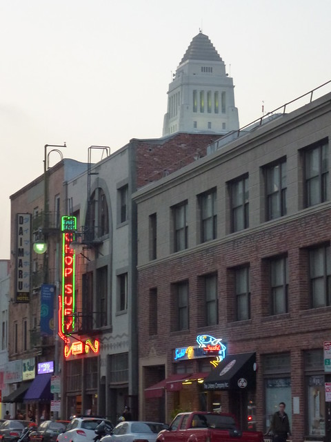
P.S. Here's one I really miss on the far east end of the Miracle Mile district
It capped the streetscape off beautifully.
I loved the six palms pinned in place on the west side of the building and it
certainly handled signage much better than the poor E. Clem Wilson Building
(Myer & Holler, 1930) with its awkwardly added hat.

anoxlou/flickr


shootthepianoplayer

Last edited by tovangar2; Dec 10, 2012 at 11:39 AM. Reason: add image
Reply With Quote
     
     
This discussion thread continues

Use the page links to the lower-right to go to the next page for additional posts

Reply

Go Back   SkyscraperPage Forum > Photography Forums > Found City Photos
Forum Jump


Thread Tools
Display Modes

Forum Jump


All times are GMT. The time now is 4:00 AM.

     
SkyscraperPage.com - Archive - Privacy Statement - Top

Powered by vBulletin® Version 3.8.7
Copyright ©2000 - 2024, vBulletin Solutions, Inc.