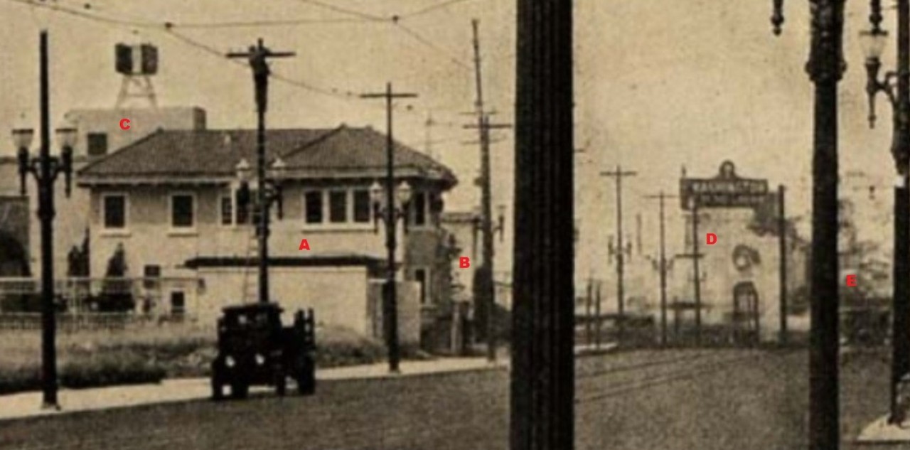
More browsing at Calisphere led to this picture, captioned "Street Scene in Glendale." I thought I'd take another try at providing a "Then and Now."

Calisphere.org
No date was given, but I would guess mid-20s from the cars. The obvious clue is the hotel name. I found it in the 1923 Glendale City Directory at 1531 S Central.

ancestry.com
Looking at the hotel, its name appears more aspirational than descriptive.
Here is a view from a contemporary Sanborn map showing the location of the camera and its field of view marked:

lapl.org
GSV makes available two views of the Hotel De Luxe corner, one from 2007 showing a cleared lot, and the second showing some Starbucks-containing-post-modernist nightmare that has just been built. I chose to show the earlier one here:

GSV
And finally, an inset:

Calisphere
Given the recent discussion of street lamps, I'm wondering if the experts could weigh in on the items circled in red in this inset. The one on the right looks like a gas pump; there seems to be a hose or tube running down its side. Also, what is the object in front of the hotel/garage? A bird bath?
Some of the buildings on the west side of San Fernando at Central look like survivors.


 Prev
Prev


 Linear Mode
