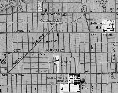
I know we've seen this map before of the P.E. route with the diagonal right of way
from Hollywood Blvd. and La Brea ending up at Fairfax and Santa Monica Blvd.
And there's a great post by Kevin W.
HERE with a visual representation of it
using period photographs.
I keep having trouble visualizing exactly where the P.E. cars connect to Santa Monica Blvd. It's probably because the area there now is so different that it's hard
for me to look at the photos and comprehend the diagonal approach. Also, the streets, especially Fairfax, look rather narrow in the photos.
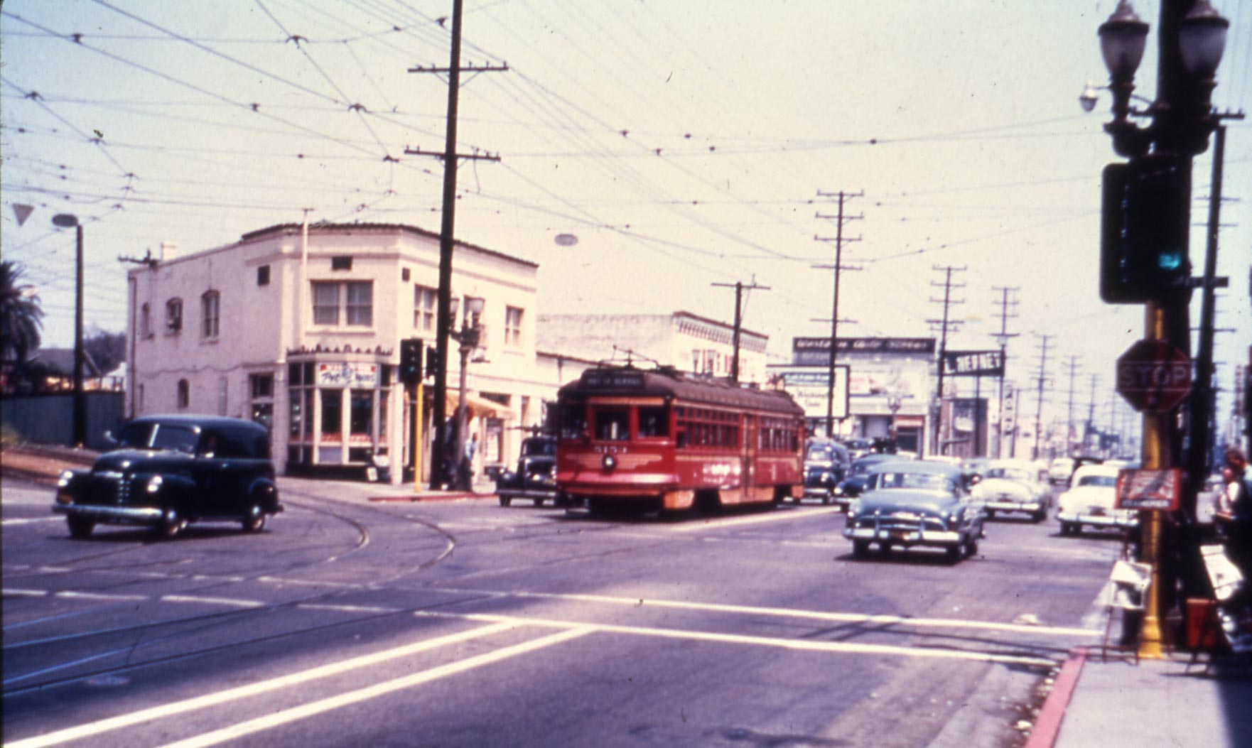
Here's a few photos from the Pacific Electric Railway Association, probably posted before, taken in the early 1950's of this intersection.
The first close shot is a Hollywood car turning onto Santa Monica Blvd. (in front of a Santa Monica line car), from the right of way at Fairfax. We're looking east.

Next is a shot further back, with a Santa Monica Line car in the same position. The right of way is at the left.
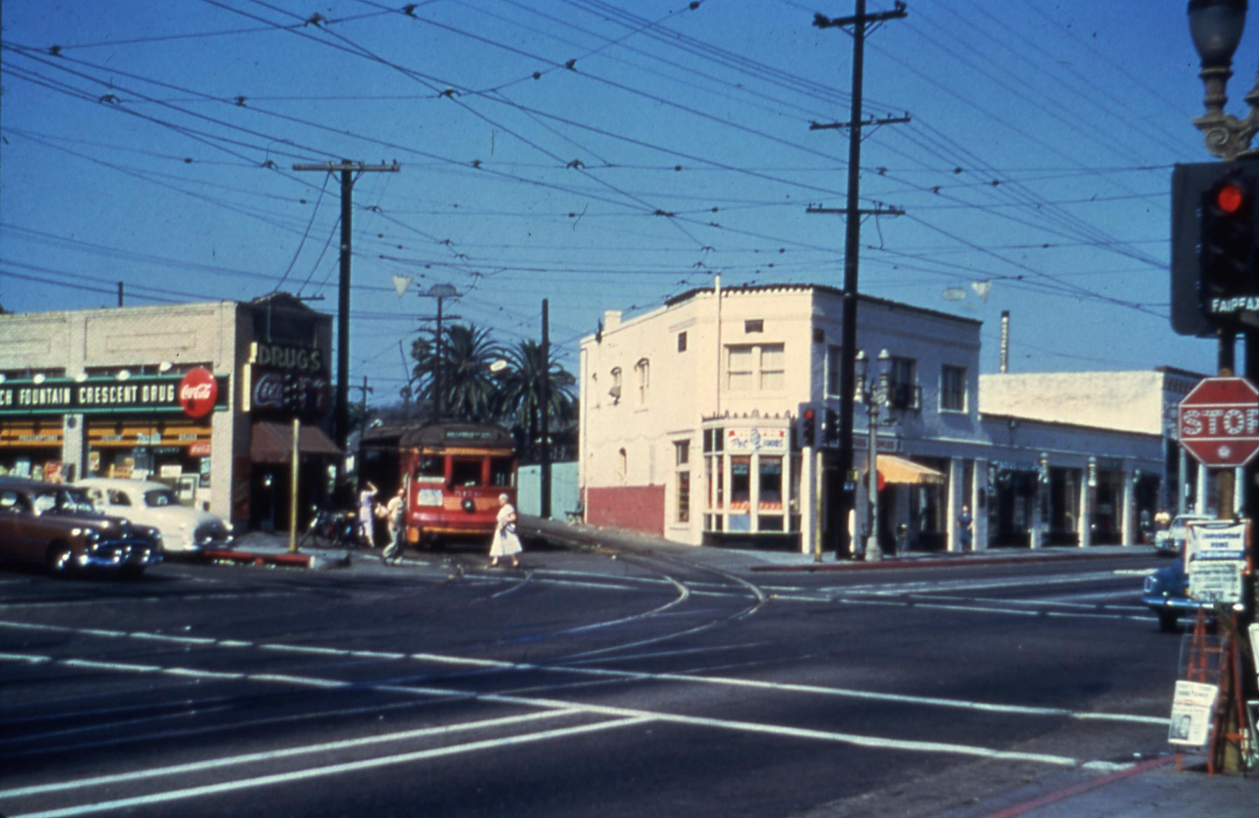
The third photo is angled toward the diagonal right of way at Fairfax, with a car waiting to turn onto Santa Monica Blvd. The Crescent Drugstore on the left is fronting Fairfax Ave.
Far right is a Fairfax Street sign. (I'm guessing it's called the Crescent Drugstore because at one time Fairfax Ave. was called Crescent Ave.)
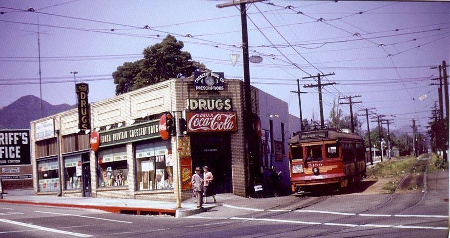
This last photo of a car arriving at the drugstore shows the tracks going off into the distance.
It's probably because the right of way intersection is at an angle and the photos aren't long shots, that I'm having trouble with the perspective of this particular location.
Also, as I said, because the area in question is now a parking lot for a Whole Foods store and the buildings in the photos are no longer there. (I'd wager the buildings on the
other side of the street could very well be the same.)
I wonder,
HossC, if there is an aerial of this area that would show the intersection? No worries if you haven't the time or inclination to look.
Here's a photo of the location from 1939:


 Prev
Prev


 Home to a spiritualist for 33 years! Now that's very interesting.


 .....unihikid, hoss and others as well.


 Linear Mode
