Quote:
Originally Posted by Flyingwedge

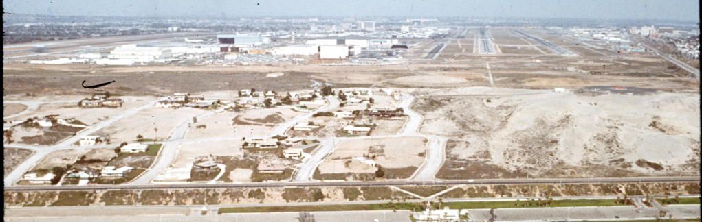
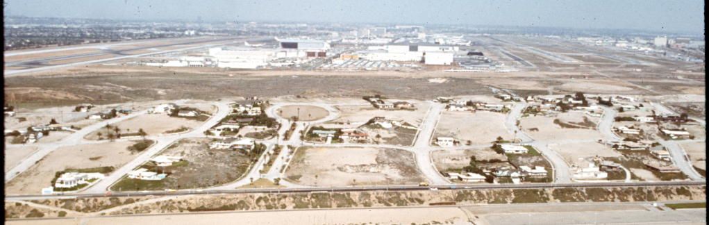
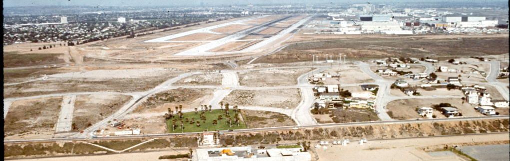
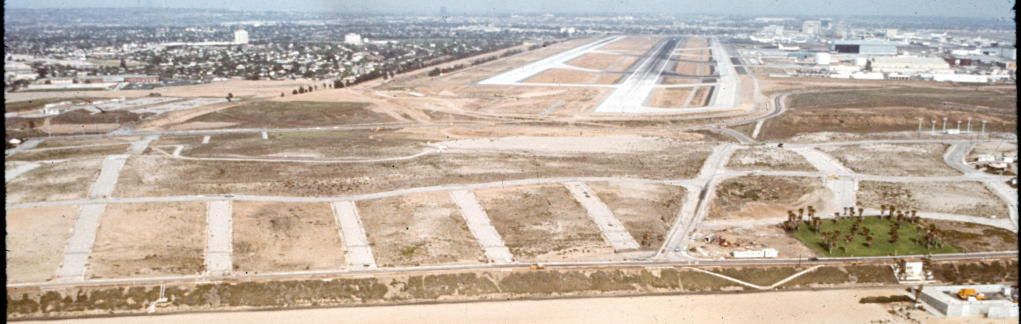
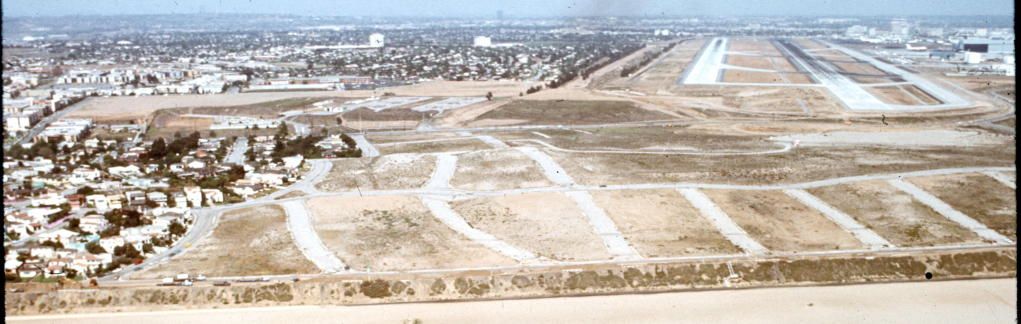
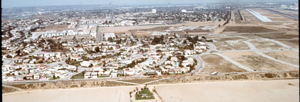
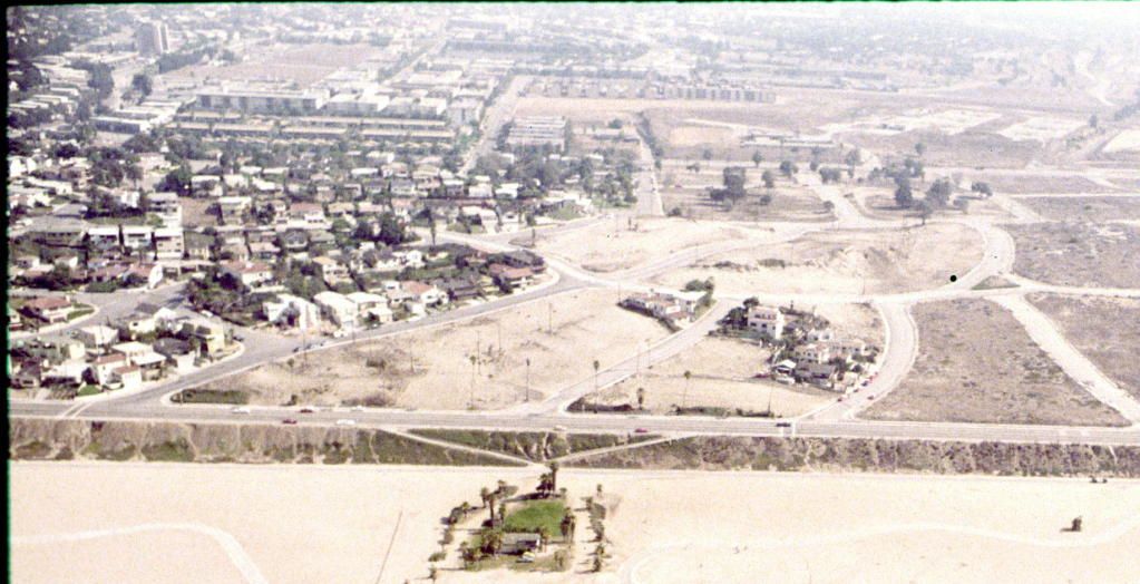
Here's the area taken by LAX in 1972 when most the houses were already gone. Sequence of pictures runs south-to-north.
|
Thank you so much for documenting Surfridge's streets. Wonderful post.
Rindge Avenue was, of course, named for Frederick Hastings Rindge. He bought almost the entire town of Port Ballona and laid out Playa del Rey, only one of his many projects in turn-of-the-20th-century Los Angeles. He also owned Rancho Malibu and built himself a splendid house on Harvard Blvd, which has been well-documented in this thread (the home's use as a filming locale is detailed
here).
After his untimely death in 1905, his widow, May, forced the Southern Pacific inland, thwarting their attempt to continue their famous coast route through her Malibu rancho, and coincidentally Los Angeles, a success we should all be grateful for.
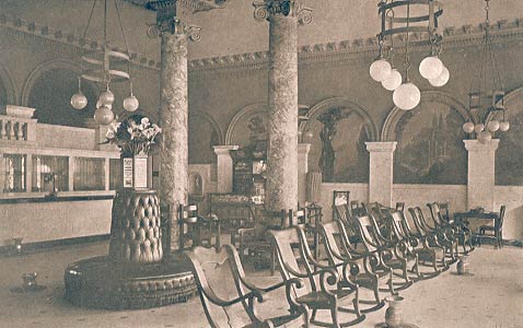
Rindge's daughter, Rhoda Adamson, started Adohr Dairy (Rhoda spelt backwards) with her husband, Merritt Adamson. Both May and Rhoda employed Stiles O. Clements, first to design Adohr's corporate headquarters at La Cienega and 18th (closely related to Clements' Chouinard School of Art, built about the same time) and later to design a house for each in Malibu, 50-room Castle Malibu for May (it burned in 1970) and a beach house for Rhoda and family, now a museum.
May Rindge started Malibu Tile in 1926, employing Rufus Keeler, California's foremost ceramics engineer, to design and manage it. Keeler collaborated with Clements on the Mayan Theater, the Pellissier Building and the Richfield Building and with Claude Beelman on the Eastern Columbia and etc. through his own company Calco. Malibu Tile executed commissions for Austin, Martin & Parkinson's City Hall, Parkinson's Union Station, Bertram Grovenor Goodhue's Central Library, Clements' Westwood Playhouse, dozens of other buildings and hundreds of homes. Simon Rodia, a Malibu Tile worker, was supplied with broken scrap from both Malibu and Calco for his Towers in Watts. Malibu Tile closed in 1932, a victim of the Depression. Keeler's early death in 1934 (it is said from the cyanide used in his famous glazes) signaled the end of Los Angeles' era of great, glazed terracotta buildings.
May Rindge died in 1941, her daughter Rhoda in 1962.
I'm glad that Rindge Avenue will continue in Playa del Rey. It's a name that should be remembered.
The later Rindge/Adamson homes:
Malibu Beach (Stiles O Clements, 1930):
23200 Pacific Coast Highway
(used by the Rindge/Adamson family as a beach house from 1930-1936, it then became their full-time home until 1962)
Adamson House
LA Curbed
Yelp
wiki
Hancock Park (Elmer Grey, 1923)
355 S Murfield
(occupied by the Rindge/Adamson family from 1923-1936, when they moved to their beach house full time)
LA Curbed
Architectural Digest
Youtube
Redfin
Malibu Potteries
Showroom 1926-1932: 119 N Larchmont Blvd (HB Saunders, 1923)
Wiki
LA Places
Malibu Times
Redondo Historical Society
LAT
Colorful Malibu Tile installed at Adamson House:
 laplaces
A Malibu Tile "carpet", also from Adamson House:
 adamsonhouse/tile
City Hall:
 davidpipertiles
Assembly-line artists at Malibu Tile:
 davidpipertiles
P.S.
Thx
e-r for the Ambassador vet sign. It is a good one. I used to take my dog there.


 Prev
Prev


 You beat to to it GW. I've been holding on to the story of the stored California for a while.
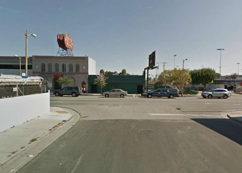


 Linear Mode
