HomeDiagramsDatabaseMapsForum About
     

Go Back   SkyscraperPage Forum > Regional Sections > United States > Southeast > Atlanta


Reply

 
Thread Tools Display Modes
     
     
  #861  
Old Posted Feb 21, 2013, 11:20 AM
Nanosolar's Avatar
Nanosolar Nanosolar is offline
Registered User
 
Join Date: Nov 2012
Posts: 139
Quote:
Originally Posted by bigstick View Post
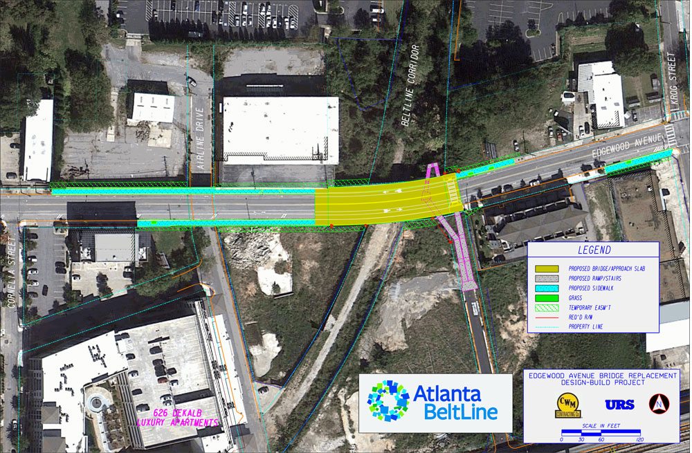
It should be recognized that in the period since the Olympics in the mid-90's, Atlanta has made huge strides in urban development in several areas and has become something of a model for Sunbelt city urbanization. The 80,000-seat Olympic Stadium where Muhammad Ali lighted the caldron to open the Games was reconfigured as a 50,000-seat ballpark for the Braves. Dorms built for athletes were later converted into housing for Georgia State University students. Centennial Olympic Park was carved out of 21 acres of abandoned blight downtown and begat projects later on, too, like the Georgia Aquarium, the new World of Coca Cola and a surge of condo and office building. The city is the first in the nation to essentially raze all of its public housing projects and erect more mixed-use developments in their place. The mixed-use, New Urbanist Atlantic Station development replaced a large brownfield site in Midtown in 2005 and received the EPA's 2004 Phoenix Award as the Best National Brownfield Redevelopment as well as the Sierra Club's 2005 America's Best New Development Projects listing. In 2000, MARTA opened two new rail stations – Sandy Springs and North Springs – on the North Line. The 47-acre Lindbergh City Center, a TOD centered around the Lindbergh MARTA station, opened in 2002. The 28-acre New Urbanist Glenwood Park development opened in 2005 on a former industrial site two miles east of downtown and received a Charter Award from the Congress for the New Urbanism in that same year. The 2.7 mile, 12-station streetcar line that will run from Centennial Olympic Park to the Martin Luther King Jr. National Historic Site on Auburn Avenue is currently under construction. The Beltline project, which will be a 22-mile public transit, trails, and parks loop around the heart of the city of Atlanta on the site of an abandoned rail and industrial corridor, is a long-range project that has already spawned infrastructure improvements, a new signature park in Fourth Ward, and its first completed trail. Ponce City Market, the largest adaptive reuse project in Atlanta's history, will restore 1.1 million square feet of the massive historic Sears, Roebuck & Company building adjacent to the BeltLine in the historic Old Fourth Ward neighborhood; it will consist of 300,000 square feet of retail and restaurants, 450,000 square feet of office space, and 260 residential units. It will be about twice as large as Chelsea Market in NYC and is scheduled to open next year. Also, historic urban neighborhood villages like Castleberry Hill, Virginia-Highland, and East Atlanta Village have experienced considerable investment and have become popular regional destinations since the early 90's.

So while it's definitely true that Atlanta has some of the worst sprawl in the Sunbelt, it should also be recognized that it also has some of the best urban redevelopment in the Sunbelt also.
Great write up. Thanks.
Reply With Quote
     
     
  #862  
Old Posted Apr 17, 2013, 5:58 PM
smArTaLlone smArTaLlone is offline
Registered User
 
Join Date: Feb 2005
Posts: 8,619
Plans For Next Beltline Stretch Under Way

http://atlanta.curbed.com/archives/2...-under-way.php

Quote:
The Edgewood Avenue bridge is now demolished, beginning the long,
detour-ridden wait for the corresponding Beltline trail to be put together. The bridge — which essentially connects Inman Park and the Old Fourth Ward, allowing Edgewood to continue between Airline Street and Krog Street — was more than a century old and torn down over the course of last week; officials had determined the $4.5 million price tag for replacement was smaller than that for extensive repairs. Beltline spokesman Ethan Davidson told Curbed Atlanta work on the section of trail beneath Edgewood won't commence until the replacement bridge is completed — in April 2014. "We are currently working on the design for this section of the trail all the way down to Memorial Drive," Davidson said.
Reply With Quote
     
     
  #863  
Old Posted Apr 18, 2013, 12:41 AM
shivtim's Avatar
shivtim shivtim is offline
Registered User
 
Join Date: Aug 2008
Location: Midtown Atlanta
Posts: 2,397
New improvements near Piedmont Park. You can now access the park from the Beltline, and there's a ped crossing over the drive to the parking deck.


photos from the Atlanta Beltline facebook page
Reply With Quote
     
     
  #864  
Old Posted May 17, 2013, 6:05 PM
smArTaLlone smArTaLlone is offline
Registered User
 
Join Date: Feb 2005
Posts: 8,619
Beltline could Get Ultra High Speed Internet

http://www.ajc.com/news/business/atl...eltline/nXs9S/


Quote:
Atlanta development officials said Thursday they are considering ultra-high-speed Internet service as a way to attract businesses to the loop of trails and planned transit known as the Atlanta Beltline.

Invest Atlanta is considering the prospects, and cost, for adding advanced fiber optic cable-based Internet service to the 22-mile loop around the city.

The cable could be buried beneath the trails and planned transit routes, where infrastructure upgrades have placed utilities underground.
Reply With Quote
     
     
  #865  
Old Posted Jun 14, 2013, 3:44 AM
Libertarian's Avatar
Libertarian Libertarian is offline
Registered User
 
Join Date: Feb 2013
Posts: 1,430
Reply With Quote
     
     
  #866  
Old Posted Jun 14, 2013, 4:40 PM
shivtim's Avatar
shivtim shivtim is offline
Registered User
 
Join Date: Aug 2008
Location: Midtown Atlanta
Posts: 2,397
Continued progress on connecting the Beltline to Piedmont Park:
http://beltline.org/2013/06/14/pedes...anta-beltline/

Reply With Quote
     
     
  #867  
Old Posted Jul 7, 2013, 8:22 PM
arjay57 arjay57 is offline
Registered User
 
Join Date: Jun 2013
Posts: 792
I noticed the COA has funded $425,000 for a Silver Comet connector trail. I had not heard about this but they must be pretty serious about it (that's over twice what they're putting into the GA 400 trail).

While I don't know the route I'm assuming it would go something like this.

An even better route would be one that incorporates the beautiful restored bridge at Paces Ferry.

Does anyone have more details?


Last edited by arjay57; Jul 7, 2013 at 9:54 PM.
Reply With Quote
     
     
  #868  
Old Posted Jul 24, 2013, 3:15 PM
smArTaLlone smArTaLlone is offline
Registered User
 
Join Date: Feb 2005
Posts: 8,619
How Beltline Could Snake Through Cabbagetown

http://atlanta.curbed.com/

Quote:
Beltline officials have released a conceptual rendering for the Wylie Street corridor they presented to a neighborhood study group for feedback last month. All changes to sidewalks and Wylie Street are still very much subject to review by the Department of Public Works, but it's clear evidence that plans are moving forward for what will ultimately be a temporary connection route for bicyclists and pedestrians until Beltline transit is implemented.
click image for larger view
Reply With Quote
     
     
  #869  
Old Posted Jul 24, 2013, 7:50 PM
ATLswede ATLswede is offline
Registered User
 
Join Date: Jan 2012
Posts: 105
Quote:
Originally Posted by smArTaLlone View Post
http://atlanta.curbed.com/


click image for larger view
This will surely make me sound like a thin-skinned R-towner, but I get a little annoyed that the media tends to charcterize everything positive in that vicinity as happening in Cabbagetown, and everything negative as Reynoldstown. This is just one example, but seriously--ONE block of the BeltLine is in Cabbagetown and the remaining five blocks and half mile of trail are in R-Town. Yet according to this story the whole thing will "meander" through C-Town.
Reply With Quote
     
     
  #870  
Old Posted Jul 24, 2013, 7:54 PM
AtlantaMustang's Avatar
AtlantaMustang AtlantaMustang is online now
Registered User
 
Join Date: Nov 2008
Location: Shanghai
Posts: 797
Quote:
Originally Posted by ATLswede View Post
This will surely make me sound like a thin-skinned R-towner, but I get a little annoyed that the media tends to charcterize everything positive in that vicinity as happening in Cabbagetown, and everything negative as Reynoldstown. This is just one example, but seriously--ONE block of the BeltLine is in Cabbagetown and the remaining five blocks and half mile of trail are in R-Town. Yet according to this story the whole thing will "meander" through C-Town.
Maybe it's just because people know the name Cabbagetown better? Not sure, just I hear more of the name Cabbagetown.
__________________
Raised in Atlanta, based in Shanghai
Reply With Quote
     
     
  #871  
Old Posted Jul 24, 2013, 8:09 PM
Alfred E Neuman's Avatar
Alfred E Neuman Alfred E Neuman is offline
Registered User
 
Join Date: Nov 2008
Posts: 145
How about Reynagetown, Caboldtown or... Towntown?
Reply With Quote
     
     
  #872  
Old Posted Jul 24, 2013, 8:44 PM
arjay57 arjay57 is offline
Registered User
 
Join Date: Jun 2013
Posts: 792
Quote:
Originally Posted by smArTaLlone View Post
Wonder if the planted medians are just at the ends or along the whole Wylie street corridor?
Reply With Quote
     
     
  #873  
Old Posted Jul 24, 2013, 10:01 PM
sunking1056 sunking1056 is offline
Registered User
 
Join Date: Jan 2007
Location: Atlanta- Reynoldstown
Posts: 252
Quote:
Originally Posted by ATLswede View Post
This will surely make me sound like a thin-skinned R-towner, but I get a little annoyed that the media tends to charcterize everything positive in that vicinity as happening in Cabbagetown, and everything negative as Reynoldstown. This is just one example, but seriously--ONE block of the BeltLine is in Cabbagetown and the remaining five blocks and half mile of trail are in R-Town. Yet according to this story the whole thing will "meander" through C-Town.
As a fellow Reynoldstowner, I can echo your frustration. I was gonna post the same thing! My next door neighbor will even tell people she lives in Cabbagetown. I get so mad at her.
Reply With Quote
     
     
  #874  
Old Posted Jul 24, 2013, 10:16 PM
trainiac's Avatar
trainiac trainiac is offline
Registered User
 
Join Date: Feb 2006
Location: Atlanta - Grove Park
Posts: 1,060
Quote:
Originally Posted by ATLswede View Post
This will surely make me sound like a thin-skinned R-towner, but I get a little annoyed that the media tends to charcterize everything positive in that vicinity as happening in Cabbagetown, and everything negative as Reynoldstown. This is just one example, but seriously--ONE block of the BeltLine is in Cabbagetown and the remaining five blocks and half mile of trail are in R-Town. Yet according to this story the whole thing will "meander" through C-Town.
Wait, what is the line between them? I always thought their shared border was the Beltline itself; like Inman Park & Old 4th Ward; Ormewood Park & Grant Park
__________________
Atlanta history blog
Reply With Quote
     
     
  #875  
Old Posted Jul 24, 2013, 10:25 PM
ATLswede ATLswede is offline
Registered User
 
Join Date: Jan 2012
Posts: 105
Quote:
Originally Posted by trainiac View Post
Wait, what is the line between them? I always thought their shared border was the Beltline itself; like Inman Park & Old 4th Ward; Ormewood Park & Grant Park
Pearl Street, which is the first street to the east of Krog/Estoria. It's not even a real block, more like a half of a real city block.
Reply With Quote
     
     
  #876  
Old Posted Sep 3, 2013, 6:28 PM
smArTaLlone smArTaLlone is offline
Registered User
 
Join Date: Feb 2005
Posts: 8,619
Atlanta BeltLine to Receive $18 Million Grant from the U.S. DOT

http://beltline.org/2013/09/02/atlan...ransportation/

Quote:
The City of Atlanta will receive an $18 million TIGER V grant from the U.S. Department of Transportation for the development of a 2.5-mile portion of the Atlanta BeltLine in the southwest corridor, announced Mayor Reed on Monday.

The project includes the construction of shared use trails, trailheads and access points, and the preservation of the future streetcar transit corridor. It will run from Allene Avenue north to Lawton Street, where it will transition to the existing West End Trail for a few blocks, then return to the rail corridor near Ralph Abernathy Boulevard and run north to Lena Street and Washington Park, where it will terminate at the existing Westside Trail, a PATH Foundation trail.
Reply With Quote
     
     
  #877  
Old Posted Sep 4, 2013, 10:50 AM
bryantm3 bryantm3 is offline
Registered User
 
Join Date: Feb 2012
Posts: 732
i'm really hoping that they expand the rail corridor and put both the transit and the pedestrian path down in the corridor— the 'west end trail' is really not much more than a sidewalk. also, this time around they need to separate the cyclists and the pedestrians (excluding small kids on trikes and bikes of course).
Reply With Quote
     
     
  #878  
Old Posted Sep 4, 2013, 1:03 PM
arjay57 arjay57 is offline
Registered User
 
Join Date: Jun 2013
Posts: 792
This should be great for the kids (and parents) at Washington High, KIPP Strive and Brown Middle School. A new safe way to walk to school and related events, without having to risk getting on the street.
Reply With Quote
     
     
  #879  
Old Posted Sep 5, 2013, 5:37 PM
smArTaLlone smArTaLlone is offline
Registered User
 
Join Date: Feb 2005
Posts: 8,619
Edgewood Avenue Bridge Rendering

Reply With Quote
     
     
  #880  
Old Posted Nov 23, 2013, 3:19 AM
smArTaLlone smArTaLlone is offline
Registered User
 
Join Date: Feb 2005
Posts: 8,619
Mayor Reed: BeltLine transit should be funded with up to $4 billion in public private

http://saportareport.com/blog/2013/1...e-partnership/

Quote:
Atlanta Mayor Kasim Reed says the planned transit system along the Atlanta BeltLine should be funded through a public private partnership.
Mayor Kasim Reed said the BeltLine's planned transit system will require a public private partnership. Here he rides a bike at the dedication of the BeltLine's East Side Trail. Credit: Christopher T. Martin

Mayor Kasim Reed said the construction of the BeltLine’s planned transit system will require a public private partnership. Here he rides a bike at the dedication of the BeltLine’s East Side Trail. Credit: Christopher T. Martin

“We’re going to have to have a public private partnership,” Reed said. “We’re going to need to partner with an investor to put up $3 [billion] to $4 billion to put up the rail component. … I believe that is the right way to go because I’d like to ride the light rail while I’m alive.”

If the project moves forward, the price would dwarf the $840 million network of managed lanes the state Department of Transportation is building in Cobb and Cherokee counties alongside I-75 and I-575 through a public private partnership. This project is the largest project of its kind in Georgia history.

Reed said he recognizes that the BeltLine has touched the soul of Atlantans. Because of this attachment to the BeltLine’s promise, Reed said he intends to take a year to work toward public acceptance of bringing in private funding to develop support for a public private partnership.
Reply With Quote
     
     
This discussion thread continues

Use the page links to the lower-right to go to the next page for additional posts
 
 
Reply

Go Back   SkyscraperPage Forum > Regional Sections > United States > Southeast > Atlanta
Forum Jump


Forum Jump


All times are GMT. The time now is 9:44 AM.

     
SkyscraperPage.com - Archive - Privacy Statement - Top

Powered by vBulletin® Version 3.8.7
Copyright ©2000 - 2024, vBulletin Solutions, Inc.