HomeDiagramsDatabaseMapsForum About
     

Go Back   SkyscraperPage Forum > Regional Sections > United States > Mountain West


Reply

 
Thread Tools Display Modes
     
     
  #7001  
Old Posted Sep 6, 2016, 10:41 PM
Liberty Wellsian Liberty Wellsian is offline
Registered User
 
Join Date: Oct 2015
Posts: 810
Quote:
Originally Posted by Future Mayor View Post
Yes it gets it's water from there, but it is meant as a historic re-creation of the south fork of City Creek.

As for the map, I think it's important to keep Amtrak on there. It's still a vital component of national travel.
It wasn't really a criticism just an FYI. It would be funny if they renamed the mall to Deer Creek mall though. (or better yet the Salt Lake Aqueduct mall)
Reply With Quote
     
     
  #7002  
Old Posted Sep 6, 2016, 10:44 PM
Liberty Wellsian Liberty Wellsian is offline
Registered User
 
Join Date: Oct 2015
Posts: 810
Quote:
Originally Posted by ImaJem View Post
I thought about a key for bus routes, but was unsure where to put it. Do you mean for all of the stations or just SLC?
All Buses preferably. I was thinking a list either "south" of Provo or "North" of Pleasant View, 2 or 3 columns.
Reply With Quote
     
     
  #7003  
Old Posted Sep 7, 2016, 4:53 PM
Hatman's Avatar
Hatman Hatman is offline
Registered User
 
Join Date: Aug 2013
Location: Salt Lake City, Utah
Posts: 1,430
I think I can understand UTA's reasoning for including no transfer information on their FrontRunner maps:

These things look to be pretty permanent. If they're like the other maps UTA has in their vehicles, these are just big stickers that aren't really meant to be replaced all that often. So you want to make these things as generic as possible so that you don't need to peel off old maps and put on new ones every change day, when bus routes (and potentially LRT routes (Where is the Black Line???)) can be added or dropped. Putting more information on a map would require that all the maps be changed overnight prior to the change day route changes.

I don't agree with UTA's decision - it really shouldn't be that hard to change stickers! - but having a map at all is better than no map. Ideally, no one on the train would need a printed map. Instead we would all be using a navigation app, telling us where to go. It would tell us to get on the train, and then alert us when our stop is coming up. A member of the general public wouldn't even need to know how many stops FrontRunner has or where else it goes - they could just plug themselves in to whatever work or entertainment they've got queued up, and not need to put any thought into navigation at all.
But obviously we aren't there yet - we're still dealing with stickers glued on walls.
Reply With Quote
     
     
  #7004  
Old Posted Sep 7, 2016, 10:05 PM
Future Mayor's Avatar
Future Mayor Future Mayor is offline
Vote for me in 2019!
 
Join Date: Jun 2007
Location: Salt Lake City, UT
Posts: 4,803
You make a very valid point Hatman, about the change days. At the very least, along with the "T" for Trax access, maybe a simple not that says, "Transfers to buses available at all stations, check RideUTA.com or the mobile app for details."

Yes it seems like common sense that there would be buses at all stops, but we all know that some people are complete idiots.
Reply With Quote
     
     
  #7005  
Old Posted Sep 7, 2016, 10:17 PM
ImaJem ImaJem is offline
Registered User
 
Join Date: Jun 2016
Location: Provo, Utah
Posts: 43
Quote:
As for the map, I think it's important to keep Amtrak on there. It's still a vital component of national travel.
Quote:
All Buses preferably. I was thinking a list either "south" of Provo or "North" of Pleasant View, 2 or 3 columns.
How's this?


Quote:
I think I can understand UTA's reasoning for including no transfer information on their FrontRunner maps:

These things look to be pretty permanent. If they're like the other maps UTA has in their vehicles, these are just big stickers that aren't really meant to be replaced all that often. So you want to make these things as generic as possible so that you don't need to peel off old maps and put on new ones every change day, when bus routes (and potentially LRT routes (Where is the Black Line???)) can be added or dropped. Putting more information on a map would require that all the maps be changed overnight prior to the change day route changes.

I don't agree with UTA's decision - it really shouldn't be that hard to change stickers! - but having a map at all is better than no map. Ideally, no one on the train would need a printed map. Instead we would all be using a navigation app, telling us where to go. It would tell us to get on the train, and then alert us when our stop is coming up. A member of the general public wouldn't even need to know how many stops FrontRunner has or where else it goes - they could just plug themselves in to whatever work or entertainment they've got queued up, and not need to put any thought into navigation at all.
But obviously we aren't there yet - we're still dealing with stickers glued on walls.
You're probably right. I certainly wouldn't want to change the maps every time! Maybe they could install a placeholder to allow for quick changes.
Also, it doesn't have to happen overnight, riders usually know about upcoming changes for change day.

Last week, I was told (via twitter) I could send my map to the marketing team. I'm hoping to get it right before I do that. They may or may not use all of my suggestions.
Reply With Quote
     
     
  #7006  
Old Posted Sep 7, 2016, 10:53 PM
Hatman's Avatar
Hatman Hatman is offline
Registered User
 
Join Date: Aug 2013
Location: Salt Lake City, Utah
Posts: 1,430
I wish you much luck, ImaJem. You've definitely got one good looking map there. I think you're onto something there on the right, where you list all the bus routes. Perhaps if that section were to be made movable/replaceable, you could list routes not by county but by FrontRunner station. That way the main section of the map doesn't need to be replaced unless something major happens (like the Black Line!)

I laughed when I saw that UTA did with the right side on their map. "Map Legend:" The only line on this map is FrontRunner, so I hope the color matches!
Reply With Quote
     
     
  #7007  
Old Posted Sep 8, 2016, 2:31 AM
Liberty Wellsian Liberty Wellsian is offline
Registered User
 
Join Date: Oct 2015
Posts: 810
Quote:
Originally Posted by ImaJem View Post
How's this?


You're probably right. I certainly wouldn't want to change the maps every time! Maybe they could install a placeholder to allow for quick changes.
Also, it doesn't have to happen overnight, riders usually know about upcoming changes for change day.

Last week, I was told (via twitter) I could send my map to the marketing team. I'm hoping to get it right before I do that. They may or may not use all of my suggestions.
Just throwin stuff at the wall. At the end of the day it's your creation. If you're going to separate buses by county it may look better to put some at both ends(utah county to the South for instance).
Maybe a way around having to change the sign out would be to color code buses by the days service is available? then again that may be a mess.
Reply With Quote
     
     
  #7008  
Old Posted Sep 8, 2016, 9:10 AM
electricron's Avatar
electricron electricron is offline
Registered User
 
Join Date: Aug 2008
Location: Granbury, Texas
Posts: 3,526
Lightbulb

I think adding all the bus routes would be a mistake, keep the transfer information on the map limited to light rail lines. Light rail lines aren't going to change that often, while bus lines are changed too often imho.
The purpose of the map on the train is so riders can tell how many stations away their destination is upon arriving at a station so they can get ready in time. Adding individual bus routes gives too much data, which can easily become out of date with frequent bus route changes.
Reply With Quote
     
     
  #7009  
Old Posted Sep 8, 2016, 8:22 PM
ImaJem ImaJem is offline
Registered User
 
Join Date: Jun 2016
Location: Provo, Utah
Posts: 43
Just sent it to UTA marketing! No more posts about crazy maps I promise!
I sent one with buses and one without. I also sent a separate table showing bus connections like hatman suggested.
Reply With Quote
     
     
  #7010  
Old Posted Sep 8, 2016, 11:19 PM
Hatman's Avatar
Hatman Hatman is offline
Registered User
 
Join Date: Aug 2013
Location: Salt Lake City, Utah
Posts: 1,430
That is pretty fantastic. Even if UTA doesn't include an update-able section of their map, I would hope that the information you've formatted ends up in the printed schedules.

Maybe we could be like SPHansen and his proposed Salt Lake City flag (a design I agree with, btw) and print and place these bus connection tables on our own! Who's with me?

Reply With Quote
     
     
  #7011  
Old Posted Oct 1, 2016, 3:56 AM
ImaJem ImaJem is offline
Registered User
 
Join Date: Jun 2016
Location: Provo, Utah
Posts: 43
Hey UTA: Commuter Gondolas in Salt Lake City:

https://www.wired.com/2016/09/commut...robably-maybe/

Reply With Quote
     
     
  #7012  
Old Posted Oct 2, 2016, 1:15 AM
(Eco)nomy_404's Avatar
(Eco)nomy_404 (Eco)nomy_404 is offline
Registered User
 
Join Date: Feb 2011
Location: Jersey Shore
Posts: 299
Utah Supreme Court denies BRT injunction

http://www.heraldextra.com/news/loca...403d17e2e.html

Provo and Orem residents seeking an injunction to stop the bus rapid transit project were denied Wednesday by the Utah Supreme Court.

According to the court order from Associate Chief Justice Thomas R. Lee, “Even assuming the court may enjoin construction on the portions of the project that would be affected by the referenda, the motions have failed to present allegations sufficient to demonstrate an emergency warranting such injunctions.”
Reply With Quote
     
     
  #7013  
Old Posted Oct 4, 2016, 2:49 PM
Hatman's Avatar
Hatman Hatman is offline
Registered User
 
Join Date: Aug 2013
Location: Salt Lake City, Utah
Posts: 1,430
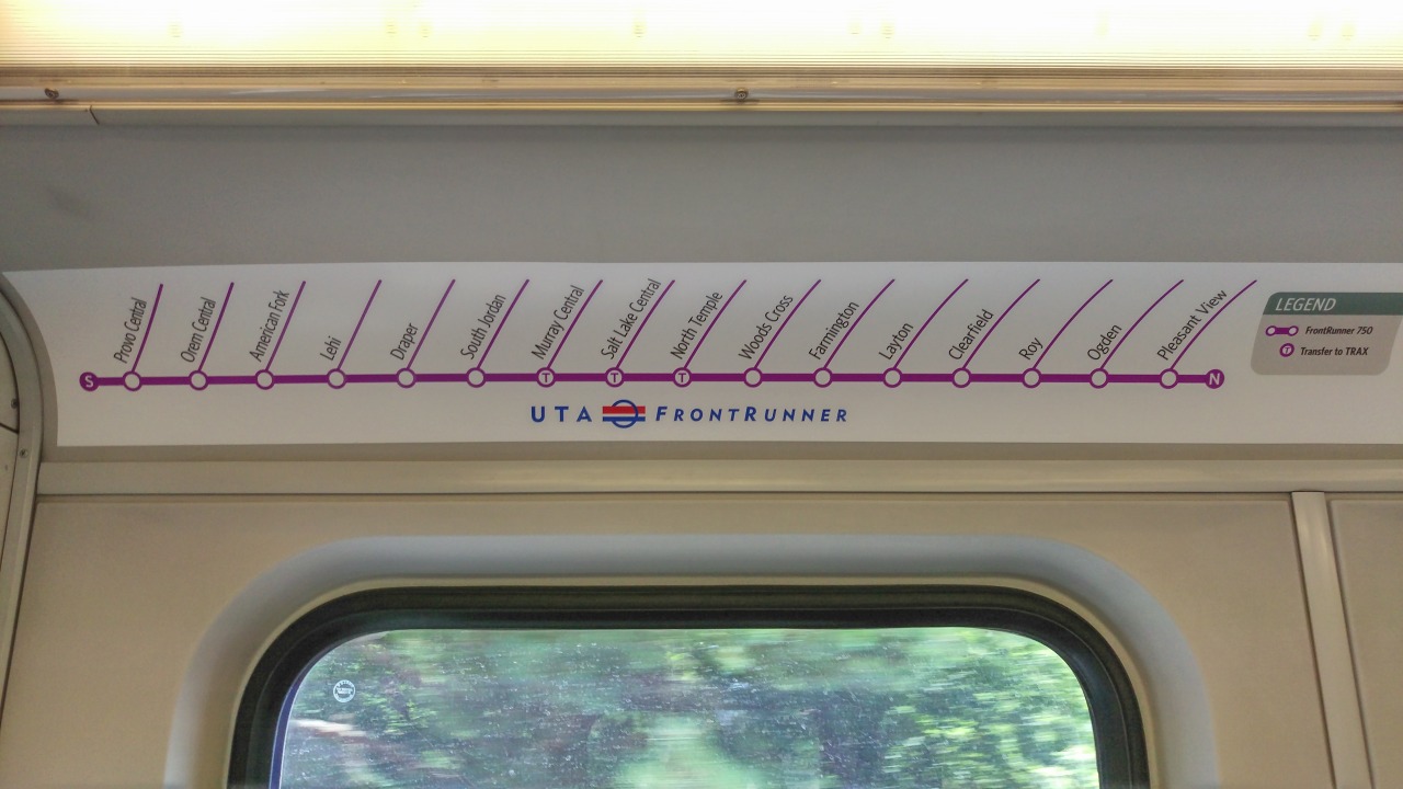
So you know how at Murray Central Station, how the TRAX station has only one pedestrian access to FrontRunner, on the south side? And how that north side access was built in 2012 but was closed with fences, a huge sign, and a gap in the crosswalk? And how annoying that makes it to transfer from FrontRunner to TRAX because if you're in the bike car you have to walk all the way to the south end of the platform and wait behind all the other people from the other southernmost cars who got there before you?


Well, it's open now.

I still can't figure out why it was ever closed. Was it a construction issue? (Poor concrete?) Was it a design issue? (Poor sight distance?) Was it a legal issue? (Added liability?)
Whatever it was, nothing looks all that different. They just put the concrete panel back on the TRAX crosswalk, took away the signs and the fences, and added some flashing 'look both ways' signs.
Really, why did that take so long? It's little things like this that make transferring so much less terrible.
In the future, I want to see Murray Central become just like Salt Lake Central, with the parking lot between TRAX and FrontRunner converted into a nice wide plaza with side platforms for easy transfers. Then fill the other parking lots to the east with some nice TOD. And then grade-separate the rail lines from 51st south (rail overpasses), and then add in a BRT station to Taylorsville/West Valley Central, and then....
Reply With Quote
     
     
  #7014  
Old Posted Oct 4, 2016, 3:13 PM
Future Mayor's Avatar
Future Mayor Future Mayor is offline
Vote for me in 2019!
 
Join Date: Jun 2007
Location: Salt Lake City, UT
Posts: 4,803
Quote:
Originally Posted by Hatman View Post
In the future, I want to see Murray Central become just like Salt Lake Central, with the parking lot between TRAX and FrontRunner converted into a nice wide plaza with side platforms for easy transfers. Then fill the other parking lots to the east with some nice TOD. And then grade-separate the rail lines from 51st south (rail overpasses), and then add in a BRT station to Taylorsville/West Valley Central, and then....
I'd love to see that middle parking lot be converted in the the mother of all TOD's. Seriously how more TODy can it get, being situated smack in the middle of FrontRunner and Trax?

I like the plaza idea, but why not add some 5-10 story buildings in the lot. Place retail uses on the ground floor, some office uses on the next floor or two and residential above that.

Build a structured garage, wrapped by residential east of Trax, with plazas and directional signage leading to both ends of both platforms. You are right that along with SL Central this station has the most potential, and it is being highly under utilized.


Real quick off the top of my head here's an idea.
Blue - 3-10 story mixed use
Purple - Small Retail
Tan - Plaza Space
Brown - Parking

Last edited by Future Mayor; Oct 4, 2016 at 3:34 PM.
Reply With Quote
     
     
  #7015  
Old Posted Oct 4, 2016, 4:34 PM
Hatman's Avatar
Hatman Hatman is offline
Registered User
 
Join Date: Aug 2013
Location: Salt Lake City, Utah
Posts: 1,430
I think you're on to something. The layout at Murray is larger than the Salt Lake Central plaza. I measured it quickly on Google Maps. SLC's plaza was 180 feet wide at its widest, and was about 27,800 sq ft total. Murray - assuming we use just the space directly between the two platforms - was over 220 feet at its widest and took up 96,000 sq feet. So there is plenty of space for TOD directly between the tracks. Provided of course that some of that space is reserved for platforms, but that still leaves an amazing amount of space to fill in with TOD.
I get the sense that you and I are going to be very hard to please when somebody else gets tasked with improving that area.
Reply With Quote
     
     
  #7016  
Old Posted Oct 4, 2016, 4:36 PM
ImaJem ImaJem is offline
Registered User
 
Join Date: Jun 2016
Location: Provo, Utah
Posts: 43
I love this idea! I used to ride FrontRunner to my High School and hated standing in the freezing cold waiting for the school shuttle (that broke down all the time). It would have been nice to have somewhere warm to wait or somewhere to buy hot cocoa!
It would also be nice to have a pick up/drop off lane somewhere between TRAX and FrontRunner, that way the station would also be autonomous future-proof.
It would be wise for UTA to open the TRAX Black line before doing this work, as it would alleviate crowding at this station for students reaching the U.
Reply With Quote
     
     
  #7017  
Old Posted Oct 4, 2016, 6:13 PM
jedikermit's Avatar
jedikermit jedikermit is offline
Registered User
 
Join Date: Aug 2006
Location: Salt Lake City, UT
Posts: 2,239
Yeah, the Murray Station is made for TOD...hopefully someone will get on that sooner rather than later.
__________________
Loving Salt Lake City. Despite everything, and because of everything.
Reply With Quote
     
     
  #7018  
Old Posted Oct 6, 2016, 3:07 AM
ImaJem ImaJem is offline
Registered User
 
Join Date: Jun 2016
Location: Provo, Utah
Posts: 43
I'm not really sure how to post this, but here it goes...

A while ago I went through the futureuta.blogspot.com website (hatman's) specifically the part about TRAX. I was interested in the idea of "Destinations" instead of "Lines" So I decided to use my design skills to make a series of symbols to represent these destinations.
Each symbol consists of a single Letter on a colored background (an A on a sky blue background for Airport) Here is a jpeg showing these:


These symbols can be used on maps, signs, or even displayed on the train headers. (these would look great on an e-ink display)

Here is a map: (I replaced the dots from hatman's map with my symbols)


Here is a Link to the Drive folder.
Reply With Quote
     
     
  #7019  
Old Posted Oct 6, 2016, 2:44 PM
Hatman's Avatar
Hatman Hatman is offline
Registered User
 
Join Date: Aug 2013
Location: Salt Lake City, Utah
Posts: 1,430
I'm totally flattered. Thanks, ImaJem!

Maybe one day you could help me make a decent-looking map for a future blog post?

I've had some time to study trends since I wrote that series on TRAX and LRT, and I'll admit that the map I designed then needs a few changes. First, I no longer think it is necessary to have a TRAX line extend north into Davis county, let alone Ogden. The transit-specific traffic density is not there to justify such an investment, especially if FrontRunner is able to improve in service like I fantasized in the most recent post. I've also cooled to the idea of putting a TRAX line down the Bangerter Highway because - again - the transit-specfic density is not there, especially if autonomous microbuses and carpooling become prevalent.
But the rest of the map stays. In the most-recent post linked above, I have a google-map embedded near the bottom that reflects my updated thinking. Hey, everybody, even a blogger, reserves the right to change his mind!

But seriously, these are cool icons. Do you mind if I use them in a future post?
Reply With Quote
     
     
  #7020  
Old Posted Oct 6, 2016, 2:53 PM
Future Mayor's Avatar
Future Mayor Future Mayor is offline
Vote for me in 2019!
 
Join Date: Jun 2007
Location: Salt Lake City, UT
Posts: 4,803
I like the idea of "Destination" markers. They could be incorporated into bus maps as well. Creating a sense of place, even away from that place.
Reply With Quote
     
     
This discussion thread continues

Use the page links to the lower-right to go to the next page for additional posts
 
 
Reply

Go Back   SkyscraperPage Forum > Regional Sections > United States > Mountain West
Forum Jump


Forum Jump


All times are GMT. The time now is 9:39 AM.

     
SkyscraperPage.com - Archive - Privacy Statement - Top

Powered by vBulletin® Version 3.8.7
Copyright ©2000 - 2024, vBulletin Solutions, Inc.