
Thanks for adding your memories,
lemster. We're a little south of there today.
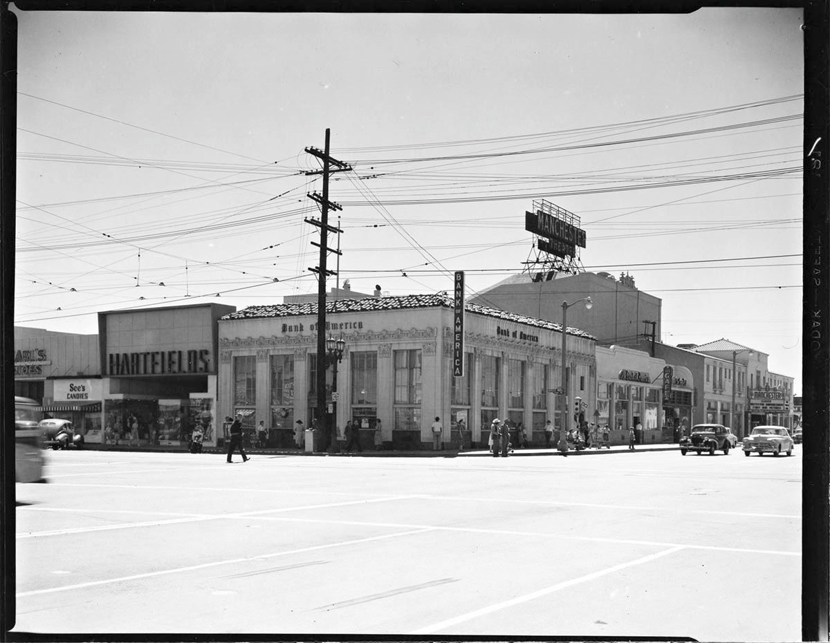
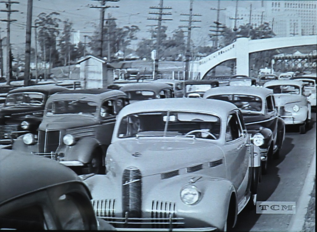
A couple of my latest Julius Shulman posts have featured a Bank of America branch on Manchester Avenue and a Bank of America branch on S Broadway, so I thought I'd combine the two and show the branch at Manchester Avenue and S Broadway. This is
"Job 1034: Bank of America (Los Angeles, Calif.),1951". On the left is Karl's Shoes, See's Candies and Hartfields. On the right, the large roof sign belongs to the Manchester Theatre at 322 W Manchester Avenue.
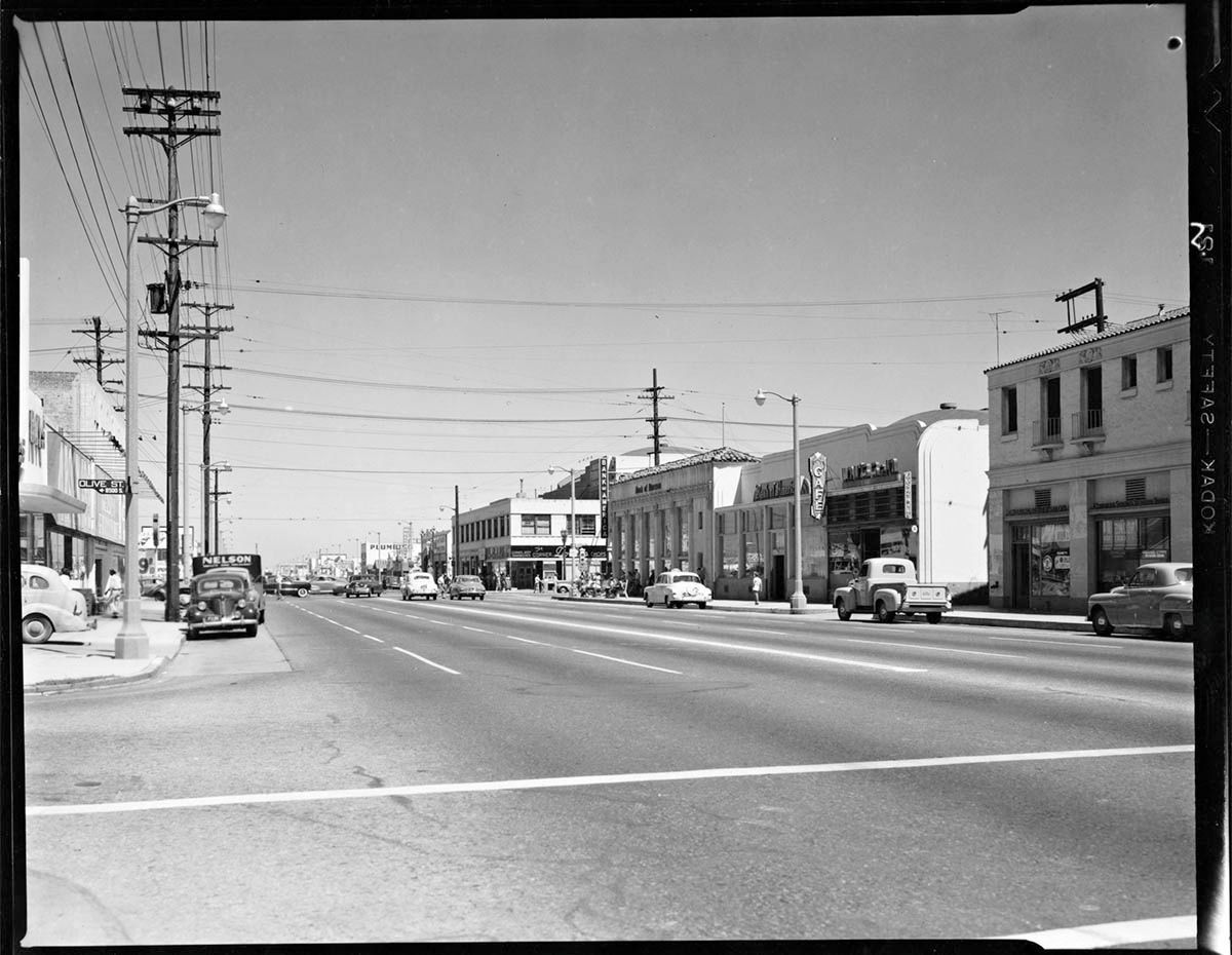
Looking east, this view shows that the bank extended up to the "Cafe" sign on the building next door.
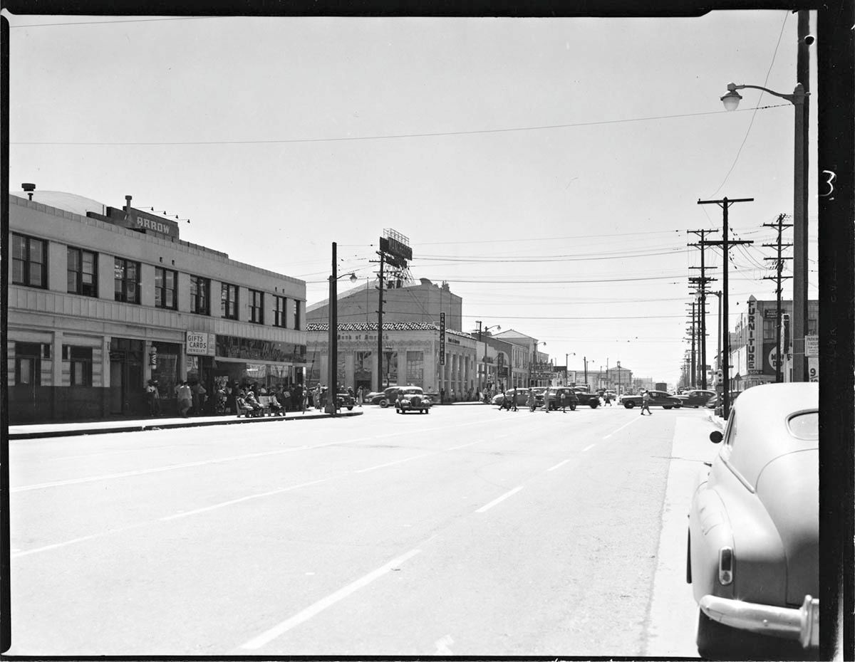
A wider view looking west on Manchester Avenue.
All from
Getty Research Institute
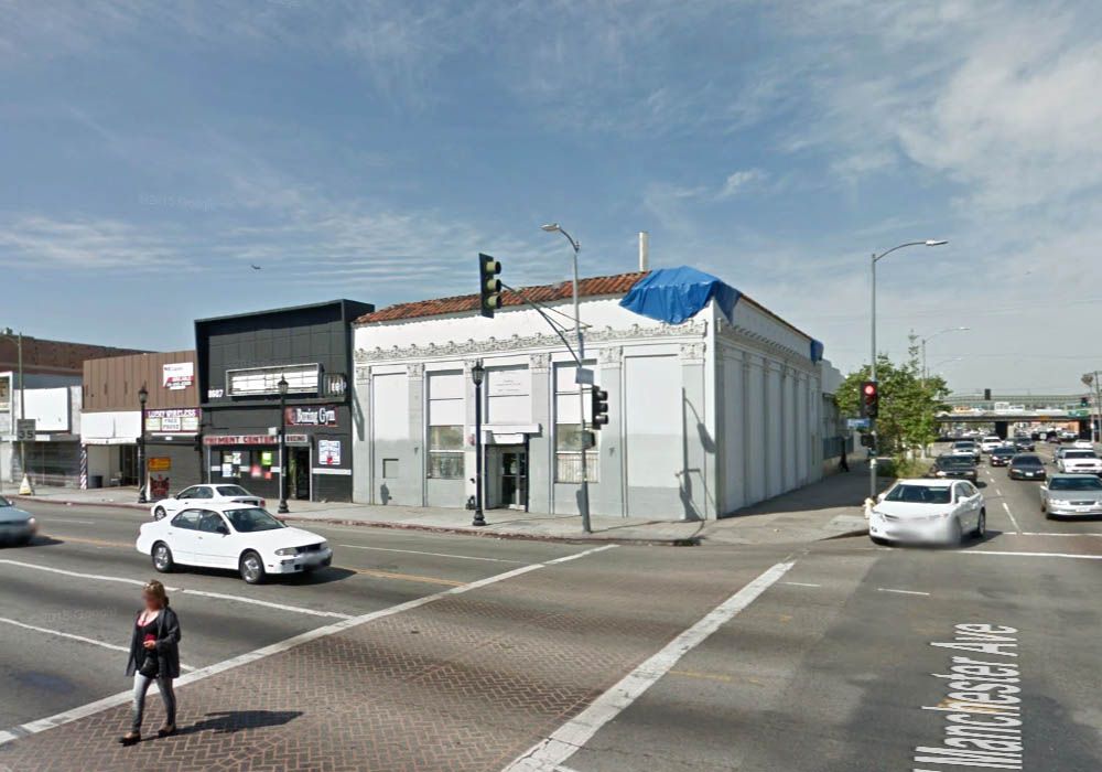
I was disappointed twice before I got my orientation correct. After seeing the Olive Street sign in the second picture, I accidentally typed "5800 S Olive" into Google instead of "8500 S Olive", and found myself at a nearly identical road layout several blocks north. Quickly realizing my mistake, I dropped my Google man at Manchester and Broadway, and found myself facing a modern Bank of America branch complete with drive-thru. Thinking it had replaced the building in the Shulman picture, I spun the Googlemobile around and finally discovered the original bank building on the opposite corner. Apart from the tarp on the roof and the covered windows, it seems to have survived pretty well. The old Karl's Shoes, See's Candies and Hartfields stores are also still recognizable.
GSV
The buildings next to and opposite the old bank also survive. I deliberately chose this angle because I think the Olive Street shotgun sign is the same as the one seen in 1951. The lamppost, hidden here by the utility pole, also looks the same, although the tops have been changed.
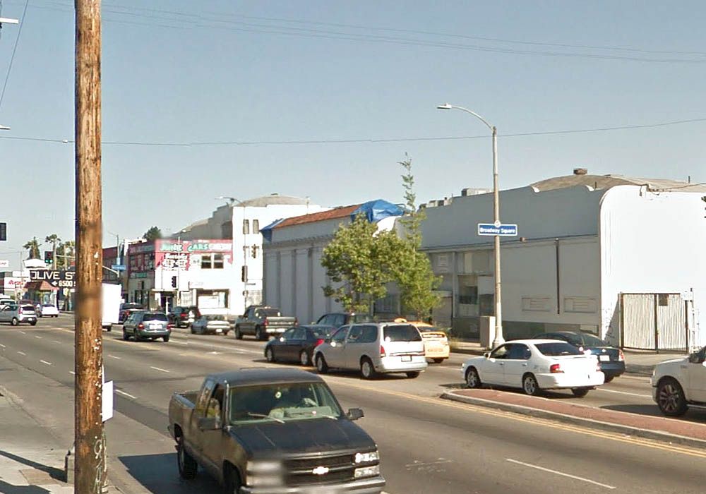
GSV
Two major changes are evident when comparing this last view to the last Shulman photo: the Manchester Theatre is missing, and the Harbor Freeway now crosses Manchester Avenue in the distance. The 1926 Manchester Theatre survived the building of the freeway, but was demolished sometime between 1963 and 1972 (going by Historic Aerials) - you can read more at
cinematreasures.org. I won't claim that the building on the left was the most beautiful in the world, but it's really not being helped by mixed paint schemes, external ducting and graffiti. On the right is the new Bank of America which initially confused me.
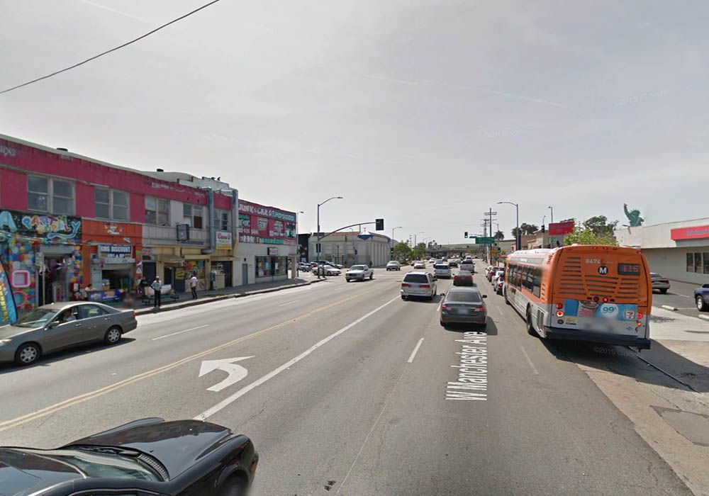
GSV


 Prev
Prev


 ) -actually, now that I think about it, tunnels are dotted lines.
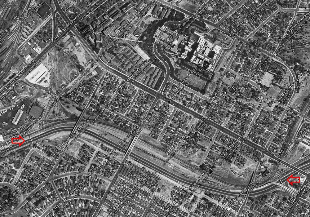
 Thanks guys for the clarification[s]. I now know that there were TWO very


 Linear Mode
