Quote:
Originally Posted by GaylordWilshire

|
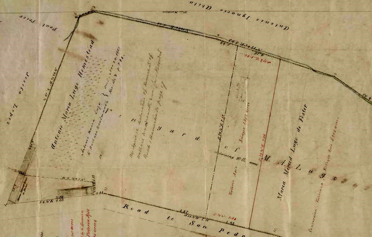
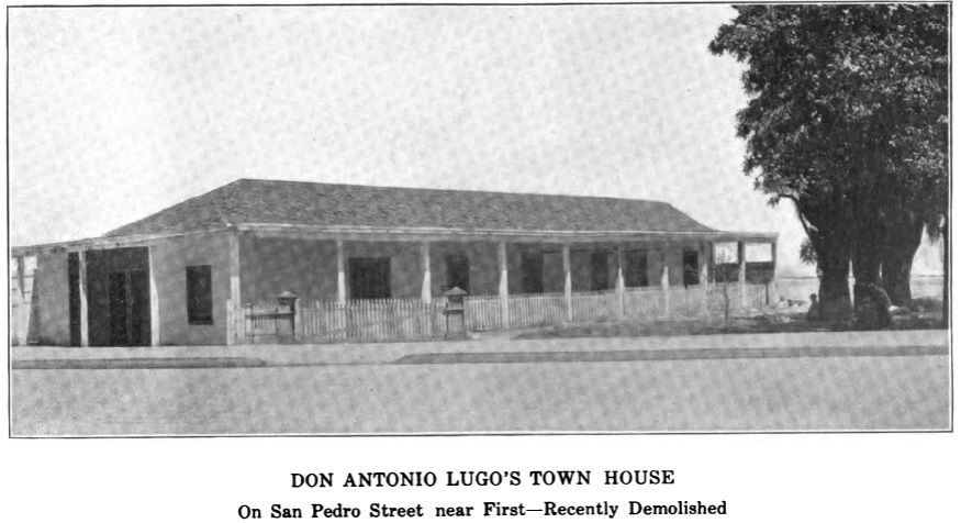
Here's an 1854 map of the Antonio Maria Lugo vineyard on the "Road to San Pedro," later San Pedro Street. The 1819 adobe is in the extreme lower left corner of the map:
Huntington Digital Library --
http://hdl.huntington.org/cdm/single...id/11676/rec/1
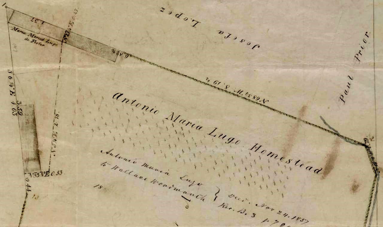
The portion of the map with the adobe, closer up and reoriented:
Maria Merced Lugo de Foster was the daughter of Antonio Maria Lugo. She married Stephen Foster, alcalde/mayor of Los Angeles 1848-49. Their daughter Carrie married Wallace Woodworth, to whom Lugo deeded the homestead property on November 24, 1857. More about Antonio Maria Lugo and his family here:
http://books.google.com/books?id=gAc...20lugo&f=false
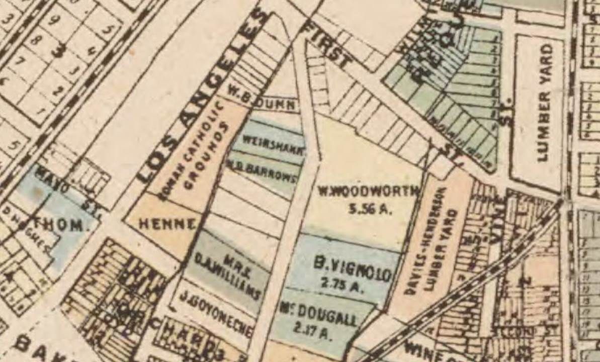
The area ("W. Woodworth") on the 1884 Stephenson Map. Mayo Street will later be renamed 3rd Street:
Calisphere --
http://content.cdlib.org/ark:/13030/hb3s2008sd/?order=1
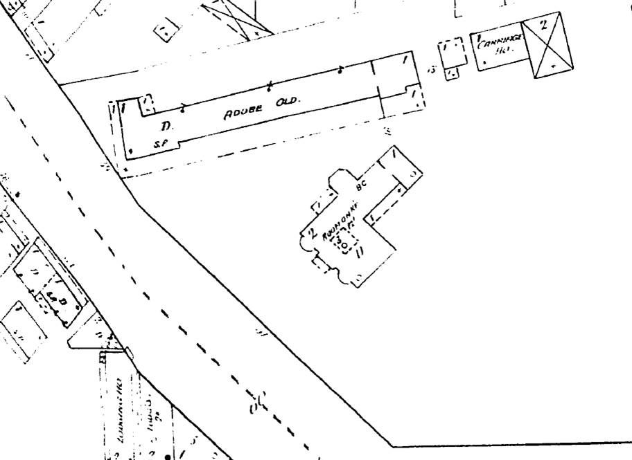
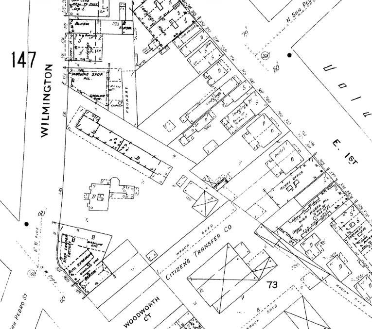
The Lugo Adobe on the 1888 Sanborn Map, with the Woodworth home just below it. Second Street has been put through the property at lower right:
LAPL
The Lugo Adobe c. 1885. Starting at the right front corner (next to the left entrance/driveway marker) and going back, I count at least 13 posts/columns. In the distance, facing the camera may be the slanted roof of the carriage house indicated on the Sanborn Map:

USC Digital Library --
http://digitallibrary.usc.edu/cdm/si...d/25330/rec/62
This is also supposed to be a c. 1885 photo of the Lugo Adobe. The picket fence matches the photo above, but I don't see those palm trees in other photos:
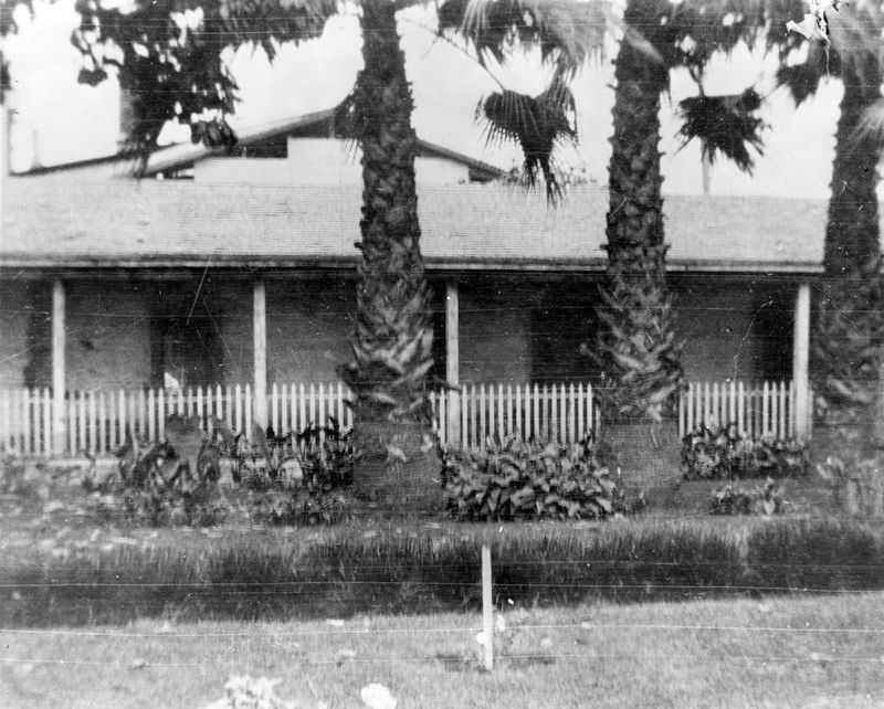
LAPL --
http://jpg1.lapl.org/00081/00081446.jpg
Here's a section of the adobe in c. 1900-02:
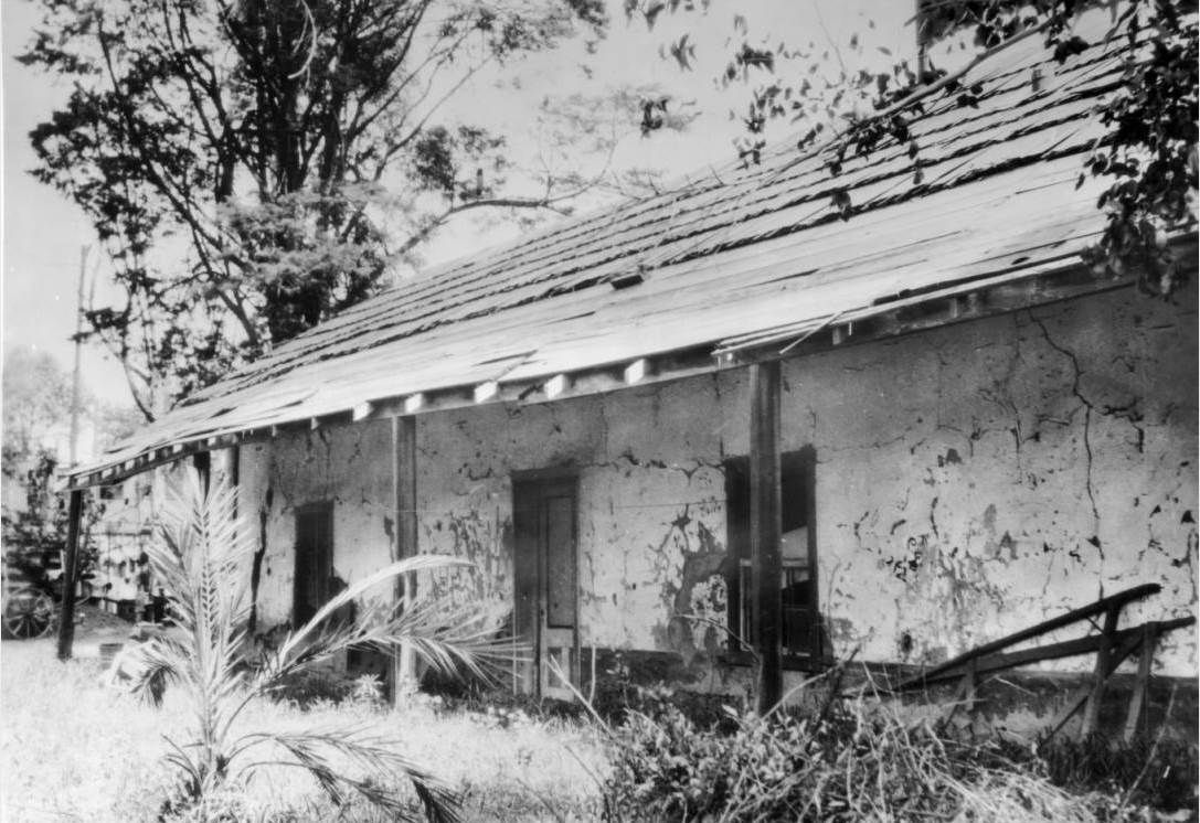
USC Digital Library --
http://digitallibrary.usc.edu/cdm/si...id/2636/rec/66
The area on the 1906 Sanborn Map:
LAPL
The entrance/driveway markers in this c. 1910 photo match the ones in the first c. 1885 photo. Starting from the right front corner and going back, I count only 10 posts/columns (you'll see why in the next photo):
The Quarterly / Historical Society of Southern California (1914) --
http://books.google.com/books?id=gF4...street&f=false
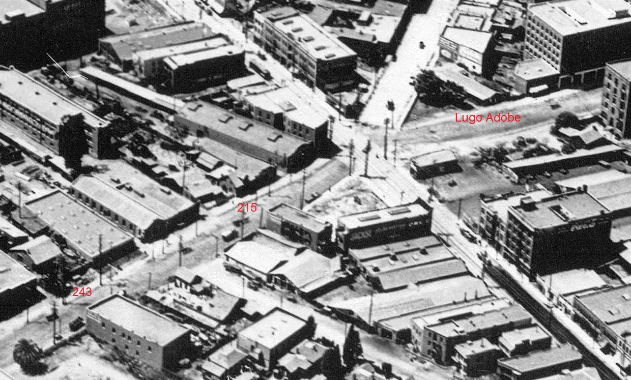
Near the end, c. 1910. San Pedro Street has been extended from 1st to 2nd, demolishing the old Woodworth house and the rear portion of the Lugo Adobe, leaving the carriage house on the east side of the new street:
USC Digital Library --
http://digitallibrary.usc.edu/cdm/si...id/4014/rec/73
Another notable property in the c. 1910 aerial photo is 243 S. San Pedro, a brick house built perhaps as early as 1853 by Dr. William A. Hammel (
http://forum.skyscraperpage.com/show...ostcount=14907).
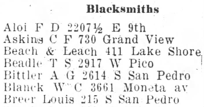
215 S. San Pedro was the home of Louis Breer, a longtime Los Angeles blacksmith. Breer built a brick house on the property in about the mid-1860s; an older adobe home that was to the left of the brick house may also be in the aerial photo. Here he is listed among the blacksmiths in the Los Angeles City Directory of 1908 -- his 80th year:
Fold3.com
The brick home survived until at least 1940; here it is on the 1940 WPA Model of Los Angeles:
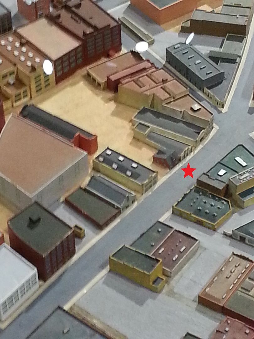
Photo by me
A wider view:
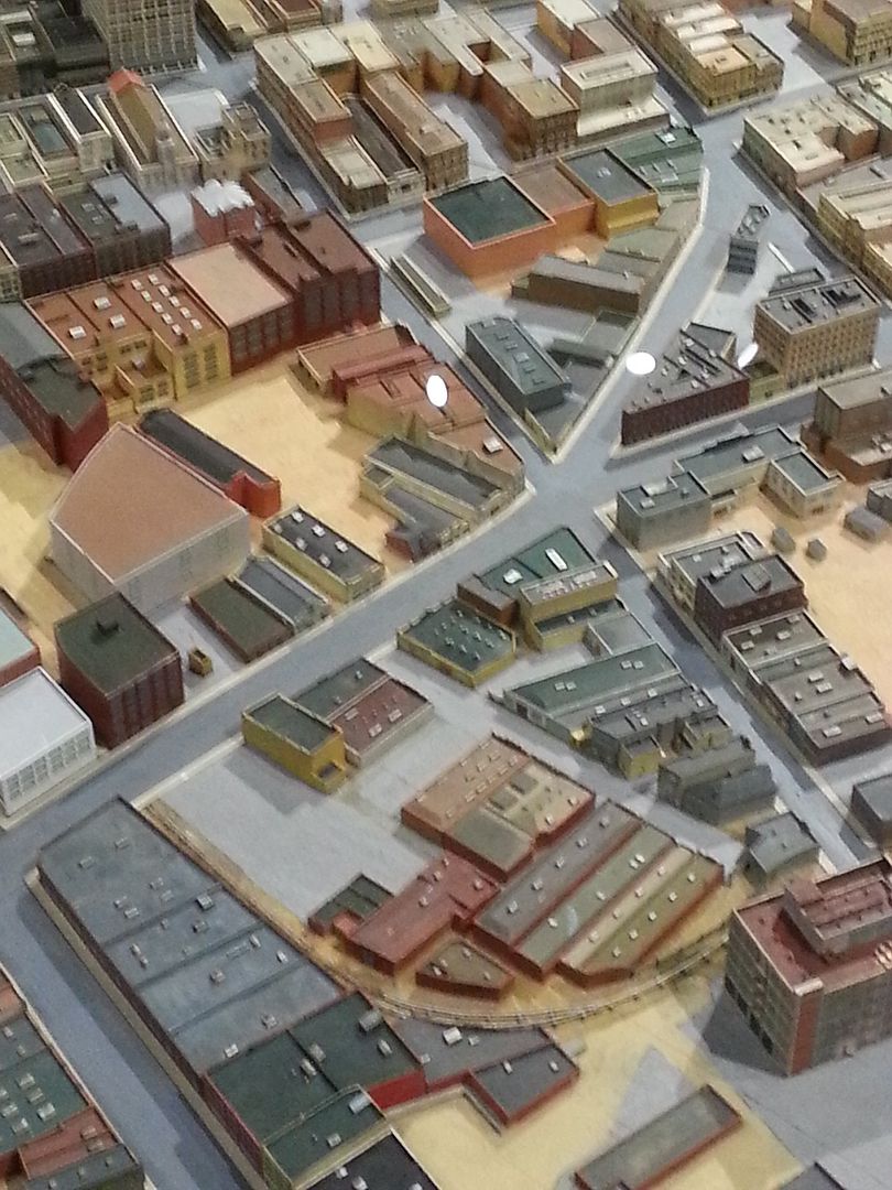
Photo also by me
Louis Breer's son Carl, at age 18, built a replica Stanley Steamer and went on to be one of the founding engineers of the Chrysler Corporation:
http://books.google.com/books?id=_dj...ksmith&f=false