Quote:
Originally Posted by ethereal_reality

I found this on ebay tonight.
ebay
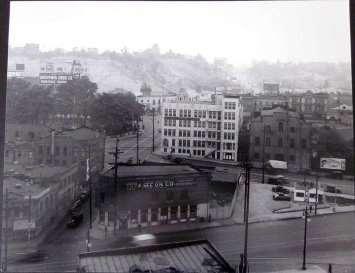
I should be able to pick out these streets but I'm not 100% sure, so I checked my old ma
alas, it's still confusing to me. Is that Sunset curving around The Plaza onto Sanchez? how about Alameda St?...
and then there's Ferguson too.
p.
OK. Here's my guess...the photograph shows Ferguson, Olvera and Alameda...with Sunset on the far side of The Plaza
__ |
I think that's Sunset passing the north end of the Plaza then turning into Bellevue as it rounds the corner with the white building on it before meeting Alameda at an angle. Ferguson on the left. Olvera St buried in the block on the right. (?) (My '48 Gillespie's Guide has
tiny type.) Anyway, we're on the Union Station block, corner of Macy.
(see ProphetM's corrections on the next page)
P.S.
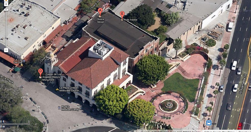
google maps
The building with the stepped gable ends is still there, the white building in the old photo is next to it, now with a peaked roof and some new "Spainish" arches at its base (man, Christine Sterling musta been working overtime). The church behind it also appears in both images. One can also see the shadow of the triangular block in the foreground of the old photo in the google maps image. And hey, there's the Avila Adobe