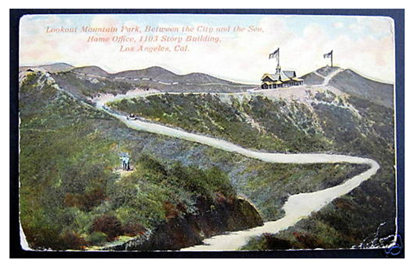
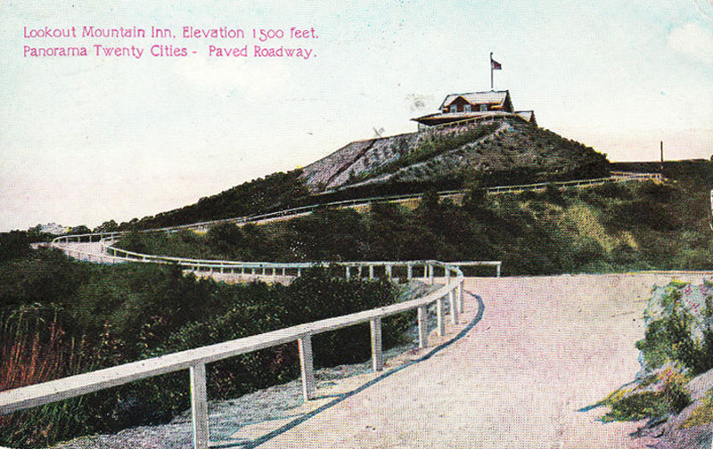
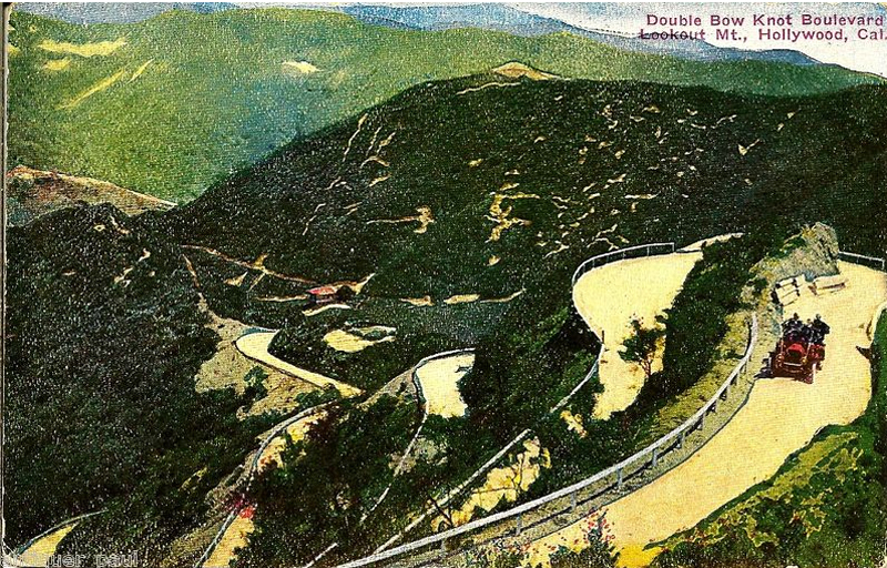
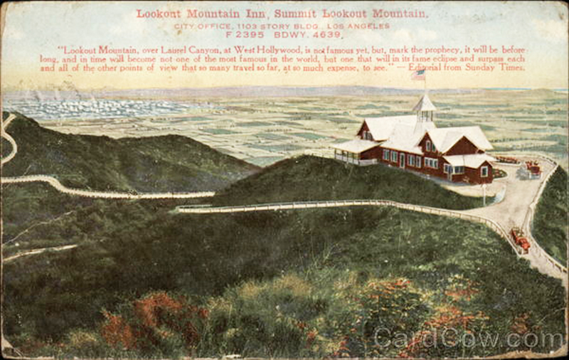
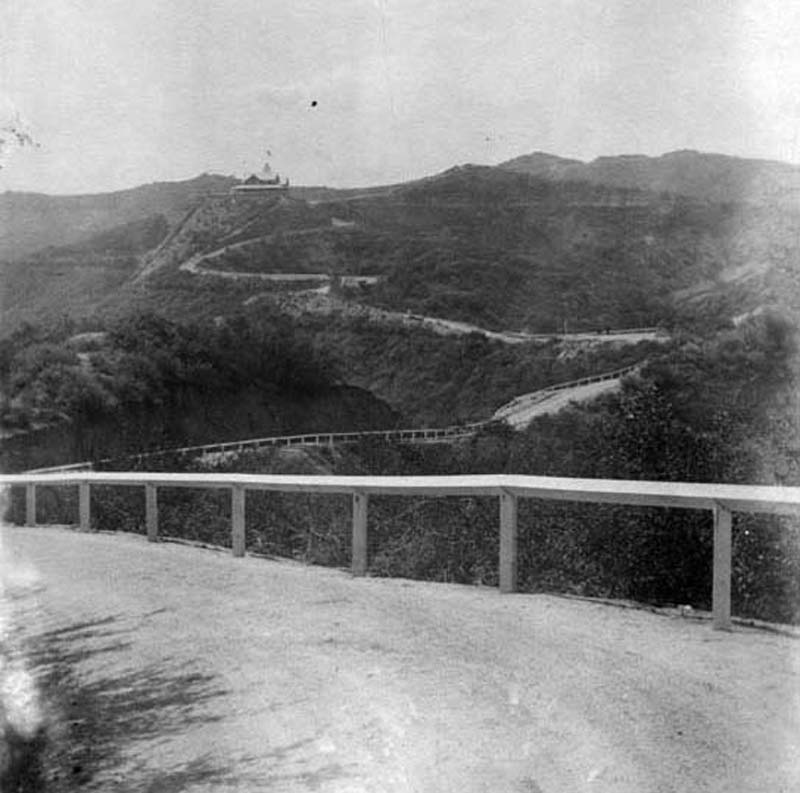
This Lookout Mountain installment will be fairly short. I'm going to post a few images showing the Inn from a distance, and the roads leading up to it.
Finding the exact location of the Inn was really tricky -- I finally figured it out, and will post then and nows in my next installment. But identifying these old roads leading up to the Inn had been even harder. I'm close now, but not quite there yet.
So, here is a selection of photos showing the approaches to the Inn. I've identified some, but am still working on others. Tomorrow I'm heading out there with a friend whose camera skills far exceed mine to get some "now" versions of some of these images and try to identify the roads that are still eluding me. But in the meantime, I'm going to go ahead and post the old versions -- partly to keep my narrative going, but also as a puzzle and a challenge. If anyone out there can tell me where any of these photos were taken from, or name any of these roads, I will be very impressed!
I have to tell you that finding period maps of this area has been nearly impossible. I spent hours (days?) searching for old L.A. maps on the web, and found almost nothing. I also spent an afternoon downtown at the Central Library -- the head of their historical map department was very helpful and tried his best. He looked for a couple of hours, and pulled all sorts of old auto club maps, county maps, plat maps, city atlases -- but none of them, and I mean NONE, showed the back roads of Laurel Canyon. There were definitely several long roads that meandered around the hills, and at least two that led up to the Inn, but I still haven't seen any of them on any map.
One reason is that Laurel Canyon hadn't yet been annexed to the city, so its roads are missing from nearly all city maps of the day. All the maps of that area show Laurel Canyon Blvd., and a few show the important branch roads like Lookout Mountain Ave., Stanley Hills Drive, Wonderland Ave., and Kirkwood. But none of those roads reach the summit -- in fact they hardly even come close to it.
So here, to whet your appetite, is my little collection. See if you can name any of these locations or streets, or even find the same road in any two images. If no one responds it won't hurt my feelings, because I know how hard this is. (I'm afraid that ethereal_reality is partly disqualified, because I already spilled the beans about a couple of these roads in an email to him.)
Tomorrow, barring bad weather, I'll head out and try to bag some modern pics of these locations. I'll post the results and will name as many of these roads as I can.
 http://www.ebay.com/
 http://www.ebay.com/
 http://www.ebay.com/
 http://www.ebay.com/
 http://www.lapl.org/
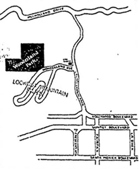
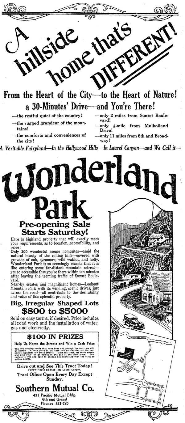
Part of an old display ad (complete image below)
 http://search.proquest.com/hnplatime...ccountid=11124
Note the text in the ad above:
"The five winding roads that have been cut through the tract are still un-named. A cash prize of $20 each will be awarded for the best names suggested for these streets. Visit the tract, see these streets and drop your list of names in the box at the tract office..."
TO BE CONTINUED