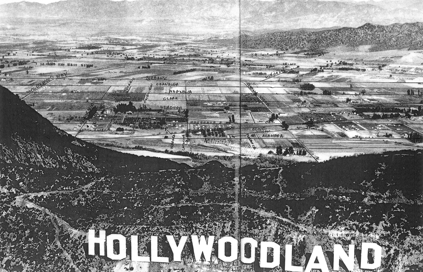
I don't think this image has appeared here before. It's quite meaningful to me because I've done a lot of hiking in all 3 of these mountain regions, and the Magnolia Park neighborhood where I live is clearly visible in the background, though this rusticated view shows more orchards than homes.
I've indicated many streets, along with their names. My own little house is on the east side of Niagara St., near Verdugo. The sign was built in '23 and my house in '26, so it may or may not have been there when this aerial shot was taken. I do see one small home in about the right place, but who knows...
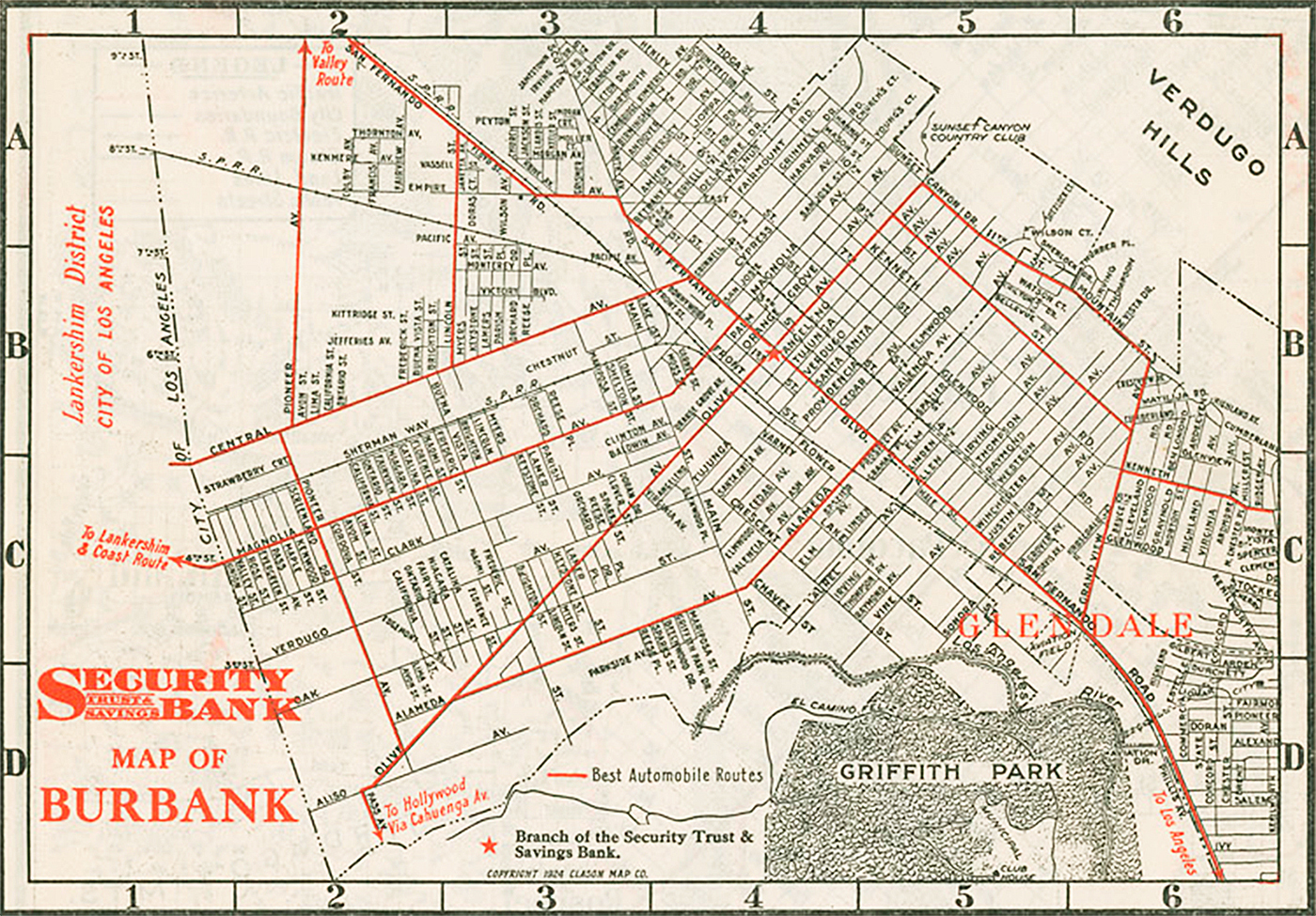
The map is from '24 and closely reflects what is seen in the aerial, though several streets still have their older names. Burbank airport doesn't exist yet, Buena Vista still ends at Burbank Blvd. (then called Central), and there's no Riverside Drive. The L.A. River appears to "begin" around what is now Forest Lawn Cemetery. A few short blocks of Victory Blvd. have been built north of Central Ave., though Randy Newman won't immortalize that street for another 60 years. In the aerial, San Fernando Road and the adjacent railway tracks would be about halfway between Burbank Blvd. and the base of the sloping Verdugo hills.
 http://www.taschen.com/pages/en/catalogue/photography/all/05705/facts.los_angeles_portrait_of_a_city.htm
 personal collection