New York Commuter Rail Map
This is something that I've been working on over the past few months. It is essentially a map illustrating the service frequencies along various commuter/intercity lines into Central New York (Manhattan) during the morning rush-hour (defined as 08:00 - 08:59).
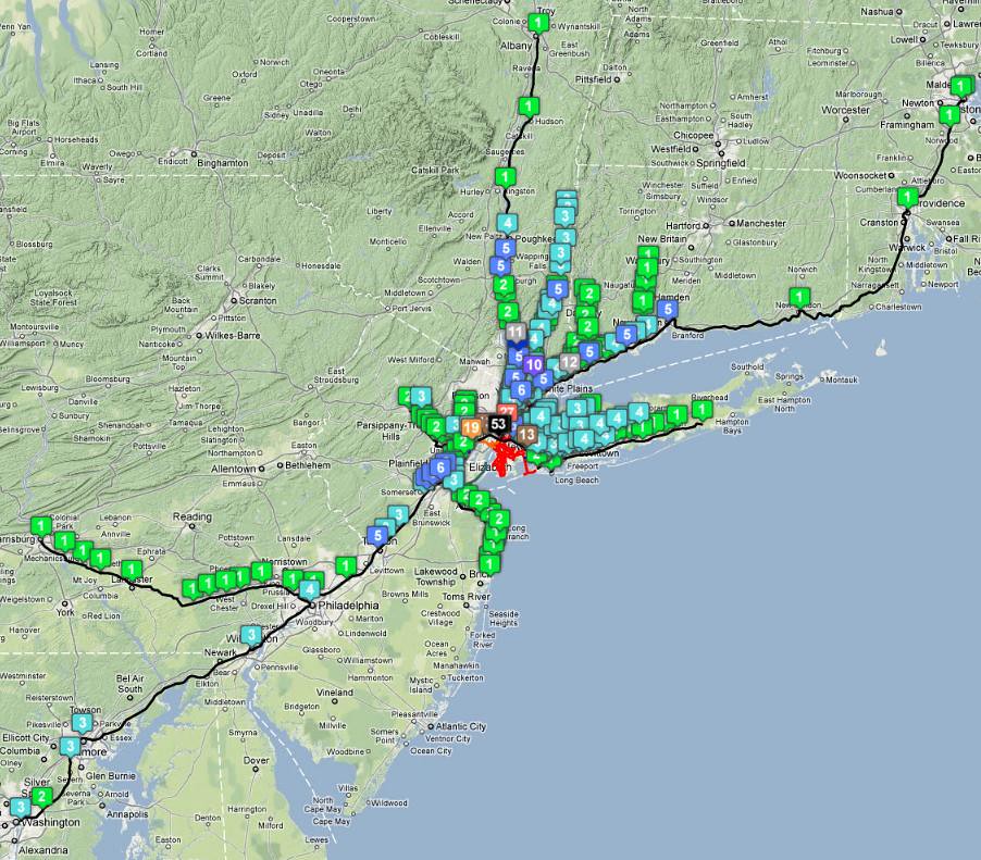
Due to the complexity and limitations of Google Map, you will need to copy and paste the following url into the Google Map search bar to 'see' the entire map and avoid having to shift between the cumbersome map pages.
http://maps.google.co.uk/maps/ms?vps...03e4fdf771def1
I also suggest switching to the terrain view to see the map in full clarity. Currently working on one for Toronto and London (
http://farm7.static.flickr.com/6132/...962d0129_b.jpg)